Bowknowe Strip

Wood, Forest in Roxburghshire

Scotland

Bowknowe Strip

Road junction, Dimpleknowe
Road junction, Dimpleknowe Credit: Richard Webb

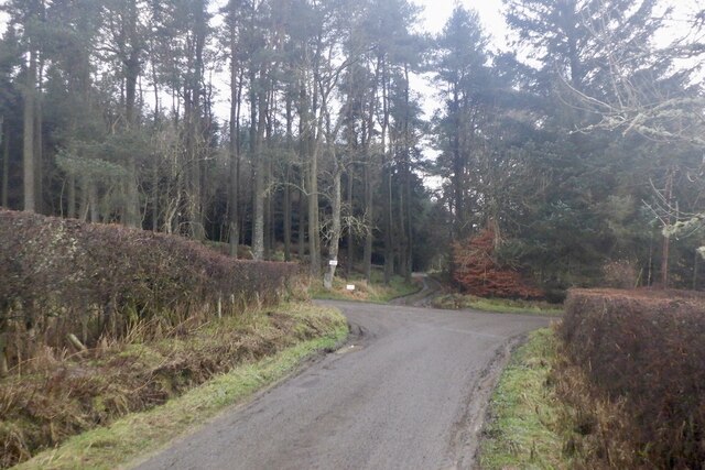
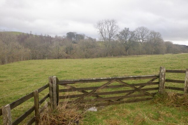
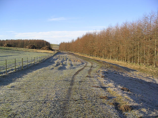
Bowknowe Strip is a small wood located in the region of Roxburghshire, Scotland. Situated near the town of Hawick, it covers an area of approximately 10 acres. This forested area is characterized by a mix of deciduous and coniferous trees, creating a diverse and visually appealing landscape.

The wood is home to a variety of flora and fauna, including oak, birch, and pine trees. The dense vegetation provides a habitat for numerous bird species, such as woodpeckers, owls, and finches. Additionally, small mammals like squirrels and rabbits can be spotted within the woodland.

Bowknowe Strip offers an ideal setting for nature enthusiasts and outdoor adventurers. Visitors can explore the wood through a network of walking trails, allowing them to experience the tranquility and beauty of the forest. The paths are well-maintained and offer different levels of difficulty, catering to both casual walkers and more experienced hikers.

The wood also serves as a recreational area, attracting locals and tourists alike. Picnic areas and benches are scattered throughout the forest, providing a peaceful spot for relaxation. Moreover, the wood is a popular destination for birdwatching enthusiasts, who can observe a wide range of avian species in their natural habitat.

Overall, Bowknowe Strip in Roxburghshire is a charming woodland that offers a serene escape from the hustle and bustle of everyday life. With its diverse vegetation, abundant wildlife, and well-maintained trails, it provides an excellent opportunity to connect with nature and enjoy the great outdoors.

If you have any feedback on the listing, please let us know in the comments section below.

Bowknowe Strip Images

Images are sourced within 2km of 55.491873/-2.8075251 or Grid Reference NT4922. Thanks to Geograph Open Source API. All images are credited.

Road junction, Dimpleknowe
Field near Synton Mill
Mill Cottage at Dimpleknowe This is a 2 storey former mill that has recently been converted into self catering holiday accommodation
Mill Cottage at Dimpleknowe
This is a 2 storey former mill that has recently been converted into self catering holiday accommodation
The 7th green at Lilliesleaf Golf Course near Dimpleknowe
Farmland and plantations Blackcraig Plantation is on the left and a larch strip plantation on the right.
Brushwood piles can be seen at a clear fell area.
Farmland and plantations
Blackcraig Plantation is on the left and a larch strip plantation on the right. Brushwood piles can be seen at a clear fell area.
The Satchels Burn The burn joins the Ale Water to the left of the red bridge in this livestock field.
The Satchels Burn
The burn joins the Ale Water to the left of the red bridge in this livestock field.
Plantation at Dimpleknowe The southeast corner of Edward's Plantation and new tree planting by the road to Satchels Farm. Lilliesleaf 9 hole golf course is in the background.
Plantation at Dimpleknowe
The southeast corner of Edward's Plantation and new tree planting by the road to Satchels Farm. Lilliesleaf 9 hole golf course is in the background.
Farm track To the south of Satchels Farm and taken on a fine February morning.
Farm track
To the south of Satchels Farm and taken on a fine February morning.
Clear fell area Brush piles in a clear fell area at Blackcraig Plantation.
Clear fell area
Brush piles in a clear fell area at Blackcraig Plantation.
Dimpleknowe Dimpleknowe is a small country estate to the east of Ashkirk that offers self catering holiday accommodation, and a nine hole golf course. For more information see:- <span class="nowrap"><a title="www.dimpleknowe.co.uk" rel="nofollow ugc noopener" href="http://www.dimpleknowe.co.uk">Link</a><img style="margin-left:2px;" alt="External link" title="External link - shift click to open in new window" src="https://s1.geograph.org.uk/img/external.png" width="10" height="10"/></span>
Dimpleknowe
Dimpleknowe is a small country estate to the east of Ashkirk that offers self catering holiday accommodation, and a nine hole golf course. For more information see:- LinkExternal link
A small glade by the Satchels Burn Some sheep paths run through this small glade by the Satchels Burn between Dimpleknowe and Hermiston.
A small glade by the Satchels Burn
Some sheep paths run through this small glade by the Satchels Burn between Dimpleknowe and Hermiston.
A hungry pond This pond at Dimpleknowe likes to be fed golf balls.  Lillesleaf Golf Course.
A hungry pond
This pond at Dimpleknowe likes to be fed golf balls. Lillesleaf Golf Course.
Dimpleknowe Mill, Dimpleknowe
Lilliesleaf Golf Course There are eleven holes at this parkland course at Dimpleknowe in the Scottish Borders. These golfers are playing the 4th hole called Satchells. For more information about the golf course, see <span class="nowrap"><a title="http://www.dimpleknowe.co.uk/golf.html" rel="nofollow ugc noopener" href="http://www.dimpleknowe.co.uk/golf.html">Link</a><img style="margin-left:2px;" alt="External link" title="External link - shift click to open in new window" src="https://s1.geograph.org.uk/img/external.png" width="10" height="10"/></span>
Lilliesleaf Golf Course
There are eleven holes at this parkland course at Dimpleknowe in the Scottish Borders. These golfers are playing the 4th hole called Satchells. For more information about the golf course, see LinkExternal link
Farmland at Satchells The foreground field was stocked with sheep (out of shot) on my visit while Lilliesleaf Golf Course is on the left on the northwest side of the Satchells Burn.
Farmland at Satchells
The foreground field was stocked with sheep (out of shot) on my visit while Lilliesleaf Golf Course is on the left on the northwest side of the Satchells Burn.
Lilliesleaf Golf Course There are eleven holes at this parkland course at Dimpleknowe in the Scottish Borders. These players are on the 7th green of the par 3 hole called Edwards. For more information about the golf course, see <span class="nowrap"><a title="http://www.dimpleknowe.co.uk/golf.html" rel="nofollow ugc noopener" href="http://www.dimpleknowe.co.uk/golf.html">Link</a><img style="margin-left:2px;" alt="External link" title="External link - shift click to open in new window" src="https://s1.geograph.org.uk/img/external.png" width="10" height="10"/></span>
Lilliesleaf Golf Course
There are eleven holes at this parkland course at Dimpleknowe in the Scottish Borders. These players are on the 7th green of the par 3 hole called Edwards. For more information about the golf course, see LinkExternal link
Lilliesleaf Golf Course There are eleven holes at this parkland course at Dimpleknowe in the Scottish Borders. These players are approaching the green on the 4th hole called Satchells. For more information about the golf course, see <span class="nowrap"><a title="http://www.dimpleknowe.co.uk/golf.html" rel="nofollow ugc noopener" href="http://www.dimpleknowe.co.uk/golf.html">Link</a><img style="margin-left:2px;" alt="External link" title="External link - shift click to open in new window" src="https://s1.geograph.org.uk/img/external.png" width="10" height="10"/></span>
Lilliesleaf Golf Course
There are eleven holes at this parkland course at Dimpleknowe in the Scottish Borders. These players are approaching the green on the 4th hole called Satchells. For more information about the golf course, see LinkExternal link
Approaching Dimpleknowe Down the hill to Dimpleknowe Mill.
Approaching Dimpleknowe
Down the hill to Dimpleknowe Mill.
Show me another place!

Bowknowe Strip is located at Grid Ref: NT4922 (Lat: 55.491873, Lng: -2.8075251)

Unitary Authority: The Scottish Borders

Police Authority: The Lothians and Scottish Borders

What 3 Words

///storm.manual.newlywed. Near Selkirk, Scottish Borders

Related Wikis

Bowismiln

Bowismiln is a village in the Scottish Borders area of Scotland. == See also == List of places in the Scottish Borders List of places in Scotland ��2...

Ashkirk

Ashkirk is a small village on the Ale Water, in the Scottish Borders area of Scotland. It is located just off the A7 road, approximately 6 miles (10 kilometres...

Woll

Woll is a village on the Ale Water, off the A7, in the Ettrick Forest, north of Hawick, and south of Selkirk in the Scottish Borders area of Scotland....

Salenside

Salenside is a village off the A7, on the Ale Water, near Ashkirk, in the Scottish Borders area of Scotland, in the former Selkirkshire. There was a Salenside...

Lilliesleaf

Lilliesleaf is a small village and civil parish 7 miles (11 km) south east of Selkirk in the Roxburghshire area of Scottish Borders of Scotland. Other...

Lothian and Borders

Lothian and Borders is an area in Scotland consisting of the East Lothian, City of Edinburgh, Midlothian, West Lothian council areas (collectively known...

Hassendean, Scottish Borders

Hassendean is a hamlet in the Scottish Borders south of Edinburgh, Scotland. The stream is the Hassendean Burn which flows down to the River Teviot five...

Hassendean railway station

Hassendean railway station served the village of Hassendean, Scottish Borders, Scotland from 1850 to 1969 on the Waverley Route. == History == The station...

Related Videos

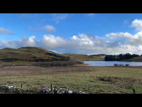
Essenside Loch exploration

Join me as I explore Essenside Loch and surrounding areas. Magnificent Hilltop for to be discovered.

Nearby Amenities

Located within 500m of 55.491873,-2.8075251
Garden Cottage
Place: isolated_dwelling
Lat/Long: 55.4925731/-2.8101257
Synton
Place: hamlet
Lat/Long: 55.492463/-2.8126112
Noexit: yes
Lat/Long: 55.4925607/-2.8102346
Sinton House (site of)
Historic: archaeological_site
Lat/Long: 55.4923103/-2.8129862
Noexit: yes
Lat/Long: 55.492501/-2.811808
Generator Method: photovoltaic
Generator Output Electricity: yes
Generator Source: solar
Generator Type: solar_photovoltaic_panel
Power: generator
Lat/Long: 55.4921758/-2.8133033
Power: pole
Lat/Long: 55.4961171/-2.8095845
Power: pole
Lat/Long: 55.4954799/-2.8106713
Power: pole
Lat/Long: 55.4949064/-2.8116496
Power: pole
Lat/Long: 55.4945067/-2.8122804
Power: pole
Lat/Long: 55.4939233/-2.8117165
Power: pole
Lat/Long: 55.4933864/-2.8111475
Power: pole
Lat/Long: 55.4928/-2.8105732
Power: pole
Lat/Long: 55.4915907/-2.8152133
Power: pole
Lat/Long: 55.4950873/-2.8097286
Power: pole
Lat/Long: 55.4946905/-2.8087862
Power: pole
Lat/Long: 55.4943113/-2.8078824
Power: pole
Lat/Long: 55.494285/-2.8062653
Power: pole
Lat/Long: 55.4950027/-2.8052637
Power: pole
Lat/Long: 55.4955395/-2.8044834
The data included in this document is from www.openstreetmap.org. The data is made available under ODbL.

Have you been to Bowknowe Strip?

Leave your review of Bowknowe Strip below (or comments, questions and feedback).