Salenside Plantation

Wood, Forest in Roxburghshire

Scotland

Salenside Plantation

Valley of the Ale Water The road to Ashkirk and the A7 with the Eildon Hills on the skyline.
Valley of the Ale Water Credit: Jim Barton

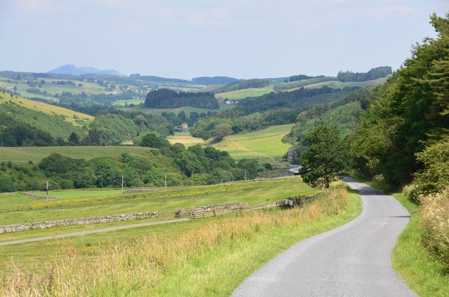
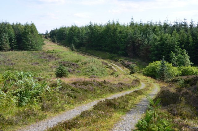
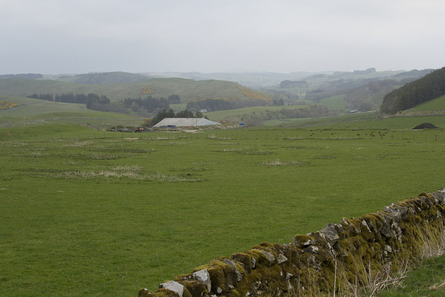
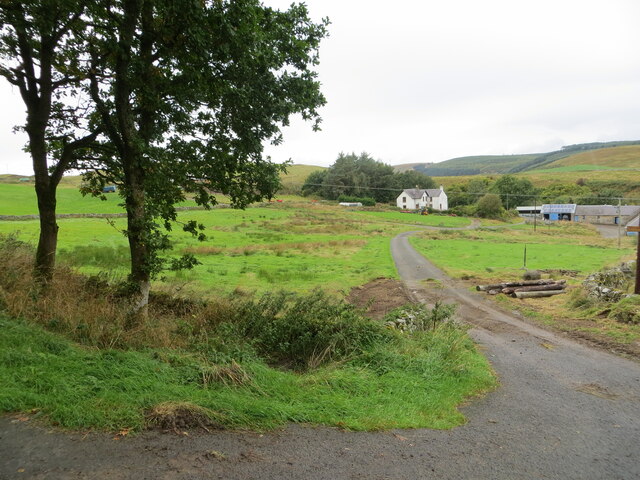
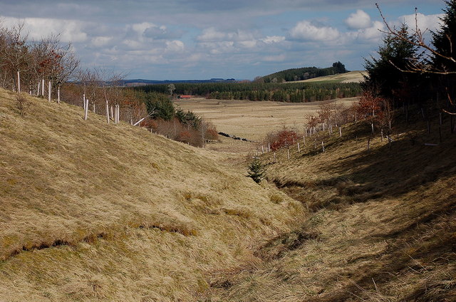
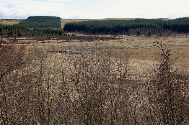
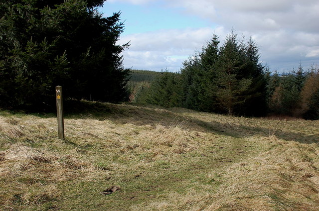
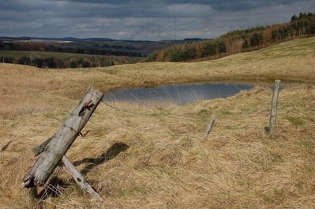
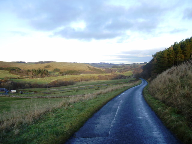
Salenside Plantation is a sprawling woodland area located in Roxburghshire, Scotland. Covering a vast expanse, the plantation is renowned for its picturesque beauty and diverse range of flora and fauna.

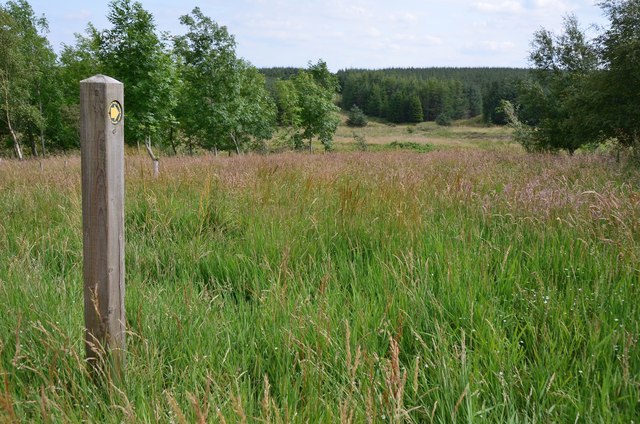
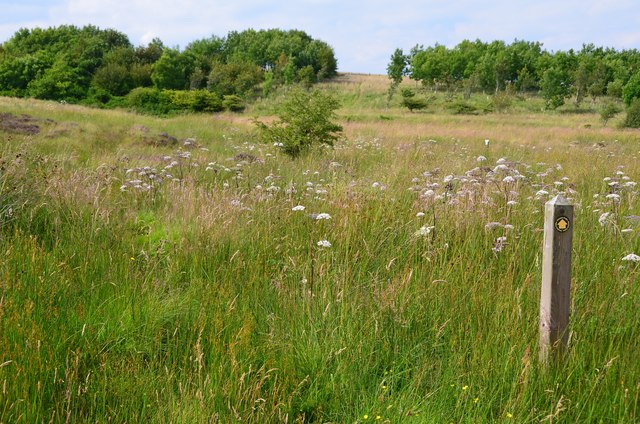
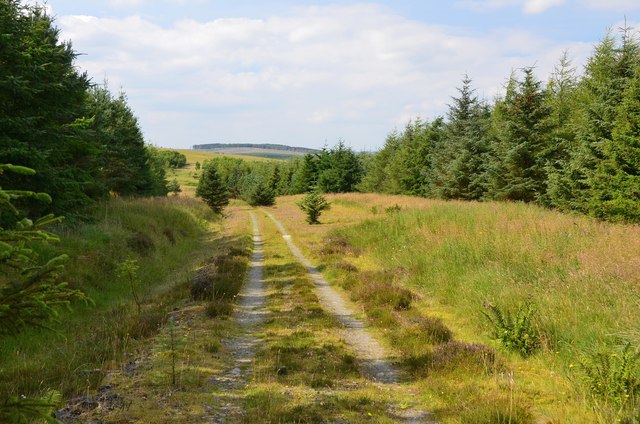
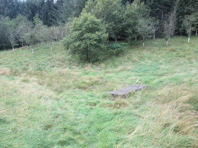
The plantation primarily consists of dense woodlands, predominantly composed of native tree species such as oak, birch, and pine. The towering trees provide a lush and verdant canopy, creating a serene and tranquil atmosphere. The woodland floor is adorned with a variety of wildflowers and ferns that add to the plantation's charm.

Salenside Plantation is not only a haven for nature enthusiasts but also serves as an important habitat for various wildlife species. The woodland is home to a plethora of bird species, including woodpeckers, thrushes, and owls. Additionally, it provides a safe haven for mammals such as deer, foxes, and squirrels.

The plantation offers several walking trails and paths that allow visitors to explore the area and immerse themselves in its natural beauty. These trails meander through the woodland, offering stunning views of the surrounding landscape and glimpses of wildlife along the way.

Salenside Plantation also boasts historical significance, with remnants of ancient settlements and structures scattered throughout the woodland. These archaeological features provide insights into the plantation's rich history and add an element of intrigue for history enthusiasts.

Overall, Salenside Plantation is a haven for nature lovers and history enthusiasts alike. With its breathtaking beauty, diverse ecosystem, and historical significance, it offers a truly enriching experience for all who visit.

If you have any feedback on the listing, please let us know in the comments section below.

Salenside Plantation Images

Images are sourced within 2km of 55.475713/-2.8452429 or Grid Reference NT4620. Thanks to Geograph Open Source API. All images are credited.

Valley of the Ale Water The road to Ashkirk and the A7 with the Eildon Hills on the skyline.
Valley of the Ale Water
The road to Ashkirk and the A7 with the Eildon Hills on the skyline.
Marker post, path to forest tracks Evidently not a path that is much used, though the route is given in the 'Paths around Hawick' booklet.
Marker post, path to forest tracks
Evidently not a path that is much used, though the route is given in the 'Paths around Hawick' booklet.
Site of medieval settlement According to the 'Paths around Hawick' guide, this unplanted area E of Shielswood Loch was once the site of a medieval village.
Site of medieval settlement
According to the 'Paths around Hawick' guide, this unplanted area E of Shielswood Loch was once the site of a medieval village.
Forest track In the plantation between Ashkirk Loch and Shielswood Loch.
Forest track
In the plantation between Ashkirk Loch and Shielswood Loch.
Forest track, Moss Knowe Here crossing a small burn draining Blind Moss.
Forest track, Moss Knowe
Here crossing a small burn draining Blind Moss.
Dropping down to the Ale Valley The road now has dry stone walls and we are descending to the Ale River.
Dropping down to the Ale Valley
The road now has dry stone walls and we are descending to the Ale River.
Footbridge  over  stream  in  Falla  Cleuch
Footbridge over stream in Falla Cleuch
Borders  Abbeys  Way  in  Ashkirk  Forest
Borders Abbeys Way in Ashkirk Forest
Pond  and  newly  resurfaced  forest  track Constant traffic, large stone carrying lorries
Pond and newly resurfaced forest track
Constant traffic, large stone carrying lorries
Access track to Shielswood Farm Looking north-westward.
Access track to Shielswood Farm
Looking north-westward.
Falla Cleuch A small valley with the margins of the burn left unplanted apart from some broadleaved trees.
Falla Cleuch
A small valley with the margins of the burn left unplanted apart from some broadleaved trees.
Ashkirk Loch The area of water is much smaller than indicated on the 1:25,000 map.
Ashkirk Loch
The area of water is much smaller than indicated on the 1:25,000 map.
Borders Abbeys Way, Ashkirk Forest Easy walking through this mature plantation.
Borders Abbeys Way, Ashkirk Forest
Easy walking through this mature plantation.
Pond by the forest track, Ashkirk Hill On the Borders Abbeys Way before the descent to the Ale Water. The TV transmitter mast near the A7 is in view ahead.
Pond by the forest track, Ashkirk Hill
On the Borders Abbeys Way before the descent to the Ale Water. The TV transmitter mast near the A7 is in view ahead.
Shielswood Loch This small loch is private fishing only. This was taken from the foot of Loch Rig just outside the square.
Shielswood Loch
This small loch is private fishing only. This was taken from the foot of Loch Rig just outside the square.
Shielswood Loch This small loch is private fishing only. This was taken from the southeast side of the loch just outside the square.
Shielswood Loch
This small loch is private fishing only. This was taken from the southeast side of the loch just outside the square.
Road to Ashkirk Passing Shielswood with Eildon Hills in the distance
Road to Ashkirk
Passing Shielswood with Eildon Hills in the distance
A small pond on Ashkirk Hill
Show me another place!

Salenside Plantation is located at Grid Ref: NT4620 (Lat: 55.475713, Lng: -2.8452429)

Unitary Authority: The Scottish Borders

Police Authority: The Lothians and Scottish Borders

What 3 Words

///fuse.king.helpfully. Near Hawick, Scottish Borders

Related Wikis

Salenside

Salenside is a village off the A7, on the Ale Water, near Ashkirk, in the Scottish Borders area of Scotland, in the former Selkirkshire. There was a Salenside...

Ashkirk

Ashkirk is a small village on the Ale Water, in the Scottish Borders area of Scotland. It is located just off the A7 road, approximately 6 miles (10 kilometres...

Woll

Woll is a village on the Ale Water, off the A7, in the Ettrick Forest, north of Hawick, and south of Selkirk in the Scottish Borders area of Scotland....

Bowismiln

Bowismiln is a village in the Scottish Borders area of Scotland. == See also == List of places in the Scottish Borders List of places in Scotland ��2...

Stirches

Stirches is an area of Hawick in the Scottish Borders, mostly consisting of ex-council housing built in 1973. It is often considered to be one of the more...

Harden Castle

Harden Castle is a 16th century tower house, about 3.5 miles (5.6 km) west of Hawick, Scottish Borders. It is alternatively known as Harden House or Harden...

Oakwood Roman Fort and Camp

Oakwood Roman Fort and Camp is a British archaeological site, a Roman fort and nearby Roman camp, about 3.5 miles (5.6 km) south-west of Selkirk in the...

Wilton Dean

Wilton Dean is a village in the Scottish Borders area of Scotland, on the Cala Burn, and close to the River Teviot. Along with Stirches and...

Nearby Amenities

Located within 500m of 55.475713,-2.8452429
Natural: peak
Lat/Long: 55.4719208/-2.8441701
Power: pole
Lat/Long: 55.4779582/-2.8519902
Power: pole
Lat/Long: 55.4793038/-2.8495273
Power: pole
Lat/Long: 55.4788854/-2.8503943
Power: pole
Lat/Long: 55.4797366/-2.8486307
Power: pole
Lat/Long: 55.4799144/-2.8478408
Power: pole
Lat/Long: 55.4784769/-2.851241
The data included in this document is from www.openstreetmap.org. The data is made available under ODbL.

Have you been to Salenside Plantation?

Leave your review of Salenside Plantation below (or comments, questions and feedback).