Horseshoe Plantation

Wood, Forest in Selkirkshire

Scotland

Horseshoe Plantation

Ascent to the Three Brethren The last part of the ascent from the west to the 464m summit with its three large cairns.
Ascent to the Three Brethren Credit: Jim Barton

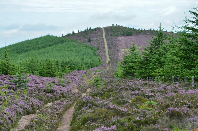
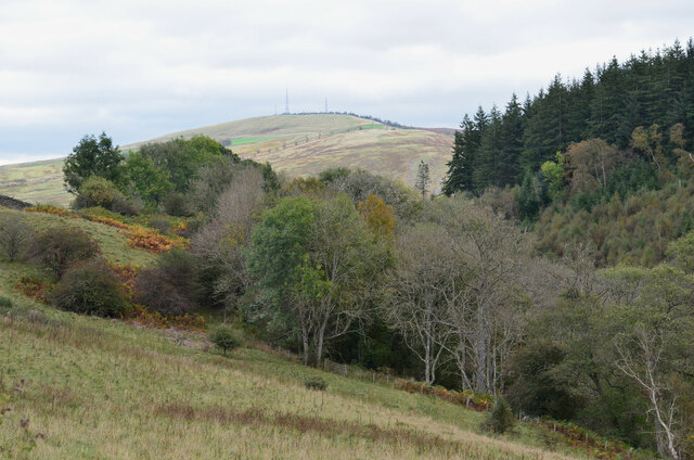
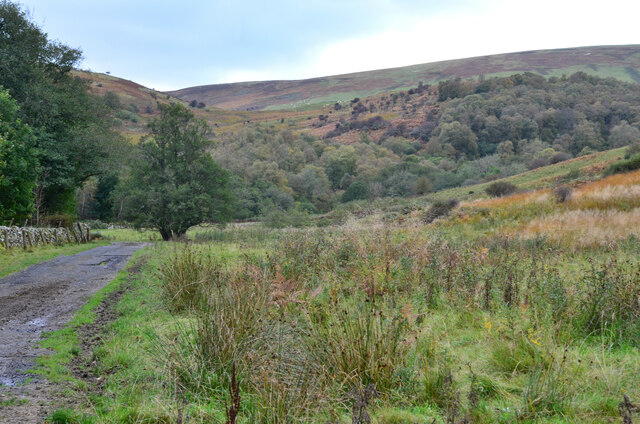
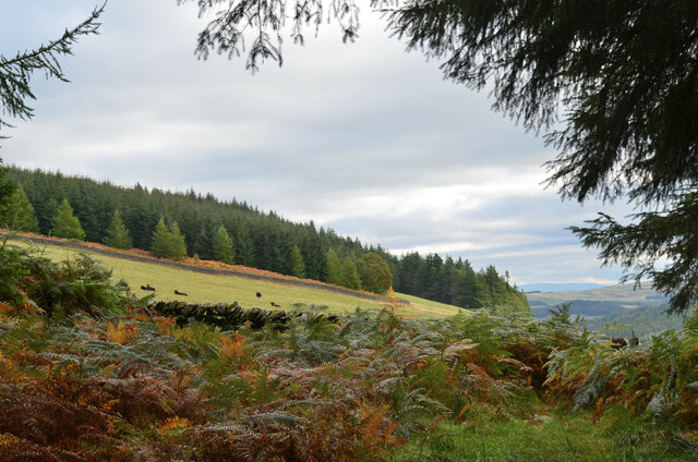
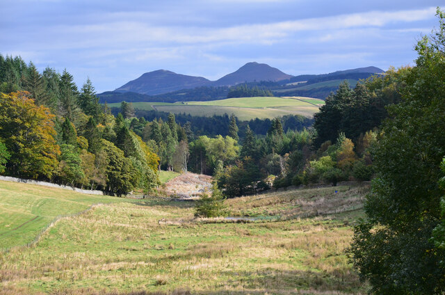
Horseshoe Plantation is a picturesque woodland area located in Selkirkshire, Scotland. Spread over a vast expanse of land, the plantation is renowned for its dense forest and captivating natural beauty. Nestled amidst rolling hills and bordered by the majestic Yarrow Water, it offers a tranquil retreat for nature enthusiasts and outdoor adventurers alike.

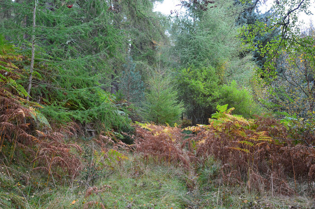
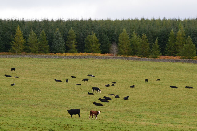
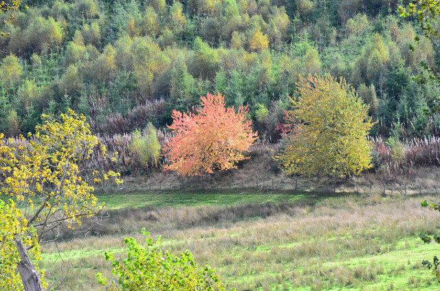
The woodland of Horseshoe Plantation is primarily composed of native tree species, including oak, birch, and Scots pine. The dense canopy provides shelter for a diverse array of wildlife, making it a haven for various bird species, including the elusive golden eagle and the vibrant European robin. Nature enthusiasts can also spot red squirrels darting through the trees or glimpse a red deer grazing in the distance.

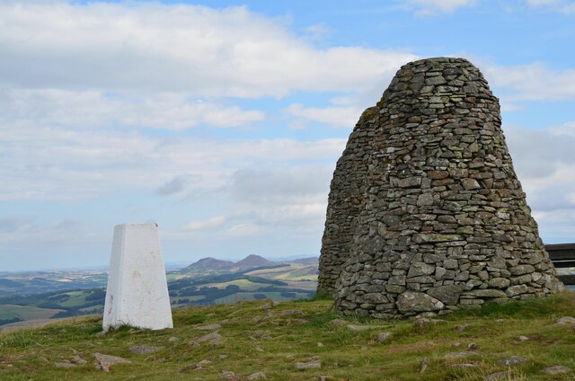
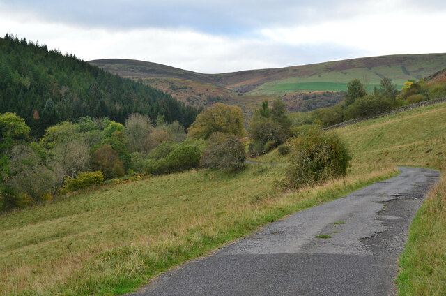
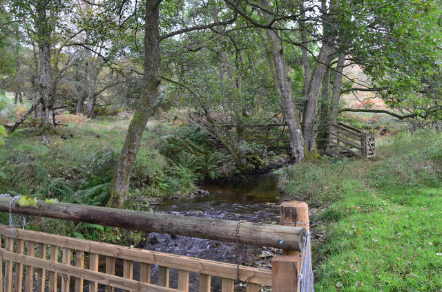
The plantation offers an extensive network of walking trails, allowing visitors to explore the woodland at their own leisure. The paths wind through the forest, revealing hidden waterfalls, serene glens, and panoramic vistas. The Horseshoe Trail, a popular route, meanders through the heart of the plantation, providing breathtaking views of the surrounding landscape.

Horseshoe Plantation caters to outdoor activities such as hiking, birdwatching, and photography. The tranquil atmosphere and stunning scenery make it an ideal location for those seeking solace in nature. Whether it is a leisurely stroll or an adventurous hike, this woodland sanctuary promises an unforgettable experience for all who visit.

If you have any feedback on the listing, please let us know in the comments section below.

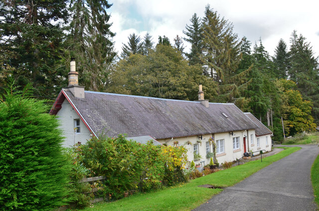
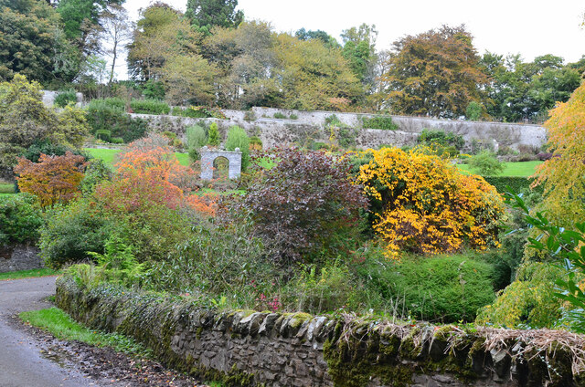
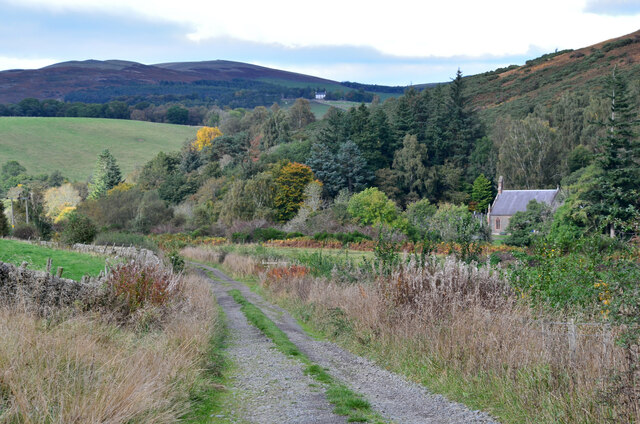
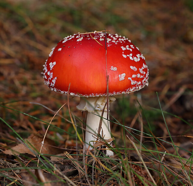
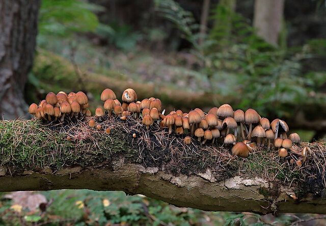
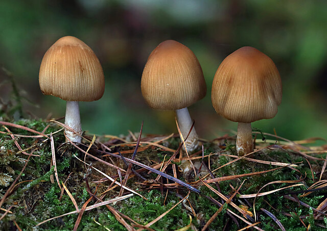
Horseshoe Plantation Images

Images are sourced within 2km of 55.58899/-2.8893251 or Grid Reference NT4433. Thanks to Geograph Open Source API. All images are credited.

Ascent to the Three Brethren The last part of the ascent from the west to the 464m summit with its three large cairns.
Ascent to the Three Brethren
The last part of the ascent from the west to the 464m summit with its three large cairns.
Cairns and trig pillar, Three Brethren Two of the cairns at this 464m summit with the Eildon Hills ahead.
Cairns and trig pillar, Three Brethren
Two of the cairns at this 464m summit with the Eildon Hills ahead.
Covid on the roll of honour Names of the Selkirk Standard Bearer in the annual Common Riding Ceremony are displayed here by the Three Brethren cairns - see <a href="https://www.geograph.org.uk/photo/6502578">NT4331 : Selkirk Standard Bearers names, Three Brethren cairns</a>. The ceremony was cancelled during the Covid-19 pandemic, but is marked on the record:

2017 Kieran Riddell
2018 Peter Forrest
2019 Craig Monk
2020 Covid-19
2021 Covid-19

For a view of the summit during the ceremony in normal times, please see Walter Baxter's photograph <a href="https://www.geograph.org.uk/photo/1354531">NT4331 : Riders at the Three Brethren during Selkirk Common Riding</a>.
Covid on the roll of honour
Names of the Selkirk Standard Bearer in the annual Common Riding Ceremony are displayed here by the Three Brethren cairns - see NT4331 : Selkirk Standard Bearers names, Three Brethren cairns. The ceremony was cancelled during the Covid-19 pandemic, but is marked on the record: 2017 Kieran Riddell 2018 Peter Forrest 2019 Craig Monk 2020 Covid-19 2021 Covid-19 For a view of the summit during the ceremony in normal times, please see Walter Baxter's photograph NT4331 : Riders at the Three Brethren during Selkirk Common Riding.
Road to Williamhope farm Williamhope is about 3km from the public road, on hill land between Ashiestiel Hill and Broomy Law on the Minchmoor - Three Brethren ridge.
Road to Williamhope farm
Williamhope is about 3km from the public road, on hill land between Ashiestiel Hill and Broomy Law on the Minchmoor - Three Brethren ridge.
Valley of the Glenkinnon Burn Meigle Hill with its radio aerials is in the background.
Valley of the Glenkinnon Burn
Meigle Hill with its radio aerials is in the background.
Farm road by the Glenkinnon Burn The road to Williamhope passing flat marshy ground with the wooded hillside around Wolf Glen ahead.
Farm road by the Glenkinnon Burn
The road to Williamhope passing flat marshy ground with the wooded hillside around Wolf Glen ahead.
Footbridge over the Glenkinnon Burn A bridge connecting the farm road to Williamhope with paths and tracks in Yair Hill Forest. The fence in the foreground is relatively recent.

See also <a href="https://www.geograph.org.uk/photo/5755109">NT4233 : Footbridge over the Glenkinnon Burn</a> for a view from the other side.
Footbridge over the Glenkinnon Burn
A bridge connecting the farm road to Williamhope with paths and tracks in Yair Hill Forest. The fence in the foreground is relatively recent. See also NT4233 : Footbridge over the Glenkinnon Burn for a view from the other side.
Path to Yair Hope This thin path leads up from the footbridge over the Glenkinnon Burn and becomes more well-trodden once past the forest road a short distance to the east.
Path to Yair Hope
This thin path leads up from the footbridge over the Glenkinnon Burn and becomes more well-trodden once past the forest road a short distance to the east.
Emerging at Yair Hope The path through the forestry plantation reaches the edge of the hill pasture.
Emerging at Yair Hope
The path through the forestry plantation reaches the edge of the hill pasture.
Cattle at Yair Hope Yair Hope is now hill pasture supporting a herd of cattle. Compare with <a href="https://www.geograph.org.uk/photo/5755132">NT4333 : Ploughed area, Yair Hope</a> taken in 2018 when this area had been ploughed.
Cattle at Yair Hope
Yair Hope is now hill pasture supporting a herd of cattle. Compare with NT4333 : Ploughed area, Yair Hope taken in 2018 when this area had been ploughed.
Autumnal tree, Yair Hill Forest A tree standing out at the edge of the forest seen from Yair Hope.
Autumnal tree, Yair Hill Forest
A tree standing out at the edge of the forest seen from Yair Hope.
Valley of the Yair Burn Looking east from Yair Hope with the Eildon Hills providing a striking skyline.
Valley of the Yair Burn
Looking east from Yair Hope with the Eildon Hills providing a striking skyline.
Cottages on Yair estate On the road on the south side of the Yair Burn.
Cottages on Yair estate
On the road on the south side of the Yair Burn.
The walled garden at Yair The garden showing some attractive autumn colours.
The walled garden at Yair
The garden showing some attractive autumn colours.
Track near Caddonfoot The track follows the south bank of the Tweed between Yair Bridge and Ashiestiel Bridge. Caddonfoot Parish Church is in view across the river.
Track near Caddonfoot
The track follows the south bank of the Tweed between Yair Bridge and Ashiestiel Bridge. Caddonfoot Parish Church is in view across the river.
A fly agaric mushroom (Amanita muscaria) This mushroom which is usually associated with birch and pine trees is one of the easiest species to recognise.
A fly agaric mushroom (Amanita muscaria)
This mushroom which is usually associated with birch and pine trees is one of the easiest species to recognise.
Glistening ink cap mushrooms (Coprinellus micaceus) This edible species is usually associated with dead tree stumps or buried wood. The photograph was taken in Lindinny Wood.
Glistening ink cap mushrooms (Coprinellus micaceus)
This edible species is usually associated with dead tree stumps or buried wood. The photograph was taken in Lindinny Wood.
Show me another place!

Horseshoe Plantation is located at Grid Ref: NT4433 (Lat: 55.58899, Lng: -2.8893251)

Unitary Authority: The Scottish Borders

Police Authority: The Lothians and Scottish Borders

What 3 Words

///afford.void.lushly. Near Selkirk, Scottish Borders

Related Wikis

Caddonlee

Caddonlee is a farm in the village of Clovenfords in the Scottish Borders area of Scotland, by the Caddon Water, near Caddonfoot where Caddon Water meets...

Caddon Water

The Caddon Water (Scottish Gaelic: Cadan) is a small river by the village of Caddonfoot, in the Scottish Borders area of Scotland. It rises on Windlestraw...

Yair, Scottish Borders

Yair, also known as The Yair, is an estate in the Scottish Borders. It stands by the River Tweed in the former county of Selkirkshire, 2.5 miles (4.0 km...

Yair Bridge

The Yair Bridge or Fairnilee Bridge is a bridge across the River Tweed at Yair, near Galashiels in the Scottish Borders. == History == It was built in...

Have you been to Horseshoe Plantation?

Leave your review of Horseshoe Plantation below (or comments, questions and feedback).