Fox Covert

Wood, Forest in Selkirkshire

Scotland

Fox Covert

Selkirk Flood Prevention Scheme work at Philiphaugh Traffic lights are in place while a low concrete wall is being constructed at a field boundary with the A708.
Selkirk Flood Prevention Scheme work at Philiphaugh Credit: Walter Baxter

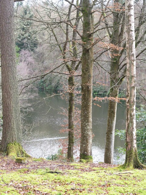
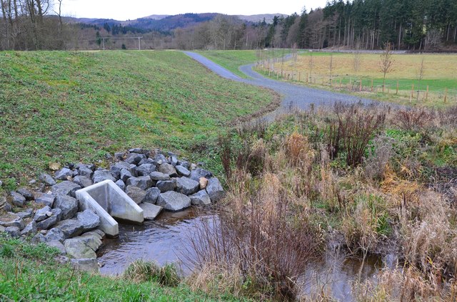
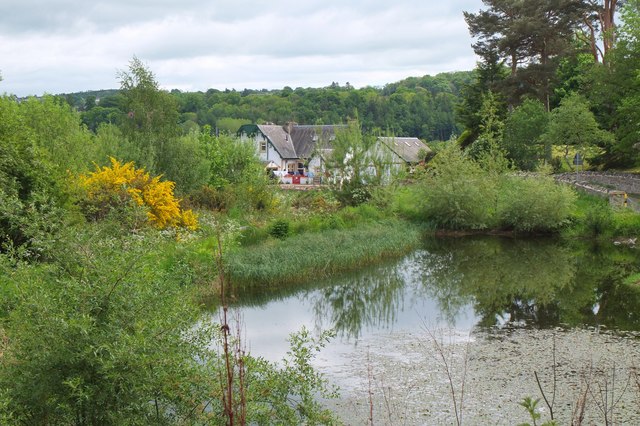
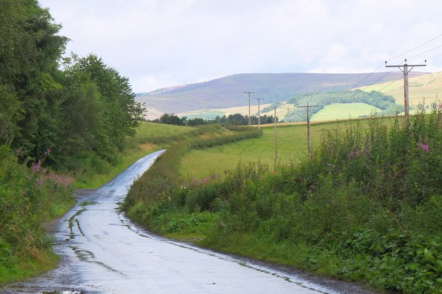
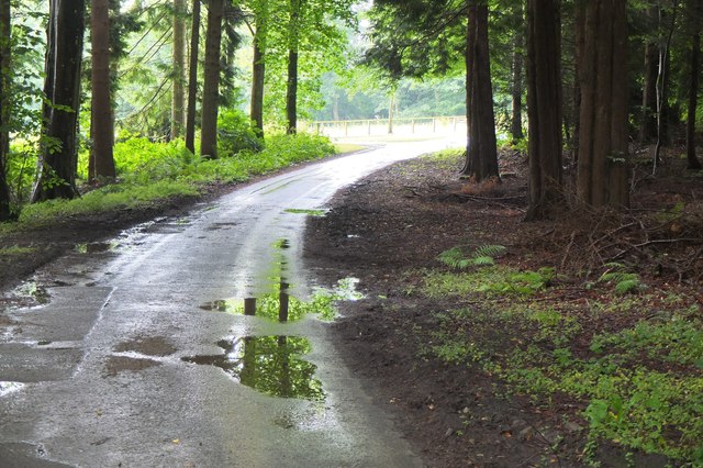
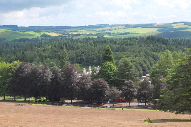
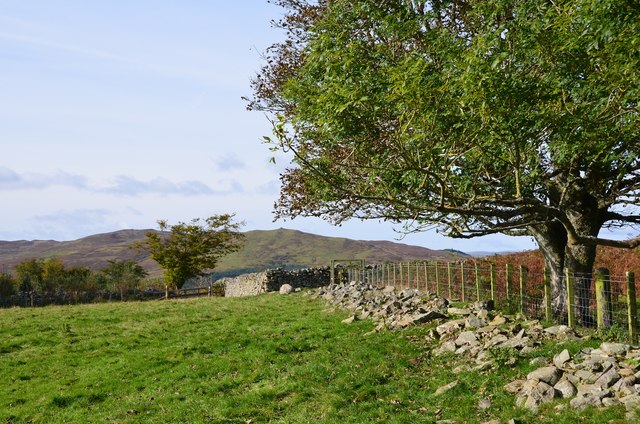
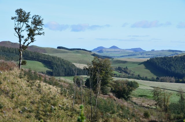
Fox Covert is a woodland area located in Selkirkshire, Scotland. Situated near the town of Selkirk, it covers an approximate area of 100 acres. The woodland is known for its dense growth of various tree species, creating a peaceful and serene environment for visitors.

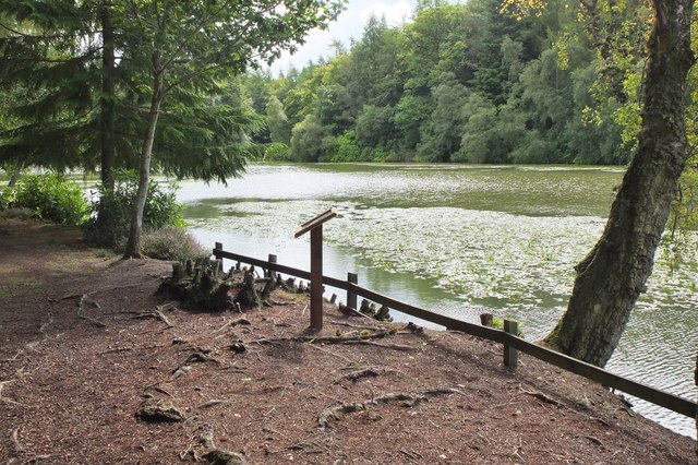
The main tree species found in Fox Covert include oak, beech, and birch, along with some coniferous trees such as Scots pine. The diverse range of trees provides a rich habitat for various wildlife species, making it a popular spot for nature enthusiasts and birdwatchers. Commonly spotted animals in the woodland include foxes, badgers, deer, and a variety of bird species.

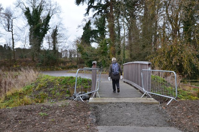
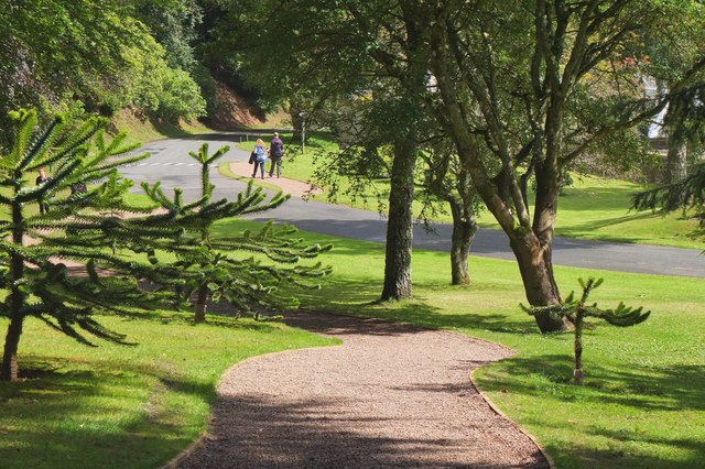
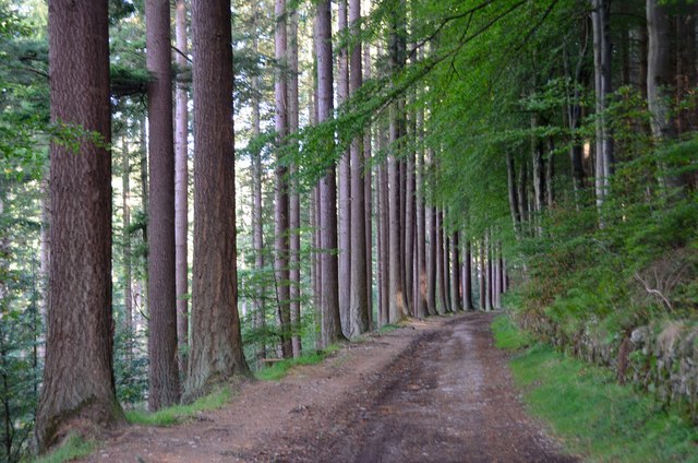
The woodland is crisscrossed by a network of well-maintained trails, allowing visitors to explore its beauty and observe the local flora and fauna. These trails vary in difficulty, catering to both casual walkers and more experienced hikers. The peaceful atmosphere and natural beauty of Fox Covert make it an ideal location for leisurely walks, picnics, and photography.

Fox Covert is managed by the local authorities, who ensure the preservation of the woodland and its biodiversity. They also organize educational programs and guided walks to raise awareness about the importance of conservation and sustainable practices.

Overall, Fox Covert is a picturesque woodland in Selkirkshire, offering a tranquil escape from the hustle and bustle of daily life. Its diverse range of trees, wildlife, and well-maintained trails make it a wonderful destination for outdoor enthusiasts and nature lovers alike.

If you have any feedback on the listing, please let us know in the comments section below.
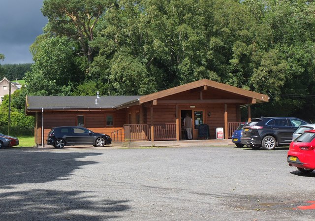
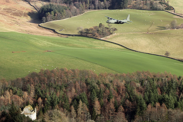
Fox Covert Images

Images are sourced within 2km of 55.553132/-2.8925096 or Grid Reference NT4329. Thanks to Geograph Open Source API. All images are credited.

Selkirk Flood Prevention Scheme work at Philiphaugh Traffic lights are in place while a low concrete wall is being constructed at a field boundary with the A708.
Selkirk Flood Prevention Scheme work at Philiphaugh
Traffic lights are in place while a low concrete wall is being constructed at a field boundary with the A708.
Newark Castle A fine looking tower situated on a bluff overlooking the Yarrow Water and commanding the route through the valley. Thought to be the 'New Werk' mentioned in a 1423 charter of Archibald, Earl of Douglas. Like most castles in the Scottish Borders, it saw battles with English invaders and a siege in 1547-8 when the tower was found to be impregnable without cannon being available.  In 1645 a hundred royalist prisoners from the Battle of Philliphaugh are said to have been shot within the courtyard. The tower appears to have been abandoned before 1700 and left to decay.
Newark Castle
A fine looking tower situated on a bluff overlooking the Yarrow Water and commanding the route through the valley. Thought to be the 'New Werk' mentioned in a 1423 charter of Archibald, Earl of Douglas. Like most castles in the Scottish Borders, it saw battles with English invaders and a siege in 1547-8 when the tower was found to be impregnable without cannon being available. In 1645 a hundred royalist prisoners from the Battle of Philliphaugh are said to have been shot within the courtyard. The tower appears to have been abandoned before 1700 and left to decay.
Through trees to the Upper Lake In the grounds of Bowhill House near Selkirk.
Through trees to the Upper Lake
In the grounds of Bowhill House near Selkirk.
Bowhill House north front The main block of the very large country house belonging to the Duke of Buccleuch. The central section seen here is 18thC whilst the wings to either side date from around 1814.
Bowhill House north front
The main block of the very large country house belonging to the Duke of Buccleuch. The central section seen here is 18thC whilst the wings to either side date from around 1814.
New footbridge over the Long Philip Burn, Selkirk Part of the flood protection works where the burn, prone to flash flooding from heavy rainfall in the hills around the Three Brethren, enters sediment ponds before continuing to the Ettrick Water through the landscaped area shown in <a href="https://www.geograph.org.uk/photo/5224909">NT4528 : Flood relief area, Long Philip Burn, Selkirk</a>. This new path starts by the A707 bridge on Linglie Road and emerges on Corbylinn Road.
New footbridge over the Long Philip Burn, Selkirk
Part of the flood protection works where the burn, prone to flash flooding from heavy rainfall in the hills around the Three Brethren, enters sediment ponds before continuing to the Ettrick Water through the landscaped area shown in NT4528 : Flood relief area, Long Philip Burn, Selkirk. This new path starts by the A707 bridge on Linglie Road and emerges on Corbylinn Road.
Mill lade and embankment, Philiphaugh The mill lade from the cauld on the Ettrick Water flows through a culvert under the new embankment built as part of the Selkirk Flood Protection Scheme.
Mill lade and embankment, Philiphaugh
The mill lade from the cauld on the Ettrick Water flows through a culvert under the new embankment built as part of the Selkirk Flood Protection Scheme.
Pond near the Long Philip Burn, Selkirk From the new footbridge and rerouted path forming part of the flood protection scheme.
Pond near the Long Philip Burn, Selkirk
From the new footbridge and rerouted path forming part of the flood protection scheme.
Estate road at Bowhill The road connects Bowhill with the North Lodge and passes Newark Castle.
Estate road at Bowhill
The road connects Bowhill with the North Lodge and passes Newark Castle.
Road to Bowhill In the Bowhill Estate approaching the drive to the car park and house.
Road to Bowhill
In the Bowhill Estate approaching the drive to the car park and house.
Bowhill and car park The visitors' car park and the chimneys of Bowhill House in view from the track descending from Parnassie Hill.
Bowhill and car park
The visitors' car park and the chimneys of Bowhill House in view from the track descending from Parnassie Hill.
Path in Bowhill Estate The path from the car park to the café and children's play area.
Path in Bowhill Estate
The path from the car park to the café and children's play area.
The Upper Lake, Bowhill There are several good short walks in the woodland around the two lakes to the south of Bowhill House.
The Upper Lake, Bowhill
There are several good short walks in the woodland around the two lakes to the south of Bowhill House.
The Waterwheel Café, Philiphaugh A good starting or finishing point for walks by the Ettrick Water on the Philiphaugh Estate. The waterwheel itself is close by, along with a modern equivalent at the hydroelectric installation at Murray's Cauld.
The Waterwheel Café, Philiphaugh
A good starting or finishing point for walks by the Ettrick Water on the Philiphaugh Estate. The waterwheel itself is close by, along with a modern equivalent at the hydroelectric installation at Murray's Cauld.
An RAF Hercules in the Yarrow Valley This was taken from Newark Hill as a Hercules was on a low level training sortie. For a closer view of the aircraft – see <a href="https://www.geograph.org.uk/photo/5532685">NT4130 : An RAF Hercules in the Yarrow Valley</a>. Newark Castle is at the bottom left.
An RAF Hercules in the Yarrow Valley
This was taken from Newark Hill as a Hercules was on a low level training sortie. For a closer view of the aircraft – see NT4130 : An RAF Hercules in the Yarrow Valley. Newark Castle is at the bottom left.
Avenue on Corbylinn Road, Philiphaugh Some fine trees line the track on the way to the reservoir.
Avenue on Corbylinn Road, Philiphaugh
Some fine trees line the track on the way to the reservoir.
Approach to Tibby Tamson's grave The easiest way to find the grave is to follow the fence up from the reservoir to the wooden stile just visible at the centre of the image. Note that the name given on the OS map is 'Tibby' but 'Tibbie' is used on the graveside plaque and in the local footpath guide.
Approach to Tibby Tamson's grave
The easiest way to find the grave is to follow the fence up from the reservoir to the wooden stile just visible at the centre of the image. Note that the name given on the OS map is 'Tibby' but 'Tibbie' is used on the graveside plaque and in the local footpath guide.
Eildon Hills from Tibby Tamson's Plantation A view characteristic of the Scottish Borders with upland pasture, plantations and shelter belts with the volcanic hills enlivening the skyline.
Eildon Hills from Tibby Tamson's Plantation
A view characteristic of the Scottish Borders with upland pasture, plantations and shelter belts with the volcanic hills enlivening the skyline.
Selkirk from Traquair Plantation, Philiphaugh Looking across Philiphaugh estate to the town of Selkirk with the Lindean transmitting mast on the left.
Selkirk from Traquair Plantation, Philiphaugh
Looking across Philiphaugh estate to the town of Selkirk with the Lindean transmitting mast on the left.
Show me another place!

Fox Covert is located at Grid Ref: NT4329 (Lat: 55.553132, Lng: -2.8925096)

Unitary Authority: The Scottish Borders

Police Authority: The Lothians and Scottish Borders

What 3 Words

///rockets.swaps.cement. Near Selkirk, Scottish Borders

Related Wikis

Yarrow Water

The Yarrow Water is a river in the Borders in the south east of Scotland. It is a tributary of the Ettrick Water (itself a tributary of the Tweed) and...

Battle of Philiphaugh

The Battle of Philiphaugh was fought on 13 September 1645 during the Wars of the Three Kingdoms near Selkirk in the Scottish Borders. The Royalist army...

Philiphaugh

Philiphaugh is a village by the Yarrow Water, on the outskirts of Selkirk, in the Scottish Borders. Places nearby include Bowhill, Broadmeadows, the Ettrick...

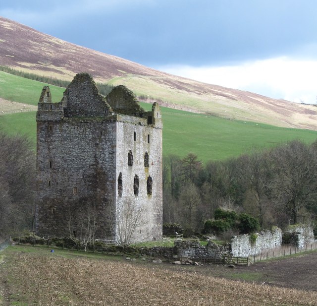
Newark Castle, Selkirkshire

Newark Tower is a large, ruined tower house standing in the grounds of Bowhill House, in the valley of the Yarrow Water three miles west of Selkirk in...
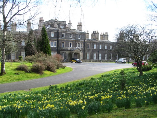
Bowhill House

Bowhill House is a historic house near Bowhill at Selkirk in the Scottish Borders area of Scotland. It is a member of the Historic Houses Association,...

Bowhill, Scottish Borders

Bowhill is a village off the A708, in the Scottish Borders area of Scotland, near Selkirk, by the Yarrow Water Other places nearby include Bowhill House...

Philiphaugh Stadium

Philiphaugh is a rugby union ground in the Royal Burgh of Selkirk, Scotland with a capacity of approximately 6,000. It is the home of Selkirk Rugby Football...

Carterhaugh

Carterhaugh is a wood and farm near the confluence of the Yarrow Water and the Ettrick Water near Selkirk in the Scottish Borders. This real location...

Nearby Amenities

Located within 500m of 55.553132,-2.8925096
Barrier: stile
Foot: yes
Lat/Long: 55.5565974/-2.8960345
The data included in this document is from www.openstreetmap.org. The data is made available under ODbL.

Have you been to Fox Covert?

Leave your review of Fox Covert below (or comments, questions and feedback).