Bankhead Plantation

Wood, Forest in Dumfriesshire

Scotland

Bankhead Plantation

Upper Millsteads Upper Millsteads Farm on the edge of Tinnisburn Forest.
Upper Millsteads Credit: Peter McDermott

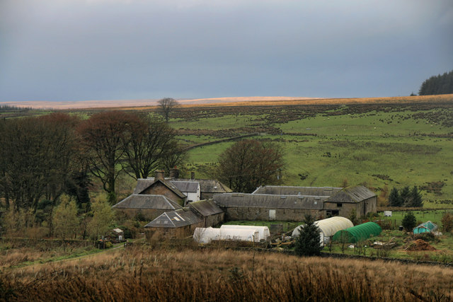
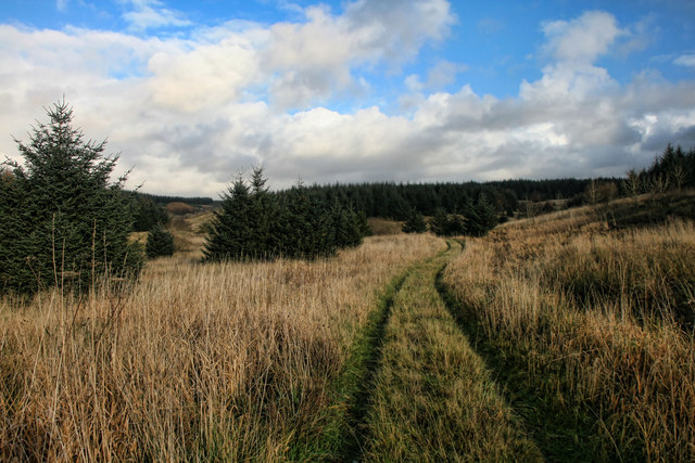
Bankhead Plantation is a historic estate located in Dumfriesshire, Scotland. It is nestled amidst picturesque woodlands and forests, providing a serene and idyllic setting for visitors. The plantation covers a vast area, boasting a diverse range of flora and fauna, making it a haven for nature enthusiasts.

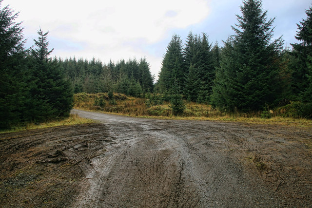
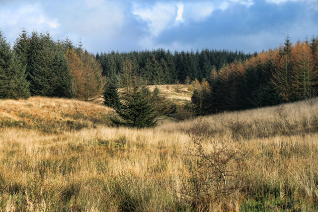
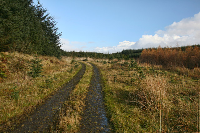
The woodlands surrounding Bankhead Plantation are primarily composed of native Scottish species, such as oak, birch, and pine trees. These majestic trees create a lush canopy, offering shade and shelter to a variety of wildlife. Visitors can explore the plantation on foot, following well-maintained trails that wind through the woods, providing opportunities for peaceful walks and hikes.

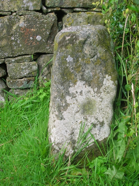
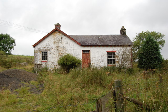
In addition to its natural beauty, Bankhead Plantation is also historically significant. The estate dates back several centuries and has witnessed a rich tapestry of events. It was once home to a prominent Scottish family, who played a significant role in the region's history. Today, the main house still stands as a testament to its past, offering a glimpse into the grandeur of a bygone era.

Visitors to Bankhead Plantation can immerse themselves in the history and natural splendor of the estate. Guided tours are available, providing insights into the plantation's heritage and the flora and fauna that call it home. Whether one is interested in history, nature, or simply seeking solace in a tranquil setting, Bankhead Plantation offers an unforgettable experience.

If you have any feedback on the listing, please let us know in the comments section below.

Bankhead Plantation Images

Images are sourced within 2km of 55.123399/-2.8828978 or Grid Reference NY4381. Thanks to Geograph Open Source API. All images are credited.

Upper Millsteads Upper Millsteads Farm on the edge of Tinnisburn Forest.
Upper Millsteads
Upper Millsteads Farm on the edge of Tinnisburn Forest.
Tinnisburn Forest Track in Tinnisburn Forest.
Tinnisburn Forest
Track in Tinnisburn Forest.
Greyscrog Sike View looking up Greyscrog Sike in Tinnisburn Forest.
Greyscrog Sike
View looking up Greyscrog Sike in Tinnisburn Forest.
Mid Cleuch Track running up the side of Mid Cleuch in Tinnisburn Forest.
Mid Cleuch
Track running up the side of Mid Cleuch in Tinnisburn Forest.
Mid Cleuch Mid Cleuch in Tinnisburn Forest.
Mid Cleuch
Mid Cleuch in Tinnisburn Forest.
Black Sike Track near Black Sike in Tinnisburn Forest.
Black Sike
Track near Black Sike in Tinnisburn Forest.
B6357 by Caulside
B6357 by Caulside
Tinnisburn Forest A large patch of forestry plantation, a lot of which has already been harvested. The Tarras Water is at the foot of the picture.
Tinnisburn Forest
A large patch of forestry plantation, a lot of which has already been harvested. The Tarras Water is at the foot of the picture.
Forestry near Caulside Part of a large area in Liddesdale, now being harvested.
Forestry near Caulside
Part of a large area in Liddesdale, now being harvested.
Old Milestone by the B6357, Caulside, Canonbie parish Stone post by the B6357, in parish of Canonbie (Dunfermline District), Caulside, outside No.3, a white cottage.

Inscription reads:-
: 32 : : 6 :
(To Jedburgh and Newcastleton) 

Surveyed

Milestone Society National ID: DG_NTCN06
Old Milestone by the B6357, Caulside, Canonbie parish
Stone post by the B6357, in parish of Canonbie (Dunfermline District), Caulside, outside No.3, a white cottage. Inscription reads:- : 32 : : 6 : (To Jedburgh and Newcastleton) Surveyed Milestone Society National ID: DG_NTCN06
Harelawpike Plantation Harvester at Harelawpike Plantation in Tinnisburn Forest.
Harelawpike Plantation
Harvester at Harelawpike Plantation in Tinnisburn Forest.
Harelawpike Plantation Forwarder at Harelawpike Plantation in Tinnisburn Forest.
Harelawpike Plantation
Forwarder at Harelawpike Plantation in Tinnisburn Forest.
Harelawpike Plantation Track in Tinnisburn Forest at Harelawpike Plantation.
Harelawpike Plantation
Track in Tinnisburn Forest at Harelawpike Plantation.
Caulside One of a row of crofts at Caulside (Cauldside)
Caulside
One of a row of crofts at Caulside (Cauldside)
Parkhouse Caulside <span class="nowrap"><a title="http://www.armstrongclan.org.uk/history/newhisessay.asp" rel="nofollow ugc noopener" href="http://www.armstrongclan.org.uk/history/newhisessay.asp">Link</a><img style="margin-left:2px;" alt="External link" title="External link - shift click to open in new window" src="https://s1.geograph.org.uk/img/external.png" width="10" height="10"/></span>
Parkhouse Caulside
Caulside croft 3 On the B6357 one of the crofts (number 3)
Caulside croft 3
On the B6357 one of the crofts (number 3)
Caulside crofts Caulside crofts (4,5, and 6)
Caulside crofts
Caulside crofts (4,5, and 6)
Whitlawside Farm Caulside Whitlawside Farm Caulside, Canonbie
Whitlawside Farm Caulside
Whitlawside Farm Caulside, Canonbie
Show me another place!

Bankhead Plantation is located at Grid Ref: NY4381 (Lat: 55.123399, Lng: -2.8828978)

Unitary Authority: Dumfries and Galloway

Police Authority: Dumfries and Galloway

What 3 Words

///oils.cassettes.explain. Near Langholm, Dumfries & Galloway

Related Wikis

Nook Pasture railway station

Nook Pasture railway station served the village of Canonbie, Dumfriesshire, Scotland, from 1864 to 1873 on the Waverley Line. The station was located...

Nicholforest

Nicholforest is a civil parish in Cumbria, England bordering Scotland. The population of the civil parish taken at the 2011 census was 372. The parish...

Penton railway station

Penton railway station served the parish of Penton from 1862 to 1969 on the Border Union Railway. == History == The station opened on 1 March 1862 by the...

Kershope Foot railway station

Kershope Foot railway station served the hamlet of Kershopefoot, Cumbria, from 1862 to 1969 on the Border Union Railway. == History == The station opened...

Nearby Amenities

Located within 500m of 55.123399,-2.8828978
Green Knowe
Place: locality
Lat/Long: 55.1243704/-2.8791007
Bankhead Plantation
Natural: wood
Lat/Long: 55.1247656/-2.88587
The data included in this document is from www.openstreetmap.org. The data is made available under ODbL.

Have you been to Bankhead Plantation?

Leave your review of Bankhead Plantation below (or comments, questions and feedback).