Middlepark Strip

Wood, Forest in Selkirkshire

Scotland

Middlepark Strip

Bowhill woodlands The northern side of Pernassie Hill.
Bowhill woodlands Credit: Richard Webb

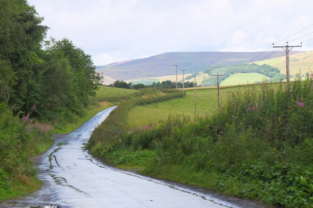
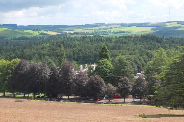
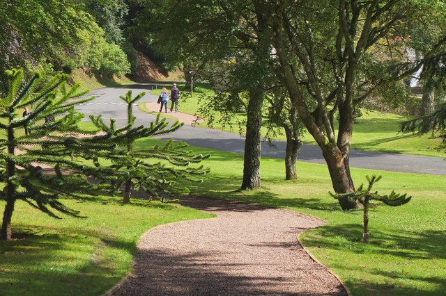
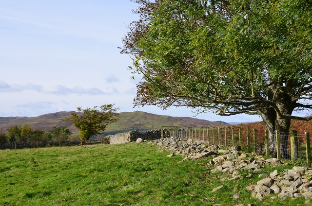
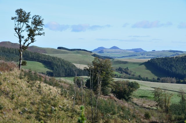
Middlepark Strip is a picturesque woodland area located in the county of Selkirkshire, Scotland. Spanning over a vast expanse of land, the forest is renowned for its abundant natural beauty and diverse range of flora and fauna.

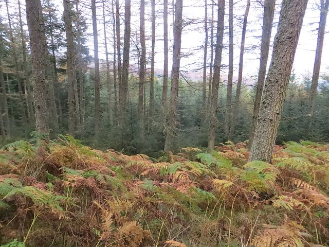
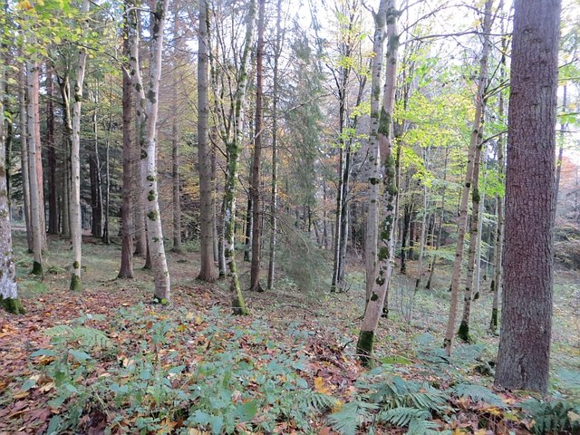
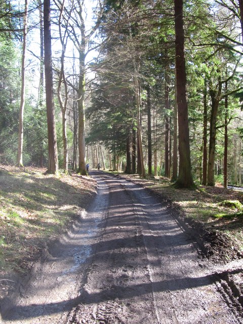
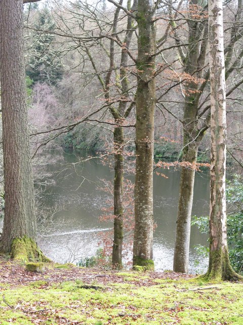
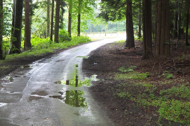
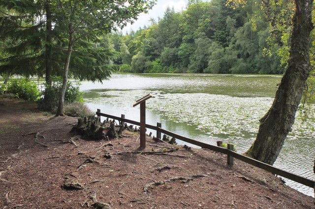
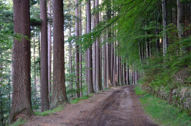
Covering an area of approximately 500 acres, Middlepark Strip is characterized by its dense woodland, consisting mainly of mature deciduous trees such as oak, birch, and beech. The forest floor is carpeted with a rich array of wildflowers, ferns, and mosses, creating a vibrant and verdant ecosystem.

The forest is home to a diverse range of wildlife, including numerous bird species such as woodpeckers, owls, and songbirds. Mammals such as red deer, roe deer, and foxes can also be spotted in the area, adding to the natural charm and biodiversity of Middlepark Strip.

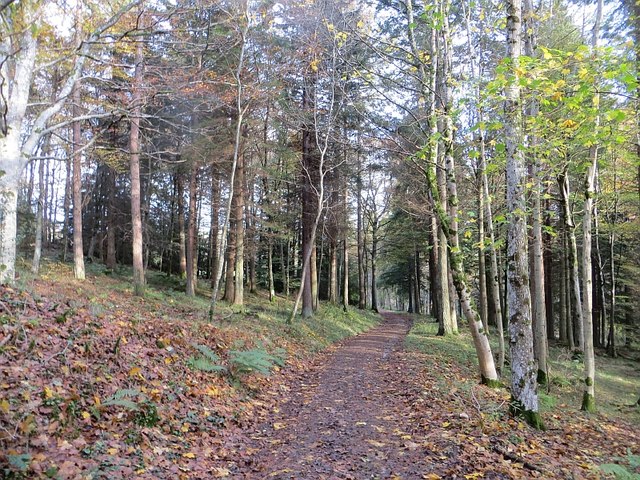
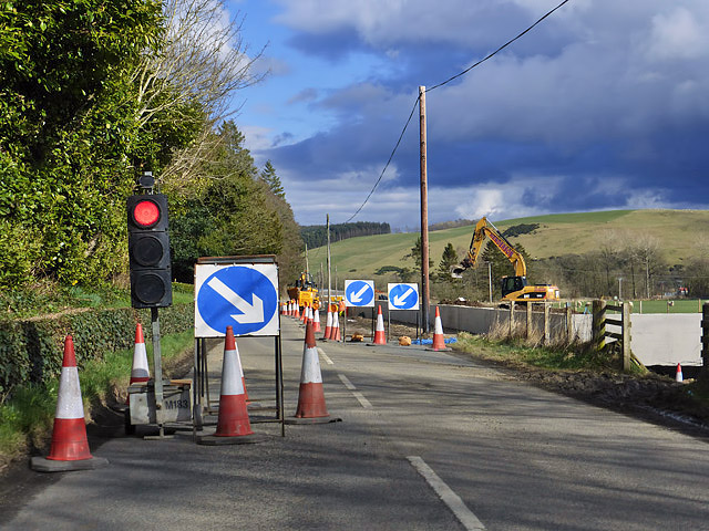
In addition to its natural beauty, the forest boasts a number of walking trails and paths, making it a popular destination for outdoor enthusiasts and nature lovers. Visitors can explore the forest's enchanting atmosphere, enjoying the soothing sounds of rustling leaves and birdsong as they traverse the well-maintained trails.

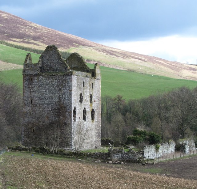
Middlepark Strip is also known for its historical significance. The woodland has played a part in local folklore and has been a source of inspiration for artists and writers throughout the years. Its serene and tranquil ambiance offers a peaceful retreat for those seeking solace amidst nature's wonders.

If you have any feedback on the listing, please let us know in the comments section below.

Middlepark Strip Images

Images are sourced within 2km of 55.55139/-2.9021075 or Grid Reference NT4329. Thanks to Geograph Open Source API. All images are credited.

Bowhill woodlands The northern side of Pernassie Hill.
Bowhill woodlands
The northern side of Pernassie Hill.
Path, Bowhill woods
Path, Bowhill woods
Woodland, Bowhill Mixed woodland at the foot of Pernassie Hill.
Woodland, Bowhill
Mixed woodland at the foot of Pernassie Hill.
Referendum hangover, Yarrowford Remnants of the no campaign which sleepwalked to victory a few weeks earlier. Who would see these tiny stickers on a road hardly walked is a mystery.  Obviously going for the cyclist vote.
Referendum hangover, Yarrowford
Remnants of the no campaign which sleepwalked to victory a few weeks earlier. Who would see these tiny stickers on a road hardly walked is a mystery. Obviously going for the cyclist vote.
Selkirk Flood Prevention Scheme work at Philiphaugh Traffic lights are in place while a low concrete wall is being constructed at a field boundary with the A708.
Selkirk Flood Prevention Scheme work at Philiphaugh
Traffic lights are in place while a low concrete wall is being constructed at a field boundary with the A708.
On the Duchess' Drive The lower end of the drive which forms a splendid 7+ mile walk from Bowhill House, being easily graded throughout.
On the Duchess' Drive
The lower end of the drive which forms a splendid 7+ mile walk from Bowhill House, being easily graded throughout.
Newark Castle A fine looking tower situated on a bluff overlooking the Yarrow Water and commanding the route through the valley. Thought to be the 'New Werk' mentioned in a 1423 charter of Archibald, Earl of Douglas. Like most castles in the Scottish Borders, it saw battles with English invaders and a siege in 1547-8 when the tower was found to be impregnable without cannon being available.  In 1645 a hundred royalist prisoners from the Battle of Philliphaugh are said to have been shot within the courtyard. The tower appears to have been abandoned before 1700 and left to decay.
Newark Castle
A fine looking tower situated on a bluff overlooking the Yarrow Water and commanding the route through the valley. Thought to be the 'New Werk' mentioned in a 1423 charter of Archibald, Earl of Douglas. Like most castles in the Scottish Borders, it saw battles with English invaders and a siege in 1547-8 when the tower was found to be impregnable without cannon being available. In 1645 a hundred royalist prisoners from the Battle of Philliphaugh are said to have been shot within the courtyard. The tower appears to have been abandoned before 1700 and left to decay.
Through trees to the Upper Lake In the grounds of Bowhill House near Selkirk.
Through trees to the Upper Lake
In the grounds of Bowhill House near Selkirk.
Bowhill House north front The main block of the very large country house belonging to the Duke of Buccleuch. The central section seen here is 18thC whilst the wings to either side date from around 1814.
Bowhill House north front
The main block of the very large country house belonging to the Duke of Buccleuch. The central section seen here is 18thC whilst the wings to either side date from around 1814.
Estate road at Bowhill The road connects Bowhill with the North Lodge and passes Newark Castle.
Estate road at Bowhill
The road connects Bowhill with the North Lodge and passes Newark Castle.
Road to Bowhill In the Bowhill Estate approaching the drive to the car park and house.
Road to Bowhill
In the Bowhill Estate approaching the drive to the car park and house.
Bowhill and car park The visitors' car park and the chimneys of Bowhill House in view from the track descending from Parnassie Hill.
Bowhill and car park
The visitors' car park and the chimneys of Bowhill House in view from the track descending from Parnassie Hill.
Path in Bowhill Estate The path from the car park to the café and children's play area.
Path in Bowhill Estate
The path from the car park to the café and children's play area.
The Upper Lake, Bowhill There are several good short walks in the woodland around the two lakes to the south of Bowhill House.
The Upper Lake, Bowhill
There are several good short walks in the woodland around the two lakes to the south of Bowhill House.
An RAF Hercules in the Yarrow Valley This was taken from Newark Hill as a Hercules was on a low level training sortie. For a closer view of the aircraft – see <a href="https://www.geograph.org.uk/photo/5532685">NT4130 : An RAF Hercules in the Yarrow Valley</a>. Newark Castle is at the bottom left.
An RAF Hercules in the Yarrow Valley
This was taken from Newark Hill as a Hercules was on a low level training sortie. For a closer view of the aircraft – see NT4130 : An RAF Hercules in the Yarrow Valley. Newark Castle is at the bottom left.
Avenue on Corbylinn Road, Philiphaugh Some fine trees line the track on the way to the reservoir.
Avenue on Corbylinn Road, Philiphaugh
Some fine trees line the track on the way to the reservoir.
Approach to Tibby Tamson's grave The easiest way to find the grave is to follow the fence up from the reservoir to the wooden stile just visible at the centre of the image. Note that the name given on the OS map is 'Tibby' but 'Tibbie' is used on the graveside plaque and in the local footpath guide.
Approach to Tibby Tamson's grave
The easiest way to find the grave is to follow the fence up from the reservoir to the wooden stile just visible at the centre of the image. Note that the name given on the OS map is 'Tibby' but 'Tibbie' is used on the graveside plaque and in the local footpath guide.
Eildon Hills from Tibby Tamson's Plantation A view characteristic of the Scottish Borders with upland pasture, plantations and shelter belts with the volcanic hills enlivening the skyline.
Eildon Hills from Tibby Tamson's Plantation
A view characteristic of the Scottish Borders with upland pasture, plantations and shelter belts with the volcanic hills enlivening the skyline.
Show me another place!

Middlepark Strip is located at Grid Ref: NT4329 (Lat: 55.55139, Lng: -2.9021075)

Unitary Authority: The Scottish Borders

Police Authority: The Lothians and Scottish Borders

What 3 Words

///later.melons.existence. Near Selkirk, Scottish Borders

Related Wikis

Yarrow Water

The Yarrow Water is a river in the Borders in the south east of Scotland. It is a tributary of the Ettrick Water (itself a tributary of the Tweed) and...

Newark Castle, Selkirkshire

Newark Tower is a large, ruined tower house standing in the grounds of Bowhill House, in the valley of the Yarrow Water three miles west of Selkirk in...
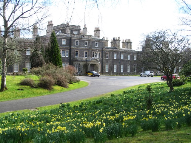
Bowhill House

Bowhill House is a historic house near Bowhill at Selkirk in the Scottish Borders area of Scotland. It is a member of the Historic Houses Association,...

Battle of Philiphaugh

The Battle of Philiphaugh was fought on 13 September 1645 during the Wars of the Three Kingdoms near Selkirk in the Scottish Borders. The Royalist army...

Philiphaugh

Philiphaugh is a village by the Yarrow Water, on the outskirts of Selkirk, in the Scottish Borders. Places nearby include Bowhill, Broadmeadows, the Ettrick...

Bowhill, Scottish Borders

Bowhill is a village off the A708, in the Scottish Borders area of Scotland, near Selkirk, by the Yarrow Water Other places nearby include Bowhill House...

Carterhaugh

Carterhaugh is a wood and farm near the confluence of the Yarrow Water and the Ettrick Water near Selkirk in the Scottish Borders. This real location...

Broadmeadows, Scottish Borders

Broadmeadows is a village in the Scottish Borders area of Scotland, on the A708 near Selkirk. Places nearby include Boleside, Bowhill, Caddonfoot, Ettrickbridge...

Nearby Amenities

Located within 500m of 55.55139,-2.9021075
The data included in this document is from www.openstreetmap.org. The data is made available under ODbL.

Have you been to Middlepark Strip?

Leave your review of Middlepark Strip below (or comments, questions and feedback).