Sauchie Plantation

Wood, Forest in Selkirkshire

Scotland

Sauchie Plantation

Causeway Bridge, Alemoor Reservoir
Causeway Bridge, Alemoor Reservoir Credit: Peter Bond

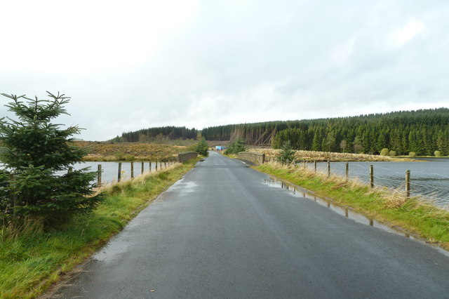
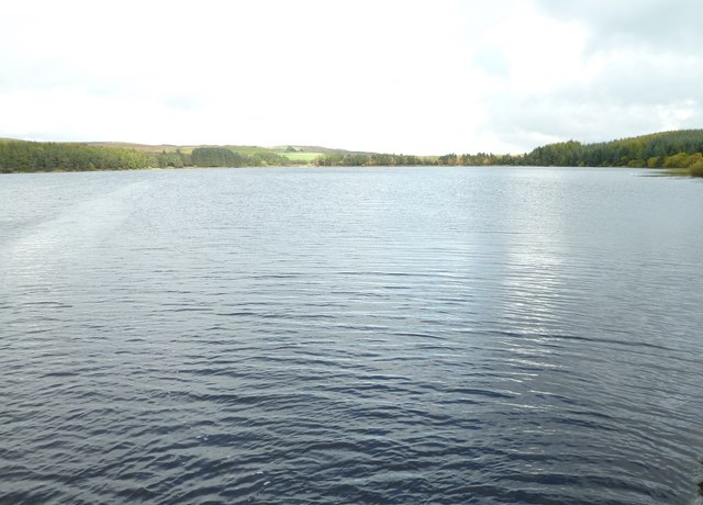
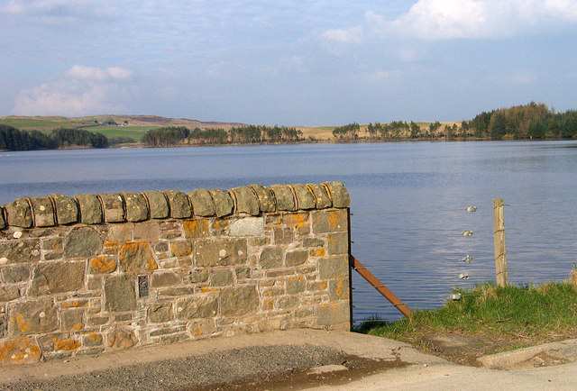
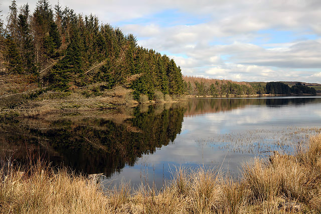
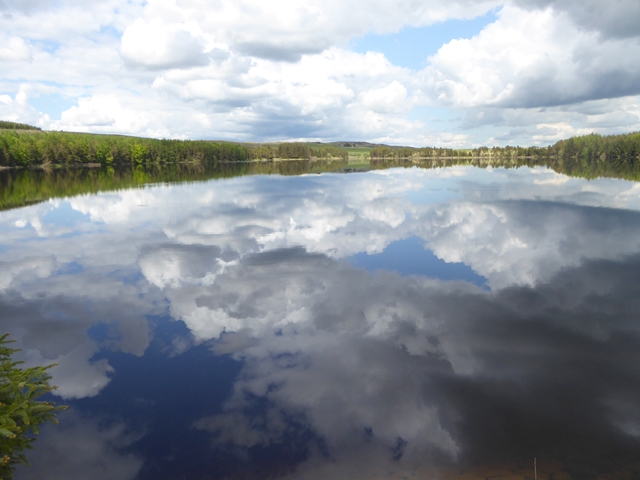
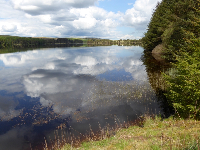
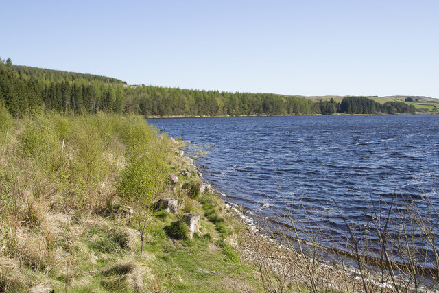
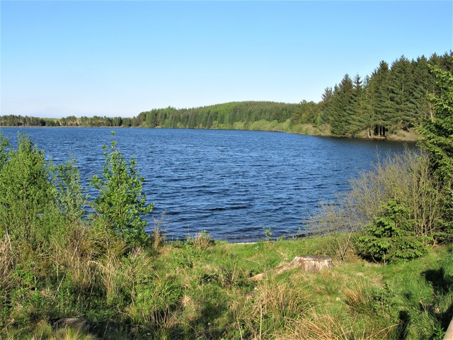
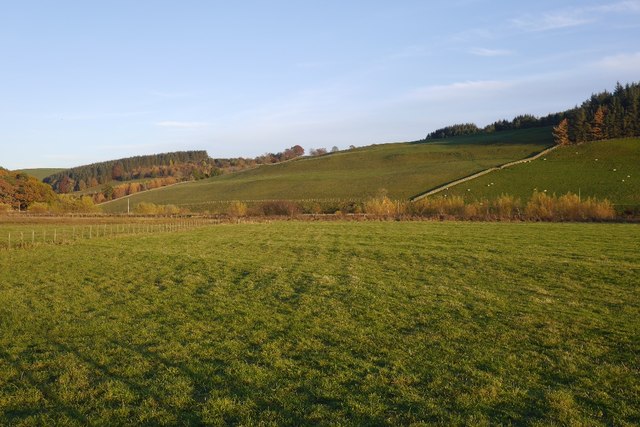
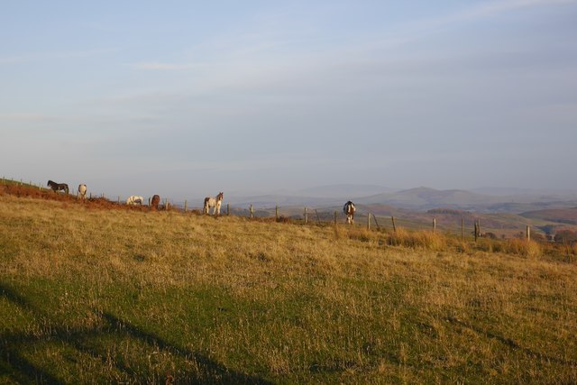
Sauchie Plantation is a beautiful wood located in Selkirkshire, Scotland. It is nestled in the rolling hills of the Scottish Borders and covers a vast area of approximately 500 hectares. The plantation is known for its diverse and lush forest, making it a haven for nature enthusiasts and outdoor lovers.

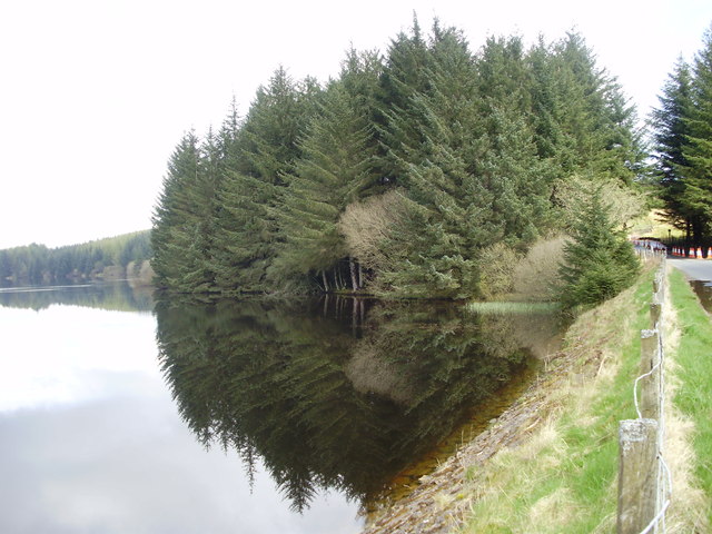
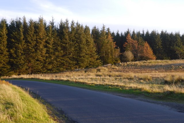
The wood is predominantly composed of deciduous trees, including oak, birch, and beech, which provide a stunning display of colors during the autumn season. These trees create a dense canopy that filters the sunlight, creating a serene and peaceful atmosphere within the woodland. Additionally, there are several coniferous trees, such as Scots pine and Douglas fir, adding to the overall variety and beauty of the plantation.

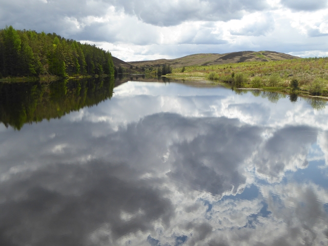
Sauchie Plantation is home to numerous wildlife species, making it a popular destination for birdwatchers and animal lovers. Visitors may catch a glimpse of red squirrels, roe deer, and a variety of bird species, including woodpeckers, owls, and finches. The woodland also supports a rich undergrowth of ferns, mosses, and wildflowers, further enhancing its natural beauty.

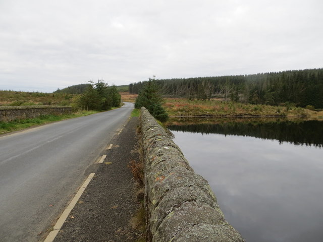
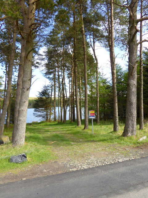
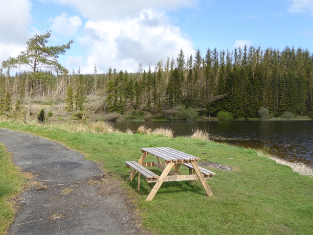
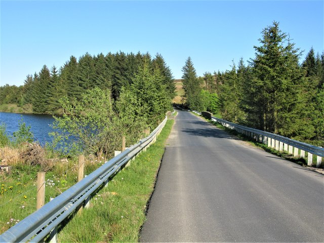
The plantation offers several well-maintained walking trails, allowing visitors to explore the wood at their leisure. These paths lead to scenic viewpoints, secluded picnic spots, and tranquil streams, providing a perfect opportunity to immerse oneself in the serenity of nature.

Sauchie Plantation is a cherished natural treasure in Selkirkshire, offering a peaceful retreat from the hustle and bustle of everyday life. With its diverse forest, abundant wildlife, and picturesque trails, it is a must-visit destination for those seeking a connection with nature in the heart of Scotland.

If you have any feedback on the listing, please let us know in the comments section below.

Sauchie Plantation Images

Images are sourced within 2km of 55.416224/-2.9298434 or Grid Reference NT4113. Thanks to Geograph Open Source API. All images are credited.

Causeway Bridge, Alemoor Reservoir
Alemoor Reservoir
Alemoor Reservoir
Reflections on Alemoor Alemoor Reservoir from the causeway on the way to Hawick
Reflections on Alemoor
Alemoor Reservoir from the causeway on the way to Hawick
Alemoor Reservoir Alemoor Reservoir lies both to the north and south of the B711 which crosses it by a causeway and bridge; the bulk of the reservoir's water lies to the north of the road and is seen here. The wall in the image, which is a parapet of the bridge, carries the OS flush bracket numbered 11071; it's clearly seen.
Alemoor Reservoir
Alemoor Reservoir lies both to the north and south of the B711 which crosses it by a causeway and bridge; the bulk of the reservoir's water lies to the north of the road and is seen here. The wall in the image, which is a parapet of the bridge, carries the OS flush bracket numbered 11071; it's clearly seen.
Ordnance Survey Flush Bracket 11071 This can be found on the parapet wall of Alemoor Reservoir.
For more detail see : <span class="nowrap"><a title="http://www.bench-marks.org.uk/bm11108" rel="nofollow ugc noopener" href="http://www.bench-marks.org.uk/bm11108">Link</a><img style="margin-left:2px;" alt="External link" title="External link - shift click to open in new window" src="https://s1.geograph.org.uk/img/external.png" width="10" height="10"/></span>
Ordnance Survey Flush Bracket 11071
This can be found on the parapet wall of Alemoor Reservoir. For more detail see : LinkExternal link
The Causeway Road (B711) crossing Alemoor Reservoir Looking westward.
The Causeway Road (B711) crossing Alemoor Reservoir
Looking westward.
Alemoor Reservoir
Alemoor Reservoir
Reflected cloudscape Looking west from the Causeway up the narrow central section of Alemoor Reservoir.
Reflected cloudscape
Looking west from the Causeway up the narrow central section of Alemoor Reservoir.
Reflected cloudscape Looking from the Causeway towards the eastern end of the Alemoor Reservoir.
Reflected cloudscape
Looking from the Causeway towards the eastern end of the Alemoor Reservoir.
Reflected cloudscape Looking from the Causeway towards the eastern end of the Alemoor Reservoir.
Reflected cloudscape
Looking from the Causeway towards the eastern end of the Alemoor Reservoir.
Track to the water's edge A short track leading through the trees from the B711 to the south shore of Alemoor Reservoir. The notice cheerily informs us that "Deaths have occurred at reservoirs".
Track to the water's edge
A short track leading through the trees from the B711 to the south shore of Alemoor Reservoir. The notice cheerily informs us that "Deaths have occurred at reservoirs".
Picnic table by the Alemoor Reservoir On a short length of abandoned road near the Causeway which divides the reservoir into two parts.
Picnic table by the Alemoor Reservoir
On a short length of abandoned road near the Causeway which divides the reservoir into two parts.
The Alemoor Reservoir The Alemoor Reservoir is crossed by a causeway on which runs the B711. This road is rather variable in parts being single track and passing places in others rather wider.
The Alemoor Reservoir
The Alemoor Reservoir is crossed by a causeway on which runs the B711. This road is rather variable in parts being single track and passing places in others rather wider.
Causeway in the Alemoor Reservoir Sometimes known as Alemoor Loch, the causeway carries the B711 and divides the reservoir into 2 parts.
Causeway in the Alemoor Reservoir
Sometimes known as Alemoor Loch, the causeway carries the B711 and divides the reservoir into 2 parts.
Northern Half of Alemoor Reservoir Alemoor Reservoir is divided into 2 parts by the causeway carrying the B711. This view of the northern half is from the western end of the causeway.
Northern Half of Alemoor Reservoir
Alemoor Reservoir is divided into 2 parts by the causeway carrying the B711. This view of the northern half is from the western end of the causeway.
Haugh below Milsingden Flat grassland beside the Borthwick Water.
Haugh below Milsingden
Flat grassland beside the Borthwick Water.
Rough grazing Hill pasture above Wester Alemoor.
Rough grazing
Hill pasture above Wester Alemoor.
Parkend Plantation B711 passes a small conifer block.
Parkend Plantation
B711 passes a small conifer block.
Show me another place!

Sauchie Plantation is located at Grid Ref: NT4113 (Lat: 55.416224, Lng: -2.9298434)

Unitary Authority: The Scottish Borders

Police Authority: The Lothians and Scottish Borders

What 3 Words

///inversely.hopeless.ponies. Near Teviothead, Scottish Borders

Related Wikis

Burnfoot, Roberton

Burnfoot (Scottish Gaelic: Bun na h-Aibhne) is a hamlet in the Scottish Borders area of Scotland, close to Roberton, by the Borthwick Water. The nearest...

Roberton, Scottish Borders

Roberton is a small village in the Scottish Borders area of Scotland, on the B711 and near to the A7, 5 miles (8 kilometres) from Hawick, 22 mi (35 km...

Alemoor Loch

Alemoor Loch, also known as Alemoor Reservoir, is a small reservoir in the Scottish Borders area of Scotland. It is situated on the Ale Water, 10 kilometres...

Harden Castle

Harden Castle is a 16th century tower house, about 3.5 miles (5.6 km) west of Hawick, Scottish Borders. It is alternatively known as Harden House or Harden...

Newmill-on-Teviot

Newmill-on-Teviot, commonly called Newmill, is a hamlet in the Scottish Borders, 7 kilometres (4.3 mi) south of Hawick on the River Teviot. The remains...

Branxholme Castle

Branxholme Castle is a five-storey tower at Branxholme, about 3 miles south-west of Hawick in the Borders region of Scotland. == History == The present...

Branxholme

Branxholme is a hamlet in the Scottish Borders area of Scotland, overlooking the River Teviot, three miles southwest of Hawick, on the A7 road to Langholm...

Broadhaugh

Broadhaugh is a hamlet in the Scottish Borders area of Scotland, in the parish of Teviothead, in former Roxburghshire. == See also == List of places in...

Nearby Amenities

Located within 500m of 55.416224,-2.9298434
Power: pole
Lat/Long: 55.4123948/-2.9317539
Power: pole
Lat/Long: 55.4127369/-2.9311977
Power: pole
Lat/Long: 55.4131505/-2.930227
Power: pole
Lat/Long: 55.4135671/-2.9292176
Power: pole
Lat/Long: 55.4137966/-2.9278734
Power: pole
Lat/Long: 55.4140348/-2.926537
Power: pole
Lat/Long: 55.4142687/-2.9251852
Power: pole
Lat/Long: 55.4143973/-2.9244539
Power: pole
Lat/Long: 55.4149101/-2.923483
Power: pole
Lat/Long: 55.4155111/-2.922345
Power: pole
Lat/Long: 55.4143871/-2.9235681
Power: pole
Lat/Long: 55.4137542/-2.9233132
The data included in this document is from www.openstreetmap.org. The data is made available under ODbL.

Have you been to Sauchie Plantation?

Leave your review of Sauchie Plantation below (or comments, questions and feedback).