Corsehope Strip

Wood, Forest in Midlothian

Scotland

Corsehope Strip

Road to Roughsware Wood
Road to Roughsware Wood Credit: Richard Webb

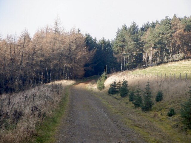
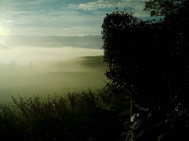
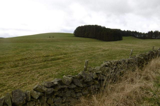
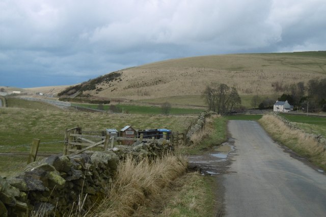
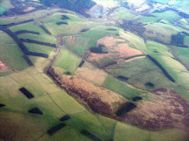
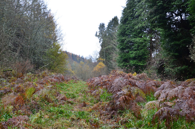
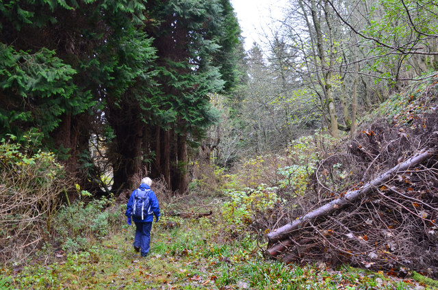
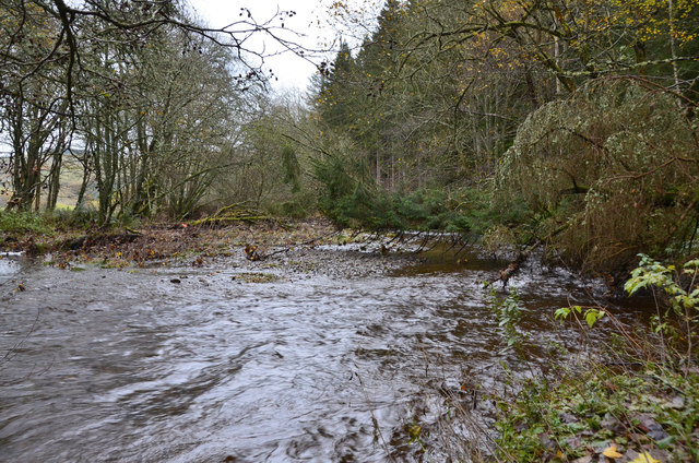
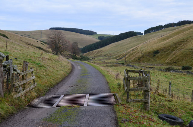
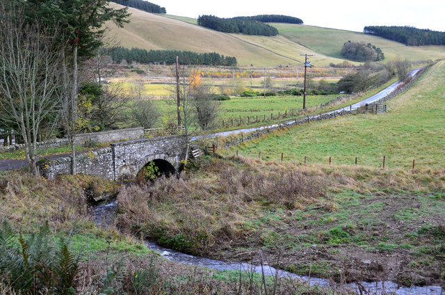
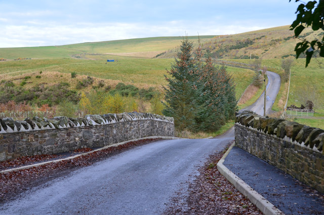
Corsehope Strip is a scenic woodland area located in Midlothian, Scotland. Situated within the larger expanse of the Pentland Hills Regional Park, this forested area spans approximately 200 acres and is a popular destination for nature lovers and outdoor enthusiasts.

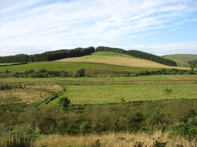
The woodland is predominantly composed of native Scottish tree species, such as oak, birch, and rowan, creating a diverse and vibrant ecosystem. The forest floor is adorned with a rich carpet of wildflowers, including bluebells, primroses, and wood sorrel, which add to the area's natural beauty.

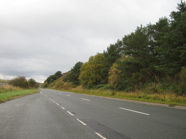
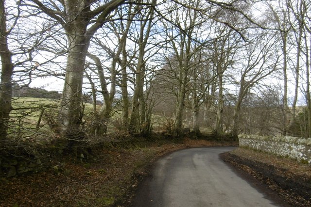
Corsehope Strip offers a range of recreational activities for visitors to enjoy. There are several well-marked trails that crisscross the woodland, providing opportunities for hiking, walking, and cycling. These paths cater to different fitness levels and offer stunning views of the surrounding countryside.

The forest also provides habitat for a variety of wildlife species, including red squirrels, roe deer, and a wide array of birdlife. It is not uncommon to spot buzzards soaring overhead or hear the distinct call of a woodpecker in the distance.

In addition to its natural splendor, Corsehope Strip holds historical significance. The remnants of an ancient settlement, dating back to the Iron Age, can be found within the woodland. These archaeological remains add an extra layer of intrigue to the area, allowing visitors to explore the rich cultural heritage of the region.

Overall, Corsehope Strip in Midlothian offers a captivating blend of natural beauty, recreational opportunities, and historical significance, making it a must-visit destination for those seeking to immerse themselves in Scotland's enchanting woodlands.

If you have any feedback on the listing, please let us know in the comments section below.

Corsehope Strip Images

Images are sourced within 2km of 55.76021/-2.9630969 or Grid Reference NT3952. Thanks to Geograph Open Source API. All images are credited.

Road to Roughsware Wood
The Borders Railway, Heriot Contractors carrying out some minor excavation by the side of the recently completed line, due to open next month, seen from the new road bridge S of Heriot village.
The Borders Railway, Heriot
Contractors carrying out some minor excavation by the side of the recently completed line, due to open next month, seen from the new road bridge S of Heriot village.
Border Railway near Heriot On opening day, looking southwards. The railway was closed between 1969 and 2015 and remains closed south of Tweedbank.
Border Railway near Heriot
On opening day, looking southwards. The railway was closed between 1969 and 2015 and remains closed south of Tweedbank.
New road, Heriot A bridge has been built south of the old level crossing site at Heriot. There is now a pedestrian underpass there. The railway reopened on the 6th September 2015. <a href="https://www.geograph.org.uk/photo/4648382">NT4054 : Borders Railway, Heriot</a>
New road, Heriot
A bridge has been built south of the old level crossing site at Heriot. There is now a pedestrian underpass there. The railway reopened on the 6th September 2015. NT4054 : Borders Railway, Heriot
Mist blanketing Gala Valley South of Heriot
A7 lay-by
A7 lay-by
A steam special on the Borders Railway at Hangingshaw The steam locomotive Royal Scot is being hauled back to Edinburgh by a vintage diesel.
A steam special on the Borders Railway at Hangingshaw
The steam locomotive Royal Scot is being hauled back to Edinburgh by a vintage diesel.
Chapel Hill The recently reopened Borders Railway crosses the centre of this picture.
Chapel Hill
The recently reopened Borders Railway crosses the centre of this picture.
Hillside above Halltree
Yellow road, Kilcoulter Approach to Kilcoulter Bridge, heading northwards.
Yellow road, Kilcoulter
Approach to Kilcoulter Bridge, heading northwards.
Road south of Heriot The white house by the A7 used to have a shop and filling station.
<a href="https://www.geograph.org.uk/photo/38033">NT4053 : Hangingshaw Post Office.</a>
Road south of Heriot
The white house by the A7 used to have a shop and filling station. NT4053 : Hangingshaw Post Office.
Between Heriot and Fountainhall Plantations and upland pastures to the west of the Gala Water valley. The A7 runs in the valley across the  top of the picture.
Between Heriot and Fountainhall
Plantations and upland pastures to the west of the Gala Water valley. The A7 runs in the valley across the top of the picture.
Rough path near White Bridge, Heriot The path shown running ENE from White Bridge cannot be recommended. The section shown here looks straightforward but led here through a flooded ditch, avoided by taking to the undergrowth on the right.
Rough path near White Bridge, Heriot
The path shown running ENE from White Bridge cannot be recommended. The section shown here looks straightforward but led here through a flooded ditch, avoided by taking to the undergrowth on the right.
A forlorn hope, Heriot On an abortive attempt to follow the path shown on the S bank of the Heriot Water between White Bridge and Kilcoulter Bridge. Beyond this point the route was heavily overgrown with fallen trees, swampland and barbed wire adding to the fun.
A forlorn hope, Heriot
On an abortive attempt to follow the path shown on the S bank of the Heriot Water between White Bridge and Kilcoulter Bridge. Beyond this point the route was heavily overgrown with fallen trees, swampland and barbed wire adding to the fun.
Heriot Water at Kilcoulter Wood The furthest point reached on the attempt to follow the path from White Bridge to Kilcoulter Bridge.
Heriot Water at Kilcoulter Wood
The furthest point reached on the attempt to follow the path from White Bridge to Kilcoulter Bridge.
Corsehope glen On the access road to Corsehope House from the minor road at Kilcoulter.
Corsehope glen
On the access road to Corsehope House from the minor road at Kilcoulter.
Chapel Bridge, Kilcoulter Old maps (e.g. OS 6" Edinburghshire sheet XXI.SW 1895) show Halltree Chapel a short distance to the south on Chapel Hill. The bridge carries the Fountainhall road across the Corsehope Burn.
Chapel Bridge, Kilcoulter
Old maps (e.g. OS 6" Edinburghshire sheet XXI.SW 1895) show Halltree Chapel a short distance to the south on Chapel Hill. The bridge carries the Fountainhall road across the Corsehope Burn.
Refurbished Kilcoulter Bridge The stone bridge carries the Heriot to Fountainhall road over the Heriot Water and has clearly undergone maintenance work recently. Compare with Mike Richardson's photograph <a href="https://www.geograph.org.uk/photo/3946067">NT4052 : Kilcoulter Bridge</a>.
Refurbished Kilcoulter Bridge
The stone bridge carries the Heriot to Fountainhall road over the Heriot Water and has clearly undergone maintenance work recently. Compare with Mike Richardson's photograph NT4052 : Kilcoulter Bridge.
Show me another place!

Corsehope Strip is located at Grid Ref: NT3952 (Lat: 55.76021, Lng: -2.9630969)

Unitary Authority: The Scottish Borders

Police Authority: The Lothians and Scottish Borders

What 3 Words

///shorthand.keyboard.fizzy. Near Gorebridge, Midlothian

Related Wikis

Heriot, Scottish Borders

Heriot is a small village in the Moorfoot Hills southeast of Edinburgh, Scotland, within Eildon (part of the Scottish Borders council area, though historically...

Halltree

Halltree is a hamlet in the Scottish Borders. == Etymology == The etymology of Halltree is debated, but the second element is likely to be a Cumbric word...
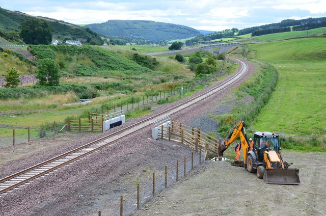
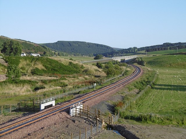
Borders Railway

The Borders Railway connects the city of Edinburgh with Galashiels and Tweedbank in the Scottish Borders. The railway follows most of the alignment of...

Heriot railway station

Heriot railway station served the village of Heriot, Scottish Borders, Scotland from 1848 to 1969 on the Waverley Route. == History == The station opened...

Carcant

Carcant is a small settlement and a wind farm, near Heriot in the Scottish Borders area of Scotland. A famous inhabitant of Carcant was Eric Liddell....

Fountainhall railway station

Fountainhall railway station served the village of Fountainhall, Scottish Borders from 1848 to 1969 on the Waverley Route. == History == The station opened...

Falahill

Falahill is a village in the Scottish Borders, in the Moorfoot Hills, at NT387563, in the Parish of Heriot, and close to the border with Midlothian. Nearby...

Garvald, Scottish Borders

Garvald (Scots: Garvit) is a hamlet on the B7007, near Dewar, by the Dewar Burn, in the Moorfoot Hills, in the Scottish Borders area of Scotland, in the...

Nearby Amenities

Located within 500m of 55.76021,-2.9630969
Power: pole
Lat/Long: 55.7614414/-2.9559762
Power: pole
Lat/Long: 55.761155/-2.9579995
Power: pole
Lat/Long: 55.7609569/-2.9594718
Power: pole
Lat/Long: 55.7601412/-2.9599987
Power: pole
Lat/Long: 55.7590801/-2.9606629
Power: pole
Lat/Long: 55.757996/-2.9613298
Power: pole
Lat/Long: 55.7568474/-2.96205
Power: pole
Lat/Long: 55.7559308/-2.9623045
The data included in this document is from www.openstreetmap.org. The data is made available under ODbL.

Have you been to Corsehope Strip?

Leave your review of Corsehope Strip below (or comments, questions and feedback).