Aucharroch Wood

Wood, Forest in Angus

Scotland

Aucharroch Wood

View from above Audallan This is interesting scenery. A steep sided valley with a small burn and flat floor. The valley runs along the base of the higher hills rather than away from them and gives one the impression that this must have been some sort of glacial meltwater channel.
View from above Audallan Credit: Gordon Hatton

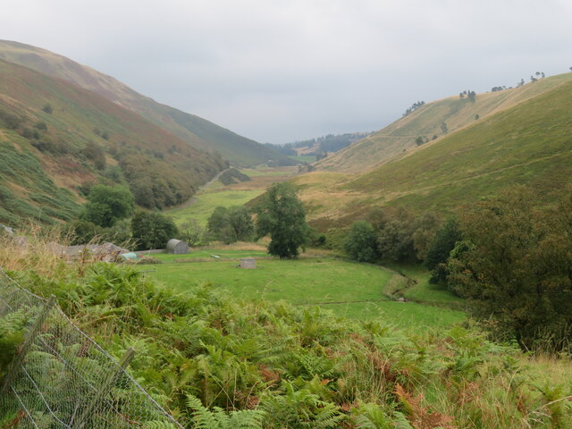
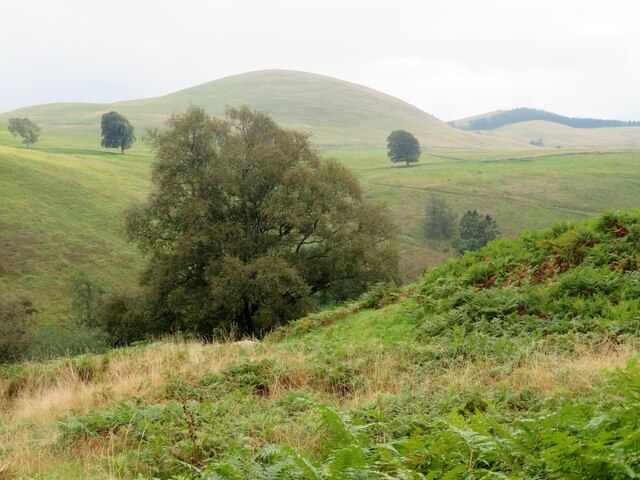
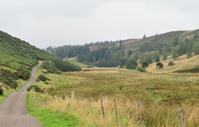
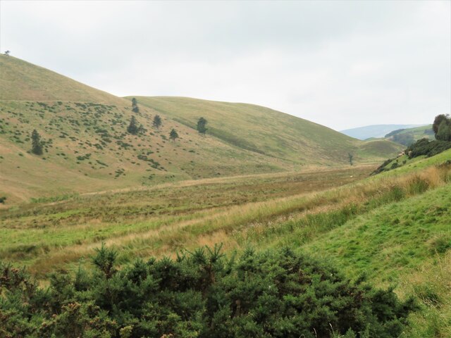
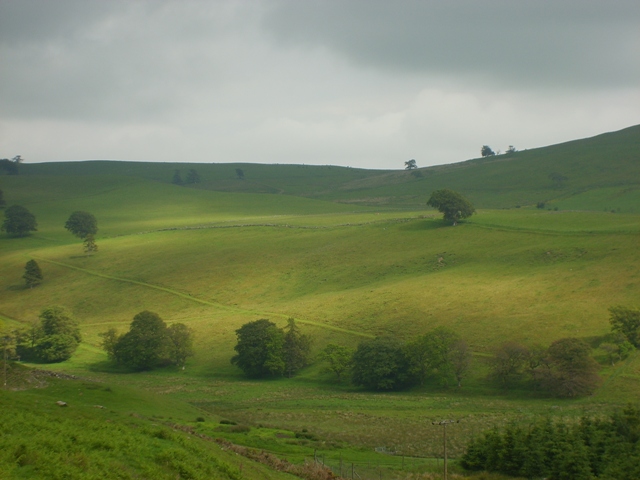
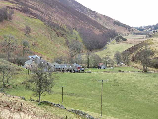
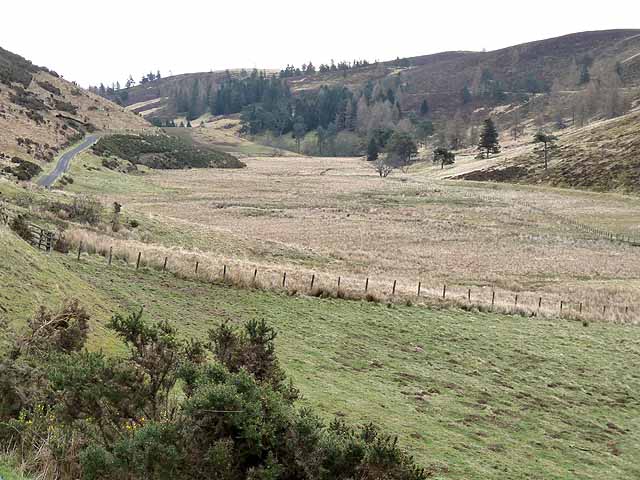
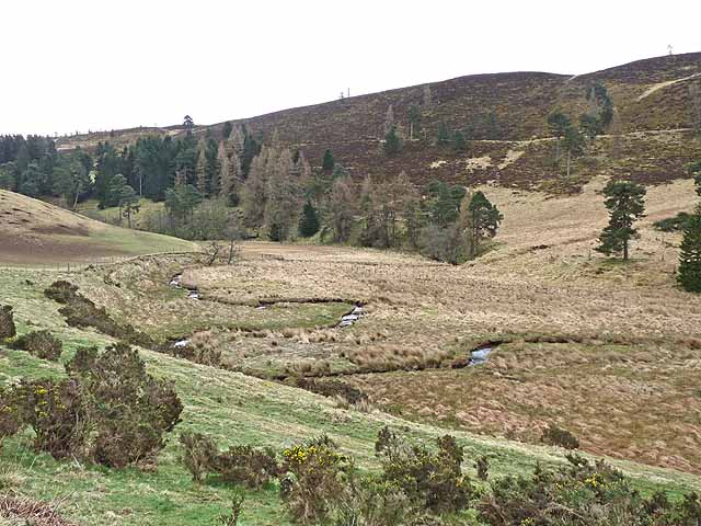
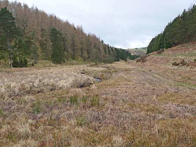
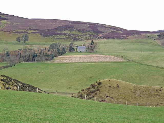
Aucharroch Wood, located in Angus, Scotland, is a charming forest known for its scenic beauty and diverse flora and fauna. Spanning an area of approximately 100 acres, the wood is nestled in the countryside, offering visitors a tranquil and serene environment to explore.

The forest is primarily composed of native broadleaf trees such as oak, birch, and beech, which create a dense canopy providing shade and shelter for a variety of wildlife. The undergrowth consists of wildflowers, ferns, and mosses, adding to the wood's natural charm.

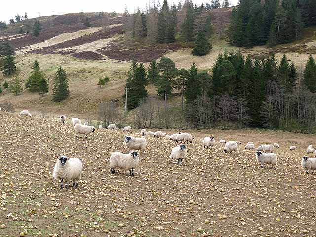
Aucharroch Wood is a haven for nature enthusiasts and birdwatchers, as it is home to numerous bird species including woodpeckers, jays, and owls. The wood also attracts a range of small mammals like red squirrels, rabbits, and voles, making it an ideal spot for wildlife observation.

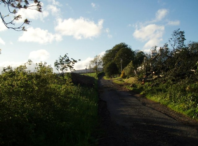
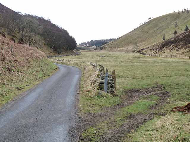
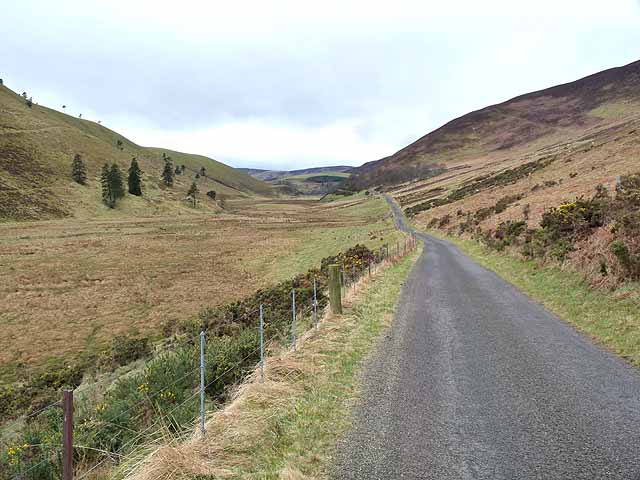
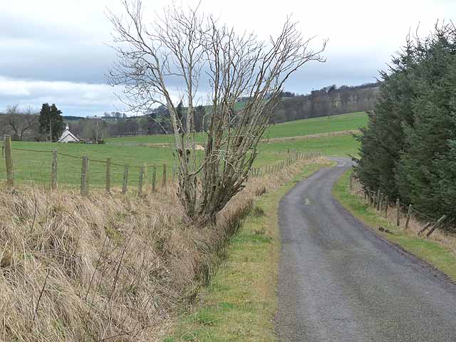
The wood offers several well-maintained trails for visitors to explore, allowing them to immerse themselves in the beauty of nature. These trails are suitable for walkers of all abilities and are often accompanied by information boards providing insights into the forest's ecological importance and historical significance.

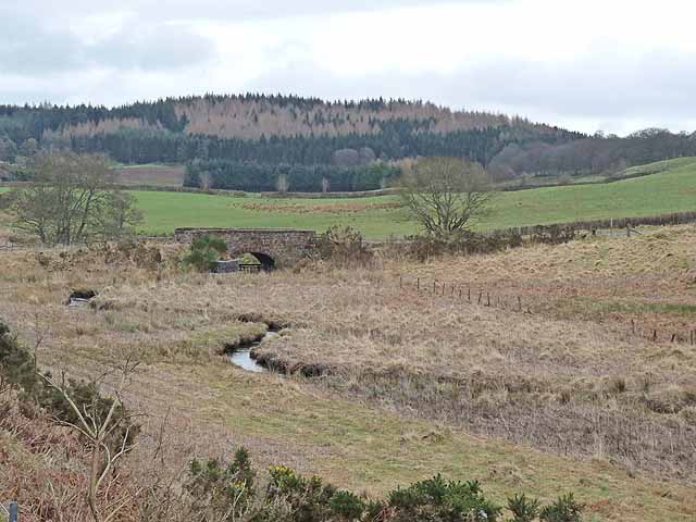
In addition to its natural beauty, Aucharroch Wood also holds cultural and historical value. The wood is believed to have ancient origins, with remnants of prehistoric settlements and burial sites discovered in the surrounding area. This makes it an intriguing destination for those interested in archaeology and history.

Overall, Aucharroch Wood is a captivating forest that offers a peaceful retreat for nature lovers, providing a glimpse into the natural and cultural heritage of Angus.

If you have any feedback on the listing, please let us know in the comments section below.

Aucharroch Wood Images

Images are sourced within 2km of 56.707386/-3.1033351 or Grid Reference NO3257. Thanks to Geograph Open Source API. All images are credited.

View from above Audallan This is interesting scenery. A steep sided valley with a small burn and flat floor. The valley runs along the base of the higher hills rather than away from them and gives one the impression that this must have been some sort of glacial meltwater channel.
View from above Audallan
This is interesting scenery. A steep sided valley with a small burn and flat floor. The valley runs along the base of the higher hills rather than away from them and gives one the impression that this must have been some sort of glacial meltwater channel.
A southward view near Audallan Interesting country, not quite highland and not quite lowland. There's grassland, moorland and forest around here and a curious number of mature trees scattered across the hillside. The rounded pudding shaped hill in the distance is Mile Hill at 410m.
A southward view near Audallan
Interesting country, not quite highland and not quite lowland. There's grassland, moorland and forest around here and a curious number of mature trees scattered across the hillside. The rounded pudding shaped hill in the distance is Mile Hill at 410m.
Valley of the Quharity Burn The minor road keeps to the slopes on the left of this flat bottomed valley where the little Quharity Burn meanders slowly along. This must be a misfit stream in an oversized valley, which in turn must have seen glacial action and may well have once held a lake.
Valley of the Quharity Burn
The minor road keeps to the slopes on the left of this flat bottomed valley where the little Quharity Burn meanders slowly along. This must be a misfit stream in an oversized valley, which in turn must have seen glacial action and may well have once held a lake.
Looking west along the valley towards Audallan The curious valley of the Quharity Burn, a very small stream in an impressive, steep sided valley which runs west to east along the base of the big hills instead of away from them. This bears all the hallmarks of a glacial spillway or overflow channel carved out at a time when the ice age was coming to an end.
Looking west along the valley towards Audallan
The curious valley of the Quharity Burn, a very small stream in an impressive, steep sided valley which runs west to east along the base of the big hills instead of away from them. This bears all the hallmarks of a glacial spillway or overflow channel carved out at a time when the ice age was coming to an end.
Sunny pastures at Gairlaw
After the storm A May storm had felled many trees. The remains of one lie to the right after road was cleared.
After the storm
A May storm had felled many trees. The remains of one lie to the right after road was cleared.
Auldallan and the valley of the Quharity Burn This valley which runs along the foot of the Highlands to the north (left) gives the strong impression of having been a glacial overflow channel dating from the Ice Age.
Auldallan and the valley of the Quharity Burn
This valley which runs along the foot of the Highlands to the north (left) gives the strong impression of having been a glacial overflow channel dating from the Ice Age.
The "High Road" at Auldallan The valley of the Quharity Burn which runs along the foot of the Highlands to the north (left) gives the strong impression of having been a glacial overflow channel dating from the Ice Age.
The "High Road" at Auldallan
The valley of the Quharity Burn which runs along the foot of the Highlands to the north (left) gives the strong impression of having been a glacial overflow channel dating from the Ice Age.
The "High Road" and the valley of the Quharity Burn The valley of the Quharity Burn which runs along the foot of the Highlands to the north (left) gives the strong impression of having been a glacial overflow channel dating from the Ice Age.
The "High Road" and the valley of the Quharity Burn
The valley of the Quharity Burn which runs along the foot of the Highlands to the north (left) gives the strong impression of having been a glacial overflow channel dating from the Ice Age.
The "High Road" and the valley of the Quharity Burn The valley of the Quharity Burn which runs along the foot of the Highlands to the north (right) gives the strong impression of having been a glacial overflow channel dating from the Ice Age.
The "High Road" and the valley of the Quharity Burn
The valley of the Quharity Burn which runs along the foot of the Highlands to the north (right) gives the strong impression of having been a glacial overflow channel dating from the Ice Age.
Aucharroch Farm
Aucharroch Farm
Peevish notice Fed up with the sat navs getting it wrong.
Peevish notice
Fed up with the sat navs getting it wrong.
Meanders in the Quharity Burn The valley of the Quharity Burn which runs along the foot of the Highlands to the north (left) gives the strong impression of having been a glacial overflow channel dating from the Ice Age.
Meanders in the Quharity Burn
The valley of the Quharity Burn which runs along the foot of the Highlands to the north (left) gives the strong impression of having been a glacial overflow channel dating from the Ice Age.
Sheep folded on root crops In the valley of the Quharity Burn.
Sheep folded on root crops
In the valley of the Quharity Burn.
Country road near Over Ascreavie
Bridge over the Quharity Burn The valley of the Quharity Burn which runs along the foot of the Highlands to the north (left) gives the strong impression of having been a glacial overflow channel dating from the Ice Age. The large wood in the distance adjoins the lower end of Glen Prosen.
Bridge over the Quharity Burn
The valley of the Quharity Burn which runs along the foot of the Highlands to the north (left) gives the strong impression of having been a glacial overflow channel dating from the Ice Age. The large wood in the distance adjoins the lower end of Glen Prosen.
Valley of the Quharity Burn The marshy valley of the Quharity Burn which runs along the foot of the Highlands to the north (right) gives the strong impression of having been a glacial overflow channel dating from the Ice Age.
Valley of the Quharity Burn
The marshy valley of the Quharity Burn which runs along the foot of the Highlands to the north (right) gives the strong impression of having been a glacial overflow channel dating from the Ice Age.
Wester Pearsie Isolated house at the foot of Linkie Hill <a href="https://www.geograph.org.uk/gridref/NO3359">NO3359</a>.
Wester Pearsie
Isolated house at the foot of Linkie Hill NO3359.
Show me another place!

Aucharroch Wood is located at Grid Ref: NO3257 (Lat: 56.707386, Lng: -3.1033351)

Unitary Authority: Angus

Police Authority: Tayside

What 3 Words

///stands.friends.surfacing. Near Kirriemuir, Angus

Related Wikis

Ascreavie

Ascreavie is a country house in Angus, Scotland. It is located 2 kilometres (1.2 mi) north of Kirkton of Kingoldrum, and 6 kilometres (3.7 mi) north-west...

Kirkton of Kingoldrum

Kirkton of Kingoldrum is a village in Angus, Scotland. It lies in approximately four miles (6 km) west of Kirriemuir on the B951 road. == References ==

Cat Law

Cat Law (671 m) is a hill in the southern Mounth of Scotland, north of Kirriemuir in Angus. A rounded peak, it lies above Strathmore in the south and offers...

Balfour Castle, Angus

Balfour Castle was a baronial mansion at Balfour Mains, near Kirkton of Kingoldrum, Angus, Scotland. The castle which was built in the 16th century is...

Balintore Castle

Balintore Castle is a Victorian Category A listed building in Scotland. The castle occupies an elevated site in moorland above Balintore village, a few...

Balintore, Angus

Balintore (Scottish Gaelic: Baile an Todhair) is a village in Angus, Scotland. It lies in Glen Isla, four miles north of the Loch of Lintrathen and seven...

Loch of Kinnordy

Loch of Kinnordy is a small loch located just west of town of Kirriemuir in Angus, Scotland, which is an important wildlife habitat. The loch itself is...

Kinnordy House

Kinnordy House (alternative spellings: Kynnordy, Kinardy, Kinnordie and Kinorde) is an estate house near Kirriemuir in Angus, Scotland. The first house...

Have you been to Aucharroch Wood?

Leave your review of Aucharroch Wood below (or comments, questions and feedback).