Bonnington Covert

Wood, Forest in Peeblesshire

Scotland

Bonnington Covert

Replanting felled area, Bonnington Woodland here was felled last year and now replanting is taking place - compare with <a href="https://www.geograph.org.uk/photo/7529238">NT2539 : Felled plantation near The Cut, Peebles</a>.
Replanting felled area, Bonnington Credit: Jim Barton

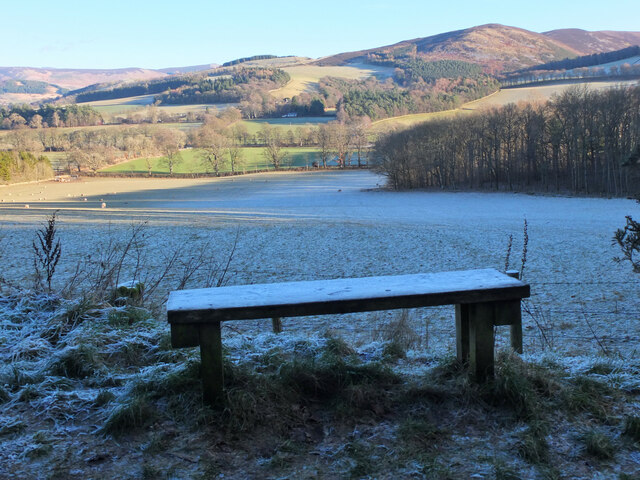
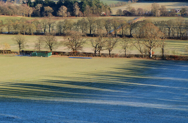
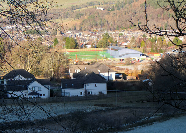
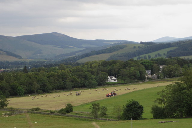
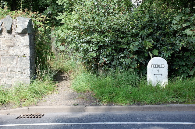
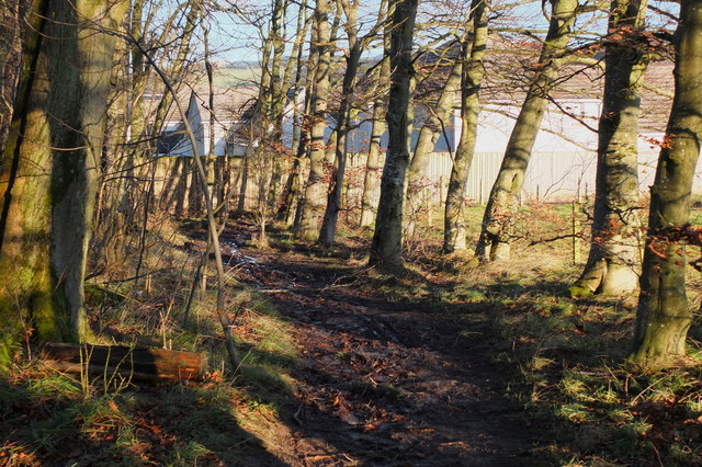
Bonnington Covert is a picturesque woodland area located in Peeblesshire, Scotland. Covering approximately 100 acres, this enchanting forest is a haven for nature enthusiasts and outdoor adventurers. The covert is situated near the small town of Peebles, just a short drive away from Edinburgh.

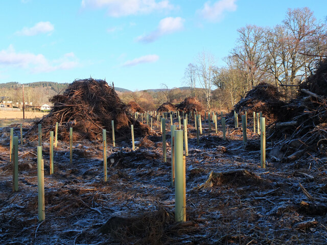
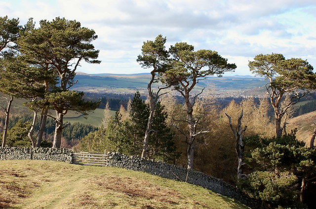
The woodland is characterized by a diverse array of trees, including oak, beech, and birch, which create a vibrant and ever-changing landscape throughout the seasons. The forest floor is adorned with an abundance of native flora, such as bluebells, wild garlic, and ferns, adding to the natural beauty of the area.

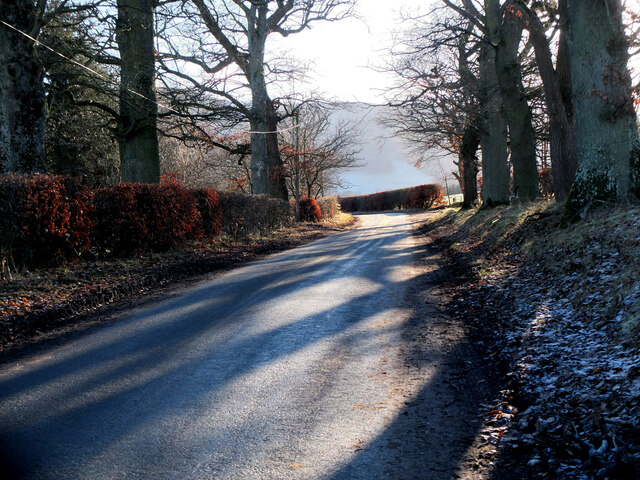
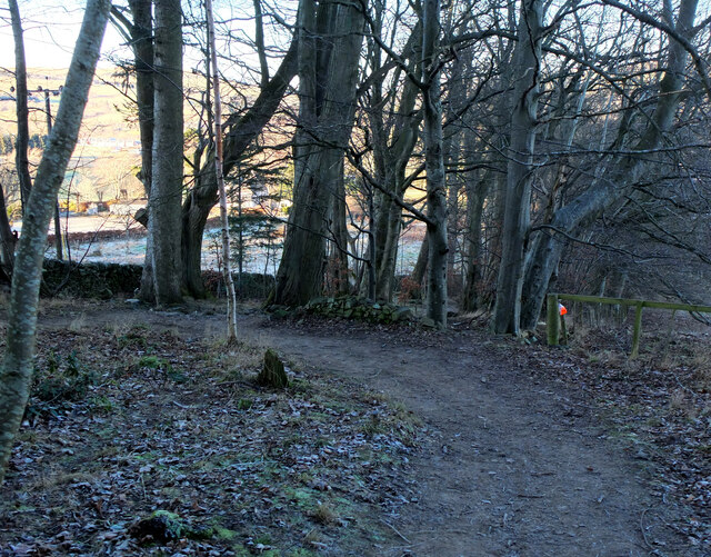
Bonnington Covert offers a variety of recreational activities for visitors to enjoy. There are numerous walking trails that wind their way through the woodland, allowing explorers to immerse themselves in the tranquility of nature. The paths are well-maintained and clearly marked, making it easy for visitors to navigate the forest and discover its hidden treasures.

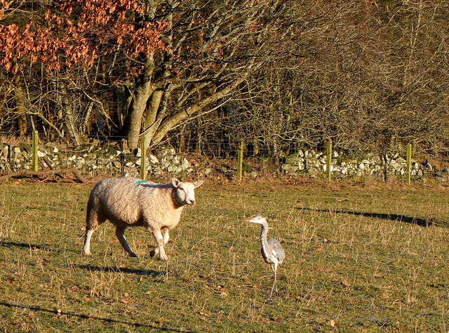
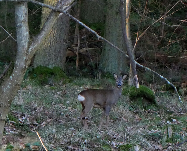
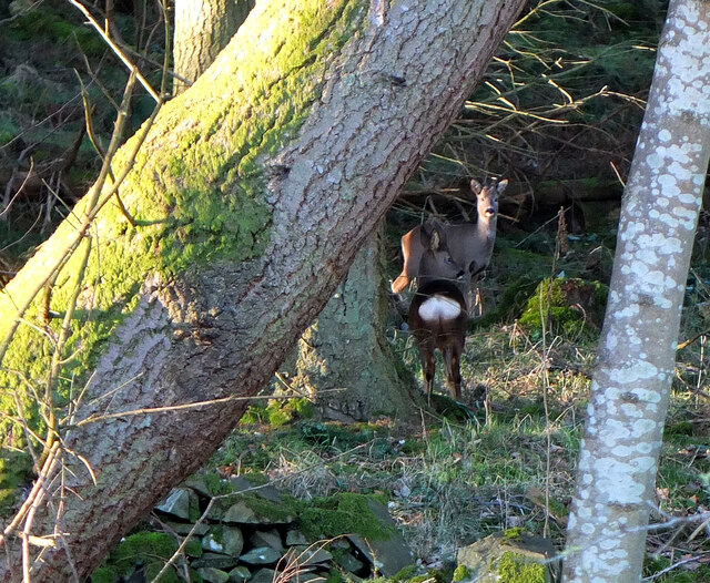
Wildlife is plentiful in Bonnington Covert, with an array of bird species, including woodpeckers and owls, making their home here. Red squirrels can also be spotted darting through the trees, while deer can sometimes be seen grazing in the quieter areas of the woodland.

For those seeking a peaceful retreat or a chance to reconnect with nature, Bonnington Covert provides the perfect opportunity. Its idyllic setting, diverse plant life, and rich wildlife make it a truly enchanting destination for all who visit.

If you have any feedback on the listing, please let us know in the comments section below.

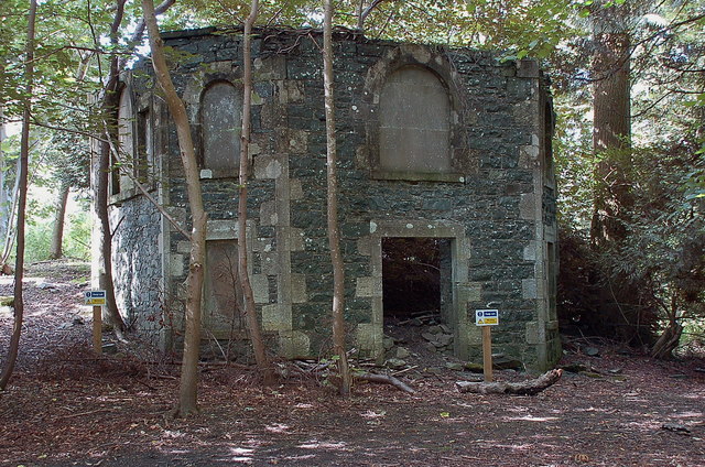
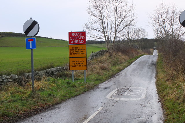
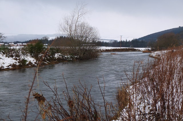
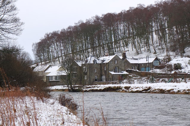
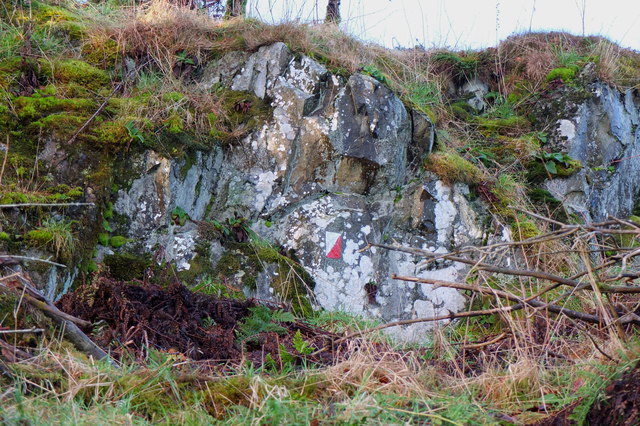
Bonnington Covert Images

Images are sourced within 2km of 55.630787/-3.180555 or Grid Reference NT2538. Thanks to Geograph Open Source API. All images are credited.

Replanting felled area, Bonnington Woodland here was felled last year and now replanting is taking place - compare with <a href="https://www.geograph.org.uk/photo/7529238">NT2539 : Felled plantation near The Cut, Peebles</a>.
Replanting felled area, Bonnington
Woodland here was felled last year and now replanting is taking place - compare with NT2539 : Felled plantation near The Cut, Peebles.
Tree shadows, Bonnington On the minor road around Cademuir to the Manor Valley.
Tree shadows, Bonnington
On the minor road around Cademuir to the Manor Valley.
Frosty viewpoint to Haystoun A bench on the track near Cademuir Forest car park in cold settled weather.
Frosty viewpoint to Haystoun
A bench on the track near Cademuir Forest car park in cold settled weather.
The sheep and the heron An inquisitive ewe taking a look at a heron in a pasture near Bonnington farm.
The sheep and the heron
An inquisitive ewe taking a look at a heron in a pasture near Bonnington farm.
Spiky tree shadows, Bonnington Long shadows from a strip of woodland bordering a field by the road between Peebles and Kirkton Manor.
Spiky tree shadows, Bonnington
Long shadows from a strip of woodland bordering a field by the road between Peebles and Kirkton Manor.
Roe deer, Cademuir Forest A roe deer not far from the track contouring the east edge of the woodland.
Roe deer, Cademuir Forest
A roe deer not far from the track contouring the east edge of the woodland.
Two roe deer, Cademuir Forest I spotted one deer by the track here <a href="https://www.geograph.org.uk/photo/7692276">NT2438 : Roe deer, Cademuir Forest</a>, then saw a second animal. They stayed long enough for a quick portrait.
Two roe deer, Cademuir Forest
I spotted one deer by the track here NT2438 : Roe deer, Cademuir Forest, then saw a second animal. They stayed long enough for a quick portrait.
New sports fields, Peebles High School Recently completed sports fields next to the site of the new High School currently under construction. The viewpoint is the track on the edge of the Cademuir plantation.
New sports fields, Peebles High School
Recently completed sports fields next to the site of the new High School currently under construction. The viewpoint is the track on the edge of the Cademuir plantation.
Path to Craigerne A path through a strip wood to the houses at Craigerne on the south edge of Peebles. Note the orienteering marker at the fence corner.
Path to Craigerne
A path through a strip wood to the houses at Craigerne on the south edge of Peebles. Note the orienteering marker at the fence corner.
Pine trees above Upper Newby Some eye-catching pines at the edge of a small plantation on the steep end of the ridge descending from Hundleshope Heights.
Pine trees above Upper Newby
Some eye-catching pines at the edge of a small plantation on the steep end of the ridge descending from Hundleshope Heights.
Cutting hay at Edderston near Peebles The red tractor is pulling the baling machine, and two more tractors are loading and carting the bales to the farm nearby. Left of centre is a flock of blackheaded gulls that have been feeding on the cut field. Lee Pen is the hill in the background.
Cutting hay at Edderston near Peebles
The red tractor is pulling the baling machine, and two more tractors are loading and carting the bales to the farm nearby. Left of centre is a flock of blackheaded gulls that have been feeding on the cut field. Lee Pen is the hill in the background.
Milestone at Kingsmeadows, Peebles The One Mile marker on Kingsmeadows Road. An overgrown footpath just to the left leads to the riverside.
Milestone at Kingsmeadows, Peebles
The One Mile marker on Kingsmeadows Road. An overgrown footpath just to the left leads to the riverside.
Old summerhouse, Kingsmeadows An old summerhouse or other outbuilding in the grounds of Kingsmeadows House. Kingsmeadows used to belong to the Hay family until its sale in 1920. Much of the surrounding land was compulsorily purchased to build houses in the early 1960s, but the big house and immediate gardens were bought by the current owners, the Standard Life insurance company. See <span class="nowrap"><a title="http://historyofpeebles.com/Page178.html" rel="nofollow ugc noopener" href="http://historyofpeebles.com/Page178.html">Link</a><img style="margin-left:2px;" alt="External link" title="External link - shift click to open in new window" src="https://s1.geograph.org.uk/img/external.png" width="10" height="10"/></span> for more background to Kingsmeadows.
Old summerhouse, Kingsmeadows
An old summerhouse or other outbuilding in the grounds of Kingsmeadows House. Kingsmeadows used to belong to the Hay family until its sale in 1920. Much of the surrounding land was compulsorily purchased to build houses in the early 1960s, but the big house and immediate gardens were bought by the current owners, the Standard Life insurance company. See LinkExternal link for more background to Kingsmeadows.
Road signs near Edderston The Old Manor Brig has been closed to vehicles with apparently little prospect of re-opening, so these new signs clarify the access along the minor road past Edderston farm to the Manor Sware car parks.
Road signs near Edderston
The Old Manor Brig has been closed to vehicles with apparently little prospect of re-opening, so these new signs clarify the access along the minor road past Edderston farm to the Manor Sware car parks.
The Tweed near Scotsmill Looking upstream with some of the new houses at Whitehaugh on the edge of Peebles in view.
The Tweed near Scotsmill
Looking upstream with some of the new houses at Whitehaugh on the edge of Peebles in view.
Scotsmill by the Tweed Houses on the S bank upstream of the Kailzie Estate.
Scotsmill by the Tweed
Houses on the S bank upstream of the Kailzie Estate.
Orienteering marker, Tantah An orienteering symbol on a small outcrop by the path contouring Cademuir above Tantah. I have walked past this several dozen times without noticing it. There are several such symbols in places around Peebles.
Orienteering marker, Tantah
An orienteering symbol on a small outcrop by the path contouring Cademuir above Tantah. I have walked past this several dozen times without noticing it. There are several such symbols in places around Peebles.
Muddy path, Craigerne Path through a strip of woodland to the houses at Craigerne, soft and muddy after the stormy weather of the last two days.
Muddy path, Craigerne
Path through a strip of woodland to the houses at Craigerne, soft and muddy after the stormy weather of the last two days.
Show me another place!

Bonnington Covert is located at Grid Ref: NT2538 (Lat: 55.630787, Lng: -3.180555)

Unitary Authority: The Scottish Borders

Police Authority: The Lothians and Scottish Borders

What 3 Words

///legend.regulates.grabs. Near Peebles, Scottish Borders

Related Wikis

Peebles High School, Peeblesshire

Peebles High School is a state run comprehensive school for girls and boys aged 12–18 located in Peebles in the Scottish Borders. It was originally named...

John Buchan Way

The John Buchan Way is a walking route from Peebles to Broughton in the Scottish Borders, a distance of approximately 22 km (13 miles). The route is waymarked...

Whitestone Park

Whitestone Park is a sports ground in Peebles, Scottish Borders, Scotland, used for football and cricket. It has been the home ground of Peebles Rovers...

Peebles (West) railway station

Peebles (West) railway station was one of two railway stations that served the burgh of Peebles, Peeblesshire, Scotland from 1864 to 1950 on the Symington...

Nearby Amenities

Located within 500m of 55.630787,-3.180555
Power: pole
Lat/Long: 55.6330624/-3.1844554
Power: pole
Lat/Long: 55.6328223/-3.1834315
Power: pole
Lat/Long: 55.6325764/-3.1823929
Power: pole
Lat/Long: 55.6323698/-3.1815278
Power: pole
Lat/Long: 55.6321477/-3.1804764
Power: pole
Lat/Long: 55.6316951/-3.179679
Power: pole
Lat/Long: 55.6312175/-3.1787969
Power: pole
Lat/Long: 55.630778/-3.1779719
Power: pole
Lat/Long: 55.630415/-3.1772358
Power: pole
Lat/Long: 55.6302036/-3.1761168
Power: pole
Lat/Long: 55.6300341/-3.1748835
Power: pole
Lat/Long: 55.6298967/-3.1737814
Power: pole
Lat/Long: 55.6296495/-3.1742257
Power: pole
Lat/Long: 55.6291205/-3.1733732
Power: pole
Lat/Long: 55.6340451/-3.1845823
Power: pole
Lat/Long: 55.6321095/-3.1843411
Power: pole
Lat/Long: 55.6312019/-3.1846457
Power: pole
Lat/Long: 55.6308007/-3.1847727
Power: pole
Lat/Long: 55.630126/-3.185365
Power: pole
Lat/Long: 55.6292805/-3.1861074
Power: pole
Lat/Long: 55.6284159/-3.1868499
The data included in this document is from www.openstreetmap.org. The data is made available under ODbL.

Have you been to Bonnington Covert?

Leave your review of Bonnington Covert below (or comments, questions and feedback).