Bankhead Wood

Wood, Forest in Fife

Scotland

Bankhead Wood

Remains of Carden Den Tower The tower was erected between 1432 and 1532 but has long since disappeared. For more information, see <span class="nowrap"><a title="https://canmore.org.uk/site/52960/carden-tower" rel="nofollow ugc noopener" href="https://canmore.org.uk/site/52960/carden-tower">Link</a><img style="margin-left:2px;" alt="External link" title="External link - shift click to open in new window" src="https://s1.geograph.org.uk/img/external.png" width="10" height="10"/></span>.
Remains of Carden Den Tower Credit: Becky Williamson

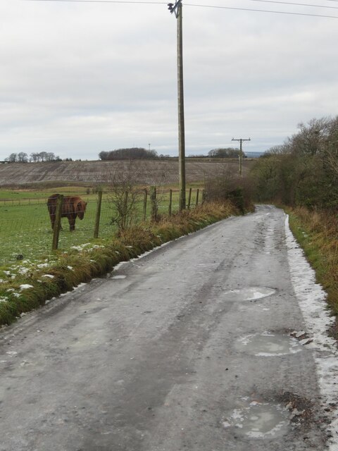
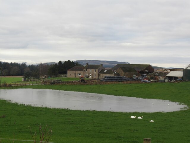
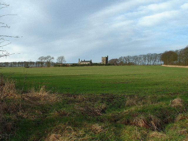
Bankhead Wood, located in Fife, Scotland, is a picturesque forest encompassing an area of approximately 200 acres. This woodland, also known as Bankhead of Kinloch Wood, is situated near the village of Strathkinness, just a few miles from the town of St Andrews.

The wood is a haven for nature lovers and those seeking tranquility amidst the stunning Scottish countryside. It predominantly consists of a mixture of broadleaved trees, including oak, birch, and beech, which create a diverse and vibrant ecosystem. The forest floor is adorned with a carpet of wildflowers and ferns, adding to its natural beauty.

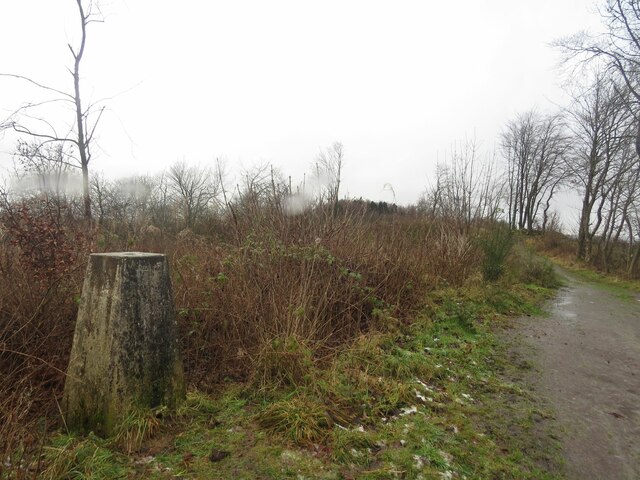
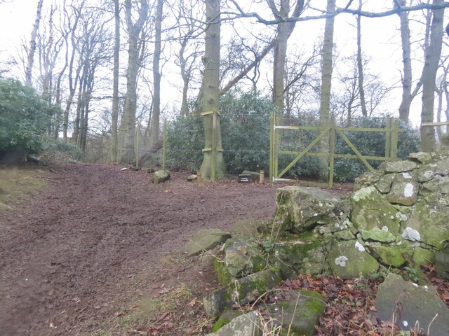
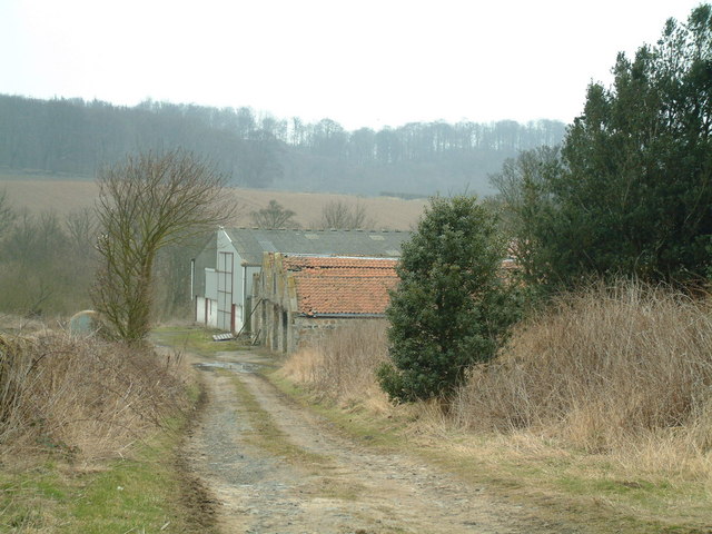
Visitors can explore the woodland through a network of well-maintained paths, which offer opportunities for leisurely walks, jogging, or cycling. The paths wind through the wood, leading visitors to discover hidden corners, picturesque viewpoints, and peaceful clearings perfect for picnics. Along the way, one may encounter an array of wildlife, such as deer, red squirrels, and a variety of bird species.

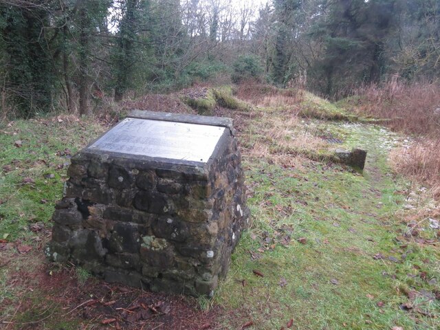
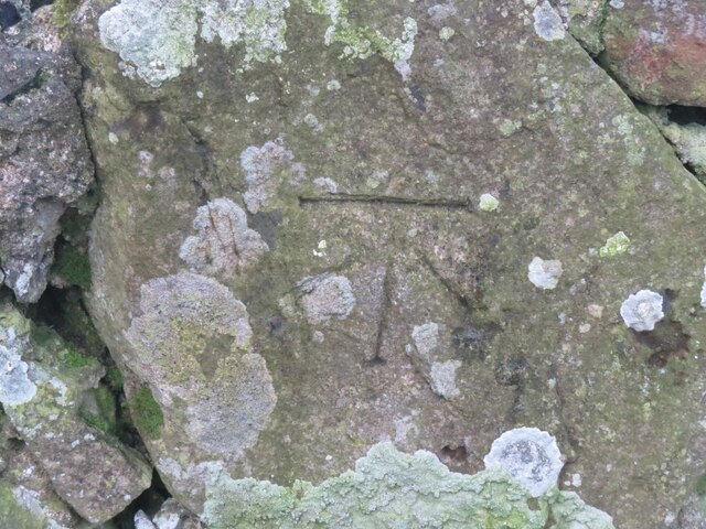
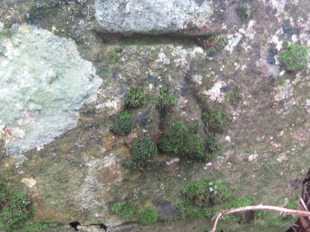
Bankhead Wood also holds historical significance. It is believed to be an ancient woodland, with remnants of old walls and ditches marking the boundaries of long-lost settlements. The wood has been managed by the Forestry Commission since the mid-20th century and has become a popular recreational spot for local residents and tourists alike.

With its enchanting atmosphere, stunning scenery, and rich biodiversity, Bankhead Wood offers a perfect escape from the hustle and bustle of everyday life, providing a serene setting for nature lovers to immerse themselves in the beauty of the Scottish countryside.

If you have any feedback on the listing, please let us know in the comments section below.

Bankhead Wood Images

Images are sourced within 2km of 56.12487/-3.2308943 or Grid Reference NT2393. Thanks to Geograph Open Source API. All images are credited.

Remains of Carden Den Tower The tower was erected between 1432 and 1532 but has long since disappeared. For more information, see <span class="nowrap"><a title="https://canmore.org.uk/site/52960/carden-tower" rel="nofollow ugc noopener" href="https://canmore.org.uk/site/52960/carden-tower">Link</a><img style="margin-left:2px;" alt="External link" title="External link - shift click to open in new window" src="https://s1.geograph.org.uk/img/external.png" width="10" height="10"/></span>.
Remains of Carden Den Tower
The tower was erected between 1432 and 1532 but has long since disappeared. For more information, see LinkExternal link.
Trigpoint, Keir Brae
Benchmark, Lambswell Wood Ordnance Survey benchmark, described on database at <span class="nowrap"><a title="https://www.bench-marks.org.uk/bm147458" rel="nofollow ugc noopener" href="https://www.bench-marks.org.uk/bm147458">Link</a><img style="margin-left:2px;" alt="External link" title="External link - shift click to open in new window" src="https://s1.geograph.org.uk/img/external.png" width="10" height="10"/></span>. sEE ALSO <a href="https://www.geograph.org.uk/photo/7005710">NT2391 : Lambswell Wood, near Newbigging</a>.
Benchmark, Lambswell Wood
Ordnance Survey benchmark, described on database at LinkExternal link. sEE ALSO NT2391 : Lambswell Wood, near Newbigging.
Benchmark, West Balbarton farm Ordnance Survey benchmark, described on database at <span class="nowrap"><a title="https://www.bench-marks.org.uk/bm158520" rel="nofollow ugc noopener" href="https://www.bench-marks.org.uk/bm158520">Link</a><img style="margin-left:2px;" alt="External link" title="External link - shift click to open in new window" src="https://s1.geograph.org.uk/img/external.png" width="10" height="10"/></span>. See also <a href="https://www.geograph.org.uk/photo/7005716">NT2391 : West Balbarton Farm buildings, near Newbigging</a>.
Benchmark, West Balbarton farm
Ordnance Survey benchmark, described on database at LinkExternal link. See also NT2391 : West Balbarton Farm buildings, near Newbigging.
Icy farm track, Little Gleniston
Rivet benchmark, Shawsmill Bridge Ordnance Survey rivet benchmark, described on database at <span class="nowrap"><a title="https://www.bench-marks.org.uk/bm147452" rel="nofollow ugc noopener" href="https://www.bench-marks.org.uk/bm147452">Link</a><img style="margin-left:2px;" alt="External link" title="External link - shift click to open in new window" src="https://s1.geograph.org.uk/img/external.png" width="10" height="10"/></span>. See also <a href="https://www.geograph.org.uk/photo/7007009">NT2293 : Shawsmill Bridge, near Cardenden</a>.
Rivet benchmark, Shawsmill Bridge
Ordnance Survey rivet benchmark, described on database at LinkExternal link. See also NT2293 : Shawsmill Bridge, near Cardenden.
Lambswell Wood, near Newbigging There is an Ordnance Survey benchmark on this crumbling wall in the wood (just visible if you look closely). See <a href="https://www.geograph.org.uk/photo/7005679">NT2391 : Benchmark, Lambswell Wood</a>.
Lambswell Wood, near Newbigging
There is an Ordnance Survey benchmark on this crumbling wall in the wood (just visible if you look closely). See NT2391 : Benchmark, Lambswell Wood.
West Balbarton Farm buildings, near Newbigging There is an Ordnance Survey benchmark on this farm building.
West Balbarton Farm buildings, near Newbigging
There is an Ordnance Survey benchmark on this farm building.
Flooded field at Cardenbarns With three Mute Swans in the foreground.
Flooded field at Cardenbarns
With three Mute Swans in the foreground.
Shawsmill Bridge, near Cardenden There is an Ordnance Survey rivet benchmark on this bridge, which spans the Gelly Burn. See <a href="https://www.geograph.org.uk/photo/7005707">NT2293 : Rivet benchmark, Shawsmill Bridge</a>.
Shawsmill Bridge, near Cardenden
There is an Ordnance Survey rivet benchmark on this bridge, which spans the Gelly Burn. See NT2293 : Rivet benchmark, Shawsmill Bridge.
Benchmark, Sunnyside Plantation near Cardenden This Ordnance Survey benchmark took a lot of finding. It was hidden beneath moss and brambles on an old and crumbling wall away from the main path through the woods. It is described on the database at <span class="nowrap"><a title="https://www.bench-marks.org.uk/bm147454" rel="nofollow ugc noopener" href="https://www.bench-marks.org.uk/bm147454">Link</a><img style="margin-left:2px;" alt="External link" title="External link - shift click to open in new window" src="https://s1.geograph.org.uk/img/external.png" width="10" height="10"/></span>.
Benchmark, Sunnyside Plantation near Cardenden
This Ordnance Survey benchmark took a lot of finding. It was hidden beneath moss and brambles on an old and crumbling wall away from the main path through the woods. It is described on the database at LinkExternal link.
Electric vehicle charging point In the car park of the Spiral Weave, Kirkcaldy. This one also offers an airline for inflating tyres.
The vehicle with 'St Andrews Shuttle' on its side is an airport taxi.
Electric vehicle charging point
In the car park of the Spiral Weave, Kirkcaldy. This one also offers an airline for inflating tyres. The vehicle with 'St Andrews Shuttle' on its side is an airport taxi.
Electric vehicle charging point In the car park of the Spiral Weave, Kirkcaldy. This one also offers an airline for inflating tyres.
Electric vehicle charging point
In the car park of the Spiral Weave, Kirkcaldy. This one also offers an airline for inflating tyres.
Chapel, Kirkcaldy Once this was Bogie Mains farm, that's when the pillar would have been built. It survived the big housing expansion on the north west of Kirkcaldy and now sits on its hill top just by a bus stop.
Chapel, Kirkcaldy
Once this was Bogie Mains farm, that's when the pillar would have been built. It survived the big housing expansion on the north west of Kirkcaldy and now sits on its hill top just by a bus stop.
Kirkcaldy : Chapel : A910: Lupins flowering The second season of the lupins flowering. These were planted as part of the road dualling. They provide a burst of colour during June. It will be interesting to see how long they flower and if they naturalise.
Kirkcaldy : Chapel : A910: Lupins flowering
The second season of the lupins flowering. These were planted as part of the road dualling. They provide a burst of colour during June. It will be interesting to see how long they flower and if they naturalise.
Kirkcaldy : Wester Bogie Road : Daffodils 300,000 daffodils in full bloom, planted in November 2001. Planted at a density of 30 bulbs per metre square, to give this intense effect.
Kirkcaldy : Wester Bogie Road : Daffodils
300,000 daffodils in full bloom, planted in November 2001. Planted at a density of 30 bulbs per metre square, to give this intense effect.
Kirkcaldy : Torbain Farm from Torbain Road looking towards the Tower at the Farm. The Tower is a schedule B listed monument.
Kirkcaldy : Torbain Farm
from Torbain Road looking towards the Tower at the Farm. The Tower is a schedule B listed monument.
West Balbarton Farm
West Balbarton Farm
Show me another place!

Bankhead Wood is located at Grid Ref: NT2393 (Lat: 56.12487, Lng: -3.2308943)

Unitary Authority: Fife

Police Authority: Fife

What 3 Words

///cosmetic.relief.change. Near Cardenden, Fife

Related Wikis

Cardenden

Cardenden ( ) is a Scottish town located on the south bank of the River Ore in the parish of Auchterderran, Fife. It is approximately 4 miles (6.4 km)...

Raith, Fife

Raith (Scottish Gaelic: rĂ th, "fort" or "fortified residence"), as an area of Fife, once stretched from the lands of Little Raith (earlier Wester Raith...

Dundonald Bluebell F.C.

Dundonald Bluebell Football Club are a Scottish football club based in Cardenden, Fife. The team plays in the East of Scotland League Premier Division...

Battle of Raith

The Battle of Raith was the theory of E. W. B. Nicholson, librarian at the Bodleian Library, Oxford. He was aware of the poem Y Gododdin in the Book of...

Cardenden railway station

Cardenden railway station is a railway station in Cardenden, Fife, Scotland. The station is managed by ScotRail and is on the Fife Circle Line, 27 miles...

A921 road

The A921 road is a road that connects Kirkcaldy with the M90 motorway in Fife, Scotland. Before 1990, the road was classed as the A92. == References ==

Auchterderran

Auchterderran () is a village in Fife, Scotland. It is sometimes thought as part of the larger village, Cardenden, although Cardenden is part of the parish...

Auchtertool

Auchtertool ( ; Scottish Gaelic: Uachdar Tuil) is a small village in Fife, Scotland. It is 4 miles west of Kirkcaldy. The name is from the Gaelic uachdar...

Related Videos

Cardenden School Field trip 1962

Another fine reel from Miss J Bease of the children at Cardenden Primary School going on a field trip. Lots of faces and memories ...

Bowhill Cemetery With Music On History Visit To Cardenden Fife Scotland

Tour Scotland short sunny Spring 4K travel video clip, with Scottish music, of the Bowhill cemetery on ancestry, genealogy, family ...

Feeding Pygmy Goats at The Buffalo Farm Kirkcaldy Scotland UK | Filipina Pandemic Travel Vlog

Get to know more here https://www.patreon.com/AdventuresOfaFilipina I'm from the Philippines and I travel frequently to the ...

DORIFEST 2 - 4K Drift Movie

It turns out that you end up with a lot of footage from a 2-day drift event...especially if you include the 3 days of holiday you had ...

Nearby Amenities

Located within 500m of 56.12487,-3.2308943
Power: pole
Lat/Long: 56.1210189/-3.2336236
Power: pole
Lat/Long: 56.121776/-3.233478
Power: pole
Lat/Long: 56.1218588/-3.2260487
Power: pole
Lat/Long: 56.1226847/-3.2323781
Power: pole
Lat/Long: 56.1228741/-3.2256662
Power: pole
Lat/Long: 56.1231332/-3.2313099
Power: pole
Lat/Long: 56.1234104/-3.229974
Power: pole
Lat/Long: 56.1236696/-3.2287293
Power: pole
Lat/Long: 56.1237516/-3.2253366
Power: pole
Lat/Long: 56.12395/-3.2274052
Power: pole
Lat/Long: 56.1243355/-3.2255161
Power: pole
Lat/Long: 56.1247668/-3.2249482
Power: pole
Lat/Long: 56.1259282/-3.2246882
Power: pole
Lat/Long: 56.1270926/-3.2244469
Power: pole
Lat/Long: 56.1222326/-3.2370079
Power: pole
Lat/Long: 56.1225705/-3.2357177
Power: pole
Lat/Long: 56.1229009/-3.2345161
Power: pole
Lat/Long: 56.1238922/-3.2324052
Power: pole
Lat/Long: 56.1243183/-3.2314879
Power: pole
Lat/Long: 56.1257505/-3.2285428
Power: pole
Lat/Long: 56.1263186/-3.2275021
Power: pole
Lat/Long: 56.1268852/-3.226397
Power: pole
Lat/Long: 56.1274159/-3.2253751
Ele: 164
Natural: peak
Lat/Long: 56.1231786/-3.2280448
Historic: ruins
Lat/Long: 56.1209108/-3.2323319
Power: pole
Lat/Long: 56.1207656/-3.2308045
Power: pole
Lat/Long: 56.121073/-3.2297558
Power: pole
Lat/Long: 56.1213792/-3.2287331
Power: pole
Lat/Long: 56.1216939/-3.2277365
Power: pole
Lat/Long: 56.1219868/-3.2267595
Power: pole
Lat/Long: 56.1222724/-3.2258237
Power: pole
Lat/Long: 56.1225472/-3.2248857
Power: pole
Lat/Long: 56.1228909/-3.2237544
Power: pole
Lat/Long: 56.1207075/-3.2318381
Power: pole
Lat/Long: 56.1211529/-3.2314451
Power: pole
Lat/Long: 56.1214869/-3.2311215
The data included in this document is from www.openstreetmap.org. The data is made available under ODbL.

Have you been to Bankhead Wood?

Leave your review of Bankhead Wood below (or comments, questions and feedback).