Clubhead Plantation

Wood, Forest in Lanarkshire

Scotland

Clubhead Plantation

Quad bike tracks on Broomy Law Looking towards the un-named rise north-east of the summit.
Quad bike tracks on Broomy Law Credit: Alan O'Dowd

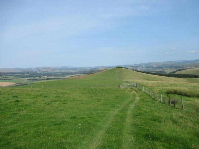
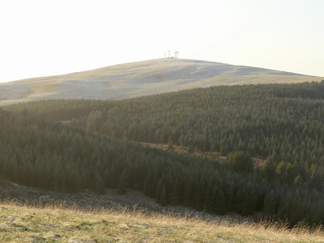
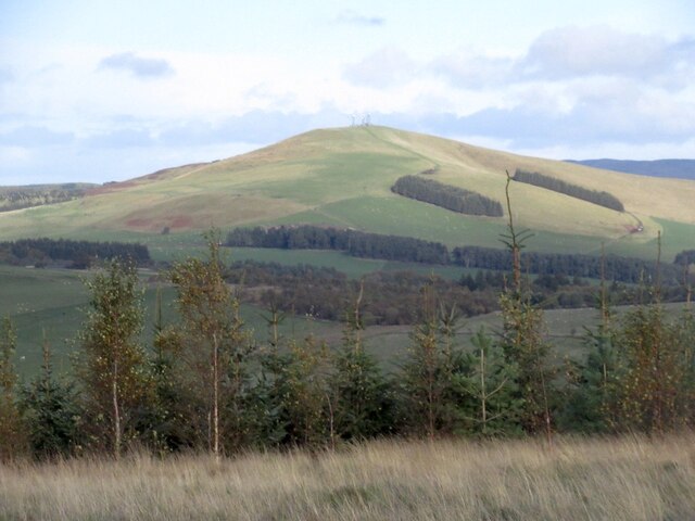
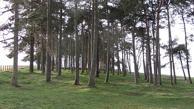
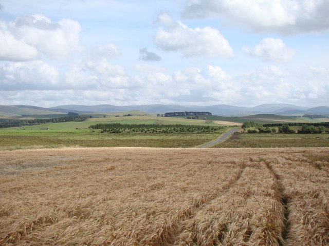
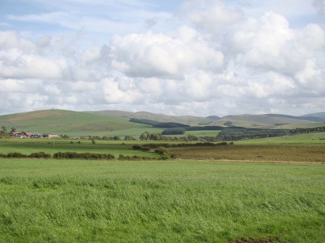
Clubhead Plantation is a vast woodland area located in the picturesque region of Lanarkshire, Scotland. Spanning over a vast expanse of approximately 1,000 acres, this beautiful woodland is a perfect destination for nature enthusiasts and outdoor adventurers.

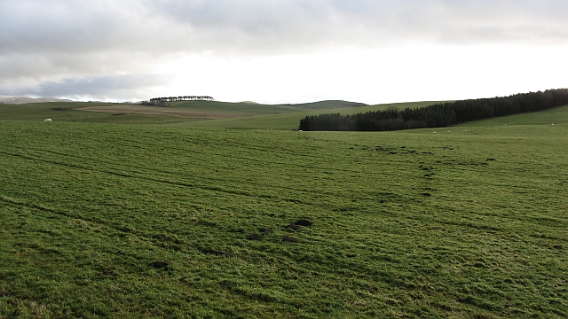
The plantation is predominantly composed of native Scottish trees, such as oak, birch, and pine, creating a diverse and vibrant ecosystem. The lush foliage provides a haven for a variety of wildlife, including deer, foxes, and a plethora of bird species, making it a popular spot for birdwatchers and wildlife photographers.

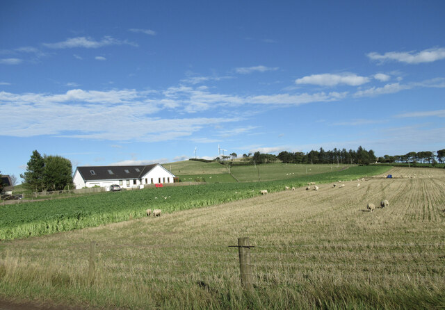
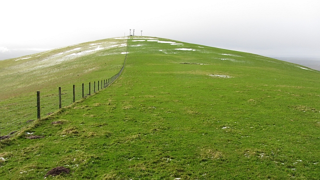
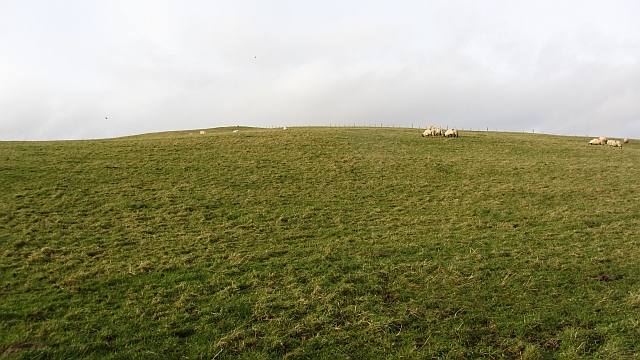
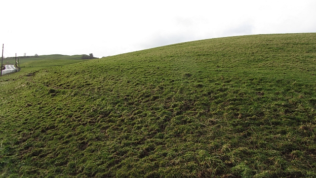
The woodland offers a network of well-maintained trails, allowing visitors to explore its beauty on foot or by mountain bike. These trails cater to various skill levels, making it suitable for both beginners and experienced hikers or cyclists. Along the way, visitors can admire the stunning panoramic views of the surrounding Lanarkshire countryside.

Clubhead Plantation also offers excellent opportunities for recreational activities such as camping, picnicking, and nature walks. The tranquil atmosphere and serene surroundings make it an ideal spot for those seeking a peaceful escape from the hustle and bustle of city life.

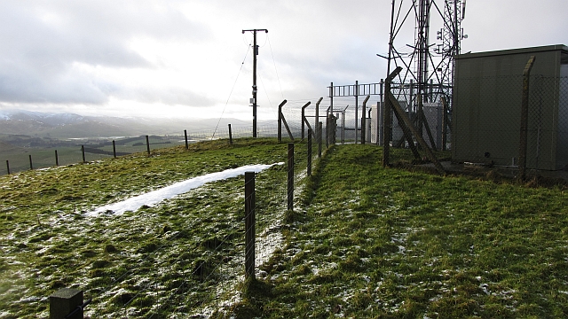
Additionally, the plantation is managed by a dedicated team of forestry professionals who ensure the preservation and conservation of the woodland. They work diligently to maintain the health of the trees and protect the natural habitat of the wildlife that calls this area home.

Clubhead Plantation, with its breathtaking beauty and abundant wildlife, is truly a gem in the heart of Lanarkshire, offering visitors a memorable and immersive experience in the midst of nature's splendor.

If you have any feedback on the listing, please let us know in the comments section below.

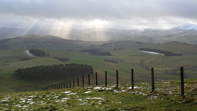
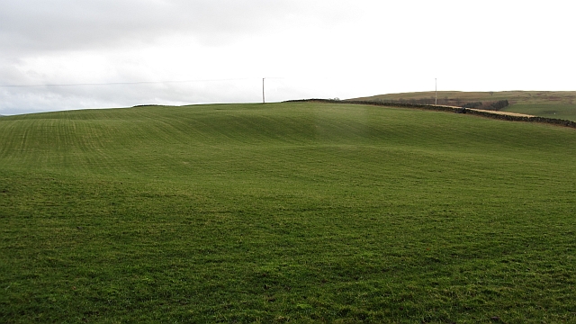
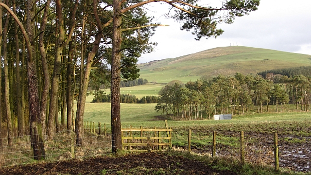
Clubhead Plantation Images

Images are sourced within 2km of 55.66941/-3.4833644 or Grid Reference NT0642. Thanks to Geograph Open Source API. All images are credited.

Quad bike tracks on Broomy Law Looking towards the un-named rise north-east of the summit.
Quad bike tracks on Broomy Law
Looking towards the un-named rise north-east of the summit.
Sheep on stubble field at Craw Knowe Craw Knowe 'translates' from Scots to English as 'crow knoll'!

Some small wind turbines above Lammerlaw are visible in the distance.
Sheep on stubble field at Craw Knowe
Craw Knowe 'translates' from Scots to English as 'crow knoll'! Some small wind turbines above Lammerlaw are visible in the distance.
Old tractor near Elsrickle I wasn't able to see anything to identify what make of tractor this is, but a looks a good few decades old.
Old tractor near Elsrickle
I wasn't able to see anything to identify what make of tractor this is, but a looks a good few decades old.
Broomy Law View from Sandy Hill.
Broomy Law
View from Sandy Hill.
Broomy Law Mast topped hill.
Broomy Law
Mast topped hill.
Broomy Law A dip on the northeast ridge of Broomy Law. The summit is amongst masts, but is accessible.
Broomy Law
A dip on the northeast ridge of Broomy Law. The summit is amongst masts, but is accessible.
Summit, Broomy Law With gratitude to the telecoms companies who have left the summit outwith their enclosures.
Summit, Broomy Law
With gratitude to the telecoms companies who have left the summit outwith their enclosures.
Grassland, Hyndshawland They have a mole.
Grassland, Hyndshawland
They have a mole.
Strip wood, Strathbogie A grown up and grown out shelterbelt.
Strip wood, Strathbogie
A grown up and grown out shelterbelt.
Castle Hill Sheep graze on a small hill north of Biggar. There is a hill fort at the summit.
Castle Hill
Sheep graze on a small hill north of Biggar. There is a hill fort at the summit.
Slopes of Castle Hill Grassland beside the A702.
Slopes of Castle Hill
Grassland beside the A702.
Masts and enclosures, Broomy Law There are several masts in this field which is also the summit of Broomy Law.
Masts and enclosures, Broomy Law
There are several masts in this field which is also the summit of Broomy Law.
Open cabinet, Broomy Law A cabinet containing circuit boards is open and exposed to the elements. The enclosure is secure, suggesting that this is a weather event. There had been a severe storm a few days earlier and winds up here would have been in excess of 100kph.
Open cabinet, Broomy Law
A cabinet containing circuit boards is open and exposed to the elements. The enclosure is secure, suggesting that this is a weather event. There had been a severe storm a few days earlier and winds up here would have been in excess of 100kph.
Fence, Broomy Law A view from near the summit over an electric fence towards farmland near Biggar and Skirling. Shaded areas have kept their thin layer of snow.
Fence, Broomy Law
A view from near the summit over an electric fence towards farmland near Biggar and Skirling. Shaded areas have kept their thin layer of snow.
Grassland, Middle Mains Rolling hill country north of  Biggar.
Grassland, Middle Mains
Rolling hill country north of Biggar.
Clubhead Plantation and Kame Wood A pair of woodlands at Strathbogie near Elsrickle. There is also a view over to Broomy Law.
Clubhead Plantation and Kame Wood
A pair of woodlands at Strathbogie near Elsrickle. There is also a view over to Broomy Law.
View of the Tweedsmuir Hills A view of the Tweedsmuir Hills, looking across a ripening barley field, with Broad Law on the far right in the distance.
View of the Tweedsmuir Hills
A view of the Tweedsmuir Hills, looking across a ripening barley field, with Broad Law on the far right in the distance.
Landscape near Elsrickle Looking over the Elsrickle area with the Broughton Heights rising in the right background.
Landscape near Elsrickle
Looking over the Elsrickle area with the Broughton Heights rising in the right background.
Show me another place!

Clubhead Plantation is located at Grid Ref: NT0642 (Lat: 55.66941, Lng: -3.4833644)

Unitary Authority: South Lanarkshire

Police Authority: Lanarkshire

What 3 Words

///hockey.reserved.vertical. Near Biggar, South Lanarkshire

Related Wikis

Elsrickle

Elsrickle is a village in South Lanarkshire, Scotland. It lies on Blackmount Hill, which is at the end of the Pentland Hills. An elrick is an old place...

Brownsbank

Brownsbank (Brounsbank in Scots) is a cottage close to the small settlement of Candymill to the north of Biggar in Scotland. It is best known as the former...

Walston, South Lanarkshire

Walston is a hamlet in the middle of black mount area of South Lanarkshire. == History == Patrick Molleson in the Old Statistical Account records that...

Skirling

Skirling is a parish, community council area and village in Peeblesshire in the Scottish Borders situated 2+1⁄2 miles east of Biggar in Lanarkshire. Biggar...

Nearby Amenities

Located within 500m of 55.66941,-3.4833644
Power: pole
Lat/Long: 55.6654777/-3.4863995
Power: pole
Lat/Long: 55.6694169/-3.491147
Power: pole
Lat/Long: 55.6689458/-3.490694
Power: pole
Lat/Long: 55.6683256/-3.4901361
Power: pole
Lat/Long: 55.6671085/-3.4889959
Power: pole
Lat/Long: 55.6677257/-3.4895752
Power: pole
Lat/Long: 55.6666758/-3.48832
Power: pole
Lat/Long: 55.6660858/-3.4873597
Power: pole
Lat/Long: 55.6653059/-3.4844065
Power: pole
Lat/Long: 55.6657316/-3.4834079
Power: pole
Lat/Long: 55.6658478/-3.4831009
Power: pole
Lat/Long: 55.6696966/-3.4892946
The data included in this document is from www.openstreetmap.org. The data is made available under ODbL.

Have you been to Clubhead Plantation?

Leave your review of Clubhead Plantation below (or comments, questions and feedback).