Oldmill Wood

Wood, Forest in Lanarkshire

Scotland

Oldmill Wood

Carstairs Junction Geocaching is a type of global treasure hunt of people looking for caches, or hidden stashes of objects. Geocaching may also be described as a series of hide-and-seek games, where hiders provide online clues for seekers. Seekers use global positioning system (GPS) devices to find hidden caches
Carstairs Junction Credit: Ralph Greig

Oldmill Wood is a picturesque woodland located in Lanarkshire, Scotland. Covering an area of approximately 50 hectares, this enchanting forest is renowned for its natural beauty and diverse flora and fauna. The wood is situated near the village of Old Mill, providing a peaceful and tranquil escape from the bustling city life.

As visitors step into Oldmill Wood, they are greeted by a dense canopy of towering trees, predominantly consisting of oak, beech, and birch. The woodland floor is adorned with a carpet of vibrant wildflowers, creating a stunning display of colors throughout the seasons. The wood is intersected by several meandering walking trails, offering visitors the opportunity to explore and immerse themselves in the natural surroundings.

Wildlife enthusiasts are in for a treat at Oldmill Wood. The forest is home to a wide range of species, including deer, badgers, foxes, and a variety of bird species. Birdwatchers can spot woodland birds such as woodpeckers, owls, and thrushes, making it a popular destination for birdwatching enthusiasts.

Oldmill Wood is not only a haven for nature lovers but also plays a vital role in conservation efforts. The woodland is managed by the local authorities to preserve its ecological balance and protect its unique ecosystem. Efforts are made to control invasive species and promote the growth of native plants and trees.

With its natural beauty and rich biodiversity, Oldmill Wood is a cherished gem in Lanarkshire. Whether it's for a leisurely stroll, birdwatching, or simply reconnecting with nature, this woodland provides a serene retreat for visitors of all ages.

If you have any feedback on the listing, please let us know in the comments section below.

Oldmill Wood Images

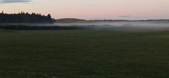
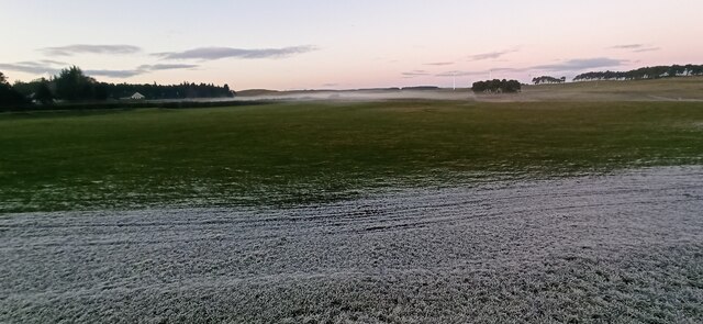
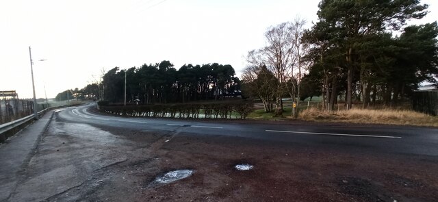
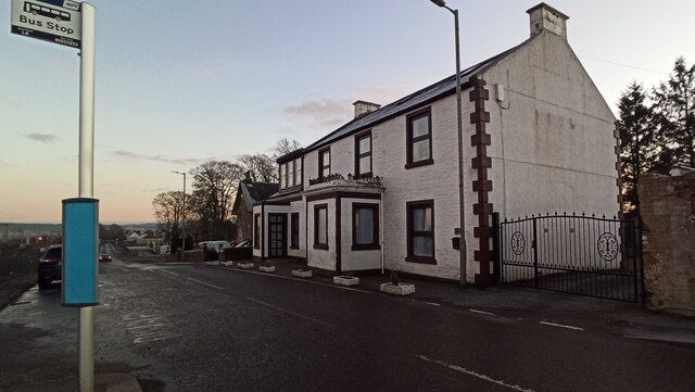
Images are sourced within 2km of 55.690601/-3.6949429 or Grid Reference NS9345. Thanks to Geograph Open Source API. All images are credited.

Carstairs Junction Geocaching is a type of global treasure hunt of people looking for caches, or hidden stashes of objects. Geocaching may also be described as a series of hide-and-seek games, where hiders provide online clues for seekers. Seekers use global positioning system (GPS) devices to find hidden caches
Carstairs Junction
Geocaching is a type of global treasure hunt of people looking for caches, or hidden stashes of objects. Geocaching may also be described as a series of hide-and-seek games, where hiders provide online clues for seekers. Seekers use global positioning system (GPS) devices to find hidden caches
Carstairs centre
Carstairs centre
Carstairs Junction Houses on the North side of the West Coast Main Line railway.
Carstairs Junction
Houses on the North side of the West Coast Main Line railway.
Barry the Barrel at Carstairs railway station At the foot of the stairs on the island platform.
Barry the Barrel at Carstairs railway station
At the foot of the stairs on the island platform.
Mist at Monteith Park Low lying late afternoon mist north of Station Road.
Mist at Monteith Park
Low lying late afternoon mist north of Station Road.
Mist at Monteith Park Low lying late afternoon mist north of Station Road.
Mist at Monteith Park
Low lying late afternoon mist north of Station Road.
Mist at Monteith Park Low lying late afternoon mist north of Station Road.
Mist at Monteith Park
Low lying late afternoon mist north of Station Road.
Carstairs Road, Carstairs Looking towards Carstairs from Carstairs Junction.
Carstairs Road, Carstairs
Looking towards Carstairs from Carstairs Junction.
Carstairs railway station Looking towards Station Road bridge.
Carstairs railway station
Looking towards Station Road bridge.
Carstairs railway station The entrance to the station from Strawfrank Road.
Carstairs railway station
The entrance to the station from Strawfrank Road.
Strawfrank Road Station Apartments, overlooking the railway station.
Strawfrank Road
Station Apartments, overlooking the railway station.
Strawfrank Road Looking towards the railway station from the entrance to the Park and Ride car park.
Strawfrank Road
Looking towards the railway station from the entrance to the Park and Ride car park.
Carstairs railway station The footbridge leads from Strawfrank Road to the island platform.
Carstairs railway station
The footbridge leads from Strawfrank Road to the island platform.
Carstairs railway station The footbridge leads from Strawfrank Road to the island platform.
Carstairs railway station
The footbridge leads from Strawfrank Road to the island platform.
Station Road railway bridge Looking south over the narrow bridge which crosses over Carstairs station.
Station Road railway bridge
Looking south over the narrow bridge which crosses over Carstairs station.
Station Road railway bridge Looking south over the narrow bridge which crosses over Carstairs station.
Station Road railway bridge
Looking south over the narrow bridge which crosses over Carstairs station.
Station Road railway bridge Looking south over the narrow bridge which crosses over Carstairs station.
Station Road railway bridge
Looking south over the narrow bridge which crosses over Carstairs station.
Carstairs railway station Looking in to the station from the north end of the road bridge.
Carstairs railway station
Looking in to the station from the north end of the road bridge.
Show me another place!

Oldmill Wood is located at Grid Ref: NS9345 (Lat: 55.690601, Lng: -3.6949429)

Unitary Authority: South Lanarkshire

Police Authority: Lanarkshire

What 3 Words

///entrusted.wiping.rooks. Near Carnwath, South Lanarkshire

Nearby Locations

Carstairs Oldmill Wood

Related Wikis

Carstairs

Carstairs (, Scottish Gaelic: Caisteal Tarrais) is a village in South Lanarkshire, Scotland. Carstairs is located 5 miles (8 kilometres) east of the county...

Ravenstruther Rail Terminal

Ravenstruther Rail Terminal is a freight handling facility near Ravenstruther in Scotland. == History == The terminal was formerly operated by Scottish...

Carstairs Castle

Carstairs Castle was a stronghold in the east of Carstairs, a short distance from the current site of Carstairs Parish Church. Now long gone, it dates...

Ravenstruther

Ravenstruther (Scots: Raenstrie) is a small hamlet in South Lanarkshire, Scotland, near the town of Lanark. In 1517 the lands of Carstairs and Ravenstruther...

Nearby Amenities

Located within 500m of 55.690601,-3.6949429
Noexit: yes
Lat/Long: 55.6941379/-3.6955277
Noexit: yes
Lat/Long: 55.6938263/-3.6950996
Noexit: yes
Lat/Long: 55.6935641/-3.6947326
Noexit: yes
Lat/Long: 55.6945802/-3.6964104
Noexit: yes
Lat/Long: 55.6941275/-3.6957944
Noexit: yes
Lat/Long: 55.6937096/-3.6951795
Noexit: yes
Lat/Long: 55.6933931/-3.69472
Railway: buffer_stop
Lat/Long: 55.6886233/-3.6997637
Street Lamp
Lamp Type: led
Lat/Long: 55.6938702/-3.6951521
Addr Housenumber: 2
Addr Street: Castledyke Gardens
Lat/Long: 55.6943942/-3.6954546
Addr Housenumber: 32
Addr Street: Lanark Road
Lat/Long: 55.6944673/-3.6980123
Generator Method: photovoltaic
Generator Output Electricity: yes
Generator Source: solar
Generator Type: solar_photovoltaic_panel
Power: generator
Lat/Long: 55.6944081/-3.6962436
Generator Method: photovoltaic
Generator Output Electricity: yes
Generator Source: solar
Generator Type: solar_photovoltaic_panel
Power: generator
Lat/Long: 55.6941609/-3.6951721
Addr Housenumber: 84
Addr Street: Rosemount Crescent
Lat/Long: 55.694687/-3.6939611
Noexit: yes
Lat/Long: 55.6945328/-3.6961725
Generator Method: photovoltaic
Generator Output Electricity: yes
Generator Source: solar
Generator Type: solar_photovoltaic_panel
Power: generator
Lat/Long: 55.6946666/-3.696536
Generator Method: photovoltaic
Generator Output Electricity: yes
Generator Source: solar
Generator Type: solar_photovoltaic_panel
Power: generator
Lat/Long: 55.6935162/-3.6950916
Generator Method: photovoltaic
Generator Output Electricity: yes
Generator Source: solar
Generator Type: solar_photovoltaic_panel
Power: generator
Lat/Long: 55.6940385/-3.6945123
Generator Method: photovoltaic
Generator Output Electricity: yes
Generator Source: solar
Generator Type: solar_photovoltaic_panel
Power: generator
Lat/Long: 55.6949032/-3.6929244
Generator Method: photovoltaic
Generator Output Electricity: yes
Generator Source: solar
Generator Type: solar_photovoltaic_panel
Power: generator
Lat/Long: 55.692879/-3.6923276
Generator Method: photovoltaic
Generator Output Electricity: yes
Generator Source: solar
Generator Type: solar_photovoltaic_panel
Power: generator
Lat/Long: 55.6935585/-3.6941595
Addr Housenumber: 30
Addr Street: Rosemount Crescent
Lat/Long: 55.6948994/-3.6935507
Railway: switch
Lat/Long: 55.6922431/-3.688452
Railway: switch
Lat/Long: 55.6920812/-3.6896645
The data included in this document is from www.openstreetmap.org. The data is made available under ODbL.

Have you been to Oldmill Wood?

Leave your review of Oldmill Wood below (or comments, questions and feedback).