Carstairs

Settlement in Lanarkshire

Scotland

Carstairs

Carstairs Junction Here also labelled as Dolphinton Junction. Looking north to Black Hill, with two wind turbines nearby, from a train approaching the junction.
Carstairs Junction Credit: M J Richardson

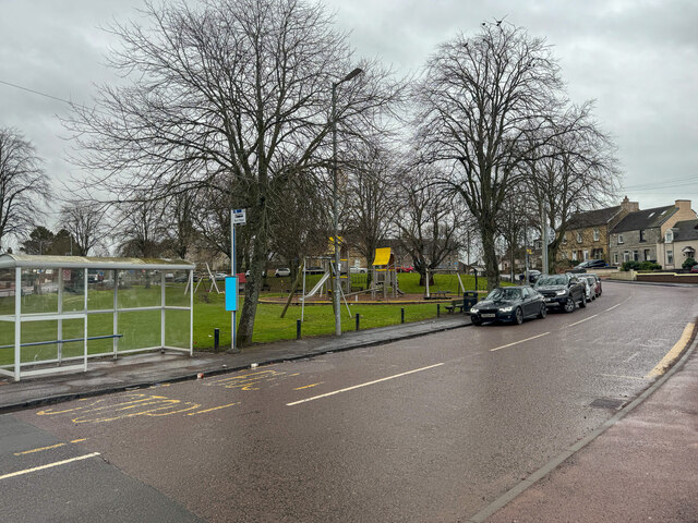
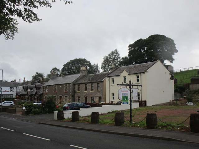
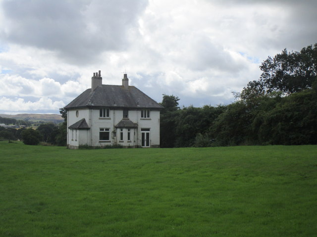
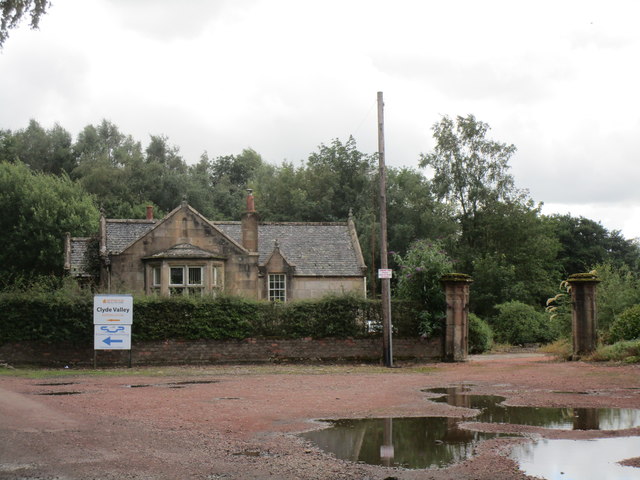
Carstairs is a small village located in the South Lanarkshire council area of Scotland. Situated approximately 30 miles southeast of Glasgow, it lies on the border of the Scottish Lowlands and the Southern Uplands. With a population of around 2,000 residents, Carstairs is a peaceful and close-knit community.

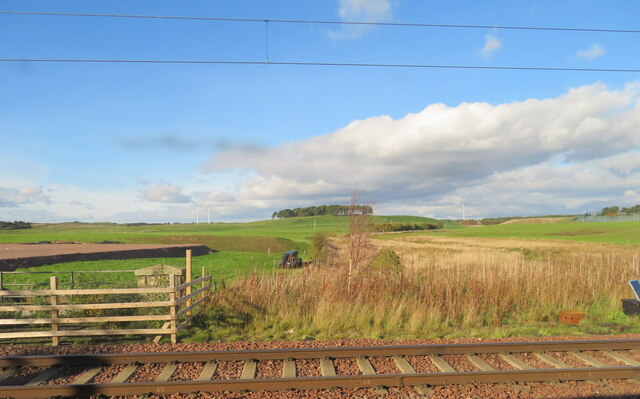
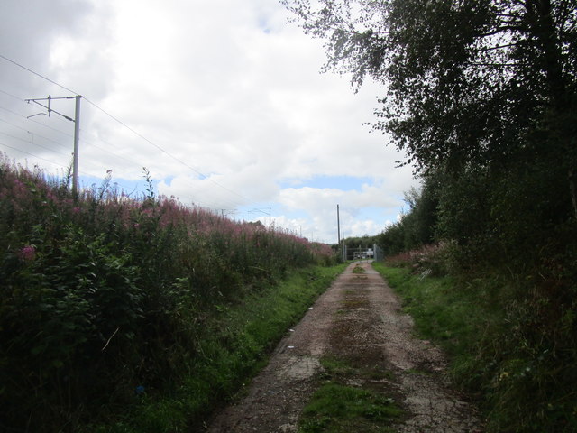
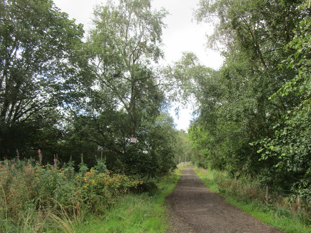
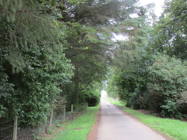
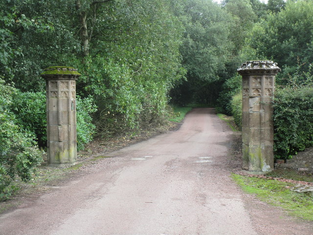
The village is known for its picturesque surroundings, nestled amidst rolling hills and farmland. It benefits from a tranquil atmosphere and offers stunning views of the surrounding countryside. The nearby River Clyde adds to the natural beauty of the area, providing opportunities for outdoor activities such as fishing and scenic walks.

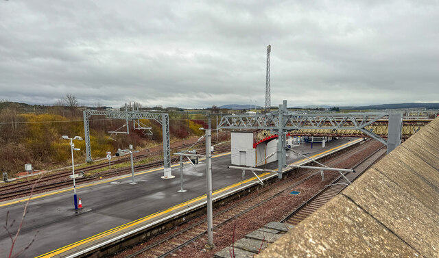
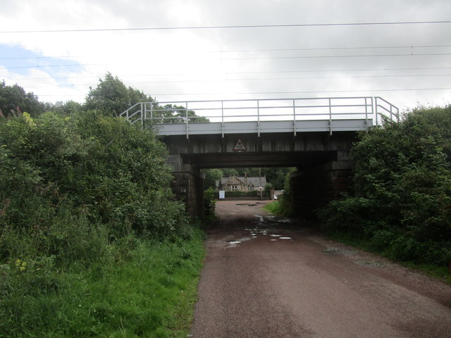
Carstairs is well-connected by road and rail, with the M74 motorway and Carstairs railway station both easily accessible. This makes it convenient for residents to commute to nearby towns and cities for work or leisure.

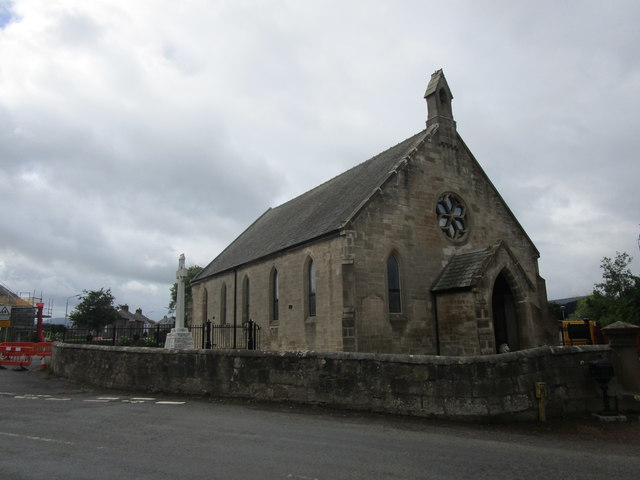
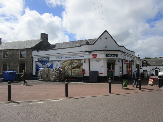
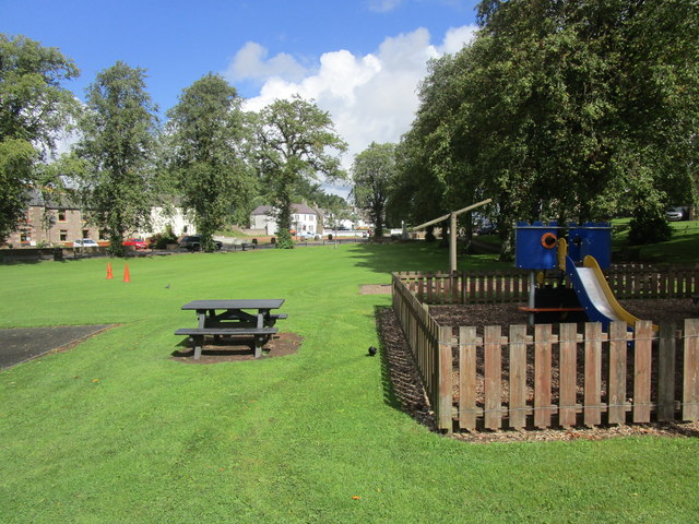
The village boasts a range of amenities including a primary school, a post office, a community center, and a few local shops. There are also several churches serving different denominations. Additionally, Carstairs has a village hall which hosts various events and gatherings throughout the year, fostering a strong sense of community spirit.

For those seeking a slower pace of life and a peaceful countryside setting, Carstairs offers an attractive and welcoming environment. The village's natural beauty, convenient location, and community-focused atmosphere make it an appealing place to live or visit.

If you have any feedback on the listing, please let us know in the comments section below.
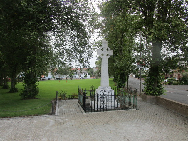
Carstairs Images

Images are sourced within 2km of 55.695688/-3.69075 or Grid Reference NS9345. Thanks to Geograph Open Source API. All images are credited.

Carstairs Junction Here also labelled as Dolphinton Junction. Looking north to Black Hill, with two wind turbines nearby, from a train approaching the junction.
Carstairs Junction
Here also labelled as Dolphinton Junction. Looking north to Black Hill, with two wind turbines nearby, from a train approaching the junction.
Carstairs Junction Geocaching is a type of global treasure hunt of people looking for caches, or hidden stashes of objects. Geocaching may also be described as a series of hide-and-seek games, where hiders provide online clues for seekers. Seekers use global positioning system (GPS) devices to find hidden caches
Carstairs Junction
Geocaching is a type of global treasure hunt of people looking for caches, or hidden stashes of objects. Geocaching may also be described as a series of hide-and-seek games, where hiders provide online clues for seekers. Seekers use global positioning system (GPS) devices to find hidden caches
Carstairs centre
Carstairs centre
Monteith House Viewed from across the River Clyde.
Monteith House
Viewed from across the River Clyde.
Houses on Lanark Road, Carstairs
Track to the sewage works, Carstairs Runs alongside The West Coast Main Line.
Track to the sewage works, Carstairs
Runs alongside The West Coast Main Line.
Track to Westwalk Wood
Grass field near Carstairs Mains
Former church, Carstairs Junction Dates from 1879 and now converted to a house.
Former church, Carstairs Junction
Dates from 1879 and now converted to a house.
Monteith House Dates from 1821. Now in use as a nursing home.
Monteith House
Dates from 1821. Now in use as a nursing home.
House in the grounds of Monteith House Probably dates from the time when Menteith House was in use as a children's home.
House in the grounds of Monteith House
Probably dates from the time when Menteith House was in use as a children's home.
Road from Monteith House to Carstairs
Road to Carstairs Mains and Monteith House The bridge is numbered WCM1/408 and carries the main Glasgow to Carlisle railway line.
Road to Carstairs Mains and Monteith House
The bridge is numbered WCM1/408 and carries the main Glasgow to Carlisle railway line.
North Lodge Lodge to Monteith House.
North Lodge
Lodge to Monteith House.
Gateway to Monteith House and Carstairs Mains
McColl's store, Carstairs
The Green at Carstairs
War memorial at Carstairs
Show me another place!

Carstairs is located at Grid Ref: NS9345 (Lat: 55.695688, Lng: -3.69075)

Unitary Authority: South Lanarkshire

Police Authority: Lanarkshire

What 3 Words

///daydreams.piano.hides. Near Carnwath, South Lanarkshire

Nearby Locations

Oldmill Wood Carstairs

Related Wikis

Carstairs

Carstairs (, Scottish Gaelic: Caisteal Tarrais) is a village in South Lanarkshire, Scotland. Carstairs is located 5 miles (8 kilometres) east of the county...

Carstairs Castle

Carstairs Castle was a stronghold in the east of Carstairs, a short distance from the current site of Carstairs Parish Church. Now long gone, it dates...

Ravenstruther Rail Terminal

Ravenstruther Rail Terminal is a freight handling facility near Ravenstruther in Scotland. == History == The terminal was formerly operated by Scottish...

Carstairs railway station

Carstairs railway station serves the village of Carstairs in South Lanarkshire, Scotland and is a major junction station on the West Coast Main Line (WCML...

Carstairs Junction

Carstairs Junction (Scottish Gaelic: Snaim Caisteal Tarrais) is a village in South Lanarkshire. Taking its name from the village of Carstairs and nearby...
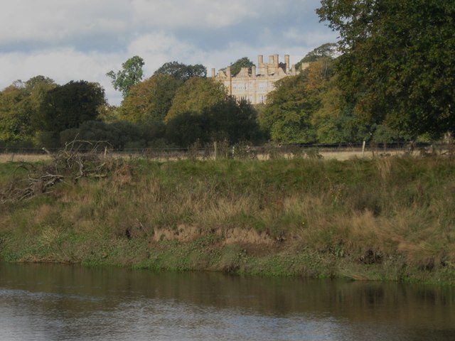
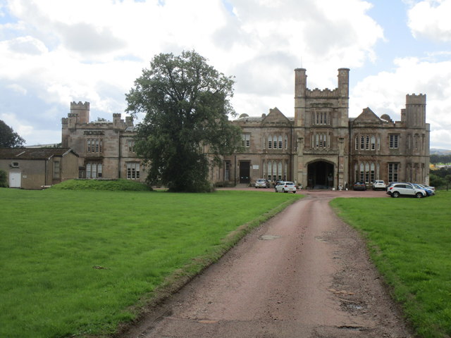
Carstairs House

Carstairs House, also known as Monteith House, is a country house 1.5 kilometres (0.93 mi) south-west of Carstairs South Lanarkshire, Scotland. The house...

Ravenstruther

Ravenstruther (Scots: Raenstrie) is a small hamlet in South Lanarkshire, Scotland, near the town of Lanark. In 1517 the lands of Carstairs and Ravenstruther...
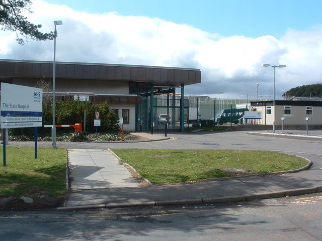
State Hospital

The State Hospital (also known as Carstairs Hospital, or simply Carstairs) is a psychiatric hospital in the village of Carstairs, in South Lanarkshire...

Nearby Amenities

Located within 500m of 55.695688,-3.69075
Railway: switch
Lat/Long: 55.6924749/-3.6861886
Carstairs
Is In: South Lanarkshire
Place: village
Population: 914
Wikidata: Q1009254
Wikipedia: en:Carstairs
Lat/Long: 55.695947/-3.690944
Bus Stop
Carstairs, At Rosemount Crescent On Lanark Road
Bench: no
Bus: yes
Departures Board: timetable
Naptan AtcoCode: 61501248
Naptan Bearing: SW
Naptan CommonName: Rosemount Crescent
Naptan Indicator: At Rosemount Crescent
Naptan Landmark: Rosemount Crescent
Naptan NaptanCode: 75232834
Naptan Street: Lanark Road
Public Transport: platform
Shelter: yes
Source: naptan_import
Tactile Paving: no
Lat/Long: 55.6950948/-3.6965893
Bus Stop
Carstairs, Opposite Rosemount Crescent On Lanark Road
Bench: no
Bus: yes
Departures Board: timetable
Naptan AtcoCode: 61501249
Naptan Bearing: NE
Naptan CommonName: Rosemount Crescent
Naptan Indicator: Opp Rosemount Crescent
Naptan Landmark: Rosemount Crescent
Naptan NaptanCode: 75236269
Naptan Street: Lanark Road
Public Transport: platform
Shelter: no
Source: naptan_import
Tactile Paving: no
Lat/Long: 55.6952349/-3.6963954
Bus Stop
Lanark Road
Bench: yes
Bus: yes
Naptan AtcoCode: 61501250
Naptan Bearing: NW
Naptan CommonName: Lanark Road
Naptan Indicator: Near Lanark Road
Naptan Landmark: Lanark Road
Naptan NaptanCode: 75232986
Naptan Street: Carstairs Road
Public Transport: platform
Shelter: yes
Source: naptan_import
Lat/Long: 55.6956753/-3.6912797
Bus Stop
East End Terrace
Bus: yes
Naptan AtcoCode: 61501251
Naptan Bearing: NW
Naptan CommonName: East End Terrace
Naptan Indicator: Opp East End Terrace
Naptan Landmark: East End Terrace
Naptan NaptanCode: 75236368
Naptan Street: Carstairs Road
Naptan Verified: no
Public Transport: platform
Shelter: no
Source: naptan_import
Tactile Paving: no
Lat/Long: 55.6951461/-3.6870268
Bus Stop
West View
Bus: yes
Naptan AtcoCode: 61501466
Naptan Bearing: SE
Naptan CommonName: West View
Naptan Indicator: At West View
Naptan Landmark: West View
Naptan NaptanCode: 75236242
Naptan Street: Carstairs Road
Naptan Verified: no
Public Transport: platform
Shelter: yes
Source: naptan_import
Lat/Long: 55.6957892/-3.6913913
Noexit: yes
Lat/Long: 55.6941379/-3.6955277
Noexit: yes
Lat/Long: 55.6938263/-3.6950996
Noexit: yes
Lat/Long: 55.6935641/-3.6947326
Noexit: yes
Lat/Long: 55.6945802/-3.6964104
Noexit: yes
Lat/Long: 55.6956442/-3.6858407
Noexit: yes
Lat/Long: 55.6941275/-3.6957944
Noexit: yes
Lat/Long: 55.6937096/-3.6951795
Noexit: yes
Lat/Long: 55.6933931/-3.69472
Noexit: yes
Lat/Long: 55.6960839/-3.6865303
Post Box
Collection Times: Mo-Fr 09:00; Sa 07:00
Operator: Royal Mail
Post Box Type: lamp
Ref: ML11 51D
Royal Cypher: scottish_crown
Lat/Long: 55.695431/-3.6955085
Rosemount Car Sales
Shop: car_repair
Lat/Long: 55.6977093/-3.6898806
Post Box
Collection Times: Mo-Fr 17:15; Sa 11:30
Operator: Royal Mail
Post Box Type: lamp
Ref: ML11 14
Royal Cypher: scottish_crown
Lat/Long: 55.6956095/-3.6910257
Morrisons Daily
Addr City: Carstairs Village
Addr Housenumber: 16
Addr Postcode: ML11 8QD
Addr Street: Carstairs Road
Brand: Morrisons Daily
Brand Wikidata: Q99752411
Brand Wikipedia: en:McColl's
Currency GBP: yes
Internet Access: no
Opening Hours: Mo-Su 07:00-22:00
Operator: Morrisons
Payment Apple Pay: yes
Payment Cards: yes
Payment Cash: yes
Payment Coins: yes
Payment Google Pay: yes
Phone: +44 1555 870973
Shop: convenience
Website: https://my.morrisons.com/storefinder/64637/morrisons-daily-larnark-16-carstairs-rd
Lat/Long: 55.695594/-3.6911166
Post Office
Carstairs Post Office
Addr Postcode: ML11 8QD
Branch: Carstairs
Brand: Post Office
Brand Wikidata: Q1783168
Check Date: 2020-02-20
Contact Website: https://www.postoffice.co.uk/branch-finder/2358328/carstairs
Ref Pol Id: 9125
Lat/Long: 55.6955864/-3.691197
Access: customers
Addr City: Carstairs Village
Addr Housenumber: 16
Addr Postcode: ML11 8QD
Addr Street: Carstairs Road
Door: automatic
Entrance: main
Level: 0
Lat/Long: 55.6956286/-3.6910819
Carstairs Village War Memorial
Historic: memorial
Material: stone
Memorial: war_memorial
Lat/Long: 55.696309/-3.6904836
Telephone
Booth: KX100
Covered: booth
Lat/Long: 55.6958457/-3.6915752
Street Lamp
Lamp Type: led
Lat/Long: 55.6958256/-3.6969124
Carstairs
Siren
Description: Used to alert local residents of a patient being unaccounted for at the State Hospital. Tested on the third Thursday of every month. All clear / test signal: 3x 30 second blasts Alert: continuous 8 minute blast
Emergency: siren
Operator: NHS Scotland
Siren Purpose: escape
Siren Type: pneumatic
Lat/Long: 55.6948386/-3.6905449
Community Centre
Carstairs Community Centre
Addr City: Carstairs Village
Addr Postcode: ML11 8QF
Addr Street: School Road
Lat/Long: 55.6959532/-3.6898066
Doctors
Medwyn Medical Practice
Addr City: Carstairs Village
Addr Postcode: ML11 8QF
Addr Street: School Road
Healthcare: doctor
Healthcare Speciality: general
Phone: +44 1555 870512
Website: https://www.medwynmedicalpractice.co.uk/
Lat/Long: 55.6960091/-3.6899756
Street Lamp
Lamp Type: led
Lat/Long: 55.6938702/-3.6951521
Waste Basket
Lat/Long: 55.6956566/-3.691098
Waste Basket
Waste: dog_excrement
Lat/Long: 55.6957949/-3.6902477
Board Type: map
Information: board
Tourism: information
Lat/Long: 55.6959378/-3.6902544
Board Type: map
Information: board
Tourism: information
Lat/Long: 55.6958214/-3.6914547
Addr Housenumber: 21
Addr Street: Milne Street
Lat/Long: 55.6960923/-3.6938556
Addr Housenumber: 2
Addr Street: Castledyke Gardens
Lat/Long: 55.6943942/-3.6954546
Addr Housenumber: 32
Addr Street: Lanark Road
Lat/Long: 55.6944673/-3.6980123
Access: private
Addr City: Carstairs Village
Addr Housenumber: 67
Addr Postcode: ML11 8QL
Addr Street: Lanark Road
Entrance: yes
Level: 0
Wheelchair: no
Lat/Long: 55.6953684/-3.6963044
Access: private
Addr City: Carstairs Village
Addr Housenumber: 67
Addr Postcode: ML11 8QL
Addr Street: Lanark Road
Entrance: yes
Level: 0
Wheelchair: no
Lat/Long: 55.6954304/-3.6963561
Generator Method: photovoltaic
Generator Output Electricity: yes
Generator Source: solar
Generator Type: solar_photovoltaic_panel
Power: generator
Lat/Long: 55.6944081/-3.6962436
Generator Method: photovoltaic
Generator Output Electricity: yes
Generator Source: solar
Generator Type: solar_photovoltaic_panel
Power: generator
Lat/Long: 55.6941609/-3.6951721
Generator Method: photovoltaic
Generator Output Electricity: yes
Generator Source: solar
Generator Type: solar_photovoltaic_panel
Power: generator
Lat/Long: 55.695297/-3.6883472
Generator Method: photovoltaic
Generator Output Electricity: yes
Generator Source: solar
Generator Type: solar_photovoltaic_panel
Power: generator
Lat/Long: 55.6949553/-3.6870946
Generator Method: photovoltaic
Generator Output Electricity: yes
Generator Source: solar
Generator Type: solar_photovoltaic_panel
Power: generator
Lat/Long: 55.6949047/-3.6871764
Generator Method: photovoltaic
Generator Output Electricity: yes
Generator Source: solar
Generator Type: solar_photovoltaic_panel
Power: generator
Lat/Long: 55.6948775/-3.6876217
Generator Method: photovoltaic
Generator Output Electricity: yes
Generator Source: solar
Generator Type: solar_photovoltaic_panel
Power: generator
Lat/Long: 55.6949243/-3.6875412
Generator Method: photovoltaic
Generator Output Electricity: yes
Generator Source: solar
Generator Type: solar_photovoltaic_panel
Power: generator
Lat/Long: 55.6951299/-3.687851
Generator Method: photovoltaic
Generator Output Electricity: yes
Generator Source: solar
Generator Type: solar_photovoltaic_panel
Power: generator
Lat/Long: 55.6950929/-3.6879449
Generator Method: photovoltaic
Generator Output Electricity: yes
Generator Source: solar
Generator Type: solar_photovoltaic_panel
Power: generator
Lat/Long: 55.6948246/-3.6859989
Addr Housenumber: 84
Addr Street: Rosemount Crescent
Lat/Long: 55.694687/-3.6939611
Generator Method: photovoltaic
Generator Output Electricity: yes
Generator Source: solar
Generator Type: solar_photovoltaic_panel
Power: generator
Lat/Long: 55.6957172/-3.6890835
Generator Method: photovoltaic
Generator Output Electricity: yes
Generator Source: solar
Generator Type: solar_photovoltaic_panel
Power: generator
Lat/Long: 55.6960671/-3.6922793
Generator Method: photovoltaic
Generator Output Electricity: yes
Generator Source: solar
Generator Type: solar_photovoltaic_panel
Power: generator
Lat/Long: 55.6962077/-3.6933267
Generator Method: photovoltaic
Generator Output Electricity: yes
Generator Source: solar
Generator Type: solar_photovoltaic_panel
Power: generator
Lat/Long: 55.6953446/-3.6953907
Generator Method: photovoltaic
Generator Output Electricity: yes
Generator Source: solar
Generator Type: solar_photovoltaic_panel
Power: generator
Lat/Long: 55.6953945/-3.6953035
Generator Method: photovoltaic
Generator Output Electricity: yes
Generator Source: solar
Generator Type: solar_photovoltaic_panel
Power: generator
Lat/Long: 55.6954859/-3.6949575
Noexit: yes
Lat/Long: 55.6945328/-3.6961725
Generator Method: photovoltaic
Generator Output Electricity: yes
Generator Source: solar
Generator Type: solar_photovoltaic_panel
Power: generator
Lat/Long: 55.6942622/-3.689636
Generator Method: photovoltaic
Generator Output Electricity: yes
Generator Source: solar
Generator Type: solar_photovoltaic_panel
Power: generator
Lat/Long: 55.6952312/-3.6957313
Generator Method: photovoltaic
Generator Output Electricity: yes
Generator Source: solar
Generator Type: solar_photovoltaic_panel
Power: generator
Lat/Long: 55.6952267/-3.6958896
Generator Method: photovoltaic
Generator Output Electricity: yes
Generator Source: solar
Generator Type: solar_photovoltaic_panel
Power: generator
Lat/Long: 55.6951586/-3.6961296
Generator Method: photovoltaic
Generator Output Electricity: yes
Generator Source: solar
Generator Type: solar_photovoltaic_panel
Power: generator
Lat/Long: 55.6946666/-3.696536
Generator Method: photovoltaic
Generator Output Electricity: yes
Generator Source: solar
Generator Type: solar_photovoltaic_panel
Power: generator
Lat/Long: 55.6935162/-3.6950916
Generator Method: photovoltaic
Generator Output Electricity: yes
Generator Source: solar
Generator Type: solar_photovoltaic_panel
Power: generator
Lat/Long: 55.6940385/-3.6945123
Generator Method: photovoltaic
Generator Output Electricity: yes
Generator Source: solar
Generator Type: solar_photovoltaic_panel
Power: generator
Lat/Long: 55.6955456/-3.6938269
Generator Method: photovoltaic
Generator Output Electricity: yes
Generator Source: solar
Generator Type: solar_photovoltaic_panel
Power: generator
Lat/Long: 55.6953453/-3.6937518
Generator Method: photovoltaic
Generator Output Electricity: yes
Generator Source: solar
Generator Type: solar_photovoltaic_panel
Power: generator
Lat/Long: 55.6951375/-3.6951801
Generator Method: photovoltaic
Generator Output Electricity: yes
Generator Source: solar
Generator Type: solar_photovoltaic_panel
Power: generator
Lat/Long: 55.6949032/-3.6929244
Generator Method: photovoltaic
Generator Output Electricity: yes
Generator Source: solar
Generator Type: solar_photovoltaic_panel
Power: generator
Lat/Long: 55.692879/-3.6923276
Generator Method: photovoltaic
Generator Output Electricity: yes
Generator Source: solar
Generator Type: solar_photovoltaic_panel
Power: generator
Lat/Long: 55.6935585/-3.6941595
Addr Housenumber: 30
Addr Street: Rosemount Crescent
Lat/Long: 55.6948994/-3.6935507
Entrance: yes
Lat/Long: 55.6965248/-3.6899882
Power: pole
Lat/Long: 55.693843/-3.6857244
Power: pole
Lat/Long: 55.6929673/-3.6857013
Power: pole
Lat/Long: 55.693907/-3.6886467
Power: pole
Lat/Long: 55.693875/-3.6871856
Power: pole
Lat/Long: 55.6938027/-3.6842906
Railway: switch
Lat/Long: 55.6922431/-3.688452
Railway: switch
Lat/Long: 55.6920812/-3.6896645
Railway: switch
Lat/Long: 55.6925307/-3.685287
Carstairs North Junction
Railway: junction
Lat/Long: 55.6924538/-3.6861707
Traffic Calming: island
Lat/Long: 55.6961779/-3.69121
The data included in this document is from www.openstreetmap.org. The data is made available under ODbL.

Have you been to Carstairs?

Leave your review of Carstairs below (or comments, questions and feedback).