Hungryhill Wood

Wood, Forest in Perthshire

Scotland

Hungryhill Wood

Field, Dunblane Not yet built upon but one lane of the old A9 was closed and there was some Heras fencing up. Something may be happening.
Field, Dunblane Credit: Richard Webb

Hungryhill Wood is a captivating forest located in Perthshire, Scotland. Covering an area of approximately 100 acres, it is nestled amidst the stunning landscape of the Scottish Highlands. The wood is easily accessible and offers a delightful experience for nature enthusiasts and outdoor lovers.

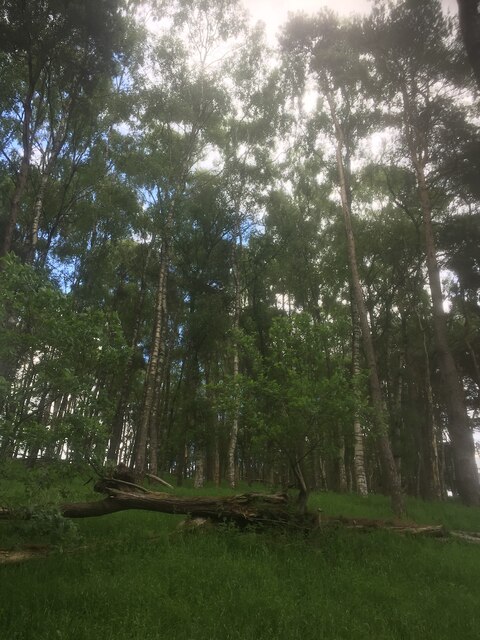
The wood is characterized by its diverse range of trees, including oak, ash, beech, and birch, which create a picturesque canopy overhead. These trees provide a habitat for a wide variety of wildlife, including red squirrels, roe deer, and a myriad of bird species. It is a haven for birdwatchers, as they can spot species such as woodpeckers, buzzards, and owls.

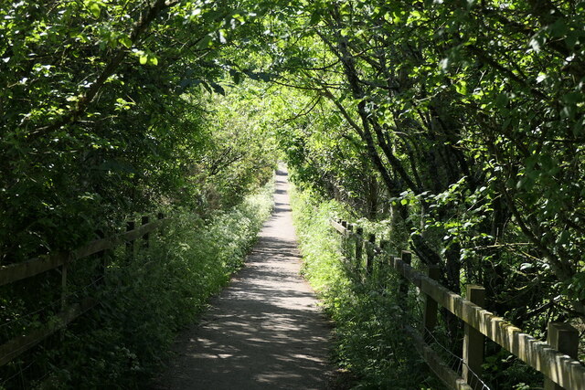
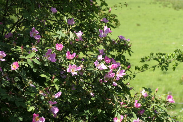
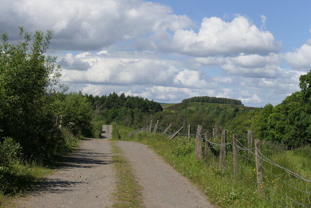
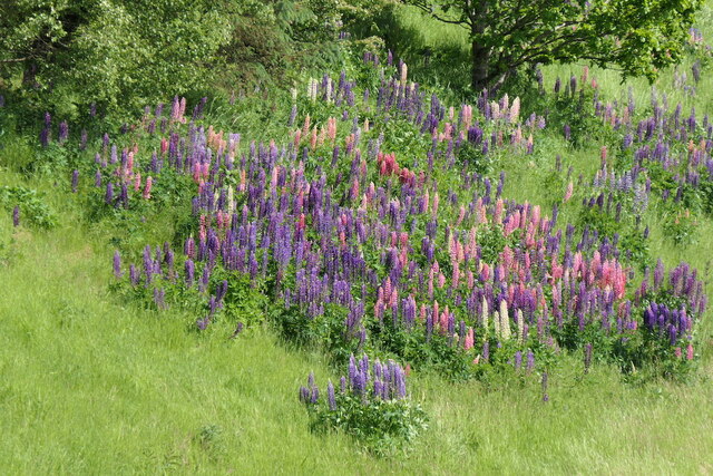
Hungryhill Wood is crisscrossed by well-maintained walking trails, allowing visitors to explore the woodland at their own pace. The trails wind through the forest, offering breathtaking views of the surrounding mountains and valleys. In spring, the forest floor bursts into a vibrant display of wildflowers, adding a splash of color to the serene environment.

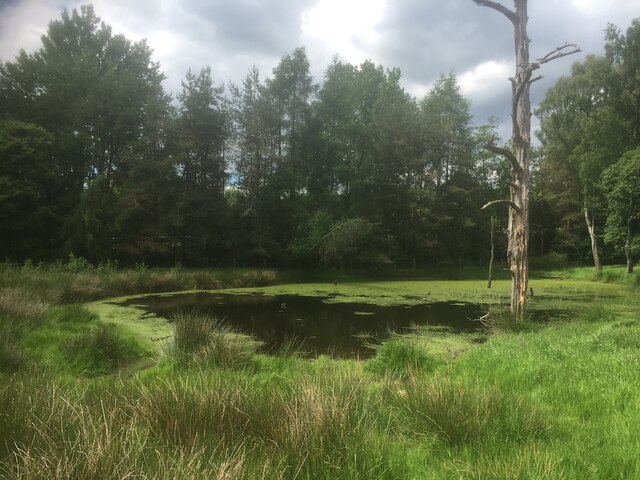
The wood also contains a small pond, which serves as a watering hole for various wildlife. It provides an ideal spot for quiet contemplation or a picnic, while enjoying the tranquil surroundings. Furthermore, there are benches strategically placed along the trails, offering visitors a chance to rest and soak in the ambiance.

Overall, Hungryhill Wood is a hidden gem in Perthshire, offering a peaceful retreat from the hustle and bustle of daily life. Its natural beauty, diverse wildlife, and well-maintained trails make it a perfect destination for hikers, nature enthusiasts, and those seeking a peaceful escape into nature.

If you have any feedback on the listing, please let us know in the comments section below.

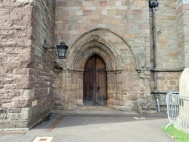
Hungryhill Wood Images

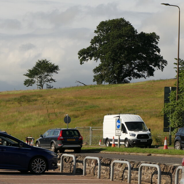
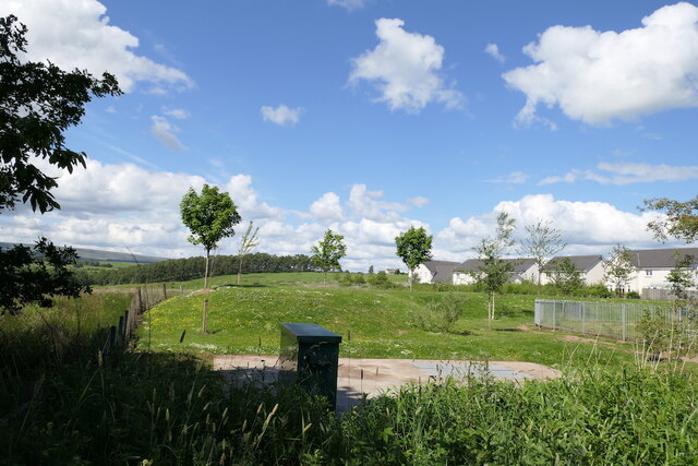
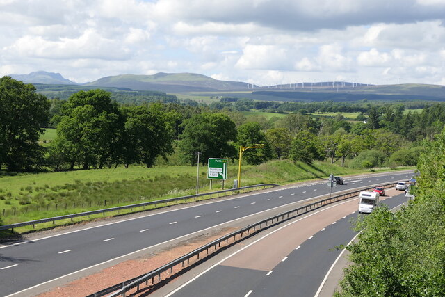
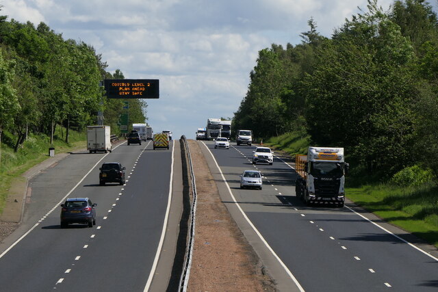
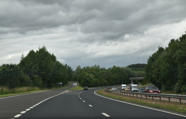
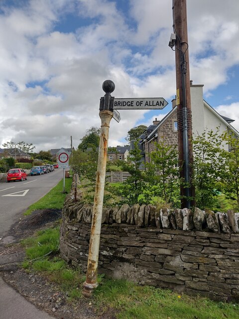
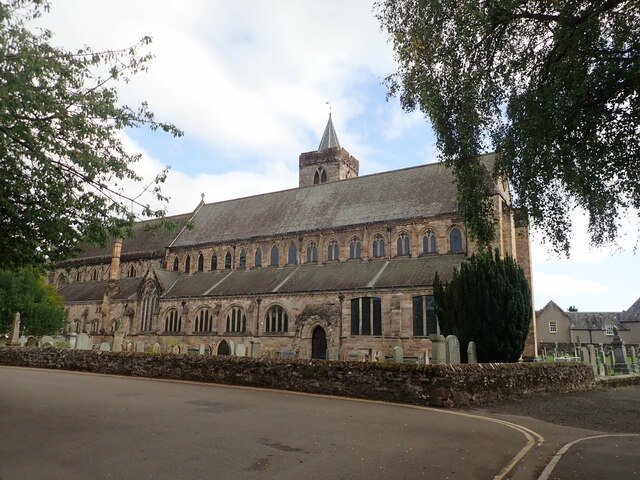
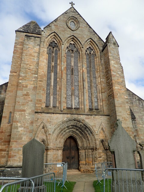
Images are sourced within 2km of 56.175566/-3.9720467 or Grid Reference NS7799. Thanks to Geograph Open Source API. All images are credited.

Field, Dunblane Not yet built upon but one lane of the old A9 was closed and there was some Heras fencing up. Something may be happening.
Field, Dunblane
Not yet built upon but one lane of the old A9 was closed and there was some Heras fencing up. Something may be happening.
Culdee Grove, Dunblane View from Old Doune Road. There is still a lot of land between the edge of town and the bypass that has not yet been built upon.
Culdee Grove, Dunblane
View from Old Doune Road. There is still a lot of land between the edge of town and the bypass that has not yet been built upon.
A9 Dunblane bypass With average speed camera.
A9 Dunblane bypass
With average speed camera.
A9 Dunblane bypass Covid-19 warning on the variable sign.  By this time the levels had lost all connection with reality.
A9 Dunblane bypass
Covid-19 warning on the variable sign. By this time the levels had lost all connection with reality.
Old Doune Road Descent from the bridge over the A9 towards Dunblane High School's playing field.
Old Doune Road
Descent from the bridge over the A9 towards Dunblane High School's playing field.
Roses, Old Doune Road
Road off Old Doune Road Connects Old Doune Road with the A820 and provides vehicular access to Dunblane High School's playing fields.
Road off Old Doune Road
Connects Old Doune Road with the A820 and provides vehicular access to Dunblane High School's playing fields.
Lupins beside the A9
Remains of a stripwood, Dunblane The A9 was built through this strip west of the current edge of the town.
Remains of a stripwood, Dunblane
The A9 was built through this strip west of the current edge of the town.
Pond, Dunblane Beside a slip road which joins the A9.  The dead tree suggests that drainage changed here in the past decades, perhaps as a result of the road being built.
Pond, Dunblane
Beside a slip road which joins the A9. The dead tree suggests that drainage changed here in the past decades, perhaps as a result of the road being built.
A9, Dunblane bypass The A9 is a strategic link between the Highlands of Scotland and the Central Belt. It runs 279 miles from junction 5 of the M9 at Polmont to Scrabster. Originally it ran from Edinburgh.
<span class="nowrap"><a title="https://www.sabre-roads.org.uk/wiki/index.php?title=A9" rel="nofollow ugc noopener" href="https://www.sabre-roads.org.uk/wiki/index.php?title=A9">Link</a><img style="margin-left:2px;" alt="External link" title="External link - shift click to open in new window" src="https://s1.geograph.org.uk/img/external.png" width="10" height="10"/></span>
A9, Dunblane bypass
The A9 is a strategic link between the Highlands of Scotland and the Central Belt. It runs 279 miles from junction 5 of the M9 at Polmont to Scrabster. Originally it ran from Edinburgh. LinkExternal link
Footbridge over A9 The A9 is a strategic link between the Highlands of Scotland and the Central Belt. It runs 279 miles from junction 5 of the M9 at Polmont to Scrabster. Originally it ran from Edinburgh.
<span class="nowrap"><a title="https://www.sabre-roads.org.uk/wiki/index.php?title=A9" rel="nofollow ugc noopener" href="https://www.sabre-roads.org.uk/wiki/index.php?title=A9">Link</a><img style="margin-left:2px;" alt="External link" title="External link - shift click to open in new window" src="https://s1.geograph.org.uk/img/external.png" width="10" height="10"/></span>
Footbridge over A9
The A9 is a strategic link between the Highlands of Scotland and the Central Belt. It runs 279 miles from junction 5 of the M9 at Polmont to Scrabster. Originally it ran from Edinburgh. LinkExternal link
A820 junction with A9 The A9 is a strategic link between the Highlands of Scotland and the Central Belt. It runs 279 miles from junction 5 of the M9 at Polmont to Scrabster. Originally it ran from Edinburgh.
<span class="nowrap"><a title="https://www.sabre-roads.org.uk/wiki/index.php?title=A9" rel="nofollow ugc noopener" href="https://www.sabre-roads.org.uk/wiki/index.php?title=A9">Link</a><img style="margin-left:2px;" alt="External link" title="External link - shift click to open in new window" src="https://s1.geograph.org.uk/img/external.png" width="10" height="10"/></span>
A820 junction with A9
The A9 is a strategic link between the Highlands of Scotland and the Central Belt. It runs 279 miles from junction 5 of the M9 at Polmont to Scrabster. Originally it ran from Edinburgh. LinkExternal link
Direction Sign – Signpost on Glen Road, Dunblane Located on the east side of the crossroads of Glen Road and Sheriffmuir Road, southwest of Dunblane. 3 arms, 1 missing and ball finial. See also <a title="https://www.geograph.org.uk/photo/5431261" href="https://www.geograph.org.uk/photo/5431261">Link</a>.

Milestone Society National ID: PR_NN7900
Direction Sign – Signpost on Glen Road, Dunblane
Located on the east side of the crossroads of Glen Road and Sheriffmuir Road, southwest of Dunblane. 3 arms, 1 missing and ball finial. See also Link. Milestone Society National ID: PR_NN7900
Cathedral Church of St Blaan and St Laurence, Dunblane Dunblane Cathedral dates back to the 12th century, most of what stands being constructed during the bishopric of Clement in the 13th century.
Cathedral Church of St Blaan and St Laurence, Dunblane
Dunblane Cathedral dates back to the 12th century, most of what stands being constructed during the bishopric of Clement in the 13th century.
Dunblane Cathedral Western end of the cathedral, with three stained glass windows
Dunblane Cathedral
Western end of the cathedral, with three stained glass windows
Door on southern side of Dunblane Cathedral There is believed to have been a 9th century church on this site, and the present cathedral of St Blaan and St Laurence erected in its place dates largely from the 12th-13th centuries, restored in 1889 by Sir Robert Rowand Anderson. Along with its surrounding close it is listed category A (LB26361) and a Scheduled Monument (SM90109).
Door on southern side of Dunblane Cathedral
There is believed to have been a 9th century church on this site, and the present cathedral of St Blaan and St Laurence erected in its place dates largely from the 12th-13th centuries, restored in 1889 by Sir Robert Rowand Anderson. Along with its surrounding close it is listed category A (LB26361) and a Scheduled Monument (SM90109).
OS Cutmark, Dunblane Cathedral At the foot of the tower
OS Cutmark, Dunblane Cathedral
At the foot of the tower
Show me another place!

Hungryhill Wood is located at Grid Ref: NS7799 (Lat: 56.175566, Lng: -3.9720467)

Unitary Authority: Stirling

Police Authority: Forth Valley

What 3 Words

///cutlets.eaten.bluffing. Near Dunblane, Stirling

Related Wikis

Duckburn Park

Duckburn Park was a football ground in Dunblane, Scotland. It was the home ground of Dunblane and Dunblane Rovers, and hosted a single Scottish Football...

Dunblane

Dunblane (, Scottish Gaelic: Dùn Bhlàthain) is a small town in the council area of Stirling in central Scotland, and inside the historic boundaries of...

Dunblane railway station

Dunblane railway station serves the town of Dunblane in central Scotland. It is located on the former Scottish Central Railway, between Stirling and Perth...

Dunblane Hotel

Dunblane Hotel (also known as The Dunblane) is an historic building in Dunblane, Scotland. Located on Stirling Street, it is a Category C listed building...

Nearby Amenities

Located within 500m of 56.175566,-3.9720467
Barrier: stile
Lat/Long: 56.1730241/-3.9679772
Communication Mobile Phone: yes
Man Made: mast
Tower Construction: concealed
Tower Type: communication
Lat/Long: 56.1735545/-3.9705543
Historic: milestone
Inscription: Bridge of Allan 1 3/4 Mls, Stirling 5 Miles. Dunblane 1 Mle. Crieff 17 Mls.
Material: cast iron
Lat/Long: 56.1718478/-3.967811
Power: pole
Lat/Long: 56.1751311/-3.9647657
Power: pole
Lat/Long: 56.1755713/-3.9659517
Power: pole
Lat/Long: 56.1759555/-3.9669808
Power: pole
Lat/Long: 56.1761232/-3.967418
Power: pole
Lat/Long: 56.1765214/-3.9667947
Power: pole
Lat/Long: 56.1771885/-3.9669055
Power: pole
Lat/Long: 56.1777439/-3.9669871
Power: pole
Lat/Long: 56.1782585/-3.9668177
Power: pole
Lat/Long: 56.1787475/-3.9666587
Power: pole
Lat/Long: 56.1717223/-3.9758895
Power: pole
Lat/Long: 56.1721054/-3.975011
Power: pole
Lat/Long: 56.1724582/-3.9742015
Power: pole
Lat/Long: 56.1727493/-3.9735091
Power: pole
Lat/Long: 56.1730858/-3.972754
Power: pole
Lat/Long: 56.1734841/-3.971819
Power: pole
Lat/Long: 56.1737927/-3.9711162
Power: pole
Lat/Long: 56.1741967/-3.9704636
Power: pole
Lat/Long: 56.1746077/-3.9698277
Power: pole
Lat/Long: 56.1748569/-3.9694428
Power: pole
Lat/Long: 56.1742212/-3.9719696
Power: pole
Lat/Long: 56.1746136/-3.9727561
Power: pole
Lat/Long: 56.1751131/-3.9737351
Power: pole
Lat/Long: 56.1755637/-3.9746408
Power: pole
Lat/Long: 56.1756196/-3.9753499
Power: pole
Lat/Long: 56.1755206/-3.9762054
Power: pole
Lat/Long: 56.1758094/-3.9776152
Power: pole
Lat/Long: 56.1761214/-3.9791317
Bus Stop
Dunblane at Keir Roundabout Northbound
Bench: no
Bin: no
Departures Board: timetable
Fixme: Naptan
Lit: no
Ref: 5870001
Shelter: no
Source: survey
Tactile Paving: no
Lat/Long: 56.1717479/-3.9687467
The data included in this document is from www.openstreetmap.org. The data is made available under ODbL.

Have you been to Hungryhill Wood?

Leave your review of Hungryhill Wood below (or comments, questions and feedback).