Keir Mains Wood

Wood, Forest in Perthshire

Scotland

Keir Mains Wood

Field, Dunblane Not yet built upon but one lane of the old A9 was closed and there was some Heras fencing up. Something may be happening.
Field, Dunblane Credit: Richard Webb

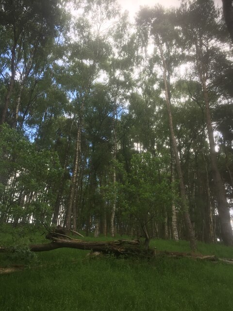
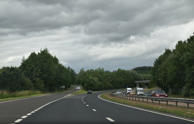
Keir Mains Wood is a picturesque forest located in the heart of Perthshire, Scotland. Spanning over a vast area of land, this woodland offers a serene and tranquil escape for nature enthusiasts and outdoor adventurers alike.

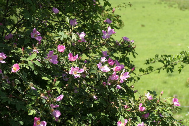
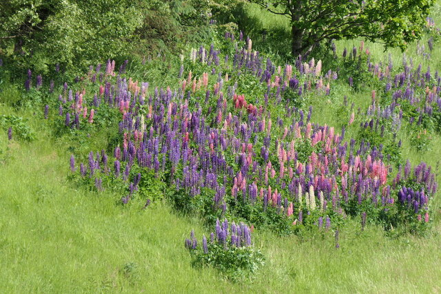
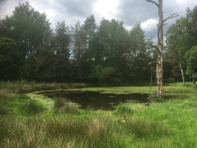
The forest is predominantly composed of native Scottish trees, including oak, birch, and pine. These towering trees provide a dense canopy, allowing for a cool and shaded environment, even during the summer months. The forest floor is covered in a lush carpet of moss, ferns, and wildflowers, creating a vibrant and diverse ecosystem.

Keir Mains Wood is home to a wide variety of wildlife, making it a haven for animal lovers and birdwatchers. Red squirrels, roe deer, and badgers can often be spotted roaming among the trees, while bird species such as woodpeckers, owls, and buzzards can be heard and seen throughout the forest. The presence of such a rich wildlife population is a testament to the healthy and well-preserved ecosystem of the wood.

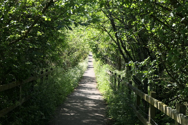
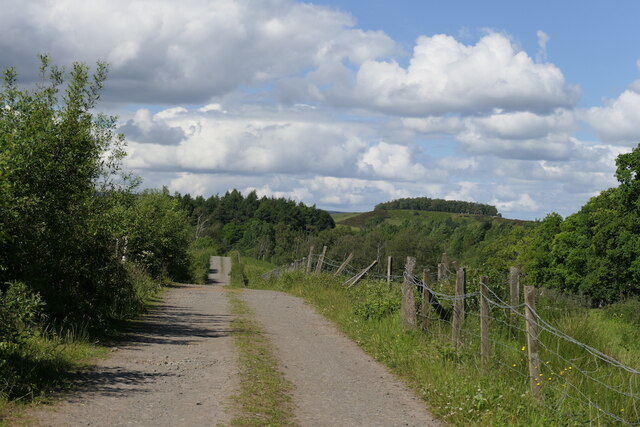
The forest offers a network of well-maintained trails, allowing visitors to explore its beauty on foot. These paths wind through the woodland, leading to hidden glens, enchanting waterfalls, and breathtaking viewpoints. Keir Mains Wood is also intersected by a meandering river, adding to the natural charm and beauty of the area.

The wood is easily accessible, with ample parking facilities and well-marked entrances. It is a popular destination for outdoor activities such as hiking, nature walks, and picnicking. With its stunning scenery, diverse flora and fauna, and peaceful ambiance, Keir Mains Wood is a true gem of Perthshire, inviting visitors to immerse themselves in the beauty of nature.

If you have any feedback on the listing, please let us know in the comments section below.

Keir Mains Wood Images

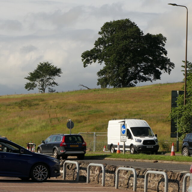
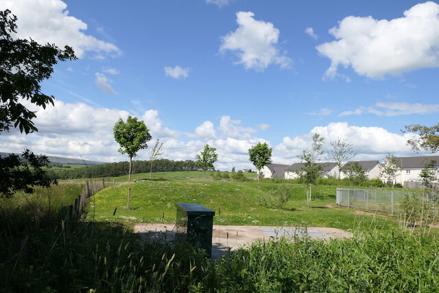
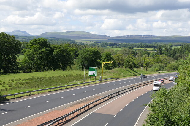
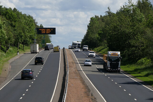
Images are sourced within 2km of 56.173769/-3.9765296 or Grid Reference NS7799. Thanks to Geograph Open Source API. All images are credited.

Field, Dunblane Not yet built upon but one lane of the old A9 was closed and there was some Heras fencing up. Something may be happening.
Field, Dunblane
Not yet built upon but one lane of the old A9 was closed and there was some Heras fencing up. Something may be happening.
Culdee Grove, Dunblane View from Old Doune Road. There is still a lot of land between the edge of town and the bypass that has not yet been built upon.
Culdee Grove, Dunblane
View from Old Doune Road. There is still a lot of land between the edge of town and the bypass that has not yet been built upon.
A9 Dunblane bypass With average speed camera.
A9 Dunblane bypass
With average speed camera.
A9 Dunblane bypass Covid-19 warning on the variable sign.  By this time the levels had lost all connection with reality.
A9 Dunblane bypass
Covid-19 warning on the variable sign. By this time the levels had lost all connection with reality.
Old Doune Road Descent from the bridge over the A9 towards Dunblane High School's playing field.
Old Doune Road
Descent from the bridge over the A9 towards Dunblane High School's playing field.
Roses, Old Doune Road
Road off Old Doune Road Connects Old Doune Road with the A820 and provides vehicular access to Dunblane High School's playing fields.
Road off Old Doune Road
Connects Old Doune Road with the A820 and provides vehicular access to Dunblane High School's playing fields.
Lupins beside the A9
Remains of a stripwood, Dunblane The A9 was built through this strip west of the current edge of the town.
Remains of a stripwood, Dunblane
The A9 was built through this strip west of the current edge of the town.
Pond, Dunblane Beside a slip road which joins the A9.  The dead tree suggests that drainage changed here in the past decades, perhaps as a result of the road being built.
Pond, Dunblane
Beside a slip road which joins the A9. The dead tree suggests that drainage changed here in the past decades, perhaps as a result of the road being built.
A9, Dunblane bypass The A9 is a strategic link between the Highlands of Scotland and the Central Belt. It runs 279 miles from junction 5 of the M9 at Polmont to Scrabster. Originally it ran from Edinburgh.
<span class="nowrap"><a title="https://www.sabre-roads.org.uk/wiki/index.php?title=A9" rel="nofollow ugc noopener" href="https://www.sabre-roads.org.uk/wiki/index.php?title=A9">Link</a><img style="margin-left:2px;" alt="External link" title="External link - shift click to open in new window" src="https://s1.geograph.org.uk/img/external.png" width="10" height="10"/></span>
A9, Dunblane bypass
The A9 is a strategic link between the Highlands of Scotland and the Central Belt. It runs 279 miles from junction 5 of the M9 at Polmont to Scrabster. Originally it ran from Edinburgh. LinkExternal link
Footbridge over A9 The A9 is a strategic link between the Highlands of Scotland and the Central Belt. It runs 279 miles from junction 5 of the M9 at Polmont to Scrabster. Originally it ran from Edinburgh.
<span class="nowrap"><a title="https://www.sabre-roads.org.uk/wiki/index.php?title=A9" rel="nofollow ugc noopener" href="https://www.sabre-roads.org.uk/wiki/index.php?title=A9">Link</a><img style="margin-left:2px;" alt="External link" title="External link - shift click to open in new window" src="https://s1.geograph.org.uk/img/external.png" width="10" height="10"/></span>
Footbridge over A9
The A9 is a strategic link between the Highlands of Scotland and the Central Belt. It runs 279 miles from junction 5 of the M9 at Polmont to Scrabster. Originally it ran from Edinburgh. LinkExternal link
A820 junction with A9 The A9 is a strategic link between the Highlands of Scotland and the Central Belt. It runs 279 miles from junction 5 of the M9 at Polmont to Scrabster. Originally it ran from Edinburgh.
<span class="nowrap"><a title="https://www.sabre-roads.org.uk/wiki/index.php?title=A9" rel="nofollow ugc noopener" href="https://www.sabre-roads.org.uk/wiki/index.php?title=A9">Link</a><img style="margin-left:2px;" alt="External link" title="External link - shift click to open in new window" src="https://s1.geograph.org.uk/img/external.png" width="10" height="10"/></span>
A820 junction with A9
The A9 is a strategic link between the Highlands of Scotland and the Central Belt. It runs 279 miles from junction 5 of the M9 at Polmont to Scrabster. Originally it ran from Edinburgh. LinkExternal link
Cathedral Church of St Blaan and St Laurence, Dunblane Dunblane Cathedral dates back to the 12th century, most of what stands being constructed during the bishopric of Clement in the 13th century.
Cathedral Church of St Blaan and St Laurence, Dunblane
Dunblane Cathedral dates back to the 12th century, most of what stands being constructed during the bishopric of Clement in the 13th century.
Dunblane Cathedral Western end of the cathedral, with three stained glass windows
Dunblane Cathedral
Western end of the cathedral, with three stained glass windows
Door on southern side of Dunblane Cathedral There is believed to have been a 9th century church on this site, and the present cathedral of St Blaan and St Laurence erected in its place dates largely from the 12th-13th centuries, restored in 1889 by Sir Robert Rowand Anderson. Along with its surrounding close it is listed category A (LB26361) and a Scheduled Monument (SM90109).
Door on southern side of Dunblane Cathedral
There is believed to have been a 9th century church on this site, and the present cathedral of St Blaan and St Laurence erected in its place dates largely from the 12th-13th centuries, restored in 1889 by Sir Robert Rowand Anderson. Along with its surrounding close it is listed category A (LB26361) and a Scheduled Monument (SM90109).
OS Cutmark, Dunblane Cathedral At the foot of the tower
OS Cutmark, Dunblane Cathedral
At the foot of the tower
Signpost, Dunblane A sculptural signpost incorporating various creatures including fish, frogs and dragonflies, at the junction of High Street, Beech Road and Stirling Road. The sign originally pointed to 'Cathedral Square', 'Dam Road' and 'Railway', however some of the signage is now missing on one side.
Signpost, Dunblane
A sculptural signpost incorporating various creatures including fish, frogs and dragonflies, at the junction of High Street, Beech Road and Stirling Road. The sign originally pointed to 'Cathedral Square', 'Dam Road' and 'Railway', however some of the signage is now missing on one side.
Show me another place!

Keir Mains Wood is located at Grid Ref: NS7799 (Lat: 56.173769, Lng: -3.9765296)

Unitary Authority: Stirling

Police Authority: Forth Valley

What 3 Words

///gifted.clay.culling. Near Dunblane, Stirling

Related Wikis

Keir House

Keir House is a large country house near Stirling in central Scotland. It is located in the parish of Lecropt, 2.5 kilometres (1.6 mi) north-west of Bridge...

Duckburn Park

Duckburn Park was a football ground in Dunblane, Scotland. It was the home ground of Dunblane and Dunblane Rovers, and hosted a single Scottish Football...

Dunblane

Dunblane (, Scottish Gaelic: Dùn Bhlàthain) is a small town in the council area of Stirling in central Scotland, and inside the historic boundaries of...

Dunblane railway station

Dunblane railway station serves the town of Dunblane in central Scotland. It is located on the former Scottish Central Railway, between Stirling and Perth...

Dunblane Hotel

Dunblane Hotel (also known as The Dunblane) is an historic building in Dunblane, Scotland. Located on Stirling Street, it is a Category C listed building...

Dunblane massacre

The Dunblane massacre took place at Dunblane Primary School in Dunblane, near Stirling, Scotland, on 13 March 1996, when 43-year-old Thomas Hamilton shot...

St Clement's Cottage

St Clement's Cottage is a building in the Scottish town of Dunblane, Stirling. Located in The Cross, immediately to the south of Dunblane Cathedral, it...

Leighton Library

The Leighton Library, or Bibliotheca Leightoniana, in The Cross, Dunblane, is the oldest purpose built library in Scotland and also has a well-documented...

Nearby Amenities

Located within 500m of 56.173769,-3.9765296
Communication Mobile Phone: yes
Man Made: mast
Tower Construction: concealed
Tower Type: communication
Lat/Long: 56.1735545/-3.9705543
Power: pole
Lat/Long: 56.169802/-3.9788326
Power: pole
Lat/Long: 56.1701059/-3.9780273
Power: pole
Lat/Long: 56.1708582/-3.9772868
Material: wood
Power: pole
Lat/Long: 56.1713228/-3.9768392
Power: pole
Lat/Long: 56.1717223/-3.9758895
Power: pole
Lat/Long: 56.1721054/-3.975011
Power: pole
Lat/Long: 56.1724582/-3.9742015
Power: pole
Lat/Long: 56.1727493/-3.9735091
Power: pole
Lat/Long: 56.1730858/-3.972754
Power: pole
Lat/Long: 56.1734841/-3.971819
Power: pole
Lat/Long: 56.1737927/-3.9711162
Power: pole
Lat/Long: 56.1741967/-3.9704636
Power: pole
Lat/Long: 56.1746077/-3.9698277
Power: pole
Lat/Long: 56.1748569/-3.9694428
Power: pole
Lat/Long: 56.1709467/-3.9762493
Material: wood
Power: pole
Lat/Long: 56.1704867/-3.9755402
Power: pole
Lat/Long: 56.1742212/-3.9719696
Power: pole
Lat/Long: 56.1746136/-3.9727561
Power: pole
Lat/Long: 56.1751131/-3.9737351
Power: pole
Lat/Long: 56.1755637/-3.9746408
Power: pole
Lat/Long: 56.1756196/-3.9753499
Power: pole
Lat/Long: 56.1755206/-3.9762054
Power: pole
Lat/Long: 56.1758094/-3.9776152
Power: pole
Lat/Long: 56.1761214/-3.9791317
Power: pole
Lat/Long: 56.1763892/-3.9804788
Power: pole
Lat/Long: 56.1766547/-3.9819075
The data included in this document is from www.openstreetmap.org. The data is made available under ODbL.

Have you been to Keir Mains Wood?

Leave your review of Keir Mains Wood below (or comments, questions and feedback).