Percy's Wood

Wood, Forest in Dumfriesshire

Scotland

Percy's Wood

Craigencoon from the air Shinnel Water runs across the foreground.
Craigencoon from the air Credit: Thomas Nugent

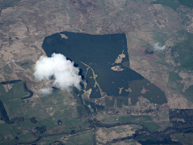
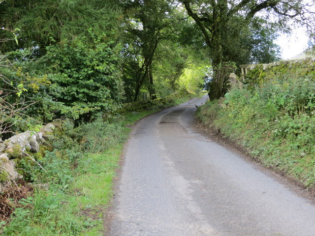
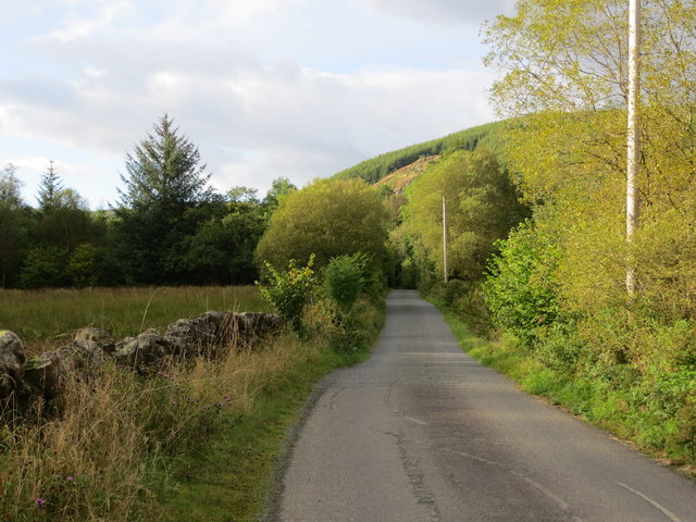
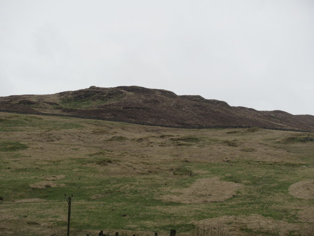
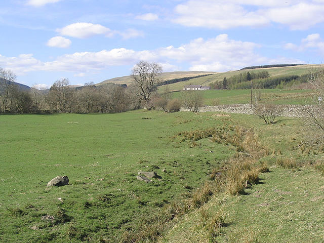
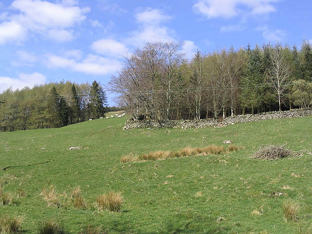
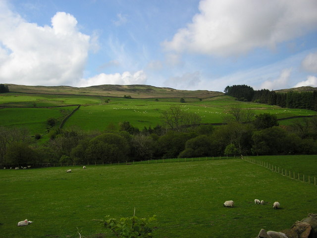
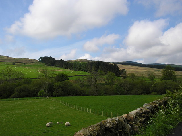
Percy's Wood is a picturesque forest located in Dumfriesshire, Scotland. Covering a vast area of approximately 500 acres, it offers a peaceful retreat for nature lovers and outdoor enthusiasts. The wood is named after the Percy family, who owned the land in the 19th century.

The woodland is primarily made up of native tree species, including oak, beech, and birch, creating a diverse and vibrant ecosystem. Walking through Percy's Wood, visitors are greeted with an enchanting display of flora and fauna. The forest floor is adorned with a carpet of wildflowers, while birdsong fills the air, providing a serene ambiance.

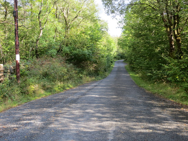
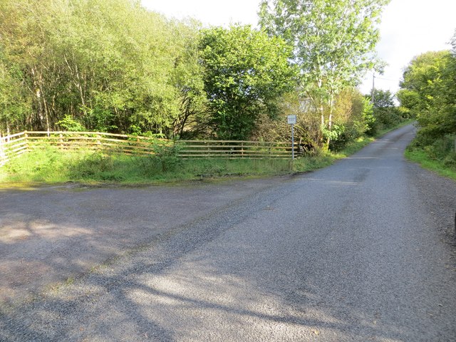
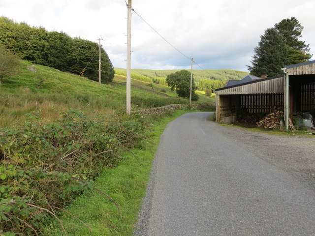
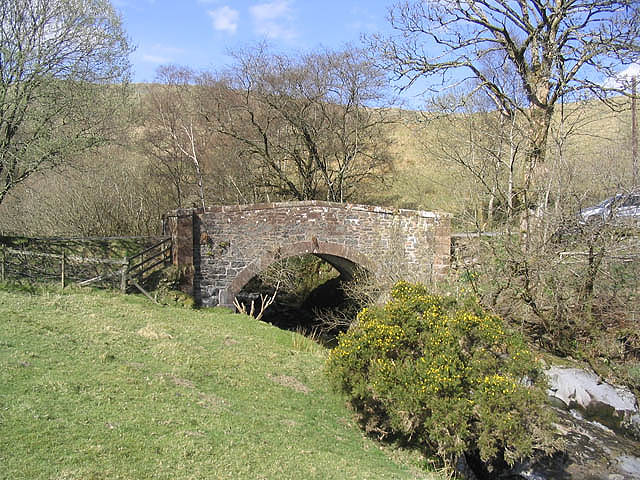
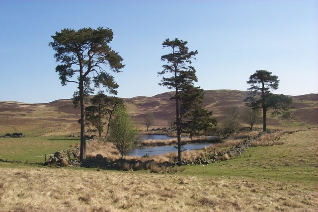
The wood is crisscrossed with a network of well-maintained trails, allowing visitors to explore its beauty at their own pace. These paths wind through the dense foliage, leading to hidden glens, tranquil ponds, and breathtaking viewpoints. The diversity of the landscape ensures there is always something new to discover, whether it be a babbling brook, a towering ancient tree, or a hidden wildlife spotting.

Percy's Wood is not only a haven for nature enthusiasts but also a popular spot for recreational activities such as hiking, birdwatching, and photography. It offers a peaceful escape from the hustle and bustle of daily life, allowing visitors to immerse themselves in the beauty of the natural world.

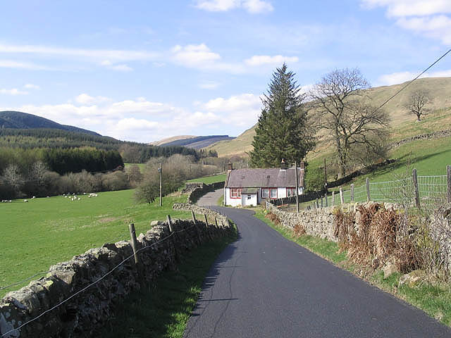
Managed by a local conservation organization, Percy's Wood aims to preserve its natural heritage and promote environmental education. The wood is open to the public year-round, with visitor facilities including car parking, picnic areas, and information boards highlighting the local flora and fauna.

Overall, Percy's Wood in Dumfriesshire is a captivating destination for those seeking tranquility, natural beauty, and a chance to reconnect with the wonders of the Scottish countryside.

If you have any feedback on the listing, please let us know in the comments section below.

Percy's Wood Images

Images are sourced within 2km of 55.248103/-3.9401057 or Grid Reference NX7696. Thanks to Geograph Open Source API. All images are credited.

Craigencoon from the air Shinnel Water runs across the foreground.
Craigencoon from the air
Shinnel Water runs across the foreground.
Road down Shinnel Glen at The Snab Looking south-eastward.
Road down Shinnel Glen at The Snab
Looking south-eastward.
Road down Shinnel Glen at the entrance to a track to Pinzarie Hill Looking south-eastward.
Road down Shinnel Glen at the entrance to a track to Pinzarie Hill
Looking south-eastward.
Road down Shinnel Glen at the entrance at Auchenbrack Looking south-eastward.
Road down Shinnel Glen at the entrance at Auchenbrack
Looking south-eastward.
Track through forestry to Appin Looking south-westward.
Track through forestry to Appin
Looking south-westward.
Road up Shinnel Glen between Auchenbrack and Old Auchenbrack Looking north-westward,
Road up Shinnel Glen between Auchenbrack and Old Auchenbrack
Looking north-westward,
Road heading up Shinnel Glen near to Pinzarie Looking north-westward.
Road heading up Shinnel Glen near to Pinzarie
Looking north-westward.
Stonefauld Knowes above Appin near Moniaive
Grazing field Wedged between a minor road and the Shinnel Water with the building at Craigencoon in the background.
Grazing field
Wedged between a minor road and the Shinnel Water with the building at Craigencoon in the background.
Pasture field and trees At Auchenbrack Farm.
Pasture field and trees
At Auchenbrack Farm.
Bridge over the Shinnel Water To the east of Appin Lodge.
Bridge over the Shinnel Water
To the east of Appin Lodge.
The road to Appin Lodge A country road running from Tynron to Appin Lodge and Appin Forest.
The road goes past Appin Lodge, and although the metalled surface ends at Appin Forest, it continues to Shinnelhead. The cottage in this picture is Old Auchenbrack.
The road to Appin Lodge
A country road running from Tynron to Appin Lodge and Appin Forest. The road goes past Appin Lodge, and although the metalled surface ends at Appin Forest, it continues to Shinnelhead. The cottage in this picture is Old Auchenbrack.
March Burn, Shinnel Glen The house in the distance is Appin Lodge.
March Burn, Shinnel Glen
The house in the distance is Appin Lodge.
Pool near Connel's Well This pool (or is it a lochan in these parts?) dries up in summer. Beyond is an un-named hill with a trig point.
Pool near Connel's Well
This pool (or is it a lochan in these parts?) dries up in summer. Beyond is an un-named hill with a trig point.
The valley of Shinnel Water south of Old Auchenbrack The trees in the foreground are along the banks of Shinnel Water. Far right (above the trees) is Stonefauld Knowes.
The valley of Shinnel Water south of Old Auchenbrack
The trees in the foreground are along the banks of Shinnel Water. Far right (above the trees) is Stonefauld Knowes.
Maqueston Wood Maqueston Wood is the long strip of woodland running up the hill. Behind it can be seen Stonefauld Knowes and Appin Forest; in front, trees along the Shinnel Water.
Maqueston Wood
Maqueston Wood is the long strip of woodland running up the hill. Behind it can be seen Stonefauld Knowes and Appin Forest; in front, trees along the Shinnel Water.
Shinnel Water View down the glen of the Shinnel Water.
Shinnel Water
View down the glen of the Shinnel Water.
Shinnel Glen in winter mist Auchenbrack is in the centre clump of trees. Taken from Appin.
Shinnel Glen in winter mist
Auchenbrack is in the centre clump of trees. Taken from Appin.
Show me another place!

Percy's Wood is located at Grid Ref: NX7696 (Lat: 55.248103, Lng: -3.9401057)

Unitary Authority: Dumfries and Galloway

Police Authority: Dumfries and Galloway

What 3 Words

///roadmap.elects.pigtails. Near Thornhill, Dumfries & Galloway

Related Wikis

Tynron

Tynron is a village and civil parish in Dumfries and Galloway, south-west Scotland, lying in a hollow of the Shinnel Water, 2 miles (3.2 km) from Moniaive...

Moniaive

Moniaive ( 'monny-IVE'; Scottish Gaelic: Am Moine Naomh, "The Holy Moor") is a village in the Parish of Glencairn, in Dumfries and Galloway, southwest...

Tynron Doon

Tynron Doon is a multivallate Iron Age hill fort outside the village of Tynron in Dumfries and Galloway, Scotland. It was occupied on and off from the...

Grennan Hill

Grennan Hill is the site of an Iron Age hill fort outside Penpont in Dumfries and Galloway, Scotland. == References == Schedule "Grennan Hill, NMRS Number...

Moniaive railway station

Moniaive railway station is the closed station terminus of the Cairn Valley Light Railway (CVR) branch, from Dumfries. It served the rural area of Moniaive...

Carsphairn and Scaur Hills

The Carsphairn and Scaur Hills are the western and eastern hills respectively of a hill range in the Southern Uplands of Scotland. Ordnance Survey maps...

Craigdarroch

"Craigdarroch, An Accessory to Murder" is an expansion set for the board game Kill Doctor Lucky Craigdarroch is a house near Moniaive, Dumfries and Galloway...

Crawfordton House

Crawfordton House is a category B listed 19th-century country house, situated close to Moniaive in Dumfriesshire, Scotland. It was operated as Crawfordton...

Nearby Amenities

Located within 500m of 55.248103,-3.9401057
Power: pole
Lat/Long: 55.2455006/-3.9352094
Power: pole
Lat/Long: 55.2460085/-3.9362214
Power: pole
Lat/Long: 55.2465019/-3.9372715
Power: pole
Lat/Long: 55.2468163/-3.9383767
Power: pole
Lat/Long: 55.2471392/-3.9394735
Power: pole
Lat/Long: 55.2474452/-3.9405788
Power: pole
Lat/Long: 55.2477656/-3.9417011
The data included in this document is from www.openstreetmap.org. The data is made available under ODbL.

Have you been to Percy's Wood?

Leave your review of Percy's Wood below (or comments, questions and feedback).