Africa Wood

Wood, Forest in Dumfriesshire

Scotland

Africa Wood

Craigencoon from the air Shinnel Water runs across the foreground.
Craigencoon from the air Credit: Thomas Nugent

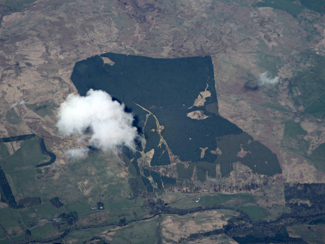
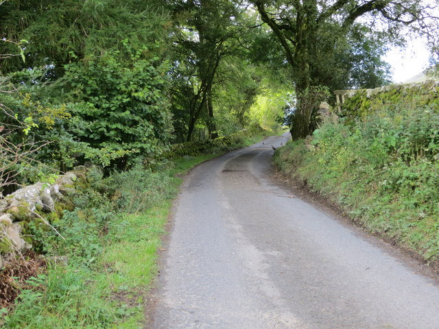
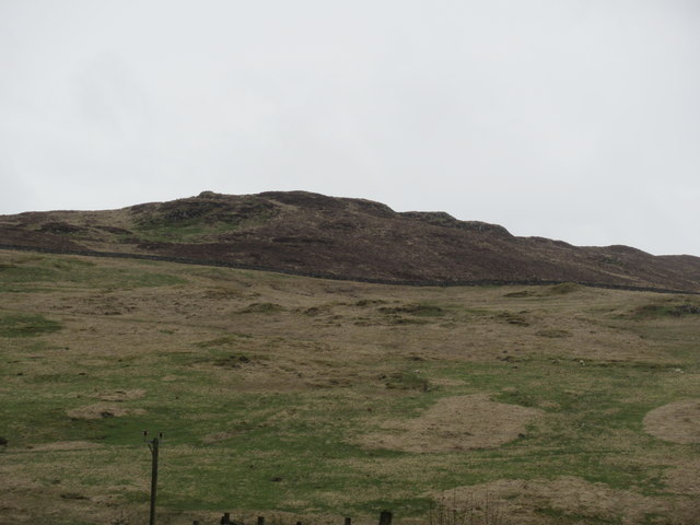
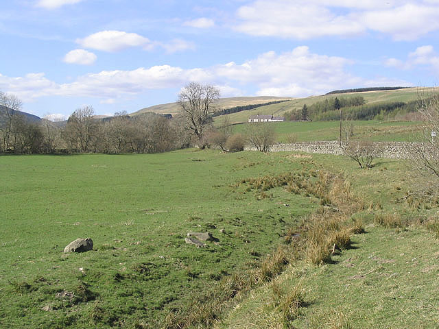
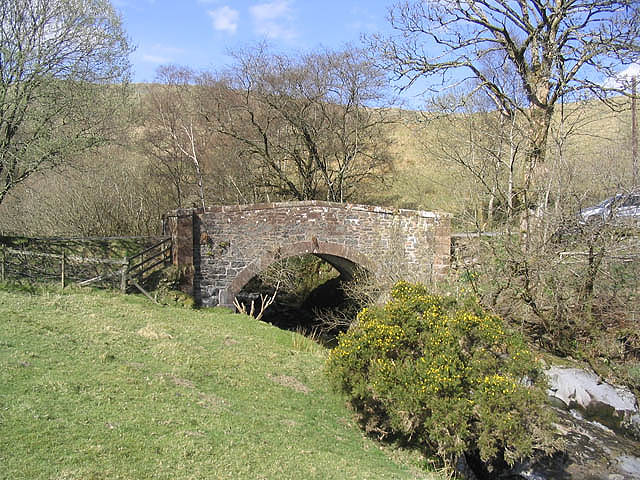
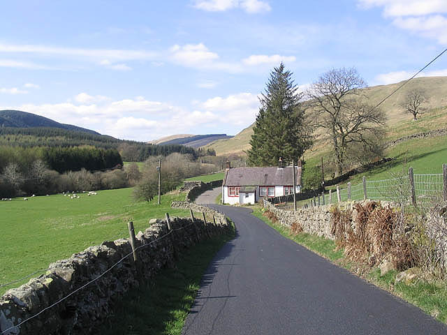
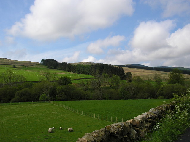
Africa Wood is a dense forest located in Dumfriesshire, Scotland. It is situated in the southern part of the country, approximately 4 miles southeast of the town of Thornhill. Covering an area of approximately 500 acres, Africa Wood is a significant natural landmark in the region.

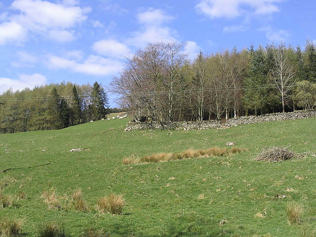
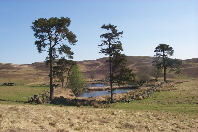
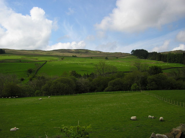
The forest is predominantly composed of a variety of broadleaf and coniferous trees, including oak, birch, beech, and pine. These trees create a lush and verdant environment, providing a habitat for various wildlife species. Visitors to Africa Wood can expect to encounter a diverse range of birds, mammals, and insects, making it an ideal destination for nature enthusiasts and birdwatchers.

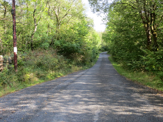
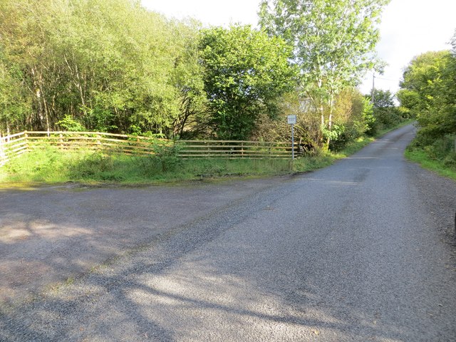
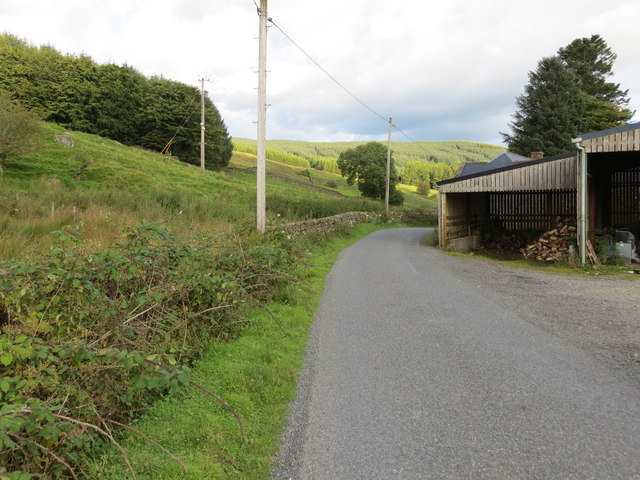
The forest offers a network of well-maintained walking trails, allowing visitors to explore its natural beauty. These trails vary in difficulty, catering to all levels of fitness and interest. Along the way, visitors can enjoy scenic views of the surrounding countryside and may even stumble upon hidden streams or picturesque clearings.

Africa Wood is managed by the local council and is open to the public throughout the year. It offers ample parking facilities and picnic areas, making it an excellent spot for a family day out or a peaceful retreat in nature. The forest is also well-known for its autumn foliage, attracting photographers and nature lovers from near and far to witness the vibrant colors of the changing seasons.

Overall, Africa Wood in Dumfriesshire is a serene and enchanting forest that showcases the natural beauty of Scotland's countryside.

If you have any feedback on the listing, please let us know in the comments section below.

Africa Wood Images

Images are sourced within 2km of 55.249387/-3.9424181 or Grid Reference NX7696. Thanks to Geograph Open Source API. All images are credited.

Craigencoon from the air Shinnel Water runs across the foreground.
Craigencoon from the air
Shinnel Water runs across the foreground.
Road down Shinnel Glen at The Snab Looking south-eastward.
Road down Shinnel Glen at The Snab
Looking south-eastward.
Road down Shinnel Glen at the entrance to a track to Pinzarie Hill Looking south-eastward.
Road down Shinnel Glen at the entrance to a track to Pinzarie Hill
Looking south-eastward.
Road down Shinnel Glen at the entrance at Auchenbrack Looking south-eastward.
Road down Shinnel Glen at the entrance at Auchenbrack
Looking south-eastward.
Track through forestry to Appin Looking south-westward.
Track through forestry to Appin
Looking south-westward.
Road up Shinnel Glen between Auchenbrack and Old Auchenbrack Looking north-westward,
Road up Shinnel Glen between Auchenbrack and Old Auchenbrack
Looking north-westward,
Stonefauld Knowes above Appin near Moniaive
Grazing field Wedged between a minor road and the Shinnel Water with the building at Craigencoon in the background.
Grazing field
Wedged between a minor road and the Shinnel Water with the building at Craigencoon in the background.
Pasture field and trees At Auchenbrack Farm.
Pasture field and trees
At Auchenbrack Farm.
Bridge over the Shinnel Water To the east of Appin Lodge.
Bridge over the Shinnel Water
To the east of Appin Lodge.
The road to Appin Lodge A country road running from Tynron to Appin Lodge and Appin Forest.
The road goes past Appin Lodge, and although the metalled surface ends at Appin Forest, it continues to Shinnelhead. The cottage in this picture is Old Auchenbrack.
The road to Appin Lodge
A country road running from Tynron to Appin Lodge and Appin Forest. The road goes past Appin Lodge, and although the metalled surface ends at Appin Forest, it continues to Shinnelhead. The cottage in this picture is Old Auchenbrack.
March Burn, Shinnel Glen The house in the distance is Appin Lodge.
March Burn, Shinnel Glen
The house in the distance is Appin Lodge.
Pool near Connel's Well This pool (or is it a lochan in these parts?) dries up in summer. Beyond is an un-named hill with a trig point.
Pool near Connel's Well
This pool (or is it a lochan in these parts?) dries up in summer. Beyond is an un-named hill with a trig point.
The valley of Shinnel Water south of Old Auchenbrack The trees in the foreground are along the banks of Shinnel Water. Far right (above the trees) is Stonefauld Knowes.
The valley of Shinnel Water south of Old Auchenbrack
The trees in the foreground are along the banks of Shinnel Water. Far right (above the trees) is Stonefauld Knowes.
Maqueston Wood Maqueston Wood is the long strip of woodland running up the hill. Behind it can be seen Stonefauld Knowes and Appin Forest; in front, trees along the Shinnel Water.
Maqueston Wood
Maqueston Wood is the long strip of woodland running up the hill. Behind it can be seen Stonefauld Knowes and Appin Forest; in front, trees along the Shinnel Water.
Shinnel Water View down the glen of the Shinnel Water.
Shinnel Water
View down the glen of the Shinnel Water.
Shinnel Glen in winter mist Auchenbrack is in the centre clump of trees. Taken from Appin.
Shinnel Glen in winter mist
Auchenbrack is in the centre clump of trees. Taken from Appin.
Shinnel Glen The farm bottom left is Craigencoon. Shinnel Water is shining through the trees. The white buildings up the glen are Kilnmark.
Shinnel Glen
The farm bottom left is Craigencoon. Shinnel Water is shining through the trees. The white buildings up the glen are Kilnmark.
Show me another place!

Africa Wood is located at Grid Ref: NX7696 (Lat: 55.249387, Lng: -3.9424181)

Unitary Authority: Dumfries and Galloway

Police Authority: Dumfries and Galloway

What 3 Words

///tabs.introduce.meant. Near Thornhill, Dumfries & Galloway

Related Wikis

Tynron

Tynron is a village and civil parish in Dumfries and Galloway, south-west Scotland, lying in a hollow of the Shinnel Water, 2 miles (3.2 km) from Moniaive...

Carsphairn and Scaur Hills

The Carsphairn and Scaur Hills are the western and eastern hills respectively of a hill range in the Southern Uplands of Scotland. Ordnance Survey maps...

Moniaive

Moniaive ( 'monny-IVE'; Scottish Gaelic: Am Moine Naomh, "The Holy Moor") is a village in the Parish of Glencairn, in Dumfries and Galloway, southwest...

Tynron Doon

Tynron Doon is a multivallate Iron Age hill fort outside the village of Tynron in Dumfries and Galloway, Scotland. It was occupied on and off from the...

Grennan Hill

Grennan Hill is the site of an Iron Age hill fort outside Penpont in Dumfries and Galloway, Scotland. == References == Schedule "Grennan Hill, NMRS Number...

Moniaive railway station

Moniaive railway station is the closed station terminus of the Cairn Valley Light Railway (CVR) branch, from Dumfries. It served the rural area of Moniaive...

Craigdarroch

"Craigdarroch, An Accessory to Murder" is an expansion set for the board game Kill Doctor Lucky Craigdarroch is a house near Moniaive, Dumfries and Galloway...

Crawfordton House

Crawfordton House is a category B listed 19th-century country house, situated close to Moniaive in Dumfriesshire, Scotland. It was operated as Crawfordton...

Nearby Amenities

Located within 500m of 55.249387,-3.9424181
Power: pole
Lat/Long: 55.2465019/-3.9372715
Power: pole
Lat/Long: 55.2468163/-3.9383767
Power: pole
Lat/Long: 55.2471392/-3.9394735
Power: pole
Lat/Long: 55.2474452/-3.9405788
Power: pole
Lat/Long: 55.2477656/-3.9417011
The data included in this document is from www.openstreetmap.org. The data is made available under ODbL.

Have you been to Africa Wood?

Leave your review of Africa Wood below (or comments, questions and feedback).