Avenue Strip

Wood, Forest in Stirlingshire
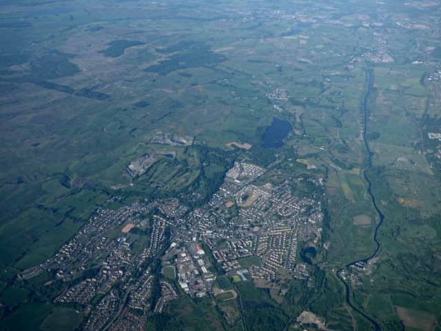
Scotland

Avenue Strip

Tak Ma Doon Road descending towards Kilsyth Looking south-eastward.
Tak Ma Doon Road descending towards Kilsyth Credit: Peter Wood

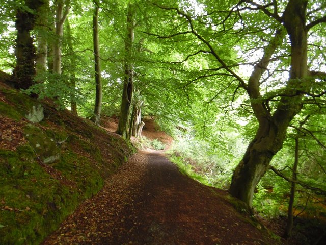
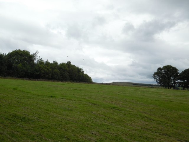
Avenue Strip in Stirlingshire, Scotland, is a charming woodland area located within the larger region of Wood, Forest. This picturesque spot offers visitors a tranquil retreat amidst nature's beauty. With its dense canopy of trees, Avenue Strip provides an enchanting setting for outdoor enthusiasts and nature lovers alike.

The woodland is home to a diverse array of flora and fauna, with a rich ecosystem that supports a variety of plant and animal species. Visitors can expect to see towering oak, beech, and pine trees, creating a lush and vibrant environment. The forest floor is adorned with a carpet of moss, ferns, and wildflowers, adding to the area's natural charm.

Avenue Strip offers a network of well-maintained trails, perfect for leisurely walks, jogging, or cycling. These pathways wind through the woodland, allowing visitors to explore its hidden corners and discover its hidden gems. Along the way, benches and picnic spots are strategically placed, providing opportunities for rest and relaxation amidst the peaceful surroundings.

The woodland is also home to a plethora of wildlife, including deer, foxes, squirrels, and a variety of bird species. Nature enthusiasts can enjoy birdwatching or keep an eye out for other animals that call Avenue Strip their home.

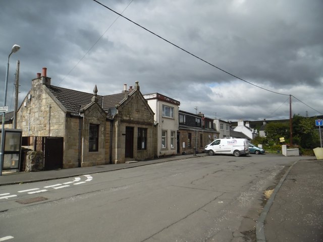
Avenue Strip is easily accessible, with parking facilities available nearby. It is a popular destination for families, couples, and individuals seeking a break from the hustle and bustle of everyday life. Whether it's for a peaceful stroll, a picnic with loved ones, or an opportunity to connect with nature, Avenue Strip in Stirlingshire provides a serene and rejuvenating experience for all who visit.

If you have any feedback on the listing, please let us know in the comments section below.

Avenue Strip Images

Images are sourced within 2km of 55.983987/-4.0363898 or Grid Reference NS7378. Thanks to Geograph Open Source API. All images are credited.

Tak Ma Doon Road descending towards Kilsyth Looking south-eastward.
Tak Ma Doon Road descending towards Kilsyth
Looking south-eastward.
Ford on unnamed burn near Drumnessie A small burn draining into the Banton Burn from the hillside in the vicinity of Katie Fristy Well which, according to the mid nineteenth-century OS name book, is 'a strong spring of pure water issuing from a rock near the ruin of Bardowie. The name is well known to all and is supposed to be derived from the name of a person who, at a very remote period, kept the Public House there.'
Ford on unnamed burn near Drumnessie
A small burn draining into the Banton Burn from the hillside in the vicinity of Katie Fristy Well which, according to the mid nineteenth-century OS name book, is 'a strong spring of pure water issuing from a rock near the ruin of Bardowie. The name is well known to all and is supposed to be derived from the name of a person who, at a very remote period, kept the Public House there.'
Ruined farm buildings at Drumnessie The old hill farm of Drumnessie, just east of the Tak-ma-doon Road in the Kilsyth Hills.
Ruined farm buildings at Drumnessie
The old hill farm of Drumnessie, just east of the Tak-ma-doon Road in the Kilsyth Hills.
Tak-Ma-Doon Road Looking down the hill.
Tak-Ma-Doon Road
Looking down the hill.
View from Tak-Ma-Doon Road Looking west towards a young conifer plantation.
View from Tak-Ma-Doon Road
Looking west towards a young conifer plantation.
Tak-ma-doon Road Plunging steeply towards Kilsyth.
Tak-ma-doon Road
Plunging steeply towards Kilsyth.
Crags, Banton Burn Out of sight, there is a waterfall here as the Banton Burn crosses one of the steep bits of the Kilsyth Traps.
Crags, Banton Burn
Out of sight, there is a waterfall here as the Banton Burn crosses one of the steep bits of the Kilsyth Traps.
Banton Burn A burn running off the rather wet Kilsyth Hills.
Banton Burn
A burn running off the rather wet Kilsyth Hills.
Burn running parallel to Tak-ma-doon Road In the Kilsyth Hills.
Burn running parallel to Tak-ma-doon Road
In the Kilsyth Hills.
Small bridge, Tak Ma Doon Road
Kilsyth from the air With the Forth & Clyde Canal running the length of the photo on the right.
Kilsyth from the air
With the Forth & Clyde Canal running the length of the photo on the right.
Banton, North Lanarkshire A few houses in the village just north of the crossroads.
Banton, North Lanarkshire
A few houses in the village just north of the crossroads.
Banton-Kilsyth path passes through woods Near to Banton Loch.
Banton-Kilsyth path passes through woods
Near to Banton Loch.
Banton Loch from the west
Fields east of Riskend Quarry
Banton Loch from the air Formerly known as Townhead reservoir. Built in 1772 to provide water to the nearby Forth & Clyde Canal . Speirs Island can be seen within the loch.

On the site of the Battle of Kilsyth (1645).
Banton Loch from the air
Formerly known as Townhead reservoir. Built in 1772 to provide water to the nearby Forth & Clyde Canal . Speirs Island can be seen within the loch. On the site of the Battle of Kilsyth (1645).
Kilsyth from the air Kilsyth Lennox Golf Club and the Beltmoss quarries can also be seen.
Kilsyth from the air
Kilsyth Lennox Golf Club and the Beltmoss quarries can also be seen.
Beltmoss quarries from the air Kilsyth Lennox Golf Club is in the foreground.
Beltmoss quarries from the air
Kilsyth Lennox Golf Club is in the foreground.
Show me another place!

Avenue Strip is located at Grid Ref: NS7378 (Lat: 55.983987, Lng: -4.0363898)

Unitary Authority: North Lanarkshire

Police Authority: Lanarkshire

What 3 Words

///chain.enacted.shepherds. Near Kilsyth, North Lanarkshire

Related Wikis

Colzium

Colzium House and Estate (pronounced Coal-Zee-Um) is about 500 metres to the north-east of Kilsyth, North Lanarkshire, Scotland. The present house dates...

Colzium railway station

Colzium railway station served the area of Colzium, North Lanarkshire, Scotland from 1888 to 1917 on the Kilsyth and Bonnybridge Railway. == History... ==
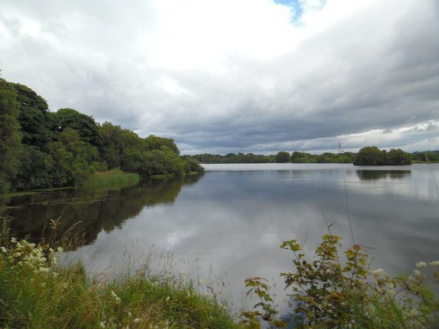
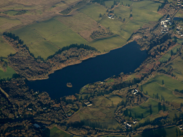
Banton Loch

Banton Loch, also known as Kilsyth Loch, Townhead Reservoir and once nicknamed Bakers' Loch, is an artificial freshwater lake located to the east of Kilsyth...

Battle of Kilsyth

The Battle of Kilsyth, fought on 15 August 1645 near Kilsyth, was an engagement of the Wars of the Three Kingdoms. The largest battle of the conflict in...

Nearby Amenities

Located within 500m of 55.983987,-4.0363898
Toilets
Opening Hours: Apr-Sep
Lat/Long: 55.981418/-4.0358517
Parking
Access: customers
Fee: no
Parking: surface
Wheelchair: yes
Lat/Long: 55.9834467/-4.0340922
Barrier: lift_gate
Bicycle: yes
Foot: yes
Lat/Long: 55.9818011/-4.0306175
Parking
Fee: no
Lit: no
Source: local_knowledge
Wheelchair: yes
Lat/Long: 55.9821659/-4.0362846
Locality: Colzium Glen
Source: OS7; survey
Lat/Long: 55.9850793/-4.0379332
Colzium Castle(ruin)
Historic: castle
Source: survey
Wheelchair: yes
Lat/Long: 55.9849839/-4.0389537
Theatre
Wheelchair: limited
Lat/Long: 55.9844791/-4.0387828
Old Coal Pit
Historic: mine
Lat/Long: 55.9843075/-4.0290861
7
Golf: pin
Lat/Long: 55.9869788/-4.0419375
12
Golf: pin
Lat/Long: 55.9858571/-4.0413503
Power: pole
Lat/Long: 55.9833704/-4.0429423
Power: pole
Lat/Long: 55.9830931/-4.0442401
Power: pole
Lat/Long: 55.9827073/-4.0436318
Power: pole
Lat/Long: 55.9823041/-4.0429818
The data included in this document is from www.openstreetmap.org. The data is made available under ODbL.

Have you been to Avenue Strip?

Leave your review of Avenue Strip below (or comments, questions and feedback).