Cumstoun Wood

Wood, Forest in Kirkcudbrightshire

Scotland

Cumstoun Wood

Garden of Broughton House, Kirkcudbright, home of artist E A Hornel E A Hornel was a well known artist in Scotland from the 1880s to 1930. He visited Japan in 1893 and this influenced his garden design. He was born in Australia in 1864, but his family returned to their home area in Kirkcudbright soon after. National Trust for Scotland own the house.
Garden of Broughton House, Kirkcudbright, home of artist E A Hornel Credit: David Hawgood

Cumstoun Wood is a picturesque woodland located in the region of Kirkcudbrightshire, Scotland. Covering an area of approximately 50 hectares, it is a well-preserved natural habitat that offers visitors a serene and tranquil escape from the hustle and bustle of everyday life.

The wood is predominantly composed of native broadleaf trees, including oak, ash, and beech. These towering trees create a dense canopy that provides shade and shelter for a diverse range of flora and fauna. Bluebells, primroses, and wild garlic carpet the forest floor in the spring, creating a stunning display of vibrant colors and sweet scents.

Walking trails wind through Cumstoun Wood, allowing visitors to explore its beauty at their own pace. The paths meander through ancient woodland, crossing babbling brooks and passing by enchanting glades. Wildlife enthusiasts will be delighted to spot various species of birds, such as woodpeckers and owls, as well as small mammals like red squirrels and badgers.

The wood also has a rich history, with remnants of an old mill and kiln still visible. These historic features provide a glimpse into the area's past and add a touch of intrigue to any visit.

Cumstoun Wood is a popular destination for nature lovers, families, and those seeking a peaceful retreat. With its stunning scenery, diverse wildlife, and historical significance, it offers a truly immersive and memorable experience for all who venture into its enchanting embrace.

If you have any feedback on the listing, please let us know in the comments section below.

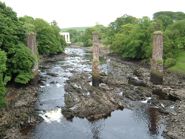
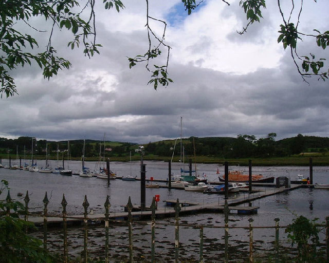
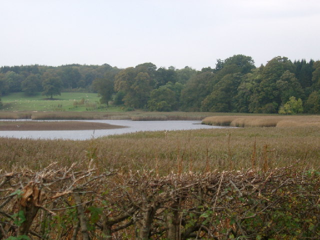
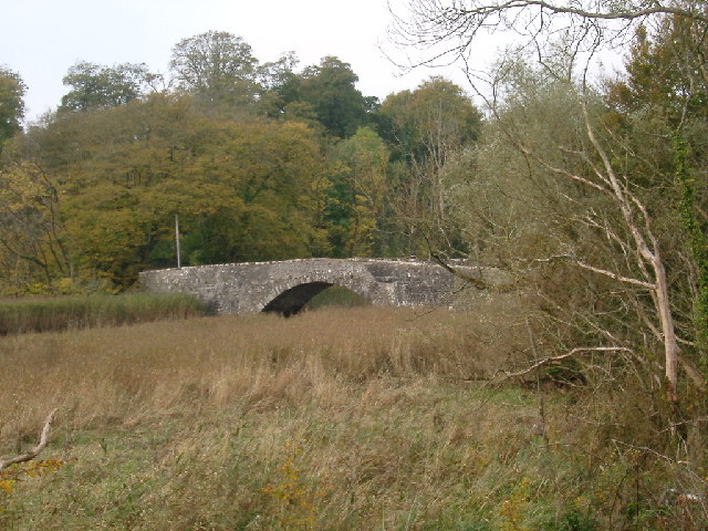
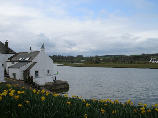
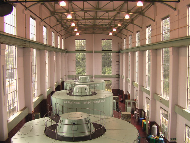
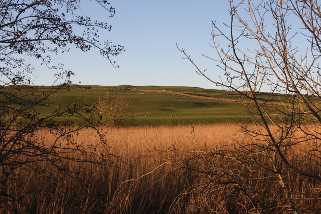
Cumstoun Wood Images

Images are sourced within 2km of 54.854375/-4.0546666 or Grid Reference NX6852. Thanks to Geograph Open Source API. All images are credited.

Garden of Broughton House, Kirkcudbright, home of artist E A Hornel E A Hornel was a well known artist in Scotland from the 1880s to 1930. He visited Japan in 1893 and this influenced his garden design. He was born in Australia in 1864, but his family returned to their home area in Kirkcudbright soon after. National Trust for Scotland own the house.
Garden of Broughton House, Kirkcudbright, home of artist E A Hornel
E A Hornel was a well known artist in Scotland from the 1880s to 1930. He visited Japan in 1893 and this influenced his garden design. He was born in Australia in 1864, but his family returned to their home area in Kirkcudbright soon after. National Trust for Scotland own the house.
Tongland Bridge View through the remains of a railway bridge to the hydroelectric power station
Tongland Bridge
View through the remains of a railway bridge to the hydroelectric power station
The River at Kirkcudbright At low tide here the river recedes to leave extensive  banks of somewhat unpleasant grey mud
The River at Kirkcudbright
At low tide here the river recedes to leave extensive banks of somewhat unpleasant grey mud
Kirkcudbright Harbour
Shelter from the storm Yachts at Kirkcudbright marina after a storm warning. The marina isn't usually as crowded as this!
Shelter from the storm
Yachts at Kirkcudbright marina after a storm warning. The marina isn't usually as crowded as this!
Tarff Water near Tongland Reedbeds near Tarff Water's junction with River Dee at Puldroit
Tarff Water near Tongland
Reedbeds near Tarff Water's junction with River Dee at Puldroit
Low Bridge of Tarff nr Tongland Crossing the Tarff Water not far upstream from its confluence with the River Dee upstream from Kirkcudbright
Low Bridge of Tarff nr Tongland
Crossing the Tarff Water not far upstream from its confluence with the River Dee upstream from Kirkcudbright
McLellan's Castle, Kirkcudbright. A red sandstone ruined castle, dating from 1582, and right in the middle of this former county town.
McLellan's Castle, Kirkcudbright.
A red sandstone ruined castle, dating from 1582, and right in the middle of this former county town.
Kirkcudbright harbour at high tide At high tide navigation into Kirkcudbright is relatively easy as this springtime shot suggests.
Kirkcudbright harbour at high tide
At high tide navigation into Kirkcudbright is relatively easy as this springtime shot suggests.
Boat on the River Dee at Kircudbright I was stood near the bridge the far side from the town.
Boat on the River Dee at Kircudbright
I was stood near the bridge the far side from the town.
Kirkcudbright Bridge
Turbine hall - Tongland HEP station
Tongland Power Station The last and largest of the Galloway hydro stations, Tongland is home to the Visitors Centre open April to October.  With three machines, Tongland is the most powerful of the scheme's six stations.
Tongland Power Station
The last and largest of the Galloway hydro stations, Tongland is home to the Visitors Centre open April to October. With three machines, Tongland is the most powerful of the scheme's six stations.
Tongland Power Station Surge Tank and Main Inlet Valve House.
Tongland Power Station
Surge Tank and Main Inlet Valve House.
Castle and church Kirkcudbright
River Dee Kirkcudbright
River Dee
Kirkcudbright
Bend in the River Dee Looking north, past west bank promontory towards Cumstoun and Tongland. Photographer on riverbank just south of map square.
Bend in the River Dee
Looking north, past west bank promontory towards Cumstoun and Tongland. Photographer on riverbank just south of map square.
Reeds and Pasture at  Ingleston Farm Looking NW from the road between Twynholm and the Cleugh, about 300 yards SSW of Ingleston.
Reeds and Pasture at Ingleston Farm
Looking NW from the road between Twynholm and the Cleugh, about 300 yards SSW of Ingleston.
Show me another place!

Cumstoun Wood is located at Grid Ref: NX6852 (Lat: 54.854375, Lng: -4.0546666)

Unitary Authority: Dumfries and Galloway

Police Authority: Dumfries and Galloway

What 3 Words

///strongman.trash.digestion. Near Kirkcudbright, Dumfries & Galloway

Related Wikis

Kirkcudbright Railway

The Kirkcudbright Railway was a railway branch line linking Kirkcudbright to the Castle Douglas and Dumfries Railway at Castle Douglas. It opened in 1864...

Tongland

Tongland is a small village about 2 miles (3 km) north of Kirkcudbright, in the historic county of Kirkcudbrightshire in Dumfries and Galloway, Scotland...

Tongland Abbey

Tungland or Tongland Abbey was a Premonstratensian monastic community located in Tongland in the historical county of Kirkcudbrightshire in Dumfries and...

Kirkcudbright railway station

Kirkcudbright railway station served the town of Kirkcudbright, Dumfries and Galloway, Scotland from 1864 to 1965 on the Kirkcudbright Railway. == History... ==

Nearby Amenities

Located within 500m of 54.854375,-4.0546666
Source: PGS
Lat/Long: 54.8505449/-4.0507728
Source: PGS
Lat/Long: 54.8510977/-4.0507406
Source: PGS
Lat/Long: 54.8515832/-4.0506494
Source: PGS
Lat/Long: 54.852212/-4.0509026
Source: PGS
Lat/Long: 54.8525894/-4.0509692
Source: PGS
Lat/Long: 54.8534849/-4.0513264
Source: PGS
Lat/Long: 54.8542149/-4.0511532
Source: PGS
Lat/Long: 54.8545028/-4.0514519
Source: PGS
Lat/Long: 54.8550562/-4.0513844
Source: PGS
Lat/Long: 54.8554718/-4.0512706
Source: PGS
Lat/Long: 54.8557719/-4.0511526
Source: PGS
Lat/Long: 54.8563421/-4.0511466
Source: PGS
Lat/Long: 54.8570394/-4.0507635
Source: PGS
Lat/Long: 54.8574694/-4.0506103
Source: PGS
Lat/Long: 54.8578545/-4.0503561
Source: PGS
Lat/Long: 54.8544095/-4.0470832
Source: PGS
Lat/Long: 54.8540989/-4.0481131
Source: PGS
Lat/Long: 54.8537666/-4.0486657
Source: PGS
Lat/Long: 54.8533243/-4.0489542
Source: PGS
Lat/Long: 54.8528154/-4.0489929
Source: PGS
Lat/Long: 54.8523954/-4.0490305
Source: PGS
Lat/Long: 54.8515401/-4.0488736
Power: pole
Lat/Long: 54.851544/-4.0507251
Power: pole
Lat/Long: 54.8534247/-4.0513071
Power: pole
Lat/Long: 54.8551941/-4.0514359
Power: pole
Lat/Long: 54.8565775/-4.0510791
Power: pole
Lat/Long: 54.8574638/-4.0509262
Cumstoun Castle
Historic: castle
Url: https://canmore.org.uk/site/64129/cumstoun-castle
Lat/Long: 54.8566497/-4.0543964
The data included in this document is from www.openstreetmap.org. The data is made available under ODbL.

Have you been to Cumstoun Wood?

Leave your review of Cumstoun Wood below (or comments, questions and feedback).