Merse Plantation

Wood, Forest in Kirkcudbrightshire

Scotland

Merse Plantation

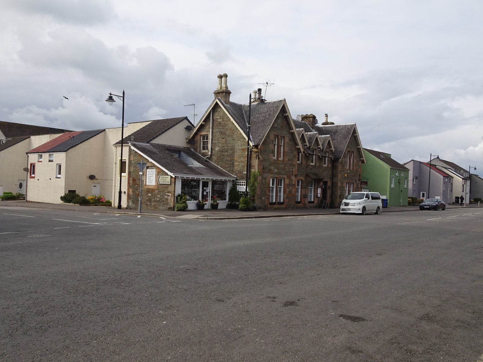
High Street, Kirkcudbright The High Street contains many 18th Century houses. It bends around the town centre from the castle, via the Tolbooth (now an Arts Centre) and church.
High Street, Kirkcudbright Credit: David Hawgood

The requested URL returned error: 429 Too Many Requests

If you have any feedback on the listing, please let us know in the comments section below.

Merse Plantation Images

Images are sourced within 2km of 54.846849/-4.0548292 or Grid Reference NX6852. Thanks to Geograph Open Source API. All images are credited.
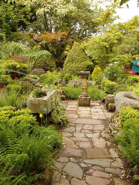
High Street, Kirkcudbright The High Street contains many 18th Century houses. It bends around the town centre from the castle, via the Tolbooth (now an Arts Centre) and church.
High Street, Kirkcudbright
The High Street contains many 18th Century houses. It bends around the town centre from the castle, via the Tolbooth (now an Arts Centre) and church.
Garden of Broughton House, Kirkcudbright, home of artist E A Hornel E A Hornel was a well known artist in Scotland from the 1880s to 1930. He visited Japan in 1893 and this influenced his garden design. He was born in Australia in 1864, but his family returned to their home area in Kirkcudbright soon after. National Trust for Scotland own the house.
Garden of Broughton House, Kirkcudbright, home of artist E A Hornel
E A Hornel was a well known artist in Scotland from the 1880s to 1930. He visited Japan in 1893 and this influenced his garden design. He was born in Australia in 1864, but his family returned to their home area in Kirkcudbright soon after. National Trust for Scotland own the house.
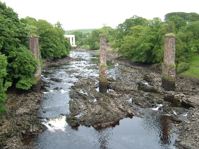
Tongland Bridge View through the remains of a railway bridge to the hydroelectric power station
Tongland Bridge
View through the remains of a railway bridge to the hydroelectric power station
The River at Kirkcudbright At low tide here the river recedes to leave extensive  banks of somewhat unpleasant grey mud
The River at Kirkcudbright
At low tide here the river recedes to leave extensive banks of somewhat unpleasant grey mud
Rooflines & facades: Kirkcudbright Taken from beside the former home of renowned artist Jessie M King.
Rooflines & facades: Kirkcudbright
Taken from beside the former home of renowned artist Jessie M King.
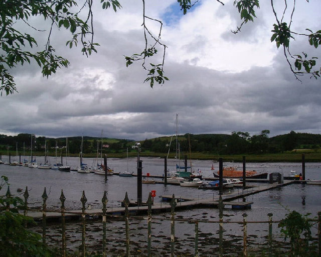
Kirkcudbright Harbour
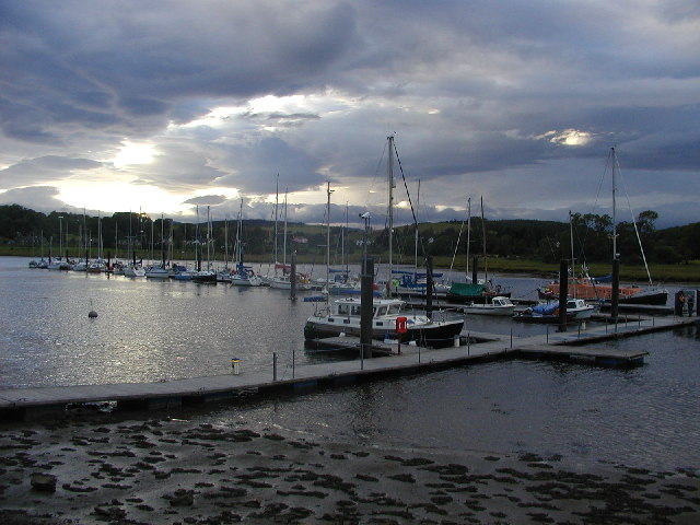
Shelter from the storm Yachts at Kirkcudbright marina after a storm warning. The marina isn't usually as crowded as this!
Shelter from the storm
Yachts at Kirkcudbright marina after a storm warning. The marina isn't usually as crowded as this!
Cemetery Gates and stones, Kirkcudbright
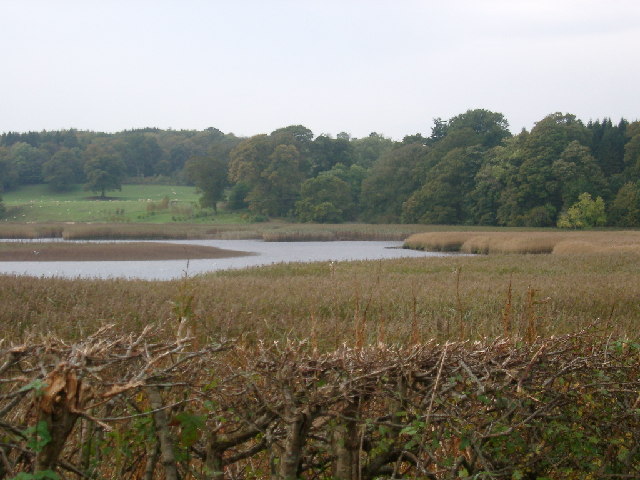
Tarff Water near Tongland Reedbeds near Tarff Water's junction with River Dee at Puldroit
Tarff Water near Tongland
Reedbeds near Tarff Water's junction with River Dee at Puldroit
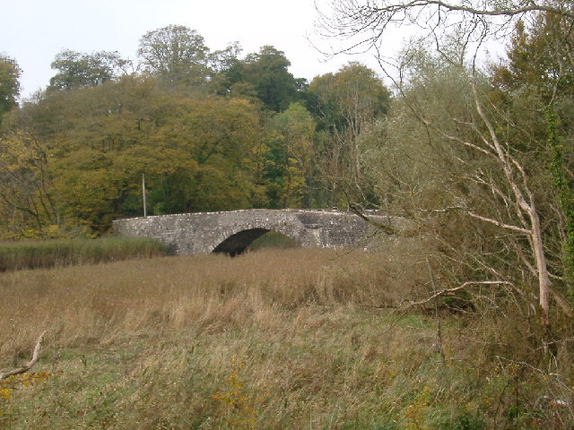
Low Bridge of Tarff nr Tongland Crossing the Tarff Water not far upstream from its confluence with the River Dee upstream from Kirkcudbright
Low Bridge of Tarff nr Tongland
Crossing the Tarff Water not far upstream from its confluence with the River Dee upstream from Kirkcudbright
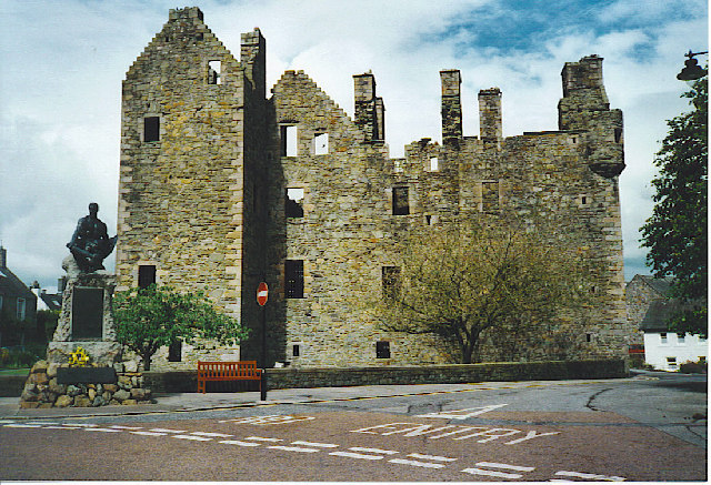
McLellan's Castle, Kirkcudbright. A red sandstone ruined castle, dating from 1582, and right in the middle of this former county town.
McLellan's Castle, Kirkcudbright.
A red sandstone ruined castle, dating from 1582, and right in the middle of this former county town.
St Cuthbert Street, Kirkcudbright. A wide street with many houses painted in pastel colours - a feature of Kirkcudbright. At the end of the street is the ruined McLellan's Castle.
St Cuthbert Street, Kirkcudbright.
A wide street with many houses painted in pastel colours - a feature of Kirkcudbright. At the end of the street is the ruined McLellan's Castle.
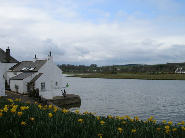
Kirkcudbright harbour at high tide At high tide navigation into Kirkcudbright is relatively easy as this springtime shot suggests.
Kirkcudbright harbour at high tide
At high tide navigation into Kirkcudbright is relatively easy as this springtime shot suggests.
Kirkcudbright High Street
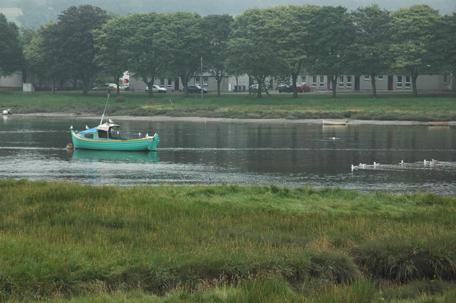
Boat on the River Dee at Kircudbright I was stood near the bridge the far side from the town.
Boat on the River Dee at Kircudbright
I was stood near the bridge the far side from the town.
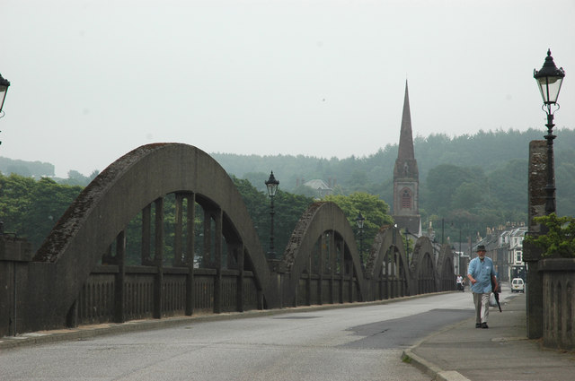
Kirkcudbright Bridge
Kirkcudbright Close This old close is off the High Street in Kirkcudbright, an attractive old town with a tradition of attracting artists.
Kirkcudbright Close
This old close is off the High Street in Kirkcudbright, an attractive old town with a tradition of attracting artists.
Kirkcudbright Police Station Kirkcudbright takes its reputation as "The Artists' Town" seriously - even the police station is festooned with flower baskets and tubs.  The castellated building in the background is the library.
Kirkcudbright Police Station
Kirkcudbright takes its reputation as "The Artists' Town" seriously - even the police station is festooned with flower baskets and tubs. The castellated building in the background is the library.
Show me another place!

Merse Plantation is located at Grid Ref: NX6852 (Lat: 54.846849, Lng: -4.0548292)

Unitary Authority: Dumfries and Galloway

Police Authority: Dumfries and Galloway

What 3 Words

///simulations.grass.entrust. Near Kirkcudbright, Dumfries & Galloway

Related Wikis

Kirkcudbright Railway

The Kirkcudbright Railway was a railway branch line linking Kirkcudbright to the Castle Douglas and Dumfries Railway at Castle Douglas. It opened in 1864...

Kirkcudbright railway station

Kirkcudbright railway station served the town of Kirkcudbright, Dumfries and Galloway, Scotland from 1864 to 1965 on the Kirkcudbright Railway. == History... ==

MacLellan's Castle

MacLellan's Castle in the town of Kirkcudbright, in Galloway, Scotland, was built in the late 16th century. It stands in the centre of Kirkcudbright...

Broughton House

Broughton House is an 18th-century town house standing on the High Street of Kirkcudbright, Scotland. It was the home of Scots impressionist artist E....

Nearby Amenities

Located within 500m of 54.846849,-4.0548292
Source: PGS
Lat/Long: 54.8475442/-4.0472635
Source: PGS
Lat/Long: 54.847475/-4.0475288
Source: PGS
Lat/Long: 54.8476656/-4.0475041
Source: PGS
Lat/Long: 54.8481394/-4.048597
Source: PGS
Lat/Long: 54.8487155/-4.0493736
Source: PGS
Lat/Long: 54.8490464/-4.0496866
Source: PGS
Lat/Long: 54.8493474/-4.0499213
Source: PGS
Lat/Long: 54.8494277/-4.0502722
Source: PGS
Lat/Long: 54.8492688/-4.0506945
Source: PGS
Lat/Long: 54.8497878/-4.0505919
Source: PGS
Lat/Long: 54.8505449/-4.0507728
Bus Stop
Merse Drive
Naptan AtcoCode: 680000373333
Naptan Bearing: NW
Naptan BusStopType: CUS
Naptan CommonName: Merse Drive
Naptan Indicator: Telephone Box
Naptan Landmark: Merse Road
Naptan NaptanCode: 34236767
Naptan Notes: none
Naptan Street: Merse Drive
Naptan Verified: no
Source: naptan_import
Lat/Long: 54.8428532/-4.0520523
Post Box
Ref: DG6 48
Lat/Long: 54.8424703/-4.0541474
Power: pole
Lat/Long: 54.8431252/-4.056288
Power: pole
Lat/Long: 54.8439962/-4.056288
Power: pole
Lat/Long: 54.8446665/-4.0564033
Power: pole
Lat/Long: 54.8452889/-4.0565321
Power: pole
Lat/Long: 54.8458819/-4.0565991
Power: pole
Lat/Long: 54.8465891/-4.0567123
Power: pole
Lat/Long: 54.8472023/-4.0564972
Power: pole
Lat/Long: 54.8478401/-4.0562504
Power: pole
Lat/Long: 54.8485837/-4.0559259
Power: pole
Lat/Long: 54.8489157/-4.0549603
Power: pole
Lat/Long: 54.849223/-4.0541449
Power: pole
Lat/Long: 54.8495242/-4.0532625
Power: pole
Lat/Long: 54.8498901/-4.0521842
Power: pole
Lat/Long: 54.8502345/-4.0511542
Generator Method: photovoltaic
Generator Output Electricity: yes
Generator Source: solar
Generator Type: solar_photovoltaic_panel
Power: generator
Lat/Long: 54.8430906/-4.0509015
Power: pole
Lat/Long: 54.8452258/-4.0612123
Power: pole
Lat/Long: 54.8456018/-4.0599806
Power: pole
Lat/Long: 54.8460142/-4.0586509
Power: pole
Lat/Long: 54.8463849/-4.0574145
The data included in this document is from www.openstreetmap.org. The data is made available under ODbL.

Have you been to Merse Plantation?

Leave your review of Merse Plantation below (or comments, questions and feedback).