South Derry Wood
Wood, Forest in Stirlingshire
Scotland
South Derry Wood
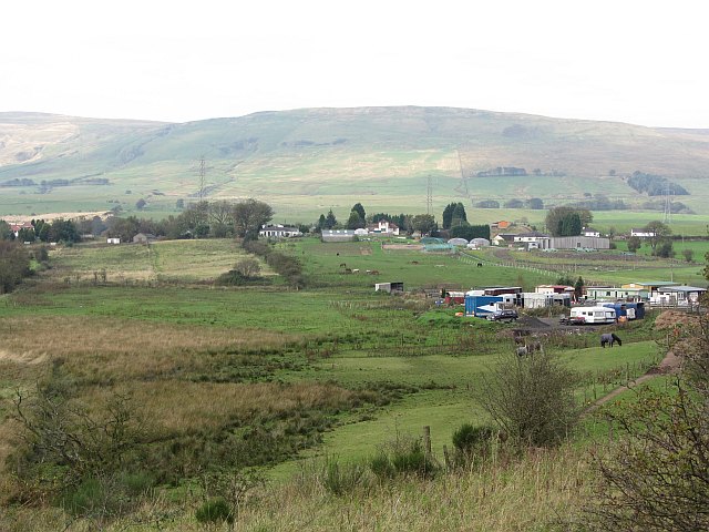
South Derry Wood is a picturesque forest located in Stirlingshire, Scotland. Covering an area of approximately 200 acres, it is a popular destination for nature lovers and outdoor enthusiasts. The wood is situated near the small village of South Derry, hence its name.
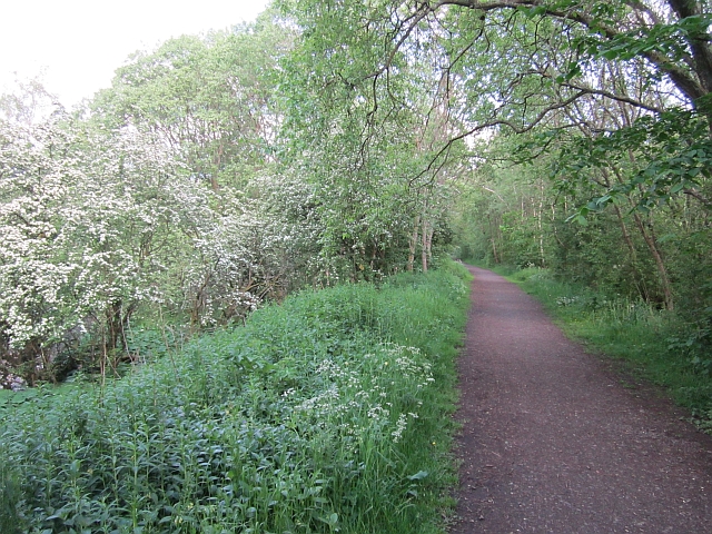
The woodland is characterized by a diverse range of tree species, including oak, birch, and beech, which create a vibrant and enchanting atmosphere. The lush undergrowth is home to a variety of flora, such as bluebells, ferns, and wildflowers, adding to the wood's natural beauty.
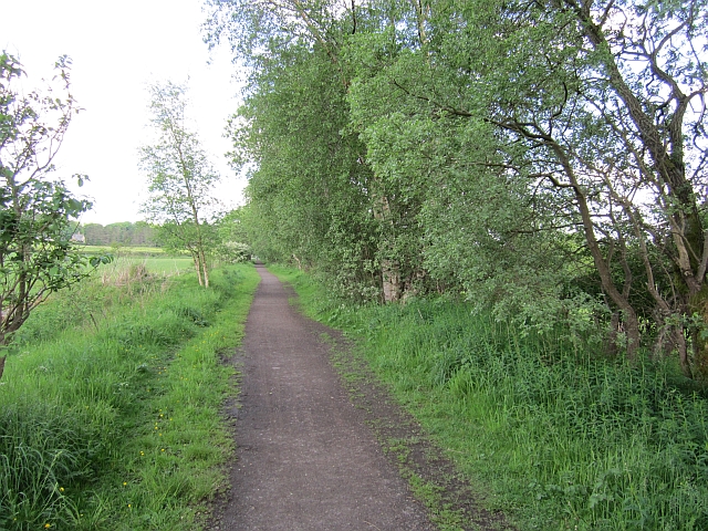
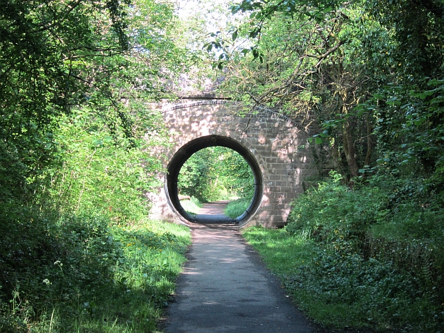
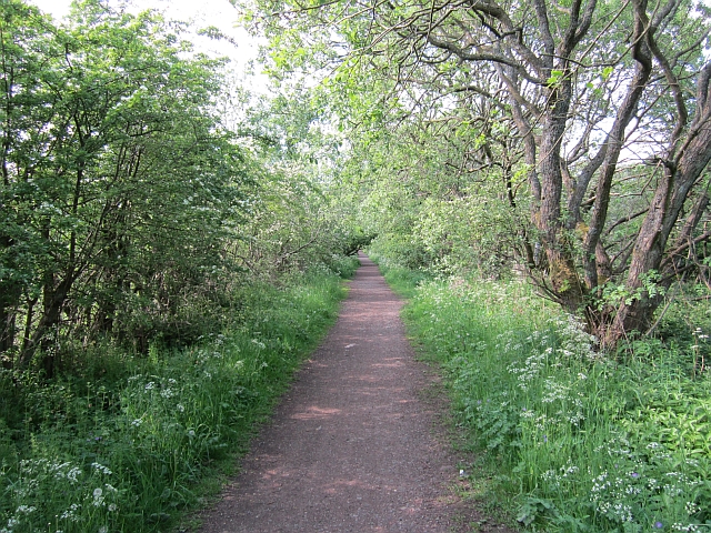
South Derry Wood offers numerous walking trails and paths, allowing visitors to explore its tranquil surroundings. These paths are well-maintained and suitable for all levels of fitness, making it an ideal destination for families and individuals seeking a peaceful escape from the hustle and bustle of everyday life.
The forest also provides habitat for a wide array of wildlife, including deer, squirrels, and a variety of bird species. Birdwatchers can spot species such as woodpeckers, owls, and songbirds within the wood's boundaries.
In addition to its natural beauty, South Derry Wood offers recreational activities such as picnicking, camping, and photography. The forest has designated areas for picnickers to enjoy a meal amidst the serene surroundings. Camping is also permitted in designated areas, allowing visitors to experience the tranquility of the wood overnight.
Overall, South Derry Wood is a haven of natural beauty and tranquility in Stirlingshire, offering visitors the opportunity to immerse themselves in the wonders of nature.
If you have any feedback on the listing, please let us know in the comments section below.
South Derry Wood Images
Images are sourced within 2km of 55.968693/-4.1592471 or Grid Reference NS6577. Thanks to Geograph Open Source API. All images are credited.
![Glorat Estate [1] Forested knoll to the east of Glorat.](https://s0.geograph.org.uk/geophotos/03/30/10/3301024_bcb3f60a.jpg)
![Glorat Estate [2] View of weir on channel which abstracts water for the Alloch Dam.](https://s0.geograph.org.uk/geophotos/03/30/10/3301036_fff3af26.jpg)
![Glorat Estate [3] View of sluice and overflow weir on channel that flows from the Ashenwell Dams to Alloch Dam.](https://s2.geograph.org.uk/geophotos/03/30/10/3301038_6670a01a.jpg)
![Glorat Estate [4] View to Alloch Dam.](https://s1.geograph.org.uk/geophotos/03/30/10/3301041_79fcd934.jpg)
![Glorat Estate [5] the boat sheds And Alloch Dam.](https://s0.geograph.org.uk/geophotos/03/30/33/3303320_72bbd443.jpg)
![Glorat Estate [6] the boat sheds [2] Deteriorating since <a href="https://www.geograph.org.uk/photo/1564349">NS6477 : Alloch Dam Boathouses</a> was taken in 2007.](https://s2.geograph.org.uk/geophotos/03/30/33/3303330_3c2f4e98.jpg)
![Glorat Estate [7] Alloch Dam sluice From here the water flows along a channel to the next user of it, Mount Dam.](https://s2.geograph.org.uk/geophotos/03/30/33/3303338_229c5790.jpg)
![Glorat Estate [8] Alloch Dam sluice](https://s1.geograph.org.uk/geophotos/03/30/33/3303349_eafebf82.jpg)
![Glorat Estate [9] feeder channel Channel from Alloch to Mount Dam.](https://s0.geograph.org.uk/geophotos/03/30/33/3303368_b5ac8a6d.jpg)
![Glorat Estate [10] Alloch Dam The swans sallied over to see who the visitors were.](https://s0.geograph.org.uk/geophotos/03/30/33/3303380_938ff0b1.jpg)
![Glorat Estate [11] Remains of the mill pond and dam of Glorat Mill. See RCAHMS site report and photos. <span class="nowrap"><a title="http://canmore.rcahms.gov.uk/en/site/184047/details/glorat+mill/" rel="nofollow ugc noopener" href="http://canmore.rcahms.gov.uk/en/site/184047/details/glorat+mill/">Link</a><img style="margin-left:2px;" alt="External link" title="External link - shift click to open in new window" src="https://s1.geograph.org.uk/img/external.png" width="10" height="10"/></span>](https://s3.geograph.org.uk/geophotos/03/30/33/3303387_9fa5add7.jpg)
South Derry Wood is located at Grid Ref: NS6577 (Lat: 55.968693, Lng: -4.1592471)
Unitary Authority: East Dunbartonshire
Police Authority: Greater Glasgow
What 3 Words
///rejoin.bits.elevates. Near Milton of Campsie, East Dunbartonshire
Nearby Locations
Related Wikis

Milton of Campsie
Milton of Campsie is a village formerly in the county of Stirlingshire, but now in East Dunbartonshire, Scotland roughly 10 miles (16 km) north of Glasgow...
Milton of Campsie railway station
Milton of Campsie railway station served the village of Milton of Campsie, in the historical county of Stirlingshire, Scotland, from 1848 to 1951 on the...
Glorat
Glorat is a place and estate in the parish of Campsie in East Dunbartonshire, Scotland. == History == A towerhouse was built at Glorat in the 16th century...
Glorat House
Glorat House is a 19th-century mansion house in East Dunbartonshire, Scotland. It is located in Milton of Campsie, in the former county of Stirlingshire...

Glazert Water
The Glazert Water is a tributary of the River Kelvin in East Dunbartonshire, Scotland. It is formed 1 kilometre (5⁄8 mi) south of Clachan of Campsie (55...
Birdston
Birdston is a hamlet located in East Dunbartonshire, Scotland between Milton of Campsie and Kirkintilloch. The 'Campsie poet' William Muir (1766-1817)...
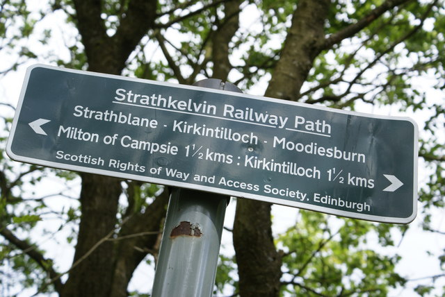
Strathkelvin Railway Path
Strathkelvin Railway Path is rail trail following the route of several dismantled railway lines extending from Gartcosh to Strathblane. It goes for 10...

Broomhill Hospital
Broomhill Hospital was a health facility in Kirkintilloch, East Dunbartonshire, Scotland. == History == The hospital, which was financed by a donation...
Nearby Amenities
Located within 500m of 55.968693,-4.1592471Have you been to South Derry Wood?
Leave your review of South Derry Wood below (or comments, questions and feedback).