Bad Biorach

Wood, Forest in Perthshire

Scotland

Bad Biorach

Signpost at Glen Finglas Estate Quality signage to be sure walkers and cyclists don't get lost!  The estate has a good range of routes marked by coloured arrows. The Great Trossachs Path is featured too.
Signpost at Glen Finglas Estate Credit: Mags49

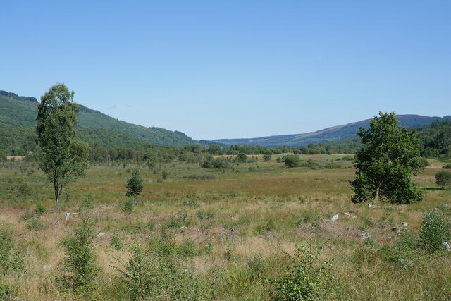
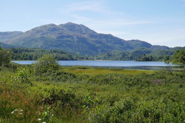
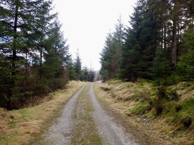
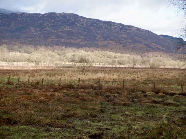
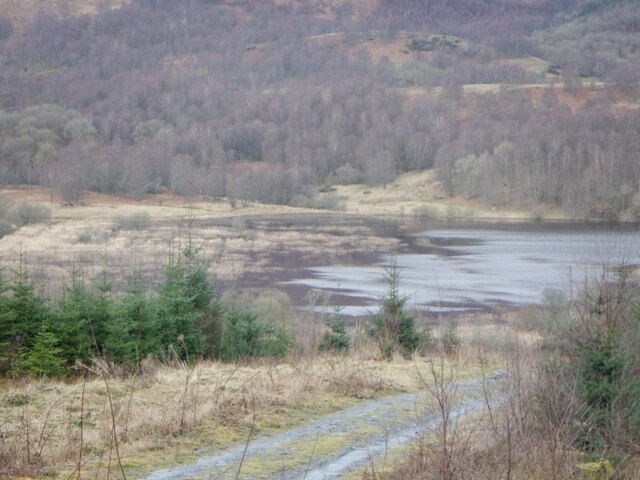
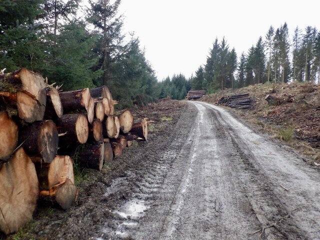
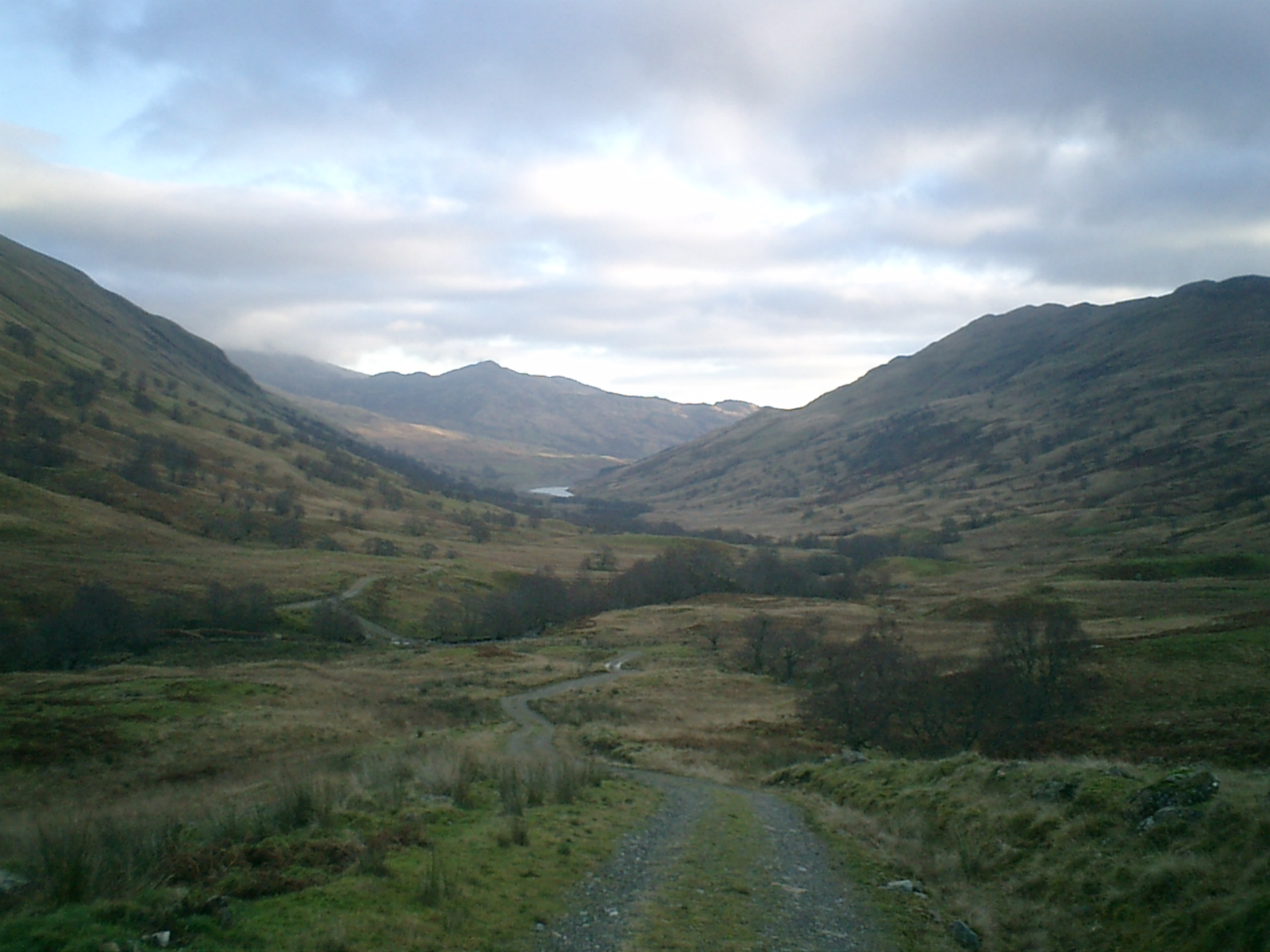
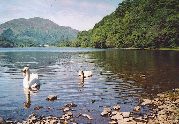
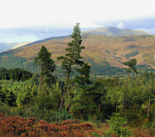
Bad Biorach is a picturesque wood located in Perthshire, Scotland. Nestled amidst the stunning landscape of the Scottish Highlands, this enchanting forest attracts visitors with its natural beauty and tranquil atmosphere. Covering an area of approximately 200 acres, Bad Biorach is home to a diverse range of flora and fauna, making it a haven for nature lovers and wildlife enthusiasts.

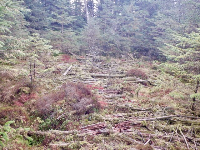
The wood is predominantly composed of native Scottish tree species, such as Scots pine, birch, and oak, which create a rich and vibrant tapestry of colors throughout the year. The dense canopy provides a soothing shade during the summer months, while the forest floor is adorned with a carpet of wildflowers and mosses.

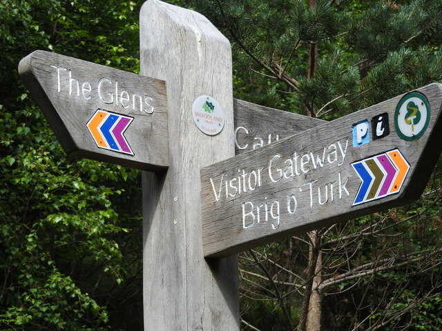
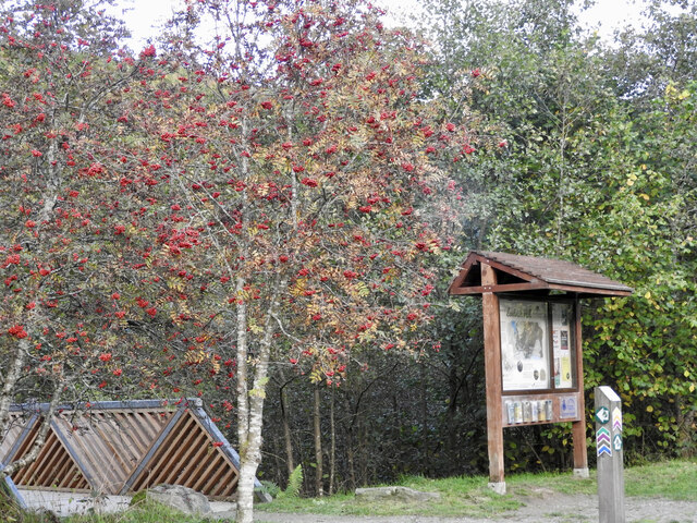
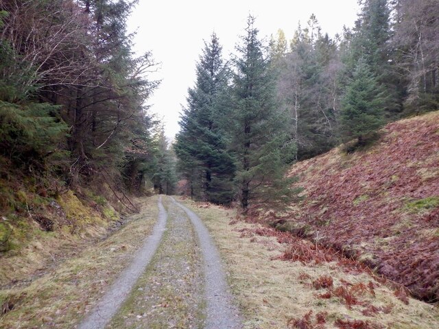
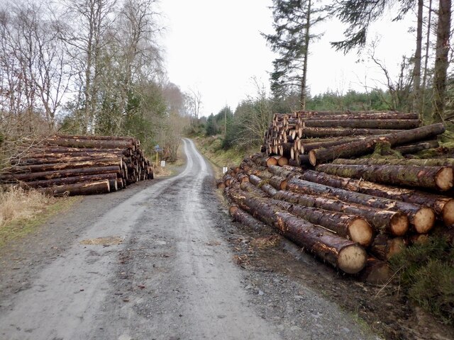
The woodland trails in Bad Biorach offer a fantastic opportunity for hiking and walking, allowing visitors to immerse themselves in the serene surroundings and enjoy the breathtaking views. The paths meander through the forest, leading to hidden gems such as cascading waterfalls and tranquil ponds.

Birdwatchers can delight in spotting a variety of avian species, including woodpeckers, owls, and various songbirds. The forest is also home to red deer, squirrels, and other small mammals, adding to the biodiversity of the area.

For those seeking a peaceful retreat, Bad Biorach provides an idyllic setting for a picnic or simply to sit and appreciate the natural wonders that surround them. The wood offers a sense of tranquility and a chance to reconnect with nature, making it a must-visit destination for anyone exploring the Perthshire region.

If you have any feedback on the listing, please let us know in the comments section below.

Bad Biorach Images

Images are sourced within 2km of 56.228687/-4.3701854 or Grid Reference NN5306. Thanks to Geograph Open Source API. All images are credited.

Signpost at Glen Finglas Estate Quality signage to be sure walkers and cyclists don't get lost!  The estate has a good range of routes marked by coloured arrows. The Great Trossachs Path is featured too.
Signpost at Glen Finglas Estate
Quality signage to be sure walkers and cyclists don't get lost! The estate has a good range of routes marked by coloured arrows. The Great Trossachs Path is featured too.
Autumn Berries on Show This year (2021) both Rowan and Hawthorn berries are really putting on a show.  The image shows an information board in the Woodland Trust Scotland Lendrick Hill car park, and you can also see the footpath marker signs on a post in the foreground.  The path signage is appreciated by visitors, especially when they have not had an opportunity to plan their walk.  The circular path sign is for the Great Trossachs Path, one of Scotland's long distance trails. See <span class="nowrap"><a title="https://www.scotlandsgreattrails.com" rel="nofollow ugc noopener" href="https://www.scotlandsgreattrails.com">Link</a><img style="margin-left:2px;" alt="External link" title="External link - shift click to open in new window" src="https://s1.geograph.org.uk/img/external.png" width="10" height="10"/></span>
Autumn Berries on Show
This year (2021) both Rowan and Hawthorn berries are really putting on a show. The image shows an information board in the Woodland Trust Scotland Lendrick Hill car park, and you can also see the footpath marker signs on a post in the foreground. The path signage is appreciated by visitors, especially when they have not had an opportunity to plan their walk. The circular path sign is for the Great Trossachs Path, one of Scotland's long distance trails. See LinkExternal link
Old milepost Just east of Loch Achray is another of the 4 Bonnybridge Foundry posts remaining in situ on the 9 miles of A821 from Kilmahog just north east of Callander to Loch Katrine.  Although painted regularly it would be good to see these posts dug out to their full height of 120cm.
Old milepost
Just east of Loch Achray is another of the 4 Bonnybridge Foundry posts remaining in situ on the 9 miles of A821 from Kilmahog just north east of Callander to Loch Katrine. Although painted regularly it would be good to see these posts dug out to their full height of 120cm.
Old milepost Vegetation and soil are gradually creeping up from the base of this milepost near the church.   Also the black paint on the lettering is disappearing.  CALLANDER 8 MILES/STIRLING 24 MILES is on the left face with TROSSACHS HOTEL/¼ MILE/LOCH KATRINE/1½ MILES on the right.
Old milepost
Vegetation and soil are gradually creeping up from the base of this milepost near the church. Also the black paint on the lettering is disappearing. CALLANDER 8 MILES/STIRLING 24 MILES is on the left face with TROSSACHS HOTEL/¼ MILE/LOCH KATRINE/1½ MILES on the right.
Low Water Levels at Glen Finglas Reservoir Water levels in the reservoir do fluctuate of course, and in summer 2021 interesting things were revealed because of a dry spell.  The Glen Finglas Woodland Trust Scotland Estate Ranger made this lovely video: <span class="nowrap"><a title="https://www.facebook.com/GlenFinglasWTS/videos/the-recent-dry-weather-exposed-areas-at-glen-finglas-otherwise-unseen-to-the-eye/525661109231879" rel="nofollow ugc noopener" href="https://www.facebook.com/GlenFinglasWTS/videos/the-recent-dry-weather-exposed-areas-at-glen-finglas-otherwise-unseen-to-the-eye/525661109231879">Link</a><img style="margin-left:2px;" alt="External link" title="External link - shift click to open in new window" src="https://s1.geograph.org.uk/img/external.png" width="10" height="10"/></span>  in July 2021 showing the past revealed.  
See  <a href="https://www.geograph.org.uk/photo/2477018">NN5307 : Viewpoint on the Glen Finglas track</a> for similar photo to the above, taken in 2011.  Completed in the mid-1960s, Glen Finglas reservoir feeds its water into Loch Katrine - major source of water for Glasgow.
Low Water Levels at Glen Finglas Reservoir
Water levels in the reservoir do fluctuate of course, and in summer 2021 interesting things were revealed because of a dry spell. The Glen Finglas Woodland Trust Scotland Estate Ranger made this lovely video: LinkExternal link in July 2021 showing the past revealed. See NN5307 : Viewpoint on the Glen Finglas track for similar photo to the above, taken in 2011. Completed in the mid-1960s, Glen Finglas reservoir feeds its water into Loch Katrine - major source of water for Glasgow.
View towards the Black Water Marshes The area in the foreground was once afforested and since its clearance has enabled an unhindered view across the marshland between Loch Venachar and Loch Achray - the Black Water Marshes.

This photograph was taken during the Coronavirus (COVID-19) pandemic of 2020/21/22.
View towards the Black Water Marshes
The area in the foreground was once afforested and since its clearance has enabled an unhindered view across the marshland between Loch Venachar and Loch Achray - the Black Water Marshes. This photograph was taken during the Coronavirus (COVID-19) pandemic of 2020/21/22.
Loch Achray and Ben Venue Approaching the heart of The Trossachs with Loch Achray and the distinctive looming presence of Ben Venue.

This photograph was taken during the Coronavirus (COVID-19) pandemic of 2020/21/22.
Loch Achray and Ben Venue
Approaching the heart of The Trossachs with Loch Achray and the distinctive looming presence of Ben Venue. This photograph was taken during the Coronavirus (COVID-19) pandemic of 2020/21/22.
Loch Achray, Trossachs Church and Ben A'an A view from the shoreline by National Cycle Route 7 which shares this section with the Great Trossachs Path and a Forest Drive.

This photograph was taken during the Coronavirus (COVID-19) pandemic of 2020/21/22.
Loch Achray, Trossachs Church and Ben A'an
A view from the shoreline by National Cycle Route 7 which shares this section with the Great Trossachs Path and a Forest Drive. This photograph was taken during the Coronavirus (COVID-19) pandemic of 2020/21/22.
Birch wood, Achray Between the loch and Duke's Pass road.
Birch wood, Achray
Between the loch and Duke's Pass road.
Achray Forest A thin deer path makes its way through dense conifers in this notoriously rough forest.
Achray Forest
A thin deer path makes its way through dense conifers in this notoriously rough forest.
Remains of an extraction lane, Achray Forest Brushwood is used to make extraction lanes in the deep peat terrain. This was used a few years earlier and is now rotting.
Remains of an extraction lane, Achray Forest
Brushwood is used to make extraction lanes in the deep peat terrain. This was used a few years earlier and is now rotting.
Extraction lane, Achray Forest
Road, Achray Forest
Road, Achray Forest
Road, Achray Forest
Road, Achray Forest
Marsh, between Loch Achray and Loch Venachar An extensive wetland north of Achray Forest.
Marsh, between Loch Achray and Loch Venachar
An extensive wetland north of Achray Forest.
Logs, Achray Forest
Logs, Achray Forest
Head of Loch Venachar
Forest road, Achray
Forest road, Achray
Show me another place!

Bad Biorach is located at Grid Ref: NN5306 (Lat: 56.228687, Lng: -4.3701854)

Unitary Authority: Stirling

Police Authority: Forth Valley

What 3 Words

///clogging.quote.direct. Near Callander, Stirling

Related Wikis

Bicycle Tree (Trossachs)

The Bicycle Tree is a veteran tree near Brig o' Turk in the Trossachs, Scotland. Dating from the late 19th century, the tree grew in or near to the scrap...

Brig o' Turk

Brig o' Turk (Scottish Gaelic: Àird Cheannchnocain) is a small rural village historically in Perthshire and today within the council area of Stirling,...
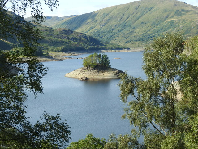
Glen Finglas

Glen Finglas (Scottish Gaelic: Gleann Fhionnghlais) is a glen in the Trossachs, in the Stirling council area of Scotland. It is an area of forest in Highlands...

Craiglich

Craiglich is a hill in western Aberdeenshire, with a height of 476 metres (1562 feet). Its ease of access, Marilyn status and scenic views make it popular...

Loch Achray

Loch Achray is a small freshwater loch 11 km (6.8 mi) west of Callander in Stirling district, Scotland. The loch lies between Loch Katrine and Loch Venachar...

Loch Drunkie

Loch Drunkie (Scottish Gaelic: Loch Drongaidh, pronounced [l̪ˠɔx ˈt̪ɾɔŋkɪ]) is a small freshwater loch in the Trossachs near Aberfoyle in the Stirling...

Duke's Pass

Duke's Pass or Dukes Pass is a pass on the A821 road between Aberfoyle and Brig o' Turk in the glen of the Trossachs in the Scottish Highlands. It climbs...

Ben A'an

Ben A'an is a hill in the Trossachs in Scotland. The pointed peak of its west top (454 m/1491 ft) resembles a small mountain. == Location == Ben A'an is...

Nearby Amenities

Located within 500m of 56.228687,-4.3701854
Barrier: kissing_gate
Bicycle: yes
Foot: yes
Lat/Long: 56.2293626/-4.3707518
Recycling
Recycling Clothes: no
Recycling Glass: yes
Recycling Paper: no
Lat/Long: 56.2282651/-4.3689493
Brig o' Turk
Name En: Brig o' Turk
Name Gd: Àird Cheannchnocain
Place: hamlet
Wikidata: Q915279
Wikipedia: en:Brig o' Turk
Lat/Long: 56.2296717/-4.3624746
Brig O' Michael
Place: locality
Lat/Long: 56.2271436/-4.368118
Bench
Lat/Long: 56.2311966/-4.366242
Achray Farm - The Old Farmhouse
Guest House: agritourism
Internet Access: yes
Internet Access Fee: no
Operator: Achray Farm
Reservation: required
Smoking: no
Tourism: guest_house
Website: https://achrayfarm.co.uk
Lat/Long: 56.2270296/-4.3726272
Ice Cream
Achray Farm Ice Cream
Addr Housename: Achray Farm
Addr Postcode: FK17 8HT
Addr Street: Brig o Turk
Opening Hours: May - October - 11am to 5:30pm
Outdoor Seating: yes
Lat/Long: 56.226771/-4.3725851
Power: pole
Lat/Long: 56.2299566/-4.3755544
Power: pole
Lat/Long: 56.230041/-4.3746288
Power: pole
Lat/Long: 56.2301371/-4.3736274
Power: pole
Lat/Long: 56.2302282/-4.3726533
Power: pole
Lat/Long: 56.2303345/-4.3715366
Power: pole
Lat/Long: 56.2285855/-4.3728287
Power: pole
Lat/Long: 56.2289541/-4.3722451
Power: pole
Lat/Long: 56.2294622/-4.3718602
Power: pole
Lat/Long: 56.2299855/-4.3715444
Power: pole
Lat/Long: 56.2309796/-4.371421
Power: pole
Lat/Long: 56.2314807/-4.3712641
Power: pole
Lat/Long: 56.2321748/-4.3712243
Power: pole
Lat/Long: 56.2302378/-4.3703061
Power: pole
Lat/Long: 56.2301715/-4.3691953
Power: pole
Lat/Long: 56.2301215/-4.3683231
Power: pole
Lat/Long: 56.2305808/-4.3676349
Power: pole
Lat/Long: 56.231033/-4.3669718
Power: pole
Lat/Long: 56.231583/-4.3668798
Power: pole
Lat/Long: 56.2300564/-4.3640057
Power: pole
Lat/Long: 56.2312667/-4.3638133
Power: pole
Lat/Long: 56.2315237/-4.364719
Power: pole
Lat/Long: 56.2312458/-4.3654951
Cafe
Brig o' Turk Tearoom
Addr City: Brig o' Turk
Addr Postcode: FK17 8HT
Website: https://brigoturktearoom.com/
Lat/Long: 56.2296312/-4.363792
Bicycle Parking
Bicycle Parking: stands
Capacity: 10
Covered: no
Lat/Long: 56.2295576/-4.3636426
Bicycle Repair Station
Service Bicycle Tools: yes
Lat/Long: 56.2295499/-4.3637242
Generator Method: photovoltaic
Generator Output Electricity: yes
Generator Source: solar
Generator Type: solar_photovoltaic_panel
Power: generator
Lat/Long: 56.2272847/-4.3627278
The data included in this document is from www.openstreetmap.org. The data is made available under ODbL.

Have you been to Bad Biorach?

Leave your review of Bad Biorach below (or comments, questions and feedback).