Cnoc nan Sitheag

Hill, Mountain in Perthshire

Scotland

Cnoc nan Sitheag

Shore of Loch Achray
Shore of Loch Achray Credit: Peter Moore

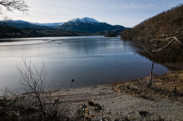
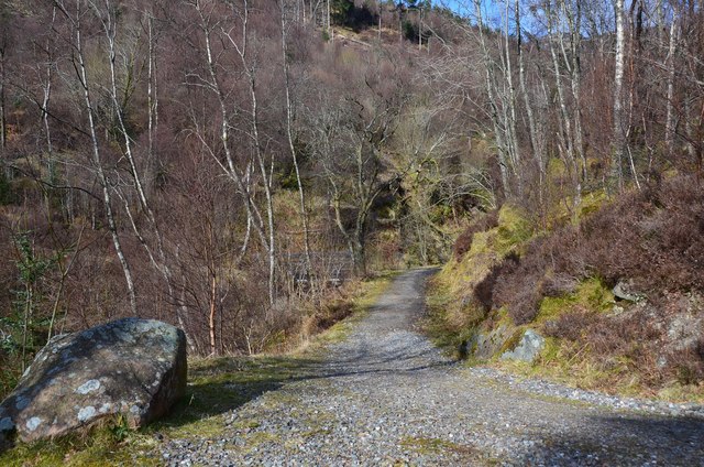
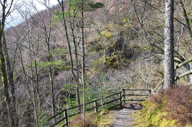
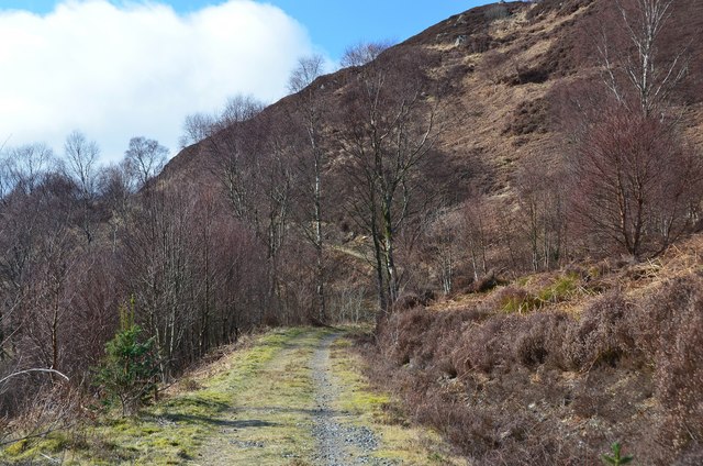
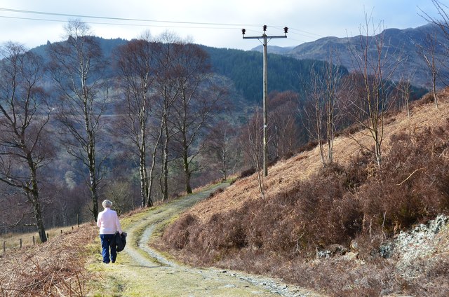
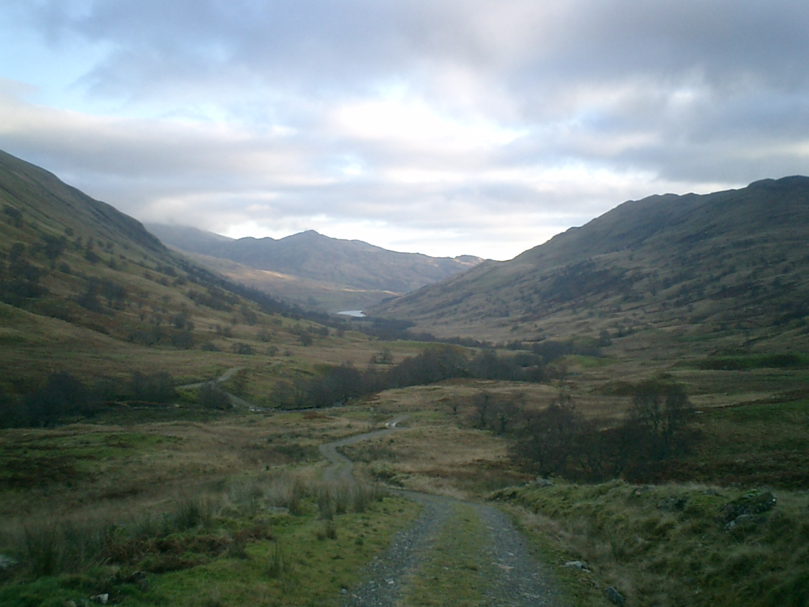
Cnoc nan Sitheag, located in Perthshire, Scotland, is a picturesque hill known for its natural beauty and historical significance. Situated in the southern part of the Scottish Highlands, this hill stands at an elevation of approximately 1,506 feet (459 meters), making it a popular destination for hikers and outdoor enthusiasts.

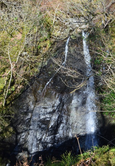
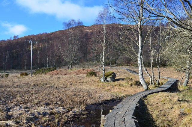
The name "Cnoc nan Sitheag" translates to "Fairy Hill" in Gaelic, reflecting the enchanting atmosphere that surrounds the area. The hill features rolling green slopes, scattered with heather and other native flora, offering breathtaking views of the surrounding countryside.

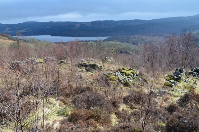
One of the main attractions of Cnoc nan Sitheag is the ancient stone circle located near its summit. Believed to date back to the Bronze Age, this circle consists of several large stones arranged in a circular formation. The purpose of the stone circle is still debated among archaeologists, but it is speculated to have had spiritual or ceremonial significance to the ancient inhabitants of the area.

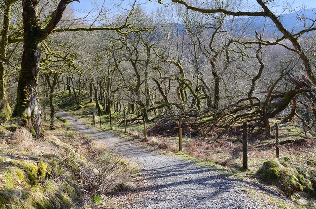
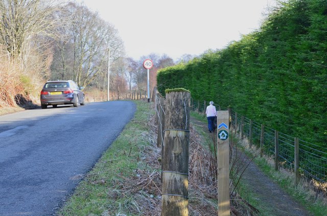
In addition to its historical importance, Cnoc nan Sitheag is home to a diverse range of wildlife. Visitors may spot red deer, grouse, and various species of birds as they traverse the hill's trails. The surrounding area is also known for its rich biodiversity, with numerous species of plants and animals thriving in the local ecosystem.

Overall, Cnoc nan Sitheag offers a tranquil retreat for those seeking natural beauty, historical exploration, and a chance to immerse themselves in the stunning Scottish landscape.

If you have any feedback on the listing, please let us know in the comments section below.

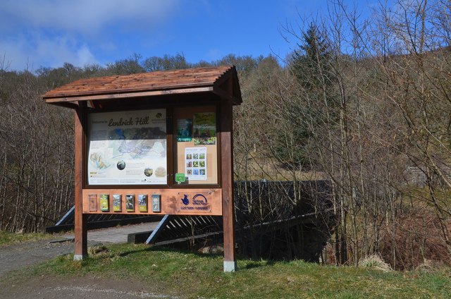
Cnoc nan Sitheag Images

Images are sourced within 2km of 56.231443/-4.3628044 or Grid Reference NN5306. Thanks to Geograph Open Source API. All images are credited.

Shore of Loch Achray
Information board, Lendrick Hill car park, Trossachs A car park by the A821 E of Brig o' Turk, with a visitor centre. It is the starting point for several walks in or near Glen Finglas.
Information board, Lendrick Hill car park, Trossachs
A car park by the A821 E of Brig o' Turk, with a visitor centre. It is the starting point for several walks in or near Glen Finglas.
Woodland path, Lendrick Hill On the Lendrick Hill and Dam Walk from the nearby car park on a well-maintained and easy path.
Woodland path, Lendrick Hill
On the Lendrick Hill and Dam Walk from the nearby car park on a well-maintained and easy path.
Ruins of Drippan farmstead, Lendrick Hill Ruins on a shelf of level ground now within the woodland on Lendrick Hill. Loch Venachar is in the background.
Ruins of Drippan farmstead, Lendrick Hill
Ruins on a shelf of level ground now within the woodland on Lendrick Hill. Loch Venachar is in the background.
Path above a waterfall, Lendrick Hill The path to Glen Finglas Reservoir contours above a waterfall.
Path above a waterfall, Lendrick Hill
The path to Glen Finglas Reservoir contours above a waterfall.
Waterfall, Lendrick Hill The burn cascades down a rock slab and can be seen from a viewpoint off the main path.
Waterfall, Lendrick Hill
The burn cascades down a rock slab and can be seen from a viewpoint off the main path.
Viewpoint, Lendrick Hill and Dam Walk A viewpoint for the fall shown in <a href="https://www.geograph.org.uk/photo/4872816">NN5407 : Waterfall, Lendrick Hill</a>.
Viewpoint, Lendrick Hill and Dam Walk
A viewpoint for the fall shown in NN5407 : Waterfall, Lendrick Hill.
Lendrick Hill and Dam Walk, Trossachs A fine walk from the car park by the A821, here passing through scattered birch woods on a SW facing hillside.
Lendrick Hill and Dam Walk, Trossachs
A fine walk from the car park by the A821, here passing through scattered birch woods on a SW facing hillside.
Lendrick Hill and Dam Walk, Trossachs This pleasant path contours in to meet the reservoir road in just over 1 km.
Lendrick Hill and Dam Walk, Trossachs
This pleasant path contours in to meet the reservoir road in just over 1 km.
Glen Finglas Reservoir A view of the reservoir from the path below Creag a' Bhlair.
Glen Finglas Reservoir
A view of the reservoir from the path below Creag a' Bhlair.
Glen Finglas Reservoir and Meall Cala A fine March day on the track by the reservoir, built in the mid 1960s as a water supply for Glasgow. There is also a small hydroelectric station by the dam at the south end.
Glen Finglas Reservoir and Meall Cala
A fine March day on the track by the reservoir, built in the mid 1960s as a water supply for Glasgow. There is also a small hydroelectric station by the dam at the south end.
Toman Dubh, Glen Finglas Reservoir 'Toman' refers to a knoll or eminence and it is named on maps made before the glen was flooded - see <span class="nowrap"><a title="http://maps.nls.uk/view/75655995" rel="nofollow ugc noopener" href="http://maps.nls.uk/view/75655995">Link</a><img style="margin-left:2px;" alt="External link" title="External link - shift click to open in new window" src="https://s1.geograph.org.uk/img/external.png" width="10" height="10"/></span> (Perth and Clackmannan six-inch OS sheet CXIV.SW (1901))
Toman Dubh, Glen Finglas Reservoir
'Toman' refers to a knoll or eminence and it is named on maps made before the glen was flooded - see LinkExternal link (Perth and Clackmannan six-inch OS sheet CXIV.SW (1901))
School and cottage, Brig o' Turk A traditional cottage and Victorian-style primary school on the road from Glen Finglas.
School and cottage, Brig o' Turk
A traditional cottage and Victorian-style primary school on the road from Glen Finglas.
Village Hall, Brig o' Turk
Brig o' Turk Tearoom A traditional style tearoom that dates back to 1923. Sadly for us, it was closed, being a Wednesday.
Brig o' Turk Tearoom
A traditional style tearoom that dates back to 1923. Sadly for us, it was closed, being a Wednesday.
Entrance to Brig o' Turk Tearoom A traditional tearoom, open every day except Wednesday.
Entrance to Brig o' Turk Tearoom
A traditional tearoom, open every day except Wednesday.
Roadside path from Brig o' Turk A welcome footpath alternative to the A821 heading E from Brig o' Turk. It connects with the Lendrick Hill car park 1 km east.
Roadside path from Brig o' Turk
A welcome footpath alternative to the A821 heading E from Brig o' Turk. It connects with the Lendrick Hill car park 1 km east.
Boardwalk below Lendrick Hill A path around wetland close to the site of a former curling pond.
Boardwalk below Lendrick Hill
A path around wetland close to the site of a former curling pond.
Show me another place!

Cnoc nan Sitheag is located at Grid Ref: NN5306 (Lat: 56.231443, Lng: -4.3628044)

Unitary Authority: Stirling

Police Authority: Forth Valley

What 3 Words

///panther.fees.branching. Near Callander, Stirling

Related Wikis

Glen Finglas

Glen Finglas (Scottish Gaelic: Gleann Fhionnghlais) is a glen in the Trossachs, in the Stirling council area of Scotland. It is an area of forest in Highlands...

Bicycle Tree (Trossachs)

The Bicycle Tree is a veteran tree near Brig o' Turk in the Trossachs, Scotland. Dating from the late 19th century, the tree grew in or near to the scrap...
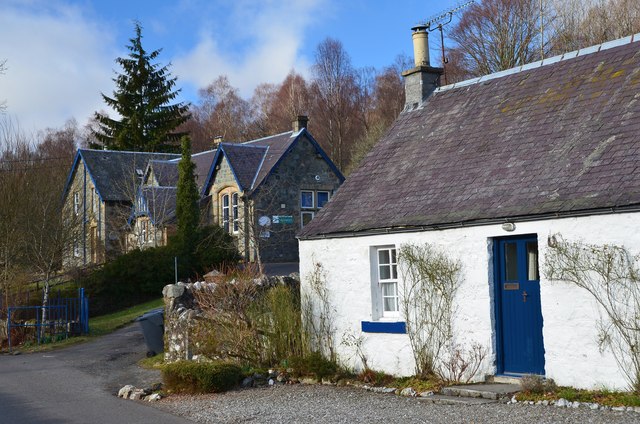
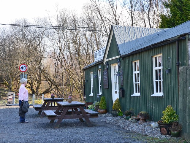
Brig o' Turk

Brig o' Turk (Scottish Gaelic: Àird Cheannchnocain) is a small rural village historically in Perthshire and today within the council area of Stirling,...

Craiglich

Craiglich is a hill in western Aberdeenshire, with a height of 476 metres (1562 feet). Its ease of access, Marilyn status and scenic views make it popular...

Nearby Amenities

Located within 500m of 56.231443,-4.3628044
Disused: Post Office
Brig O Turk Post Office
Addr Postcode: FK17 8HT
Branch: Brig O Turk
Brand: Post Office
Brand Wikidata: Q1783168
Check Date: 2020-02-20
Ref Pol Id: 17004
Lat/Long: 56.2293139/-4.3618493
Post Box
Post Box Type: lamp
Ref: FK17 89
Lat/Long: 56.2295515/-4.3619968
Brig o' Turk
Name En: Brig o' Turk
Name Gd: Àird Cheannchnocain
Place: hamlet
Wikidata: Q915279
Wikipedia: en:Brig o' Turk
Lat/Long: 56.2296717/-4.3624746
Barrier: kissing_gate
Foot: yes
Lat/Long: 56.2295647/-4.356115
Barrier: kissing_gate
Foot: yes
Lat/Long: 56.2297035/-4.3559892
Bench
Lat/Long: 56.2311966/-4.366242
Power: pole
Lat/Long: 56.2358619/-4.3627162
Power: pole
Lat/Long: 56.2354318/-4.3617435
Power: pole
Lat/Long: 56.2349738/-4.360775
Power: pole
Lat/Long: 56.234704/-4.3595723
Power: pole
Lat/Long: 56.2344262/-4.3583235
Power: pole
Lat/Long: 56.2341541/-4.3571208
Power: pole
Lat/Long: 56.2302378/-4.3703061
Power: pole
Lat/Long: 56.2301715/-4.3691953
Power: pole
Lat/Long: 56.2301215/-4.3683231
Power: pole
Lat/Long: 56.2305808/-4.3676349
Power: pole
Lat/Long: 56.231033/-4.3669718
Power: pole
Lat/Long: 56.231583/-4.3668798
Power: pole
Lat/Long: 56.2300564/-4.3640057
Power: pole
Lat/Long: 56.2297866/-4.3581886
Power: pole
Lat/Long: 56.2298331/-4.3587617
Power: pole
Lat/Long: 56.2298715/-4.3593098
Power: pole
Lat/Long: 56.2301494/-4.3553062
Power: pole
Lat/Long: 56.2301017/-4.3565361
Power: pole
Lat/Long: 56.2300192/-4.3579334
Power: pole
Lat/Long: 56.2300343/-4.3588726
Power: pole
Lat/Long: 56.2300401/-4.3600628
Power: pole
Lat/Long: 56.2304122/-4.3611212
Power: pole
Lat/Long: 56.2307749/-4.3621608
Power: pole
Lat/Long: 56.2310982/-4.3632172
Power: pole
Lat/Long: 56.2312667/-4.3638133
Power: pole
Lat/Long: 56.2315237/-4.364719
Power: pole
Lat/Long: 56.2312458/-4.3654951
Cafe
Brig o' Turk Tearoom
Addr City: Brig o' Turk
Addr Postcode: FK17 8HT
Website: https://brigoturktearoom.com/
Lat/Long: 56.2296312/-4.363792
Bicycle Parking
Bicycle Parking: stands
Capacity: 10
Covered: no
Lat/Long: 56.2295576/-4.3636426
Bicycle Repair Station
Service Bicycle Tools: yes
Lat/Long: 56.2295499/-4.3637242
Generator Method: photovoltaic
Generator Output Electricity: yes
Generator Source: solar
Generator Type: solar_photovoltaic_panel
Power: generator
Lat/Long: 56.2272847/-4.3627278
Generator Method: photovoltaic
Generator Output Electricity: yes
Generator Source: solar
Generator Type: solar_photovoltaic_panel
Power: generator
Lat/Long: 56.2286341/-4.3613609
The data included in this document is from www.openstreetmap.org. The data is made available under ODbL.

Have you been to Cnoc nan Sitheag?

Leave your review of Cnoc nan Sitheag below (or comments, questions and feedback).