Alsop en le Dale

Settlement in Derbyshire Derbyshire Dales

England

Alsop en le Dale

A ruin above Mill Dale The remains of some kind of small building, pen or fold, marked on old OS maps as a plain, unlabelled rectangle.
A ruin above Mill Dale Credit: Ian Calderwood

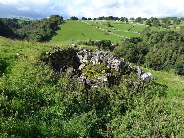
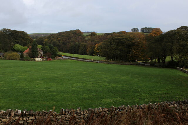
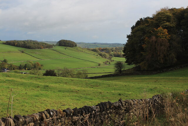
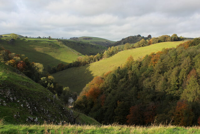
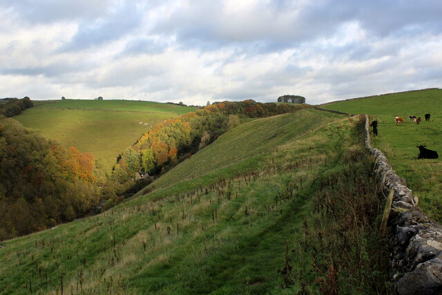
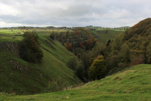
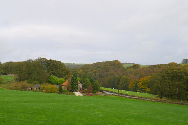
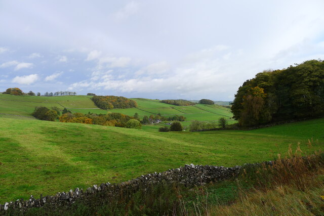
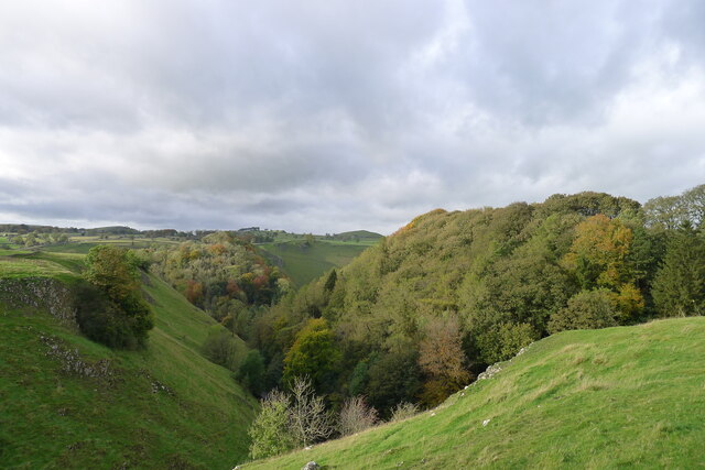
Alsop en le Dale is a small village located in the county of Derbyshire, England. It is situated in the Peak District National Park, known for its outstanding natural beauty and picturesque landscapes. The village lies on the banks of the River Dove, which forms part of the boundary between Derbyshire and Staffordshire.

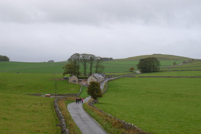
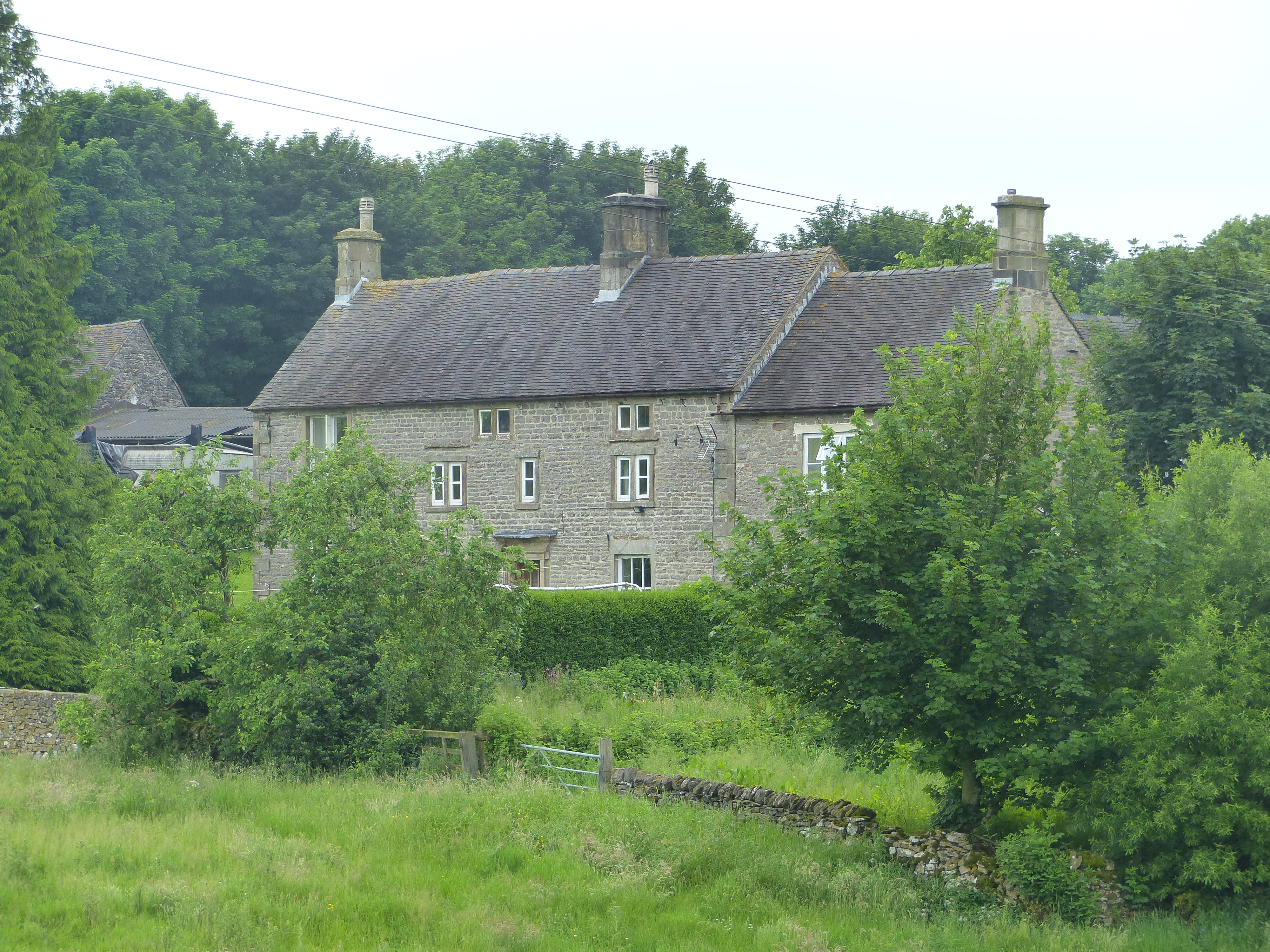
Alsop en le Dale is a traditional English village with a population of around 100 residents. The village is characterized by its charming stone cottages, many of which date back to the 18th century. The village also features a quaint church, St. Michael's Church, which adds to its historic charm.

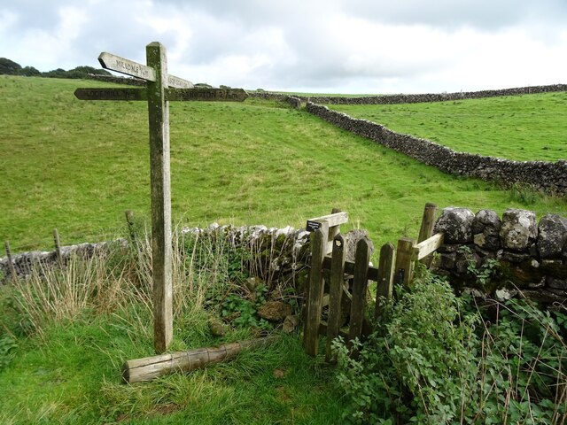
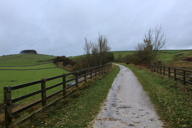
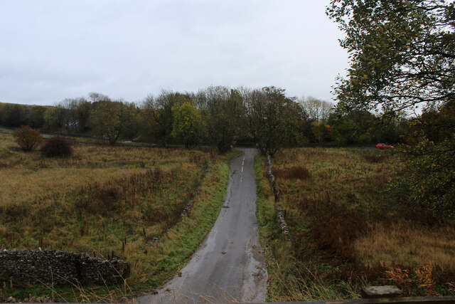
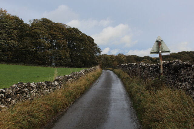
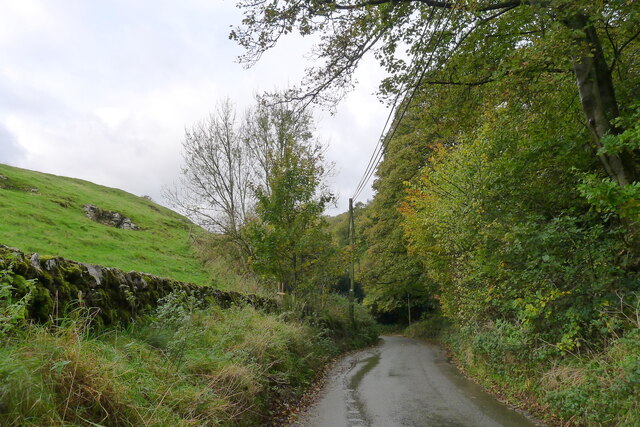
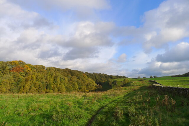
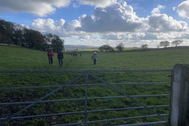
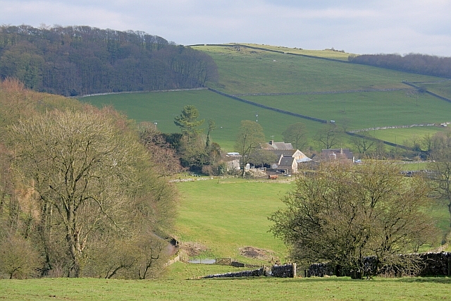
The village is surrounded by rolling hills and green pastures, making it an ideal location for outdoor enthusiasts. There are several walking and hiking trails in the area, offering breathtaking views of the surrounding countryside. The River Dove is also popular for fishing, attracting anglers from all over.

Despite its small size, Alsop en le Dale has a strong sense of community. The village hosts various events throughout the year, including a summer fete and a Christmas market. The village pub, The Alsop Arms, serves as a social hub for residents and visitors alike.

Overall, Alsop en le Dale is a picturesque village nestled in the heart of the Peak District National Park, offering a tranquil retreat for those seeking a rural escape. Its natural beauty, historic buildings, and strong community spirit make it a truly charming place to visit or reside.

If you have any feedback on the listing, please let us know in the comments section below.

Alsop en le Dale Images

Images are sourced within 2km of 53.092852/-1.761043 or Grid Reference SK1655. Thanks to Geograph Open Source API. All images are credited.

A ruin above Mill Dale The remains of some kind of small building, pen or fold, marked on old OS maps as a plain, unlabelled rectangle.
A ruin above Mill Dale
The remains of some kind of small building, pen or fold, marked on old OS maps as a plain, unlabelled rectangle.
Footpath crossroads According to the finger post, this is where the footpath from Milldale to Alsop Station crosses the footpath from Lode Mill to Tissington.
Footpath crossroads
According to the finger post, this is where the footpath from Milldale to Alsop Station crosses the footpath from Lode Mill to Tissington.
Tissington Trail crossing Liffs Road The former railway heading north towards Johnson's Knoll - topped by a stand of trees.
Tissington Trail crossing Liffs Road
The former railway heading north towards Johnson's Knoll - topped by a stand of trees.
Liffs Road approaching the A515 As seen from the former railway bridge that carries the Tissington Trail across Liffs Road
Liffs Road approaching the A515
As seen from the former railway bridge that carries the Tissington Trail across Liffs Road
Looking towards Greenlowfield and the A515 As seen from the Tissington Trail, slightly to the north of the former Alsop station.
Looking towards Greenlowfield and the A515
As seen from the Tissington Trail, slightly to the north of the former Alsop station.
Countryside near Alsop en le Dale As seen from the Tissington Trail beside Stonepit Plantation
Countryside near Alsop en le Dale
As seen from the Tissington Trail beside Stonepit Plantation
Oxclose Lane Climbing out of the trench of Dovedale towards the A515
Oxclose Lane
Climbing out of the trench of Dovedale towards the A515
View from Above Shining Tor Overlooks the deep trench that is Dovedale
View from Above Shining Tor
Overlooks the deep trench that is Dovedale
Footpath High above Milldale The public footpath follows the wall, with ground falling away sharply to the left towards Milldale
Footpath High above Milldale
The public footpath follows the wall, with ground falling away sharply to the left towards Milldale
Looking over Mill Dale
Walkers on the road past Lees Barn The group was on its way to join the Tissington Trail
Walkers on the road past Lees Barn
The group was on its way to join the Tissington Trail
Greenlowfield from the Tissington Trail Semi-detached cottages on the A515
Greenlowfield from the Tissington Trail
Semi-detached cottages on the A515
Alsop en le Dale from the Tissington Trail
The road down to Mill Dale Aptly named 'The Pinch'
The road down to Mill Dale
Aptly named 'The Pinch'
Mill Dale
Mill Dale
The path above Mill Dale After a steep climb up from the village of Milldale, the path here is running east on more level ground towards the A515 and the Tissington Trail
The path above Mill Dale
After a steep climb up from the village of Milldale, the path here is running east on more level ground towards the A515 and the Tissington Trail
Track from Middlehill Farm Crossing the farm track on the public footpath from Parwich.
Track from Middlehill Farm
Crossing the farm track on the public footpath from Parwich.
Field beside Eatondale Wood On the footpath from Parwich walkers are passing Eatondale Wood.
Field beside Eatondale Wood
On the footpath from Parwich walkers are passing Eatondale Wood.
Show me another place!

Alsop en le Dale is located at Grid Ref: SK1655 (Lat: 53.092852, Lng: -1.761043)

Administrative County: Derbyshire

District: Derbyshire Dales

Police Authority: Derbyshire

What 3 Words

///fidelity.receiving.savings. Near Newhaven, Derbyshire

Related Wikis

Nearby Amenities

Located within 500m of 53.092852,-1.761043
Post Box
Collection Times: Mo-Fr 16:00, Sa 07:15
Operator: Royal Mail
Ref: DE6 805
Royal Cypher: EIIR
Royal Cypher Wikidata: Q33102113
Lat/Long: 53.0932651/-1.761832
Barrier: stile
Material: stone
Source: survey;gps
Stile: squeezer
Lat/Long: 53.0887277/-1.7602058
Barrier: stile
Ele: 261.8427734
Steps: 2
Stile: wall
Lat/Long: 53.0887987/-1.7629943
Barrier: stile
Ele: 269.7736816
Steps: 3
Stile: wall
Lat/Long: 53.0890106/-1.7640465
Barrier: stile
Material: stone
Source: survey;gps
Stile: squeezer
Lat/Long: 53.0919553/-1.7669397
Barrier: stile
Material: stone
Source: survey;gps
Stile: squeezer
Lat/Long: 53.0920969/-1.7550301
Barrier: stile
Material: stone
Source: survey;gps
Stile: squeezer
Lat/Long: 53.0926415/-1.7651096
Barrier: stile
Material: stone
Source: survey;gps
Stile: stepover
Lat/Long: 53.0928109/-1.7565281
Barrier: stile
Material: stone
Source: survey;gps
Stile: stepover
Lat/Long: 53.0930055/-1.7578257
Barrier: stile
Material: stone
Source: survey;gps
Stile: stepover
Lat/Long: 53.0930398/-1.7601056
Barrier: stile
Material: stone
Source: survey;gps
Stile: squeezer
Lat/Long: 53.0960228/-1.7604618
Barrier: stile
Material: wood
Source: survey;gps
Stile: stepover
Lat/Long: 53.0893618/-1.7606447
Barrier: stile
Material: stone
Source: survey;gps
Stile: stepover
Lat/Long: 53.0896464/-1.7607956
Barrier: stile
Material: stone
Source: survey;gps
Stile: squeezer
Lat/Long: 53.0917081/-1.7605453
Barrier: kissing_gate
Source: survey;gps
Lat/Long: 53.0928348/-1.7604641
Barrier: kissing_gate
Source: survey;gps
Lat/Long: 53.0930123/-1.7602017
Barrier: stile
Material: stone
Source: survey;gps
Stile: stepover
Lat/Long: 53.0900396/-1.7566065
Generator Method: photovoltaic
Generator Output Electricity: yes
Generator Source: solar
Generator Type: solar_photovoltaic_panel
Location: roof
Power: generator
Lat/Long: 53.0928273/-1.7619418
Alsop en le Dale
Place: village
Wikidata: Q4735832
Lat/Long: 53.0934539/-1.7625439
The data included in this document is from www.openstreetmap.org. The data is made available under ODbL.

Have you been to Alsop en le Dale?

Leave your review of Alsop en le Dale below (or comments, questions and feedback).