Cross Low

Heritage Site in Derbyshire Derbyshire Dales

England

Cross Low

Footpath crossroads According to the finger post, this is where the footpath from Milldale to Alsop Station crosses the footpath from Lode Mill to Tissington.
Footpath crossroads Credit: Ian Calderwood

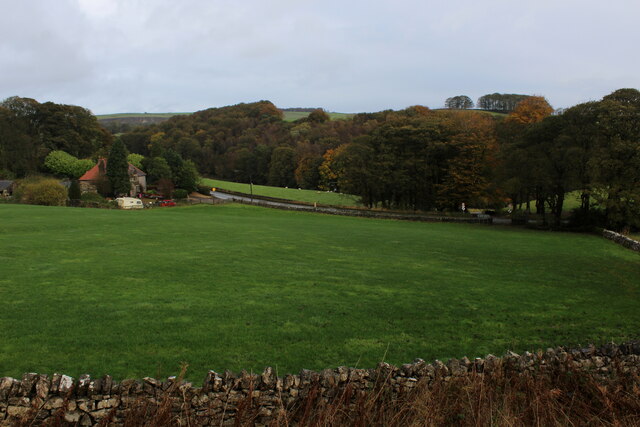
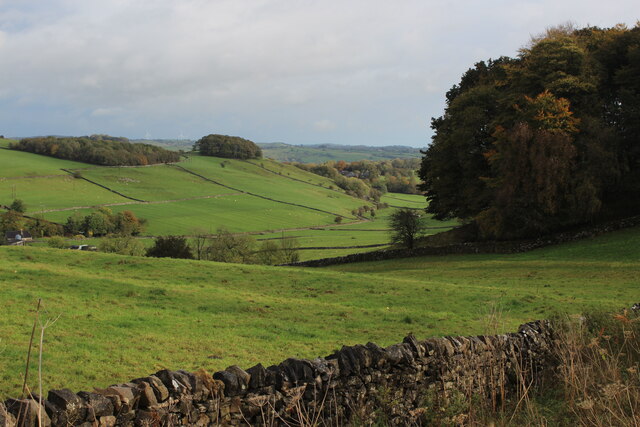
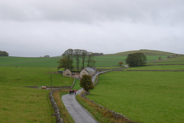
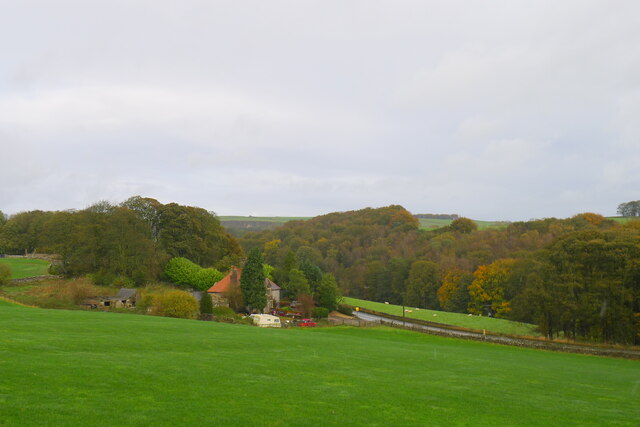
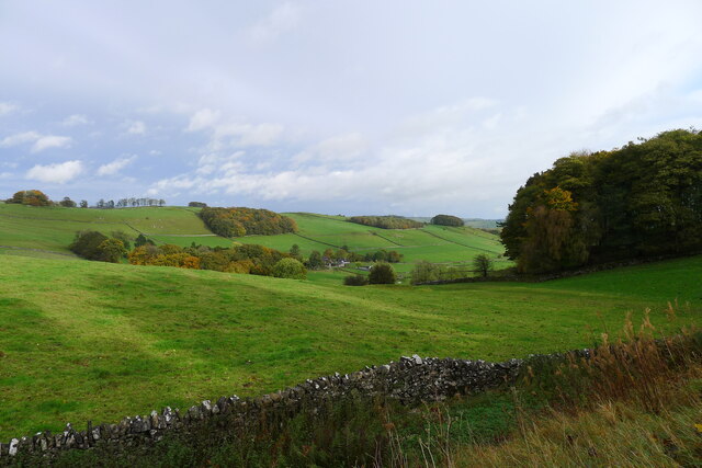
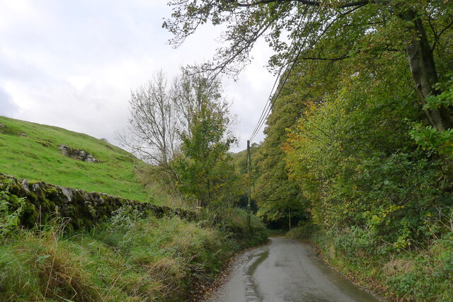
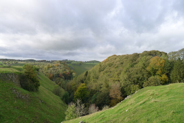
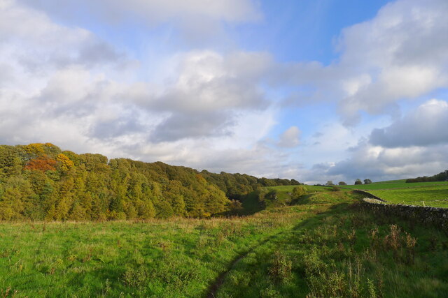
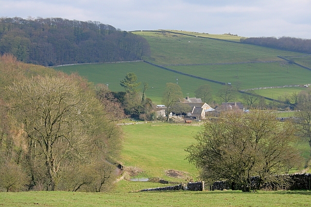
Cross Low is a historically significant area located in Derbyshire, England. It is recognized as a heritage site due to its rich cultural and archaeological importance. The site is situated on a gently sloping hillside, offering picturesque views of the surrounding countryside.

One of the main features of Cross Low is its collection of ancient burial mounds, known as barrows. These mounds date back to the Bronze Age, providing valuable insights into the burial practices and customs of the time. Archaeological excavations have uncovered various artifacts, including pottery, tools, and even human remains.

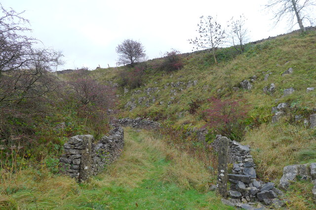
In addition to the barrows, there are also remnants of an Iron Age hillfort at Cross Low. This hillfort, believed to have been constructed around 300 BC, is evidence of the area's strategic importance in ancient times. The remains include earthworks and defensive ditches, giving visitors a glimpse into the defensive structures of that era.

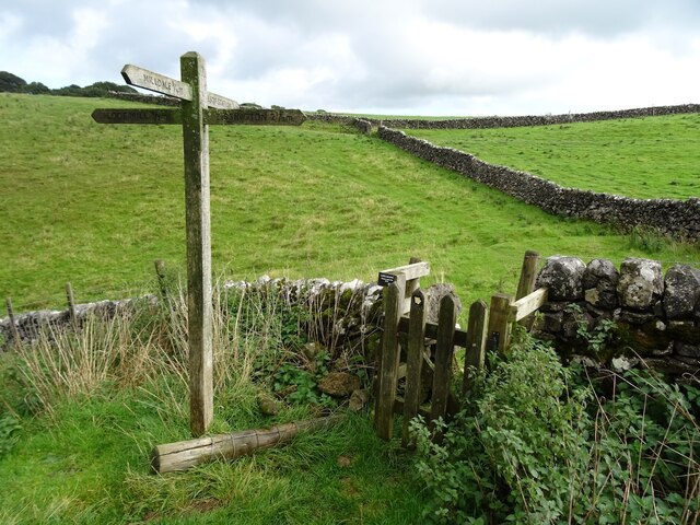
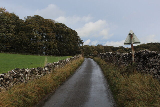
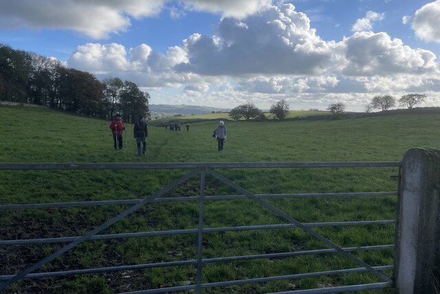
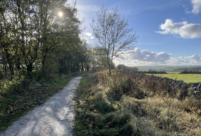
The site is easily accessible, with well-maintained footpaths leading visitors through the barrows and hillfort. Interpretive signage provides information about the history and significance of each feature, enhancing the visitor experience.

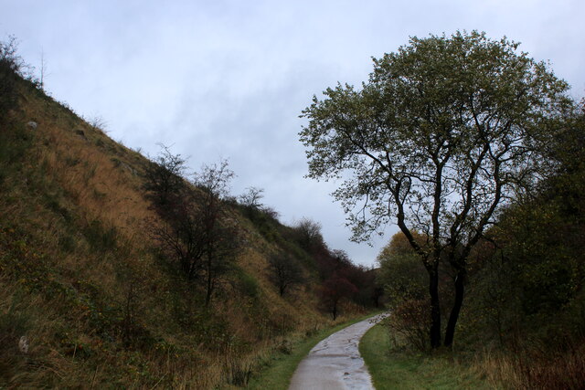
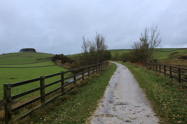
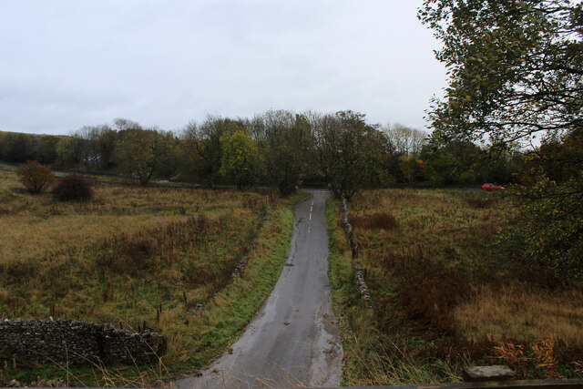
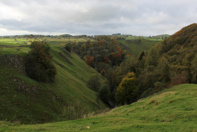
Cross Low is not only a site of archaeological significance but also a place of natural beauty. The rolling hills and scenic views make it a popular spot for walking and enjoying the outdoors. The site is also home to a diverse range of flora and fauna, adding to its ecological importance.

Overall, Cross Low in Derbyshire is a fascinating heritage site, offering a unique blend of history, archaeology, and natural beauty. It provides visitors with a chance to explore and appreciate the ancient past while enjoying the tranquil surroundings of the English countryside.

If you have any feedback on the listing, please let us know in the comments section below.

Cross Low Images

Images are sourced within 2km of 53.097/-1.753 or Grid Reference SK1655. Thanks to Geograph Open Source API. All images are credited.

Footpath crossroads According to the finger post, this is where the footpath from Milldale to Alsop Station crosses the footpath from Lode Mill to Tissington.
Footpath crossroads
According to the finger post, this is where the footpath from Milldale to Alsop Station crosses the footpath from Lode Mill to Tissington.
Cutting on the Tissington Trail Section of the leisure trail, popular among cyclists, horse riders and the walking fraternity - once part of the railway link between Buxton and Ashbourne
Cutting on the Tissington Trail
Section of the leisure trail, popular among cyclists, horse riders and the walking fraternity - once part of the railway link between Buxton and Ashbourne
Tissington Trail crossing Liffs Road The former railway heading north towards Johnson's Knoll - topped by a stand of trees.
Tissington Trail crossing Liffs Road
The former railway heading north towards Johnson's Knoll - topped by a stand of trees.
Liffs Road approaching the A515 As seen from the former railway bridge that carries the Tissington Trail across Liffs Road
Liffs Road approaching the A515
As seen from the former railway bridge that carries the Tissington Trail across Liffs Road
Looking towards Greenlowfield and the A515 As seen from the Tissington Trail, slightly to the north of the former Alsop station.
Looking towards Greenlowfield and the A515
As seen from the Tissington Trail, slightly to the north of the former Alsop station.
Countryside near Alsop en le Dale As seen from the Tissington Trail beside Stonepit Plantation
Countryside near Alsop en le Dale
As seen from the Tissington Trail beside Stonepit Plantation
Oxclose Lane Climbing out of the trench of Dovedale towards the A515
Oxclose Lane
Climbing out of the trench of Dovedale towards the A515
Looking over Mill Dale
Entrance to old track leading off the former Ashbourne to Buxton railway line The track gave access to a quarry on the other side of the line
Entrance to old track leading off the former Ashbourne to Buxton railway line
The track gave access to a quarry on the other side of the line
Walkers on the road past Lees Barn The group was on its way to join the Tissington Trail
Walkers on the road past Lees Barn
The group was on its way to join the Tissington Trail
Greenlowfield from the Tissington Trail Semi-detached cottages on the A515
Greenlowfield from the Tissington Trail
Semi-detached cottages on the A515
Alsop en le Dale from the Tissington Trail
The road down to Mill Dale Aptly named 'The Pinch'
The road down to Mill Dale
Aptly named 'The Pinch'
Mill Dale
Mill Dale
The path above Mill Dale After a steep climb up from the village of Milldale, the path here is running east on more level ground towards the A515 and the Tissington Trail
The path above Mill Dale
After a steep climb up from the village of Milldale, the path here is running east on more level ground towards the A515 and the Tissington Trail
Track from Middlehill Farm Crossing the farm track on the public footpath from Parwich.
Track from Middlehill Farm
Crossing the farm track on the public footpath from Parwich.
Field beside Eatondale Wood On the footpath from Parwich walkers are passing Eatondale Wood.
Field beside Eatondale Wood
On the footpath from Parwich walkers are passing Eatondale Wood.
Tissington Trail On the Tissington Trail close to the River Dove.
Tissington Trail
On the Tissington Trail close to the River Dove.
Show me another place!

Cross Low is located at Grid Ref: SK1655 (Lat: 53.097, Lng: -1.753)

Administrative County: Derbyshire

District: Derbyshire Dales

Police Authority: Derbyshire

What 3 Words

///camper.attic.sideburns. Near Newhaven, Derbyshire

Related Wikis

Alsop en le Dale

Alsop en le Dale is a village in Derbyshire, England about 5 miles (8.0 km) north of Ashbourne close to the Staffordshire border, and a mile from Dovedale...

St Michael and All Angels' Church, Alsop-en-le-Dale

St Michael and all Angels' Church, Alsop en le Dale is a Grade II listed parish church in the Church of England in Alsop en le Dale, Derbyshire. ��2�...

Eaton and Alsop

Eaton and Alsop is a civil parish within the Derbyshire Dales district, in the county of Derbyshire, England. Largely rural, Along with the adjacent Newton...

Alsop en le Dale railway station

Alsop en le Dale railway station was opened in 1899 near Alsop en le Dale and Alstonefield, villages in Derbyshire southeast of Buxton. It was on the...

Tissington Trail

The Tissington Trail is a bridleway, footpath and cycleway in Derbyshire, England, along part of the trackbed of the former railway line connecting Ashbourne...

Ashbourne line

The Ashbourne line was a 33+1⁄2 mi (53.9 km) railway from Buxton via Ashbourne to Uttoxeter. It was built by the London and North Western Railway using...

Newton Grange, Derbyshire

Newton Grange is a civil parish in the Derbyshire Dales district of central Derbyshire. For administrative purposes it shares a parish council with the...

Parwich Hall

Parwich Hall is a privately owned 18th-century mansion house at Parwich, near Ashbourne, Derbyshire Dales. It is a Grade II* listed building.The Manor...

Nearby Amenities

Located within 500m of 53.097,-1.753
Barrier: stile
Material: wood
Source: survey;gps
Stile: stepover
Lat/Long: 53.0983282/-1.7496086
Barrier: stile
Lat/Long: 53.0971308/-1.7479841
Generator Method: photovoltaic
Generator Output Electricity: yes
Generator Source: solar
Generator Type: solar_photovoltaic_panel
Location: roof
Power: generator
Lat/Long: 53.0976809/-1.7562917
The data included in this document is from www.openstreetmap.org. The data is made available under ODbL.

Have you been to Cross Low?

Leave your review of Cross Low below (or comments, questions and feedback).