Eatondale Wood

Wood, Forest in Derbyshire Derbyshire Dales

England

Eatondale Wood

Cutting on the Tissington Trail Section of the leisure trail, popular among cyclists, horse riders and the walking fraternity - once part of the railway link between Buxton and Ashbourne
Cutting on the Tissington Trail Credit: Chris Heaton

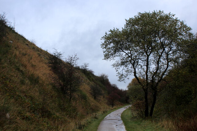
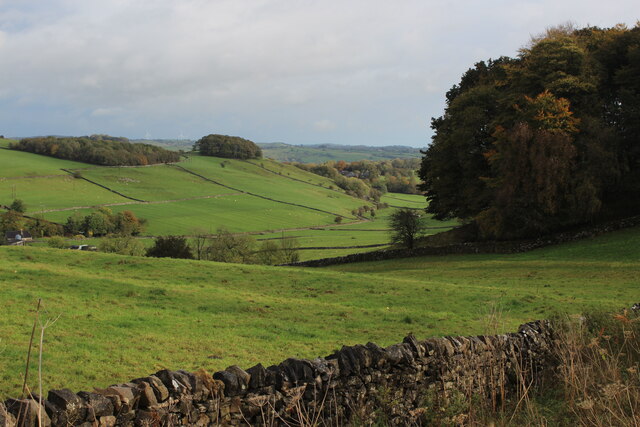
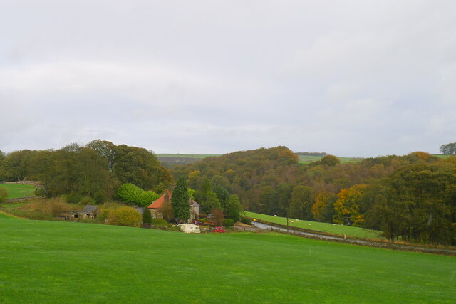
Eatondale Wood is a picturesque forest located in Derbyshire, England. Covering an area of approximately 100 acres, this woodland is known for its outstanding natural beauty and diverse ecosystem. Situated near the village of Eatondale, the wood is easily accessible and attracts visitors from both local and international communities.

The wood is characterized by a variety of tree species, including oak, beech, ash, and birch, which create a dense canopy and provide a habitat for numerous wildlife species. The forest floor is carpeted with a rich undergrowth of ferns, bluebells, and wildflowers, creating a vibrant and colorful landscape during the spring and summer months.

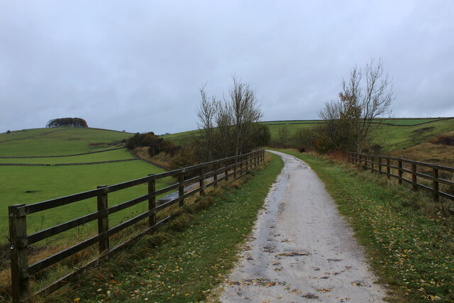
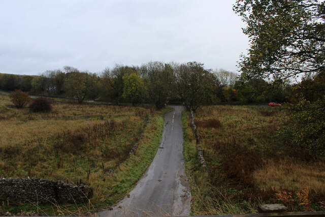
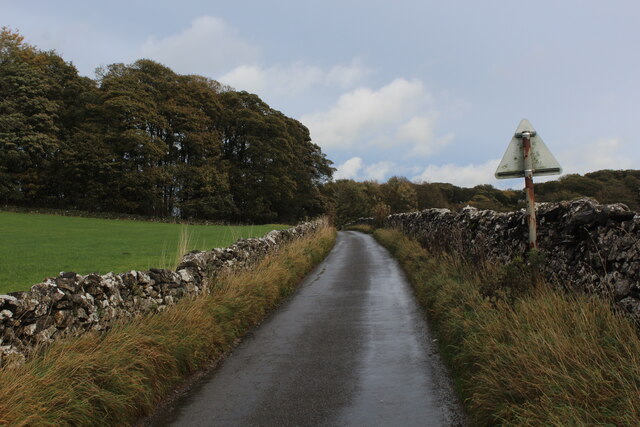
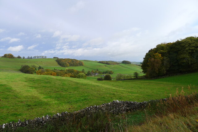
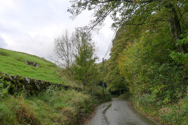
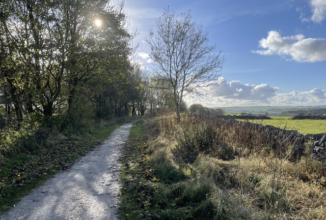
Several walking trails wind through the wood, providing ample opportunities for visitors to explore and immerse themselves in nature. The paths meander along babbling brooks and through quiet glades, offering a sense of tranquility and serenity. Birdwatchers will delight in the abundance of avian species, from woodpeckers to owls, that call Eatondale Wood their home.

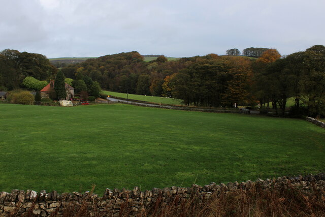
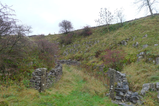
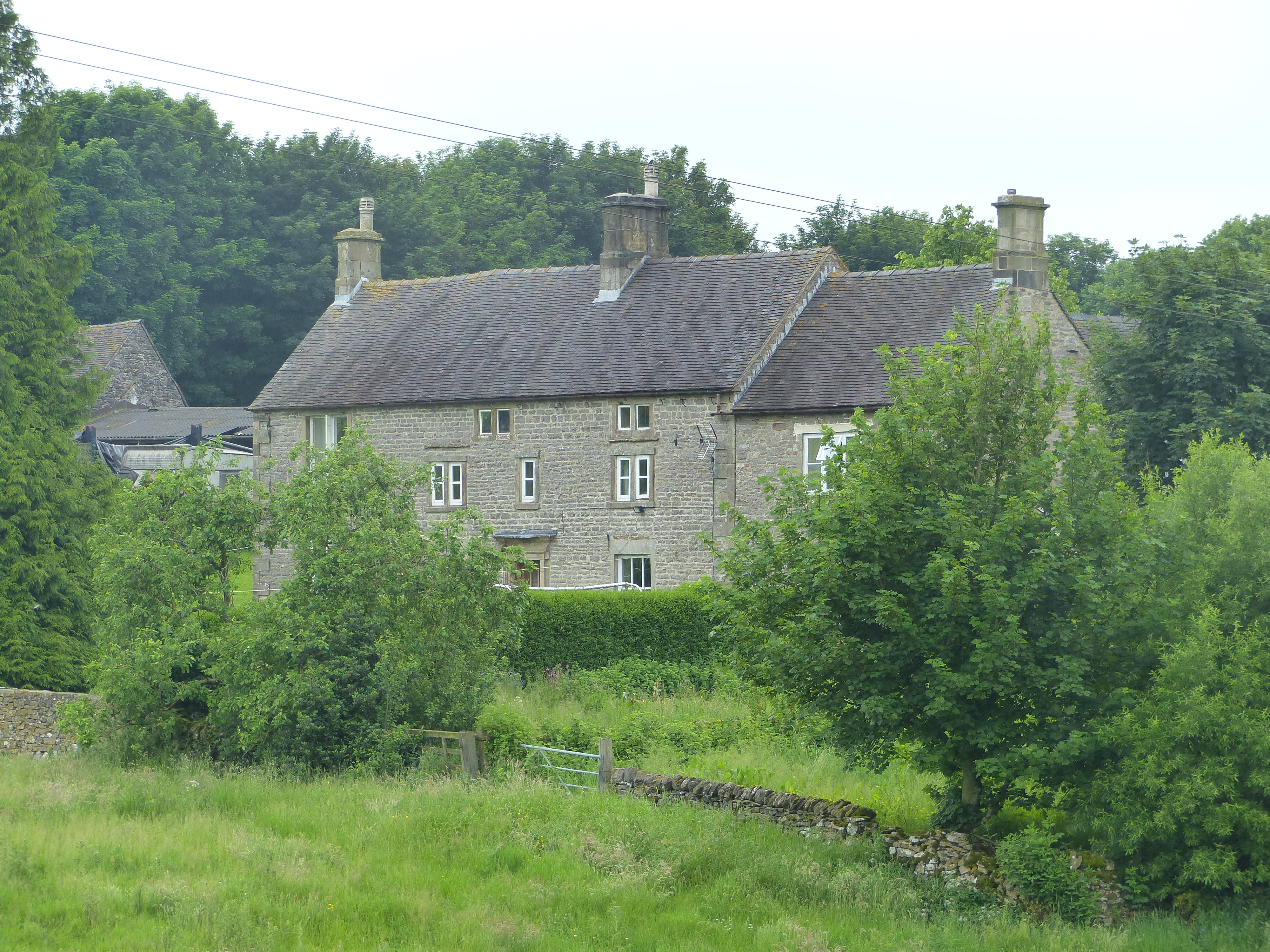
The wood is also home to a variety of mammals, such as deer, foxes, and badgers, making it a popular spot for wildlife enthusiasts and photographers. In addition to its natural beauty, Eatondale Wood has historical significance, with remnants of old stone walls and ancient ruins scattered throughout the area.

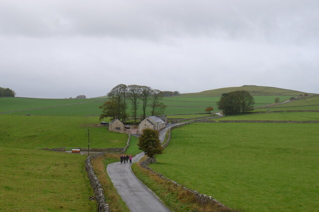
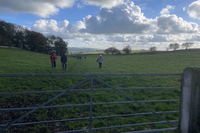
Overall, Eatondale Wood is a cherished natural gem in Derbyshire, offering visitors a peaceful retreat from the hustle and bustle of everyday life. Whether one is seeking a leisurely stroll, wildlife spotting, or simply a place to connect with nature, this enchanting woodland is sure to deliver a memorable experience.

If you have any feedback on the listing, please let us know in the comments section below.

Eatondale Wood Images

Images are sourced within 2km of 53.09978/-1.751309 or Grid Reference SK1655. Thanks to Geograph Open Source API. All images are credited.

Cutting on the Tissington Trail Section of the leisure trail, popular among cyclists, horse riders and the walking fraternity - once part of the railway link between Buxton and Ashbourne
Cutting on the Tissington Trail
Section of the leisure trail, popular among cyclists, horse riders and the walking fraternity - once part of the railway link between Buxton and Ashbourne
Tissington Trail crossing Liffs Road The former railway heading north towards Johnson's Knoll - topped by a stand of trees.
Tissington Trail crossing Liffs Road
The former railway heading north towards Johnson's Knoll - topped by a stand of trees.
Liffs Road approaching the A515 As seen from the former railway bridge that carries the Tissington Trail across Liffs Road
Liffs Road approaching the A515
As seen from the former railway bridge that carries the Tissington Trail across Liffs Road
Looking towards Greenlowfield and the A515 As seen from the Tissington Trail, slightly to the north of the former Alsop station.
Looking towards Greenlowfield and the A515
As seen from the Tissington Trail, slightly to the north of the former Alsop station.
Countryside near Alsop en le Dale As seen from the Tissington Trail beside Stonepit Plantation
Countryside near Alsop en le Dale
As seen from the Tissington Trail beside Stonepit Plantation
Oxclose Lane Climbing out of the trench of Dovedale towards the A515
Oxclose Lane
Climbing out of the trench of Dovedale towards the A515
Entrance to old track leading off the former Ashbourne to Buxton railway line The track gave access to a quarry on the other side of the line
Entrance to old track leading off the former Ashbourne to Buxton railway line
The track gave access to a quarry on the other side of the line
Walkers on the road past Lees Barn The group was on its way to join the Tissington Trail
Walkers on the road past Lees Barn
The group was on its way to join the Tissington Trail
Greenlowfield from the Tissington Trail Semi-detached cottages on the A515
Greenlowfield from the Tissington Trail
Semi-detached cottages on the A515
Alsop en le Dale from the Tissington Trail
The road down to Mill Dale Aptly named 'The Pinch'
The road down to Mill Dale
Aptly named 'The Pinch'
Track from Middlehill Farm Crossing the farm track on the public footpath from Parwich.
Track from Middlehill Farm
Crossing the farm track on the public footpath from Parwich.
Field beside Eatondale Wood On the footpath from Parwich walkers are passing Eatondale Wood.
Field beside Eatondale Wood
On the footpath from Parwich walkers are passing Eatondale Wood.
Tissington Trail On the Tissington Trail close to the River Dove.
Tissington Trail
On the Tissington Trail close to the River Dove.
Tissington Trail Fine views looking northwards on the Tissington Trail near Alsop en le Dale.
Tissington Trail
Fine views looking northwards on the Tissington Trail near Alsop en le Dale.
Approaching bridge On the Tissington Trail with walkers approaching a bridge carrying the A515 over the trail.
Approaching bridge
On the Tissington Trail with walkers approaching a bridge carrying the A515 over the trail.
Tissington Trail The former railway line is a popular walking and cycling trail.
Tissington Trail
The former railway line is a popular walking and cycling trail.
Shallow cutting on Tissington Trail
Show me another place!

Eatondale Wood is located at Grid Ref: SK1655 (Lat: 53.09978, Lng: -1.751309)

Administrative County: Derbyshire

District: Derbyshire Dales

Police Authority: Derbyshire

What 3 Words

///novels.tinted.tooth. Near Newhaven, Derbyshire

Related Wikis

Alsop en le Dale

Alsop en le Dale is a village in Derbyshire, England about 5 miles (8.0 km) north of Ashbourne close to the Staffordshire border, and a mile from Dovedale...

St Michael and All Angels' Church, Alsop-en-le-Dale

St Michael and all Angels' Church, Alsop en le Dale is a Grade II listed parish church in the Church of England in Alsop en le Dale, Derbyshire. ��2�...

Eaton and Alsop

Eaton and Alsop is a civil parish within the Derbyshire Dales district, in the county of Derbyshire, England. Largely rural, Along with the adjacent Newton...

Alsop en le Dale railway station

Alsop en le Dale railway station was opened in 1899 near Alsop en le Dale and Alstonefield, villages in Derbyshire southeast of Buxton. It was on the...

Tissington Trail

The Tissington Trail is a bridleway, footpath and cycleway in Derbyshire, England, along part of the trackbed of the former railway line connecting Ashbourne...

Ashbourne line

The Ashbourne line was a 33+1⁄2 mi (53.9 km) railway from Buxton via Ashbourne to Uttoxeter. It was built by the London and North Western Railway using...

Parwich Hall

Parwich Hall is a privately owned 18th-century mansion house at Parwich, near Ashbourne, Derbyshire Dales. It is a Grade II* listed building.The Manor...

Newton Grange, Derbyshire

Newton Grange is a civil parish in the Derbyshire Dales district of central Derbyshire. For administrative purposes it shares a parish council with the...

Nearby Amenities

Located within 500m of 53.09978,-1.751309
Barrier: stile
Material: wood
Source: survey;gps
Stile: stepover
Lat/Long: 53.0983282/-1.7496086
Barrier: stile
Lat/Long: 53.0971308/-1.7479841
Generator Method: photovoltaic
Generator Output Electricity: yes
Generator Source: solar
Generator Type: solar_photovoltaic_panel
Location: roof
Power: generator
Lat/Long: 53.0976809/-1.7562917
The data included in this document is from www.openstreetmap.org. The data is made available under ODbL.

Have you been to Eatondale Wood?

Leave your review of Eatondale Wood below (or comments, questions and feedback).