Spittal Wood

Wood, Forest in Dunbartonshire

Scotland

Spittal Wood

Path on Ben Bowie A way through the trees from the forest road.
Path on Ben Bowie Credit: Richard Webb

Spittal Wood is a picturesque woodland located in Dunbartonshire, Scotland. Covering an area of approximately 250 hectares, it is a popular destination for nature enthusiasts and outdoor adventurers alike. The wood is situated near the village of Spittal, hence its name.

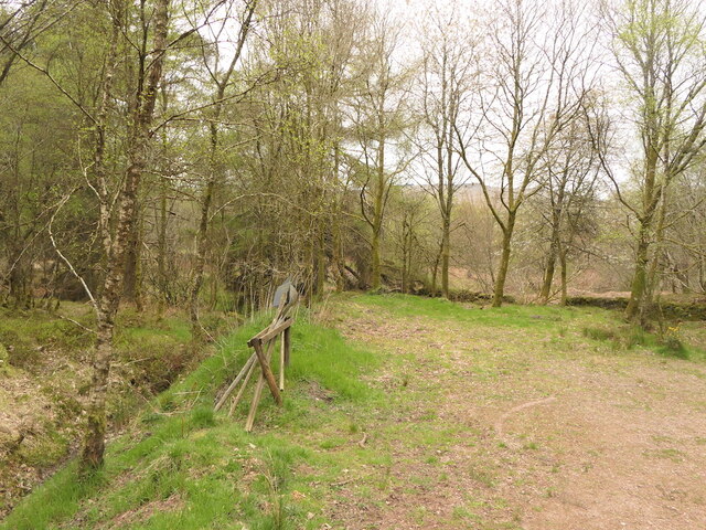
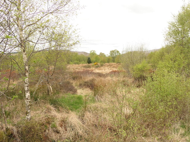
The wood is predominantly composed of native broadleaf trees, including oak, birch, and ash, which create a diverse and vibrant ecosystem. The dense canopy provides shelter for a variety of wildlife species, such as red squirrels, deer, and a range of bird species. Birdwatchers often visit the wood to catch a glimpse of rare and migratory birds.

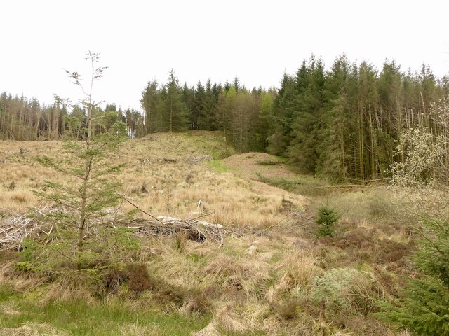
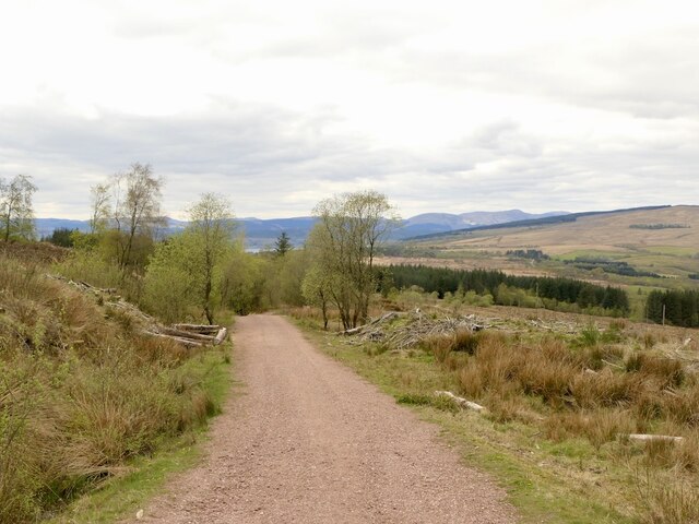
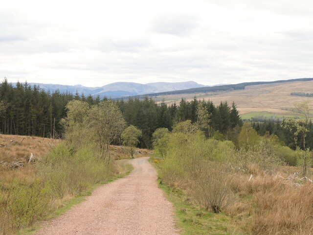
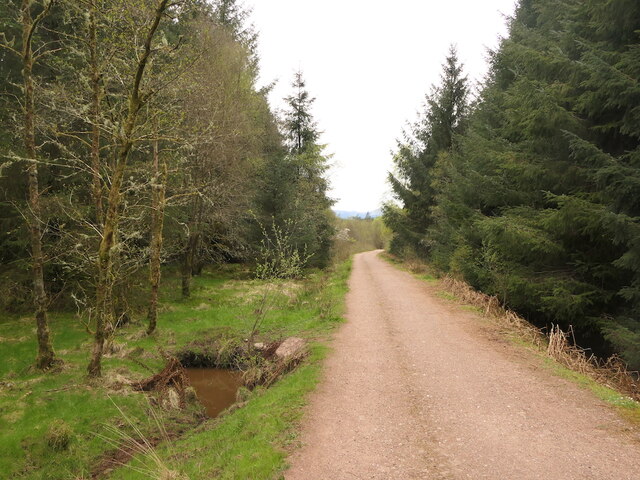
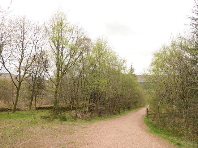
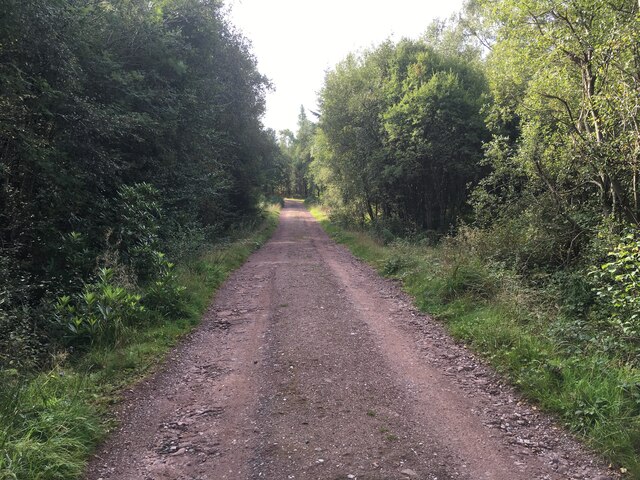
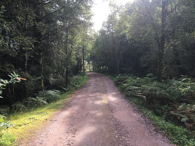
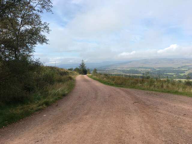
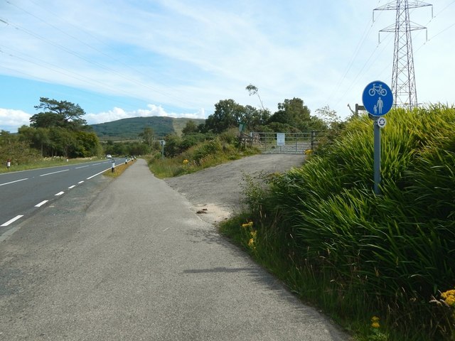
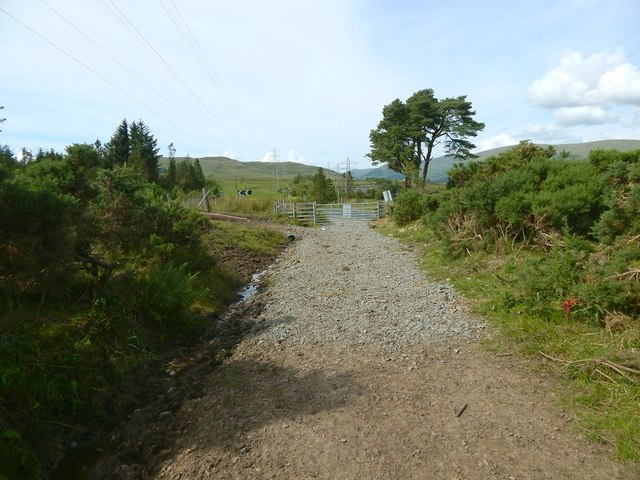
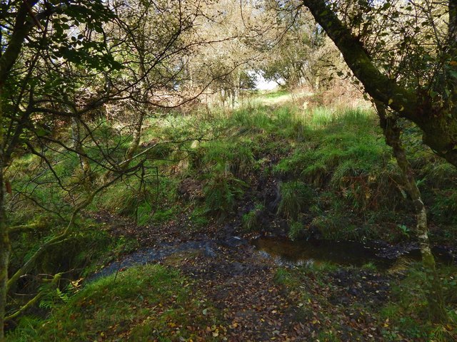
Spittal Wood offers a network of well-maintained trails that wind through the forest, providing visitors with the opportunity to explore its natural beauty. The paths meander through tranquil glades, over babbling streams, and up gentle hills, offering stunning views of the surrounding countryside.

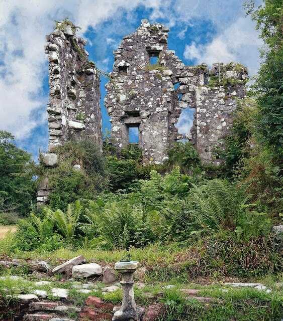
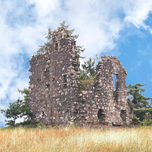
In addition to its natural attractions, Spittal Wood is also home to several historical features. The remnants of ancient settlements and burial sites can be found scattered throughout the wood, serving as a testament to its rich history.

Visitors to Spittal Wood can enjoy a wide range of activities, including walking, cycling, picnicking, and birdwatching. The wood is a peaceful retreat where visitors can escape the hustle and bustle of daily life and immerse themselves in the beauty of nature. Overall, Spittal Wood is a must-visit destination for those seeking a serene and captivating woodland experience in Dunbartonshire.

If you have any feedback on the listing, please let us know in the comments section below.
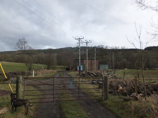
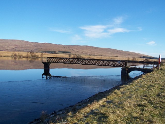
Spittal Wood Images

Images are sourced within 2km of 56.027896/-4.6776734 or Grid Reference NS3384. Thanks to Geograph Open Source API. All images are credited.

Path on Ben Bowie A way through the trees from the forest road.
Path on Ben Bowie
A way through the trees from the forest road.
Forest road, Bannachra Muir
Bannachra Woods The edge of the plantations on Bannachra Muir.
Bannachra Woods
The edge of the plantations on Bannachra Muir.
Forest road, Bannachra On the edge of the plantations with very rough and boggy land, partly wooded between here and the main road.
Forest road, Bannachra
On the edge of the plantations with very rough and boggy land, partly wooded between here and the main road.
Bannachra Wood Birch colonising a boggy area.
Bannachra Wood
Birch colonising a boggy area.
Bannachra Castle Bannachra Castle was built by the Colquhouns sometime after they acquired the associated lands in 1512, presumably on the site of the principal building of the previous owners, the Galbraiths. In 1592 it was attacked and taken by the MacGregors who killed Sir Humphrey Colquhoun with an arrow fired through a stair window.

N.B Bannachra Castle is situated within the private garden of the owner of Bannachra Estate. The owner granted me permission to visit the castle and he accompanied me as I photographed the castle from various angles.

Other image of Bannachra Castle <a title="https://www.geograph.org.uk/photo/7549868" href="https://www.geograph.org.uk/photo/7549868">Link</a>
Bannachra Castle
Bannachra Castle was built by the Colquhouns sometime after they acquired the associated lands in 1512, presumably on the site of the principal building of the previous owners, the Galbraiths. In 1592 it was attacked and taken by the MacGregors who killed Sir Humphrey Colquhoun with an arrow fired through a stair window. N.B Bannachra Castle is situated within the private garden of the owner of Bannachra Estate. The owner granted me permission to visit the castle and he accompanied me as I photographed the castle from various angles. Other image of Bannachra Castle Link
Bannachra Castle Bannachra Castle was built by the Colquhouns sometime after they acquired the associated lands in 1512, presumably on the site of the principal building of the previous owners, the Galbraiths. In 1592 it was attacked and taken by the MacGregors who killed Sir Humphrey Colquhoun with an arrow fired through a stair window.

N.B Bannachra Castle is situated within the private garden of the owner of Bannachra Estate. The owner granted me permission to visit the castle and he accompanied me as I photographed the castle from various angles.

Other image of Bannachra Castle <a title="https://www.geograph.org.uk/photo/7545894" href="https://www.geograph.org.uk/photo/7545894">Link</a>
Bannachra Castle
Bannachra Castle was built by the Colquhouns sometime after they acquired the associated lands in 1512, presumably on the site of the principal building of the previous owners, the Galbraiths. In 1592 it was attacked and taken by the MacGregors who killed Sir Humphrey Colquhoun with an arrow fired through a stair window. N.B Bannachra Castle is situated within the private garden of the owner of Bannachra Estate. The owner granted me permission to visit the castle and he accompanied me as I photographed the castle from various angles. Other image of Bannachra Castle Link
Forestry road, Bannachra Woods
Forestry road, Bannachra Muir
Fields between Helensburgh and Loch Lomond Seen from an altitude of 1886 m on the descent to Glasgow airport on Icelandair flight FI430.
Fields between Helensburgh and Loch Lomond
Seen from an altitude of 1886 m on the descent to Glasgow airport on Icelandair flight FI430.
The start of Old Luss Road Luss Road is on the left.

On the right is the northern end of Old Luss Road, which is a right of way.

The footpath/cycle route sign, and the small marker below it, which is for the John Muir Way, do not refer to that path, but to the pavement that continues straight ahead.

As the map shows, the start of Old Luss Road is opposite the start of a road that leads through Glen Fruin.
The start of Old Luss Road
Luss Road is on the left. On the right is the northern end of Old Luss Road, which is a right of way. The footpath/cycle route sign, and the small marker below it, which is for the John Muir Way, do not refer to that path, but to the pavement that continues straight ahead. As the map shows, the start of Old Luss Road is opposite the start of a road that leads through Glen Fruin.
Old Luss Road Comparison with an earlier picture (<a href="https://www.geograph.org.uk/photo/2407412">NS3184 : Old Luss Road</a>) reveals that this part of the path has been resurfaced, presumably for vehicles that were employed in the refurbishment of the overhead lines.
Old Luss Road
Comparison with an earlier picture (NS3184 : Old Luss Road) reveals that this part of the path has been resurfaced, presumably for vehicles that were employed in the refurbishment of the overhead lines.
The upper end of Garrawy Glen This is the north-eastern end of the glen, which might be said to begin here: upstream of this point, the burn merely flows through a narrow channel.
The upper end of Garrawy Glen
This is the north-eastern end of the glen, which might be said to begin here: upstream of this point, the burn merely flows through a narrow channel.
Wildlife at Fruin Farm This was, until recently, Meikle Dumfin Farm (the name that appeared on the map when this picture was submitted). It has been renamed Fruin Farm; there is a farm shop and a restaurant here.
Wildlife at Fruin Farm
This was, until recently, Meikle Dumfin Farm (the name that appeared on the map when this picture was submitted). It has been renamed Fruin Farm; there is a farm shop and a restaurant here.
Electricity sub-station by the Fruin Water
Show me another place!

Spittal Wood is located at Grid Ref: NS3384 (Lat: 56.027896, Lng: -4.6776734)

Unitary Authority: Argyll and Bute

Police Authority: Argyll and West Dunbartonshire

What 3 Words

///rally.guideline.unlisted. Near Helensburgh, Argyll & Bute

Related Wikis

Helensburgh No. 1 Reservoir

The Helensburgh No. 1 reservoir is of the non-impounding variety. It is no longer part of the local water supply system and is used by Helensburgh Angling...

Helensburgh No. 2 Reservoir

The reservoir is of the non-impounding variety. It is no longer part of the local water supply system and is used by Helensburgh Angling Club. The earthen...

Arden, Argyll

Arden is a village on the southwest shore of Loch Lomond in Argyll and Bute, Scotland. == References ==

Hill House, Helensburgh

The Hill House in Helensburgh, Scotland, was created by architects and designers Charles and Margaret Macdonald Mackintosh. The house is an example of...

Nearby Amenities

Located within 500m of 56.027896,-4.6776734
Power: pole
Lat/Long: 56.0269576/-4.6706551
Callendoun
Place: isolated_dwelling
Lat/Long: 56.0269882/-4.6721995
The data included in this document is from www.openstreetmap.org. The data is made available under ODbL.

Have you been to Spittal Wood?

Leave your review of Spittal Wood below (or comments, questions and feedback).