Bannachra Woods

Wood, Forest in Dunbartonshire

Scotland

Bannachra Woods

Grassy summit of Ben Bowie
Grassy summit of Ben Bowie Credit: Steven Brown

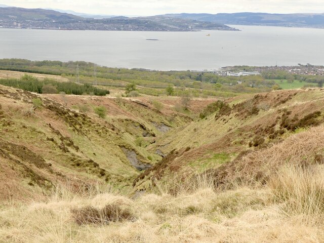
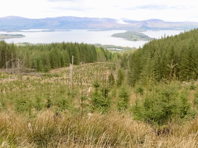
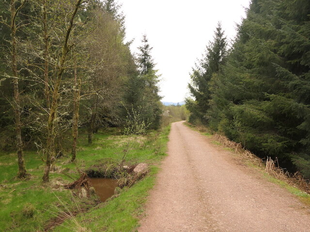
Bannachra Woods is a picturesque woodland located in Dunbartonshire, Scotland. Spanning over an area of approximately 300 hectares, this enchanting forest is a haven for nature lovers and outdoor enthusiasts alike.

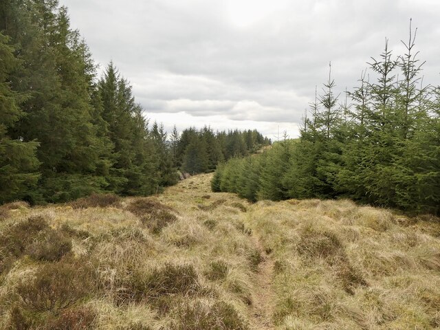
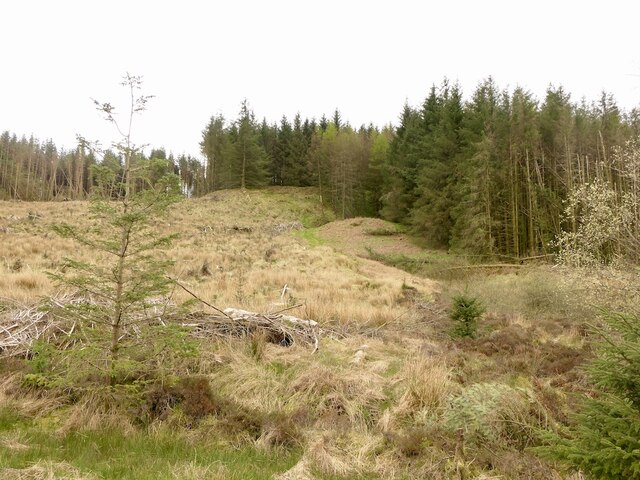
The woods are predominantly composed of native trees, including oak, birch, and rowan, creating a diverse and vibrant ecosystem. The rich variety of flora and fauna found within the woods makes it an important site for conservation.

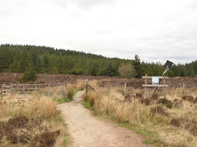
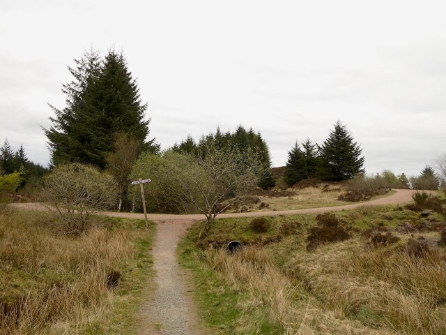
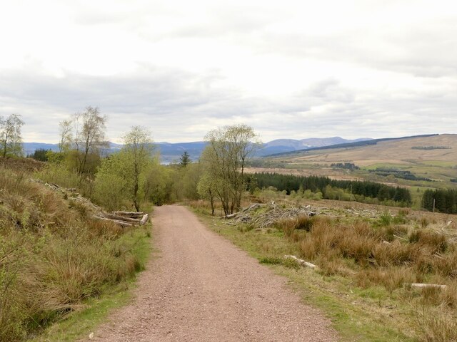
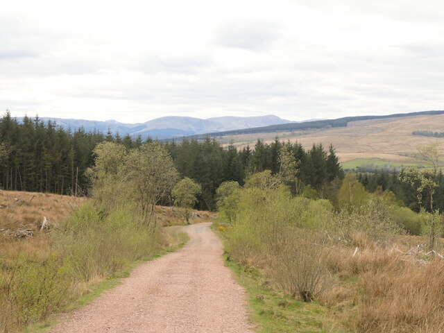
Visitors to Bannachra Woods can enjoy a range of recreational activities such as walking, hiking, and birdwatching. The well-maintained trails crisscross through the forest, providing an immersive experience in nature. Along the way, visitors may encounter a variety of wildlife, including red squirrels, roe deer, and a multitude of bird species.

The tranquil atmosphere of Bannachra Woods offers a peaceful retreat from the hustle and bustle of everyday life. The serene beauty of the forest provides a perfect backdrop for relaxation and contemplation. It is an ideal spot for picnics, family outings, or simply enjoying a leisurely stroll in nature.

The woods also hold historical significance, with remnants of Iron Age settlements and ancient burial grounds scattered throughout the area. This adds an element of intrigue and mystery to the already captivating landscape.

Bannachra Woods is easily accessible, with parking facilities available nearby. Whether you are seeking an escape into nature, an opportunity to explore local history, or simply a day of outdoor adventure, Bannachra Woods offers a truly unforgettable experience.

If you have any feedback on the listing, please let us know in the comments section below.

Bannachra Woods Images

Images are sourced within 2km of 56.020972/-4.6682708 or Grid Reference NS3384. Thanks to Geograph Open Source API. All images are credited.

Grassy summit of Ben Bowie
Red Burn and Killoeter Young forestry on Killoeter.
Red Burn and Killoeter
Young forestry on Killoeter.
Path over Ben Bowie View down towards Helensburgh on the popular Three Lochs Way path to Balloch.
Path over Ben Bowie
View down towards Helensburgh on the popular Three Lochs Way path to Balloch.
The Red Burn View down the Red Burn towards Greenock and the wreck of the Captayanis.
The Red Burn
View down the Red Burn towards Greenock and the wreck of the Captayanis.
Three Lochs Way at the head of the Red Burn Approaching the summit of the pass on Ben Bowie between Craigendoran and Balloch.
Three Lochs Way at the head of the Red Burn
Approaching the summit of the pass on Ben Bowie between Craigendoran and Balloch.
Ben Bowie Hill between Helensburgh and Loch Lomond.
Ben Bowie
Hill between Helensburgh and Loch Lomond.
Woodland edge Col between Ben Bowie and Killoeter.
Woodland edge
Col between Ben Bowie and Killoeter.
Old fence in the forest A former agricultural fence between blocks of trees of differing ages. Often a way can be found through plantations by following old boundaries.
Old fence in the forest
A former agricultural fence between blocks of trees of differing ages. Often a way can be found through plantations by following old boundaries.
Ride, Killoeter Between blocks of different ages, the ride misses the summit of Killoeter by a few prickly metres.
Ride, Killoeter
Between blocks of different ages, the ride misses the summit of Killoeter by a few prickly metres.
Between Ben Bowie and Gowk Hill Coincidently I heard my first cuckoo of the year here. The Three Lochs Way from Helensburgh meets the John Muir Way.
Between Ben Bowie and Gowk Hill
Coincidently I heard my first cuckoo of the year here. The Three Lochs Way from Helensburgh meets the John Muir Way.
Road on Ben Bowie
Road on Ben Bowie
Forestry, Ben Bowie Some windthrow above the road carrying the John Muir Way.
Forestry, Ben Bowie
Some windthrow above the road carrying the John Muir Way.
Bench with a view, Bannachra Muir A view is possible from here now that the trees have been felled.
Bench with a view, Bannachra Muir
A view is possible from here now that the trees have been felled.
View over Loch Lomond Along the Highland Boundary Fault through Loch Lomond. There was a fire near Conic Hill.
View over Loch Lomond
Along the Highland Boundary Fault through Loch Lomond. There was a fire near Conic Hill.
Path on Ben Bowie A way through the trees from the forest road.
Path on Ben Bowie
A way through the trees from the forest road.
Forest road, Bannachra Muir
Show me another place!

Bannachra Woods is located at Grid Ref: NS3384 (Lat: 56.020972, Lng: -4.6682708)

Unitary Authority: Argyll and Bute

Police Authority: Argyll and West Dunbartonshire

What 3 Words

///hamper.magpie.leathers. Near Helensburgh, Argyll & Bute

Related Wikis

Arden, Argyll

Arden is a village on the southwest shore of Loch Lomond in Argyll and Bute, Scotland. == References ==

Dumbarton (district)

Dumbarton (Scottish Gaelic: Dùn Breatainn) was, from 1975 to 1996, one of nineteen local government districts in the Strathclyde region of Scotland, covering...

Helensburgh No. 1 Reservoir

The Helensburgh No. 1 reservoir is of the non-impounding variety. It is no longer part of the local water supply system and is used by Helensburgh Angling...

Helensburgh No. 2 Reservoir

The reservoir is of the non-impounding variety. It is no longer part of the local water supply system and is used by Helensburgh Angling Club. The earthen...

Nearby Amenities

Located within 500m of 56.020972,-4.6682708
Power: pole
Lat/Long: 56.0241925/-4.6713491
Power: pole
Lat/Long: 56.024273/-4.6719427
Power: pole
Lat/Long: 56.0243881/-4.671874
Power: pole
Lat/Long: 56.0244639/-4.6718822
Power: pole
Lat/Long: 56.0245241/-4.6718838
Power: pole
Lat/Long: 56.0246876/-4.6715913
Power: pole
Lat/Long: 56.024977/-4.6709541
Power: pole
Lat/Long: 56.0252327/-4.6703903
Power: pole
Lat/Long: 56.0247104/-4.6719312
Power: pole
Lat/Long: 56.0247935/-4.67174
Power: pole
Lat/Long: 56.0225671/-4.6753292
Power: pole
Lat/Long: 56.0226772/-4.6744638
Power: pole
Lat/Long: 56.0232088/-4.6732966
Power: pole
Lat/Long: 56.0230039/-4.6717167
Power: pole
Lat/Long: 56.0228926/-4.6708115
Power: pole
Lat/Long: 56.0225577/-4.6683326
Power: pole
Lat/Long: 56.0222099/-4.6654179
Power: pole
Lat/Long: 56.022012/-4.6642403
Power: pole
Lat/Long: 56.0218235/-4.6630354
Power: pole
Lat/Long: 56.0216806/-4.6621721
Power: pole
Lat/Long: 56.0221467/-4.6743297
Power: pole
Lat/Long: 56.0216431/-4.6741683
The data included in this document is from www.openstreetmap.org. The data is made available under ODbL.

Have you been to Bannachra Woods?

Leave your review of Bannachra Woods below (or comments, questions and feedback).