Airloch Plantation

Wood, Forest in Ayrshire

Scotland

Airloch Plantation

Stubble field The harvest is done, and there are distant sounds of baling the straw. Just visible are some of the great flock of birds gleaning the remains of the crop.
Stubble field Credit: Jonathan Wilkins

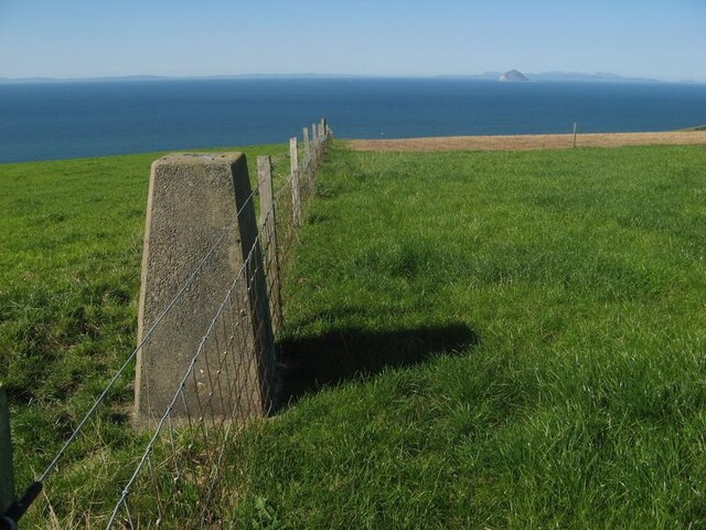
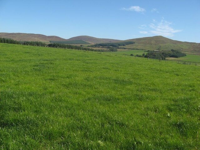
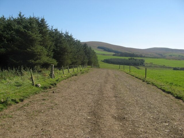
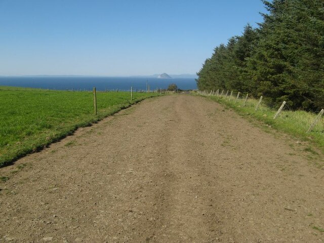
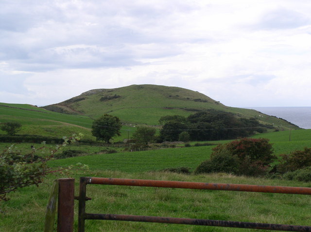
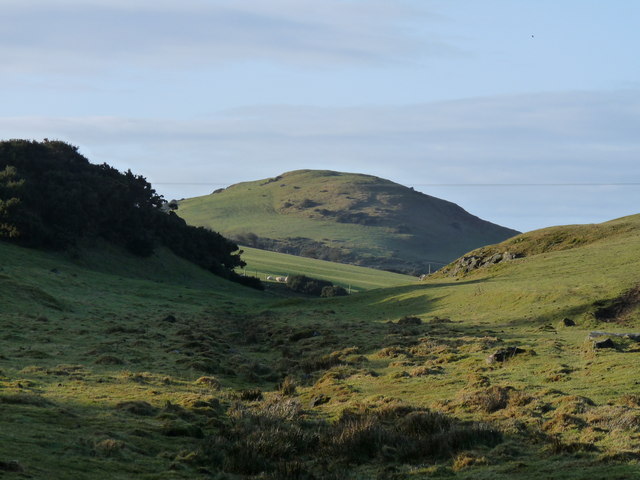
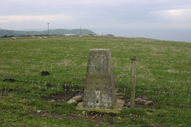
Airloch Plantation is a sprawling woodland located in Ayrshire, Scotland. Covering an area of approximately 100 acres, it is known for its diverse range of trees and enchanting natural beauty. The plantation is nestled in the picturesque countryside, offering visitors a tranquil and idyllic escape from the hustle and bustle of city life.

As one ventures into Airloch Plantation, they are greeted by a mix of native and non-native tree species. Towering Scots pines, oak, beech, and birch trees dominate the landscape, creating a dense canopy that filters sunlight and casts beautiful dappled shadows on the forest floor. The plantation is also home to a variety of wildlife, including deer, squirrels, and an array of bird species.

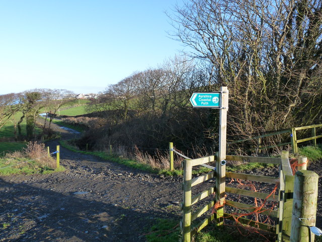
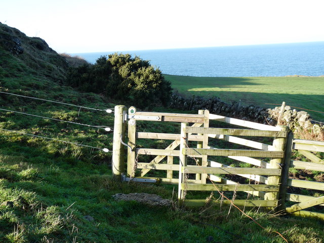
Walking trails wind through the woodland, allowing visitors to explore its hidden corners and discover its natural wonders. These trails offer a wonderful opportunity for nature lovers to immerse themselves in the peaceful ambiance and observe the flora and fauna that call Airloch Plantation their home.

The plantation is open to the public throughout the year, and there are picnic areas and benches scattered throughout, providing the perfect spots to relax and enjoy the surroundings. Additionally, guided tours and educational programs are available, offering visitors the chance to learn about the importance of woodland conservation and management.

Whether it's a leisurely stroll, a family picnic, or an educational outing, Airloch Plantation in Ayrshire is a haven for nature enthusiasts and a testament to the captivating beauty of Scotland's woodlands.

If you have any feedback on the listing, please let us know in the comments section below.

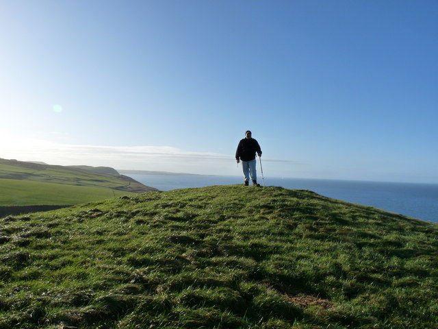
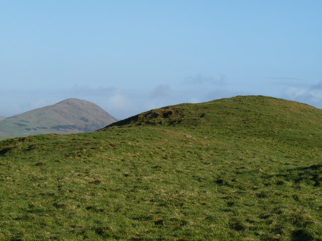
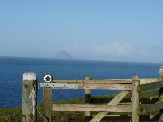
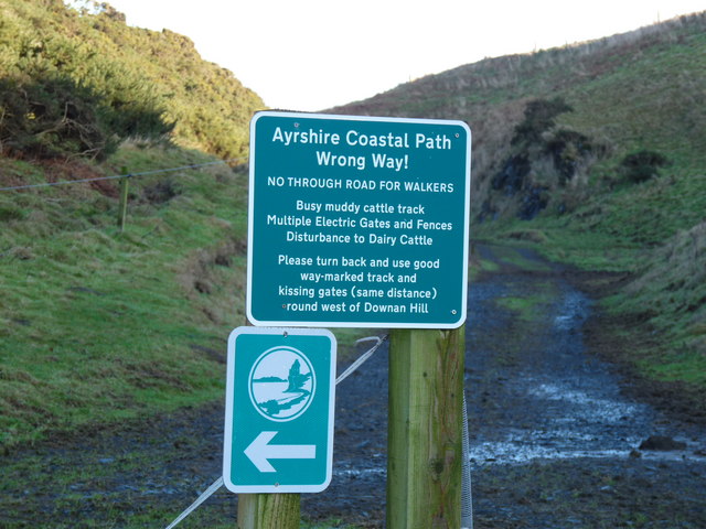
Airloch Plantation Images

Images are sourced within 2km of 55.064473/-5.0112277 or Grid Reference NX0778. Thanks to Geograph Open Source API. All images are credited.

Stubble field The harvest is done, and there are distant sounds of baling the straw. Just visible are some of the great flock of birds gleaning the remains of the crop.
Stubble field
The harvest is done, and there are distant sounds of baling the straw. Just visible are some of the great flock of birds gleaning the remains of the crop.
Farming landscape A view over stubble to Meadow Park and Craigalbert farms.
Farming landscape
A view over stubble to Meadow Park and Craigalbert farms.
Turning the straw Turning barley straw and rowing-up for baling.
Turning the straw
Turning barley straw and rowing-up for baling.
Trig point with fence The triangulation pillar at Girlaverie, which affords a fine view of Ailsa Craig.
Trig point with fence
The triangulation pillar at Girlaverie, which affords a fine view of Ailsa Craig.
Farmed grassland I once heard a commentator refer to the 'emerald desert' of the intensively-cropped grasslands which support beef and dairy cows in southwest Scotland. I get the point, and the ecology is not diverse. Distant, heather moorland on gentle hills provides a contrast.
Farmed grassland
I once heard a commentator refer to the 'emerald desert' of the intensively-cropped grasslands which support beef and dairy cows in southwest Scotland. I get the point, and the ecology is not diverse. Distant, heather moorland on gentle hills provides a contrast.
Cow track (1) Running alongside a conifer plantation is one of many local walking routes for cows to take themselves to milking parlours, guided by fringing electric fences. The track is descending towards the glen of the Ballochdowan Burn.
Cow track (1)
Running alongside a conifer plantation is one of many local walking routes for cows to take themselves to milking parlours, guided by fringing electric fences. The track is descending towards the glen of the Ballochdowan Burn.
Cow track (2) Looking northward to Ailsa Craig along a cattle walking route. See also <a href="https://www.geograph.org.uk/photo/7611731">NX0778 : Cow track (1)</a>.
Cow track (2)
Looking northward to Ailsa Craig along a cattle walking route. See also NX0778 : Cow track (1).
Hawthorn hedge Hedges are not common in this wide, cow-dominated landscape so it is nice to see hawthorn with a good crop of berries.
Hawthorn hedge
Hedges are not common in this wide, cow-dominated landscape so it is nice to see hawthorn with a good crop of berries.
Big Park Farm and sheep The sheep have found a sheltered spot from the harsh easterly wind.
Big Park Farm and sheep
The sheep have found a sheltered spot from the harsh easterly wind.
Downan Hill Hill is right on the coast just south of Ballantrae
Downan Hill
Hill is right on the coast just south of Ballantrae
Downan Hill Ayrshire Coastal Path runs round back of hill.
Downan Hill
Ayrshire Coastal Path runs round back of hill.
Ayrshire Coastal Path Sign pointing towards Downan hill.
Ayrshire Coastal Path
Sign pointing towards Downan hill.
Ayrshire Coastal Path Kissing gate leading round Downan hill.
Ayrshire Coastal Path
Kissing gate leading round Downan hill.
Downan Hill Walker on Summit of Hill.
Downan Hill
Walker on Summit of Hill.
Downan Hill Downan with view of Knockdolian Hill in the distance.
Downan Hill
Downan with view of Knockdolian Hill in the distance.
Ayrshire Coastal Path Kissing gate with a view to the Ailsa Craig.
Ayrshire Coastal Path
Kissing gate with a view to the Ailsa Craig.
Ayrshire Coastal Path Information Sign warning walkers to take correct path.
Ayrshire Coastal Path
Information Sign warning walkers to take correct path.
Girlaverie trig Looking SW from position
Girlaverie trig
Looking SW from position
Show me another place!

Airloch Plantation is located at Grid Ref: NX0778 (Lat: 55.064473, Lng: -5.0112277)

Unitary Authority: South Ayrshire

Police Authority: Ayrshire

What 3 Words

///rainfall.plump.conned. Near Cairnryan, Dumfries & Galloway

Related Wikis

Glenapp Castle

Glenapp Castle, formerly the family seat of the Earl of Inchcape, is now a luxury hotel and restaurant located about 1+1⁄2 miles (2.5 kilometres) southeast...

Ballantrae

Ballantrae is a community in Carrick, South Ayrshire, Scotland. The name probably comes from the Scottish Gaelic Baile na Tràgha, meaning the "town by...

River Stinchar

The River Stinchar ( STIN-shər) is a river in South Ayrshire, Scotland. It flows south west from the Galloway Forest Park to enter the Firth of Clyde at...

Ballantrae Windmill

The Ballantrae Windmill, on Mill Hill was a late 17th or early 18th century vaulted tower windmill, the ruins of which are located above the old raised...

Heronsford

Heronsford is a village located in South Ayrshire, South-West Scotland. == About == Heronsford is a hamlet located near Ballantrae that sits along the...

The Lagafater Estate

Lagafater is a 7000-acre (2832.8 ha) former sporting estate near New Luce in Dumfries and Galloway, Scotland. Since 1910 it has been in the family of its...

Bennane Head

Bennane Head is a tapering piece of land formed of hard rock projecting into the Firth of Clyde, Scotland, at the northern end of Ballantrae Bay, 17 kilometres...

Arecleoch Wind Farm

Arecleoch Wind Farm is a 60 turbine wind farm in South Ayrshire, Scotland with a total capacity of 120 megawatts (MW), enough to power over 67,000 homes...

Nearby Amenities

Located within 500m of 55.064473,-5.0112277
Power: pole
Lat/Long: 55.0687158/-5.0118926
Power: pole
Lat/Long: 55.0680001/-5.011391
Power: pole
Lat/Long: 55.0673028/-5.0108868
Power: pole
Lat/Long: 55.0658652/-5.0098756
Power: pole
Lat/Long: 55.0654014/-5.0085506
Power: pole
Lat/Long: 55.0650235/-5.0073892
Power: pole
Lat/Long: 55.0644998/-5.0057128
Power: pole
Lat/Long: 55.0642294/-5.0047982
Power: pole
Lat/Long: 55.0639576/-5.0038889
The data included in this document is from www.openstreetmap.org. The data is made available under ODbL.

Have you been to Airloch Plantation?

Leave your review of Airloch Plantation below (or comments, questions and feedback).