Caldermoor

Settlement in Lancashire

England

Caldermoor

Hollingworth Lake with the elevated M62 beyond
Hollingworth Lake with the elevated M62 beyond Credit: Colin Pyle

Caldermoor is a small village located in the county of Lancashire, in the northwest of England. Situated amidst the picturesque countryside, it is nestled in the scenic Calder Valley, offering stunning views of rolling hills and lush greenery.

With a population of around 500 residents, Caldermoor maintains a close-knit community atmosphere. The village is characterized by its quaint charm and peaceful ambiance, attracting visitors seeking tranquility and a break from the hustle and bustle of city life.

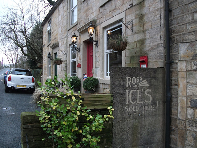
Historically, Caldermoor was primarily an agricultural settlement, and remnants of its rural past can still be seen in the form of traditional farmhouses and barns scattered across the landscape. However, in recent years, the village has also seen some residential development, with modern houses blending seamlessly with the existing architecture.

Although small in size, Caldermoor boasts a number of amenities for its residents and visitors. The village is home to a local pub, The Calder Arms, which serves as a hub for social gatherings and a place to unwind. Additionally, there is a small convenience store providing essential supplies to the community.

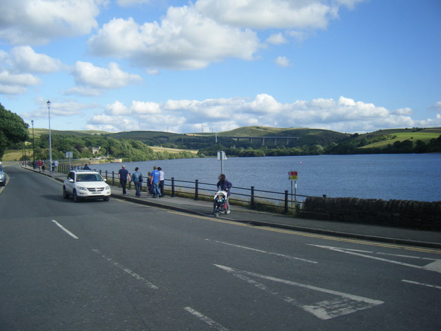
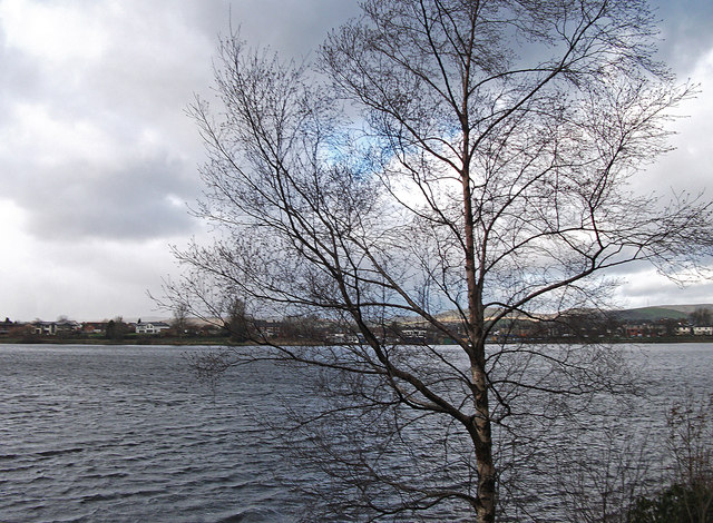
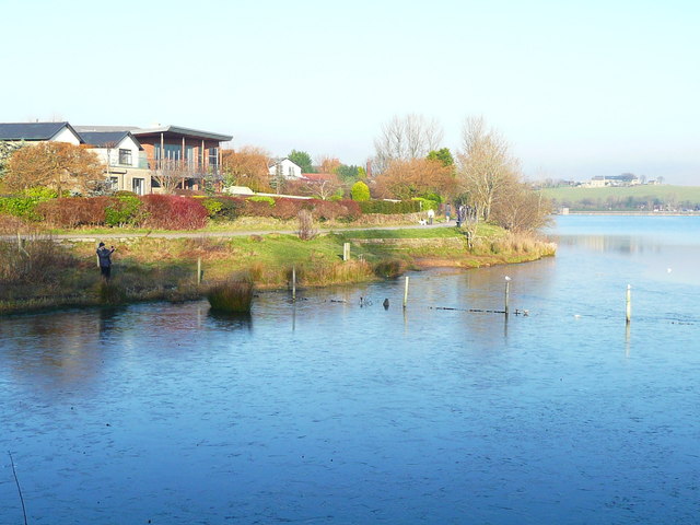
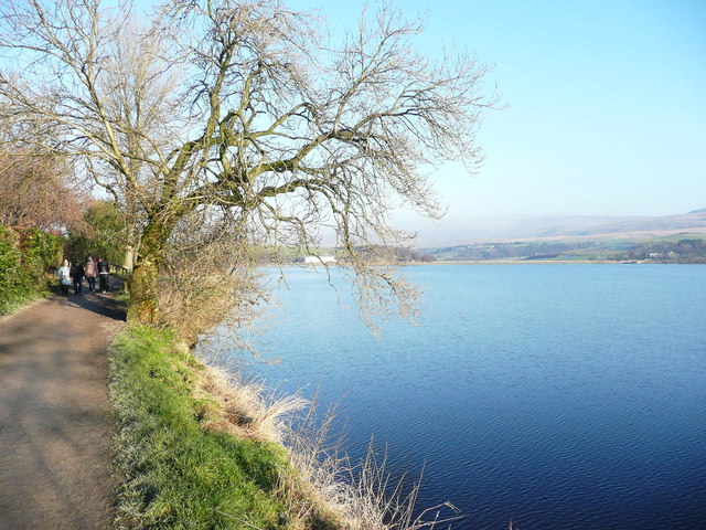
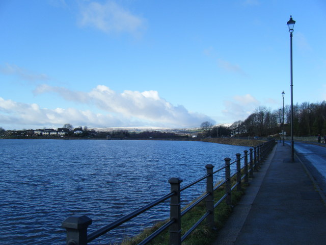
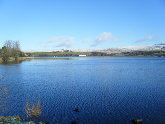
Surrounded by nature, Caldermoor offers numerous opportunities for outdoor activities. The nearby Calder River provides a tranquil setting for fishing and leisurely walks along its banks. The surrounding countryside is also a haven for hikers and nature enthusiasts, with several scenic trails meandering through the rolling hills.

Overall, Caldermoor is a charming and idyllic village that offers a peaceful retreat from the urban lifestyle. It provides a close-knit community, beautiful natural surroundings, and a place to experience the beauty of rural Lancashire.

If you have any feedback on the listing, please let us know in the comments section below.
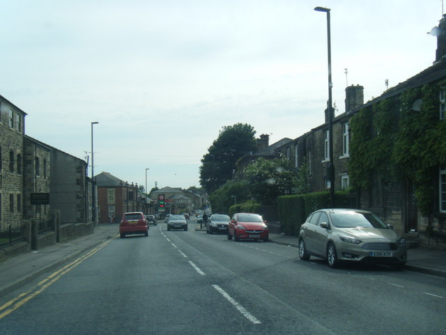
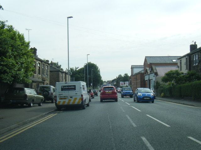
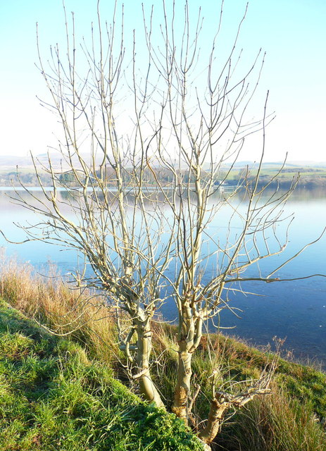
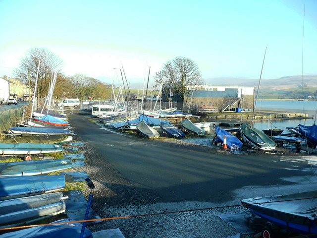
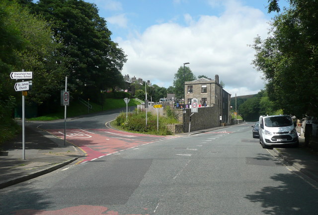
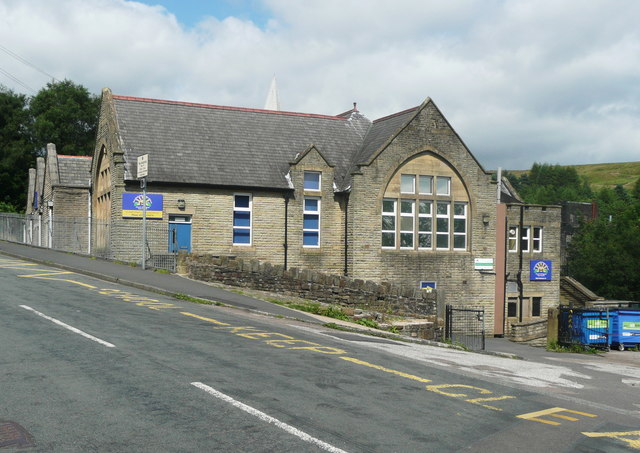
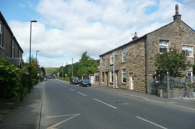
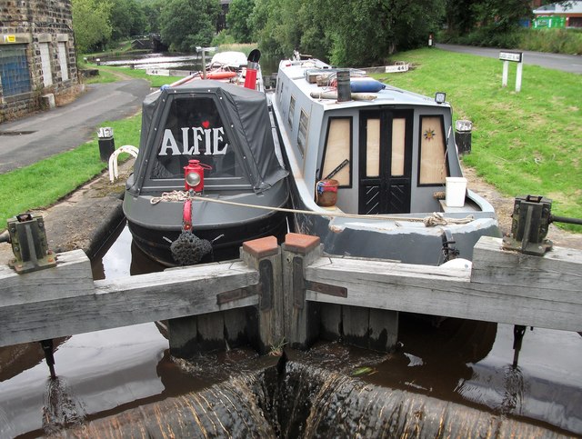
Caldermoor Images

Images are sourced within 2km of 53.646754/-2.105861 or Grid Reference SD9316. Thanks to Geograph Open Source API. All images are credited.

Hollingworth Lake with the elevated M62 beyond
Ross Ices - old ice cream sign
Silver birch at Hollingworth Lake Looking north over the lake from a point near the lakeside café.
Silver birch at Hollingworth Lake
Looking north over the lake from a point near the lakeside café.
Car in the Rochdale Canal Just below Sladen Lock. Makes a change from seeing supermarket trolleys.
Car in the Rochdale Canal
Just below Sladen Lock. Makes a change from seeing supermarket trolleys.
Red car in Rochdale Canal Just below Sladen Lock (between Summit and Littleborough) on a very windy day.
Red car in Rochdale Canal
Just below Sladen Lock (between Summit and Littleborough) on a very windy day.
Hollingworth Lake
Hollingworth Lake
A58 Church Street, Littleborough
A58 New road, Dearnley
Ash tree, Hollingworth Lake There are several trees alongside the lakeside that have been cut about a metre above ground, prompting the production of a large number of thin branches.
Ash tree, Hollingworth Lake
There are several trees alongside the lakeside that have been cut about a metre above ground, prompting the production of a large number of thin branches.
Houses alongside Hollingworth Lake These houses have a good view of the lake, and have access from a residential road behind.
Houses alongside Hollingworth Lake
These houses have a good view of the lake, and have access from a residential road behind.
The lakeside path, Hollingworth Lake
The boat yard, Hollingworth Lake
Rakewood Road and Hollingworth Lake
Hollingworth Lake with snow on the Pennines beyond
The junction of Barnes Meadows with Todmorden Road, Calderbrook The road name looks modern, and a look at the 1:2500 map on 1893 shows only a track. The 1910 edition shows the road, without a name, only as far as the newly built school. Calderbrook Terrace also appears on that map.
The junction of Barnes Meadows with Todmorden Road, Calderbrook
The road name looks modern, and a look at the 1:2500 map on 1893 shows only a track. The 1910 edition shows the road, without a name, only as far as the newly built school. Calderbrook Terrace also appears on that map.
Church of England primary School. Calderbrook. Littleborough This first appears on the 1910 edition of the 1:2500 map.
Church of England primary School. Calderbrook. Littleborough
This first appears on the 1910 edition of the 1:2500 map.
Todmorden Road (A6033) Summit, Littleborough
Rochdale Canal,Lock 44 This is Sladen Lock between Littleborough and Summit. Two narrow boats sharing the water as they climb the flight of locks towards the summit pound.
Rochdale Canal,Lock 44
This is Sladen Lock between Littleborough and Summit. Two narrow boats sharing the water as they climb the flight of locks towards the summit pound.
Show me another place!

Caldermoor is located at Grid Ref: SD9316 (Lat: 53.646754, Lng: -2.105861)

Unitary Authority: Rochdale

Police Authority: Greater Manchester

What 3 Words

///accent.suffer.ideal. Near Littleborough, Manchester

Nearby Locations

Caldermoor Stubley

Related Wikis

Littleborough, Greater Manchester

Littleborough ( LIT-əl-bər-ə) is a town in the Metropolitan Borough of Rochdale, Greater Manchester, England, in the upper Roch Valley by the foothills...

Featherstall Brook

Featherstall Brook is a watercourse in Greater Manchester and a tributary of the River Roch. == Tributaries == Middle Wood Brook Hills Brook

Littleborough and Saddleworth (UK Parliament constituency)

Littleborough and Saddleworth was a parliamentary constituency in Greater Manchester, England. It returned one Member of Parliament (MP) to the House...

Littleborough railway station

Littleborough railway station serves the town of Littleborough in the Metropolitan Borough of Rochdale, Greater Manchester, England. It lies on the Calder...

Nearby Amenities

Located within 500m of 53.646754,-2.105861
Caldermoor
Is In: Littleborough, Rochdale, Greater Manchester, UK
Place: suburb
Source: npe
Lat/Long: 53.6462054/-2.1051563
Bus Stop
Shore Road/Aberley Fold
Bus: yes
Naptan AtcoCode: 1800NE00501
Naptan Bearing: E
Naptan CommonName: Shore Road/Aberley Fold
Naptan Indicator: Factory
Naptan Landmark: FACTORY
Naptan NaptanCode: mandwadt
Naptan PlusbusZoneRef: MNCRPIC
Naptan ShortCommonName: Aberley Fold
Naptan Street: SHORE ROAD
Naptan Verified: no
Network: TfGM
Public Transport: platform
Source: naptan_import
Lat/Long: 53.6499249/-2.1091022
Bus Stop
Shore Road/Kirkstall Avenue
Bus: yes
Naptan AtcoCode: 1800NE02271
Naptan Bearing: SE
Naptan CommonName: Shore Road/Kirkstall Avenue
Naptan Indicator: O/s House 128
Naptan Landmark: HOUSE 84
Naptan NaptanCode: mandwdta
Naptan PlusbusZoneRef: MNCRPIC
Naptan ShortCommonName: Kirkstall Avenue
Naptan Street: SHORE ROAD
Naptan Verified: no
Network: TfGM
Public Transport: platform
Source: naptan_import
Lat/Long: 53.6492565/-2.1067786
Bus Stop
Calderbrook Road/Caldermoor
Bus: yes
Naptan AtcoCode: 1800NE02831
Naptan Bearing: SW
Naptan CommonName: Calderbrook Road/Caldermoor
Naptan Indicator: Waste Ground
Naptan Landmark: HOUSE 6
Naptan NaptanCode: mandwgjw
Naptan PlusbusZoneRef: MNCRPIC
Naptan ShortCommonName: Caldermoor
Naptan Street: Calderbrook Road
Naptan Verified: no
Network: TfGM
Public Transport: platform
Source: naptan_import
Lat/Long: 53.6480481/-2.1008755
Bus Stop
Whalley Avenue/Caldermoor
Bus: yes
Naptan AtcoCode: 1800NE04601
Naptan Bearing: E
Naptan CommonName: Whalley Avenue/Caldermoor
Naptan Indicator: O/s House 50
Naptan Landmark: HOUSE 50
Naptan NaptanCode: mandwjpw
Naptan PlusbusZoneRef: MNCRPIC
Naptan ShortCommonName: Caldermoor
Naptan Street: WHALLEY AVENUE
Naptan Verified: no
Network: TfGM
Public Transport: platform
Source: naptan_import
Lat/Long: 53.6485954/-2.1021627
Bus Stop
Hare Hill Road/Boundary Street
Bus: yes
Naptan AtcoCode: 1800NE24381
Naptan Bearing: NW
Naptan CommonName: Hare Hill Road/Boundary Street
Naptan Indicator: Nr Open Land
Naptan Landmark: HOUSE 49
Naptan NaptanCode: mangamat
Naptan PlusbusZoneRef: MNCRPIC
Naptan ShortCommonName: Boundary Street
Naptan Street: HARE HILL ROAD
Naptan Verified: no
Network: TfGM
Public Transport: platform
Source: naptan_import
Lat/Long: 53.6457753/-2.0993725
Bus Stop
Hare Hill Road/Boundary Street
Bus: yes
Naptan AtcoCode: 1800NE24391
Naptan Bearing: SE
Naptan CommonName: Hare Hill Road/Boundary Street
Naptan Indicator: Library
Naptan Landmark: HARE HILL Park
Naptan NaptanCode: mangamaw
Naptan PlusbusZoneRef: MNCRPIC
Naptan ShortCommonName: Boundary Street
Naptan Street: HARE HILL ROAD
Naptan Verified: no
Network: TfGM
Public Transport: platform
Source: naptan_import
Lat/Long: 53.6463954/-2.0995706
Bus Stop
Calderbrook Road/Caldermoor
Bus: yes
Naptan AtcoCode: 1800NE24401
Naptan Bearing: NE
Naptan CommonName: Calderbrook Road/Caldermoor
Naptan Indicator: O/s House 11
Naptan Landmark: HOUSE 11
Naptan NaptanCode: mangamda
Naptan PlusbusZoneRef: MNCRPIC
Naptan ShortCommonName: Caldermoor
Naptan Street: Calderbrook Road
Naptan Verified: no
Network: TfGM
Public Transport: platform
Source: naptan_import
Lat/Long: 53.6477421/-2.1014194
Bus Stop
Calderbrook Road/Whalley Avenue
Bus: yes
Naptan AtcoCode: 1800NE24411
Naptan Bearing: N
Naptan CommonName: Calderbrook Road/Whalley Avenue
Naptan Indicator: O/s House 51
Naptan Landmark: HOUSE 51
Naptan NaptanCode: mangamdg
Naptan PlusbusZoneRef: MNCRPIC
Naptan ShortCommonName: Whalley Avenue
Naptan Street: Calderbrook Road
Naptan Verified: no
Network: TfGM
Public Transport: platform
Source: naptan_import
Lat/Long: 53.6491811/-2.1003487
Bus Stop
Calderbrook Road/Whalley Avenue
Bus: yes
Naptan AtcoCode: 1800NE24421
Naptan Bearing: S
Naptan CommonName: Calderbrook Road/Whalley Avenue
Naptan Indicator: School
Naptan Landmark: SCHOOL
Naptan NaptanCode: mangamdj
Naptan PlusbusZoneRef: MNCRPIC
Naptan ShortCommonName: Whalley Avenue
Naptan Street: Calderbrook Road
Naptan Verified: no
Network: TfGM
Public Transport: platform
Source: naptan_import
Lat/Long: 53.6493431/-2.1001373
Bus Stop
Shore Road/Caldermoor Post Office
Bus: yes
Naptan AtcoCode: 1800NE24441
Naptan Bearing: NW
Naptan CommonName: Shore Road/Caldermoor Post Office
Naptan Indicator: Opp Hockley Che
Naptan Landmark: HOUSE 1
Naptan NaptanCode: mangamdw
Naptan PlusbusZoneRef: MNCRPIC
Naptan ShortCommonName: Caldermoor PO
Naptan Street: SHORE ROAD
Naptan Verified: no
Network: TfGM
Public Transport: platform
Source: naptan_import
Lat/Long: 53.6476966/-2.1020244
Bus Stop
Shore Road/Furness Avenue
Bus: yes
Naptan AtcoCode: 1800NE24451
Naptan Bearing: E
Naptan CommonName: Shore Road/Furness Avenue
Naptan Indicator: O/s House 44
Naptan Landmark: HOUSE 54
Naptan NaptanCode: mangamga
Naptan PlusbusZoneRef: MNCRPIC
Naptan ShortCommonName: Furness Avenue
Naptan Street: SHORE ROAD
Naptan Verified: no
Network: TfGM
Public Transport: platform
Source: naptan_import
Lat/Long: 53.648279/-2.1042194
Bus Stop
Shore Road/Furness Avenue
Bus: yes
Naptan AtcoCode: 1800NE24461
Naptan Bearing: NW
Naptan CommonName: Shore Road/Furness Avenue
Naptan Indicator: Nr House 22
Naptan Landmark: HOUSE 53
Naptan NaptanCode: mangamgd
Naptan PlusbusZoneRef: MNCRPIC
Naptan ShortCommonName: Furness Avenue
Naptan Street: SHORE ROAD
Naptan Verified: no
Network: TfGM
Public Transport: platform
Source: naptan_import
Lat/Long: 53.648574/-2.106081
Bus Stop
Shore Road/Turf House Close
Bus: yes
Naptan AtcoCode: 1800NE24471
Naptan Bearing: W
Naptan CommonName: Shore Road/Turf House Close
Naptan Indicator: O/s House 11
Naptan Landmark: HOUSE 81
Naptan NaptanCode: mangamgj
Naptan PlusbusZoneRef: MNCRPIC
Naptan ShortCommonName: Turf House Close
Naptan Street: SHORE ROAD
Naptan Verified: no
Network: TfGM
Public Transport: platform
Source: naptan_import
Lat/Long: 53.6497373/-2.1085953
Bus Stop
Shore Road/Ribble Avenue
Bus: yes
Naptan AtcoCode: 1800NE24481
Naptan Bearing: E
Naptan CommonName: Shore Road/Ribble Avenue
Naptan Indicator: War Memorial
Naptan Landmark: HOUSE 1
Naptan NaptanCode: mangamgm
Naptan PlusbusZoneRef: MNCRPIC
Naptan ShortCommonName: Ribble Avenue
Naptan Street: SHORE ROAD
Naptan Verified: no
Network: TfGM
Public Transport: platform
Source: naptan_import
Lat/Long: 53.6494407/-2.1117564
Bus Stop
Shore Road/Ribble Avenue
Bus: yes
Naptan AtcoCode: 1800NE24491
Naptan Bearing: W
Naptan CommonName: Shore Road/Ribble Avenue
Naptan Indicator: O/s House 2
Naptan Landmark: HOUSE 2
Naptan NaptanCode: mangamgp
Naptan PlusbusZoneRef: MNCRPIC
Naptan ShortCommonName: Ribble Avenue
Naptan Street: SHORE ROAD
Naptan Verified: no
Network: TfGM
Public Transport: platform
Source: naptan_import
Lat/Long: 53.6490267/-2.1122546
Bus Stop
Shore Road/Caldermoor Post Office
Bus: yes
Naptan AtcoCode: 1800NE07351
Naptan Bearing: SE
Naptan CommonName: Shore Road/Caldermoor Post Office
Naptan Indicator: Opp Hockley Che
Naptan Landmark: HOUSE 2A
Naptan NaptanCode: mantgtgt
Naptan PlusbusZoneRef: MNCRPIC
Naptan ShortCommonName: Caldermoor PO
Naptan Street: SHORE ROAD
Naptan Verified: no
Network: TfGM
Public Transport: platform
Source: naptan_import
Lat/Long: 53.6477686/-2.1019792
Place Of Worship
St Mary Of The Annunciation R C Church
Addr Housenumber: 40
Addr Postcode: OL15 9DW
Addr Street: Featherstall Road
Religion: christian
Website: http://stmarys.rochdale.dofs.org.uk/
Lat/Long: 53.6424155/-2.104496
Generator Method: photovoltaic
Generator Output Electricity: yes
Generator Source: solar
Generator Type: solar_photovoltaic_panel
Location: roof
Power: generator
Lat/Long: 53.6464859/-2.0998299
Generator Method: photovoltaic
Generator Output Electricity: yes
Generator Source: solar
Generator Type: solar_photovoltaic_panel
Location: roof
Power: generator
Lat/Long: 53.6458025/-2.1120349
Generator Method: photovoltaic
Generator Output Electricity: yes
Generator Source: solar
Generator Type: solar_photovoltaic_panel
Location: roof
Power: generator
Lat/Long: 53.6468031/-2.1025505
Generator Method: photovoltaic
Generator Output Electricity: yes
Generator Source: solar
Generator Type: solar_photovoltaic_panel
Location: roof
Power: generator
Lat/Long: 53.6478808/-2.1029892
Generator Method: photovoltaic
Generator Output Electricity: yes
Generator Source: solar
Generator Type: solar_photovoltaic_panel
Location: roof
Power: generator
Lat/Long: 53.6482392/-2.1032511
Generator Method: photovoltaic
Generator Output Electricity: yes
Generator Source: solar
Generator Type: solar_photovoltaic_panel
Location: roof
Power: generator
Lat/Long: 53.646165/-2.1011188
Generator Method: photovoltaic
Generator Output Electricity: yes
Generator Source: solar
Generator Type: solar_photovoltaic_panel
Location: roof
Power: generator
Lat/Long: 53.6481848/-2.1014502
Generator Method: photovoltaic
Generator Output Electricity: yes
Generator Source: solar
Generator Type: solar_photovoltaic_panel
Location: roof
Power: generator
Lat/Long: 53.6431798/-2.1099692
Barrier: lift_gate
Lat/Long: 53.6443841/-2.1015813
Barrier: yes
Lat/Long: 53.6431218/-2.1014791
Bus Stop
Laburnum Way
Bus: yes
Naptan AtcoCode: 1800NEH2851
Naptan Bearing: SE
Naptan CommonName: Laburnum Way
Naptan Indicator: SE-bound
Naptan Street: Laburnum Way
Naptan Verified: no
Network: TfGM
Public Transport: platform
Source: naptan;bing;naptan_compare_tool
Lat/Long: 53.6451377/-2.1116587
Bus Stop
Laburnum Way
Bus: yes
Naptan AtcoCode: 1800NEH4511
Naptan Bearing: NW
Naptan CommonName: Laburnum Way
Naptan Indicator: NW-bound
Naptan Street: Laburnum Way
Naptan Verified: no
Network: TfGM
Public Transport: platform
Source: naptan;bing;naptan_compare_tool
Lat/Long: 53.6451006/-2.1117755
Bus Stop
Starring Way
Bus: yes
Naptan AtcoCode: 1800NEH0441
Naptan Bearing: W
Naptan CommonName: Starring Way
Naptan Indicator: W-bound
Naptan Street: Starring Way
Naptan Verified: no
Network: TfGM
Public Transport: platform
Source: naptan;bing;naptan_compare_tool
Lat/Long: 53.6433215/-2.1099168
Bus Stop
Starring Way
Bus: yes
Naptan AtcoCode: 1800NEH4521
Naptan Bearing: E
Naptan CommonName: Starring Way
Naptan Indicator: E-bound
Naptan Street: Starring Way
Naptan Verified: no
Network: TfGM
Public Transport: platform
Source: naptan;bing;naptan_compare_tool
Lat/Long: 53.6434031/-2.1099757
Bus Stop
Lime Grove
Bus: yes
Naptan AtcoCode: 1800NEH2271
Naptan Bearing: SE
Naptan CommonName: Lime Grove
Naptan Indicator: SE-bound
Naptan Street: Lime Grove
Naptan Verified: no
Network: TfGM
Public Transport: platform
Source: naptan;bing;naptan_compare_tool
Lat/Long: 53.6452569/-2.1091177
Bus Stop
Lime Grove
Bus: yes
Naptan AtcoCode: 1800NEH2281
Naptan Bearing: NW
Naptan CommonName: Lime Grove
Naptan Indicator: NW-bound
Naptan Street: Lime Grove
Naptan Verified: no
Network: TfGM
Public Transport: platform
Source: naptan;bing;naptan_compare_tool
Lat/Long: 53.6451856/-2.1091327
Addr City: Littleborough
Addr Housenumber: 54
Addr Postcode: OL15 8ED
Addr Street: Petts Crescent
Lat/Long: 53.6477652/-2.1049177
Addr City: Littleborough
Addr Housenumber: 52
Addr Postcode: OL15 8ED
Addr Street: Petts Crescent
Lat/Long: 53.6478288/-2.104907
Addr City: Littleborough
Addr Housenumber: 20
Addr Postcode: OL15 8ED
Addr Street: Petts Crescent
Lat/Long: 53.6474885/-2.1028256
Addr City: Littleborough
Addr Housenumber: 22
Addr Postcode: OL15 8ED
Addr Street: Petts Crescent
Lat/Long: 53.6475442/-2.1029838
Addr City: Littleborough
Addr Housenumber: 24
Addr Postcode: OL15 8ED
Addr Street: Petts Crescent
Lat/Long: 53.6475617/-2.1030697
Addr City: Littleborough
Addr Housenumber: 26
Addr Postcode: OL15 8ED
Addr Street: Petts Crescent
Lat/Long: 53.6475903/-2.1032252
Addr City: Littleborough
Addr Housenumber: 28
Addr Postcode: OL15 8ED
Addr Street: Petts Crescent
Lat/Long: 53.6476046/-2.1033164
Addr City: Littleborough
Addr Housenumber: 30
Addr Postcode: OL15 8ED
Addr Street: Petts Crescent
Lat/Long: 53.6476332/-2.1034613
Addr City: Littleborough
Addr Housenumber: 32
Addr Postcode: OL15 8ED
Addr Street: Petts Crescent
Lat/Long: 53.6476523/-2.1035471
Addr City: Littleborough
Addr Housenumber: 34
Addr Postcode: OL15 8ED
Addr Street: Petts Crescent
Lat/Long: 53.6476777/-2.1036946
Addr City: Littleborough
Addr Housenumber: 36
Addr Postcode: OL15 8ED
Addr Street: Petts Crescent
Lat/Long: 53.6476936/-2.1037804
Addr City: Littleborough
Addr Housenumber: 38
Addr Postcode: OL15 8ED
Addr Street: Petts Crescent
Lat/Long: 53.6477206/-2.1039494
Addr City: Littleborough
Addr Housenumber: 40
Addr Postcode: OL15 8ED
Addr Street: Petts Crescent
Lat/Long: 53.6477381/-2.1040379
Addr City: Littleborough
Addr Housenumber: 42
Addr Postcode: OL15 8ED
Addr Street: Petts Crescent
Lat/Long: 53.6477604/-2.1041935
Addr City: Littleborough
Addr Housenumber: 44
Addr Postcode: OL15 8ED
Addr Street: Petts Crescent
Lat/Long: 53.6477779/-2.104282
Addr City: Littleborough
Addr Housenumber: 21
Addr Postcode: OL15 8ED
Addr Street: Petts Crescent
Lat/Long: 53.6475632/-2.1043866
Addr City: Littleborough
Addr Housenumber: 19
Addr Postcode: OL15 8ED
Addr Street: Petts Crescent
Lat/Long: 53.6475489/-2.1042927
Addr City: Littleborough
Addr Housenumber: 17
Addr Postcode: OL15 8ED
Addr Street: Petts Crescent
Lat/Long: 53.6475092/-2.1041452
Addr City: Littleborough
Addr Housenumber: 15
Addr Postcode: OL15 8ED
Addr Street: Petts Crescent
Lat/Long: 53.6474965/-2.1040567
Addr City: Littleborough
Addr Housenumber: 13
Addr Postcode: OL15 8ED
Addr Street: Petts Crescent
Lat/Long: 53.6474631/-2.1038904
Addr City: Littleborough
Addr Housenumber: 11
Addr Postcode: OL15 8ED
Addr Street: Petts Crescent
Lat/Long: 53.647444/-2.1037965
Addr City: Littleborough
Addr Housenumber: 9
Addr Postcode: OL15 8ED
Addr Street: Petts Crescent
Lat/Long: 53.6474154/-2.1036356
Addr City: Littleborough
Addr Housenumber: 7
Addr Postcode: OL15 8ED
Addr Street: Petts Crescent
Lat/Long: 53.6473995/-2.1035417
Addr City: Littleborough
Addr Housenumber: 2
Addr Postcode: OL15 8ED
Addr Street: Petts Crescent
Lat/Long: 53.6469941/-2.1029248
Addr City: Littleborough
Addr Housenumber: 4
Addr Postcode: OL15 8ED
Addr Street: Petts Crescent
Lat/Long: 53.6470402/-2.1029114
The data included in this document is from www.openstreetmap.org. The data is made available under ODbL.

Have you been to Caldermoor?

Leave your review of Caldermoor below (or comments, questions and feedback).