Stubley

Settlement in Lancashire

England

Stubley

Hollingworth Lake with the elevated M62 beyond
Hollingworth Lake with the elevated M62 beyond Credit: Colin Pyle

Stubley is a small village located in the county of Lancashire, England. Situated in the picturesque Pennine Hills, it is part of the Metropolitan Borough of Oldham and lies approximately 10 miles northeast of the city of Manchester. With a population of around 1,000 residents, it is considered a close-knit community.

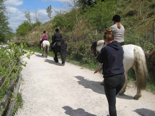
The village is renowned for its stunning natural beauty, surrounded by rolling hills and verdant countryside. It offers a tranquil and idyllic setting, making it a popular destination for those seeking a peaceful retreat from the hustle and bustle of city life. The local landscape provides ample opportunities for outdoor activities such as hiking, cycling, and horseback riding.

Stubley is predominantly a residential area, with a mix of traditional stone-built cottages and more modern houses. The village boasts a few amenities, including a local pub and a small convenience store, catering to the needs of the residents. For a wider range of shopping, dining, and entertainment options, the nearby towns of Oldham and Ashton-under-Lyne are within easy reach.

The village is well-connected to the surrounding areas by road, with major routes such as the A627(M) and the M60 motorway in close proximity. Public transportation options include regular bus services, providing convenient access to neighboring towns and cities.

Overall, Stubley offers a serene and picturesque setting, making it an attractive place to live for those seeking a peaceful and rural lifestyle while still being within commuting distance of larger urban centers.

If you have any feedback on the listing, please let us know in the comments section below.
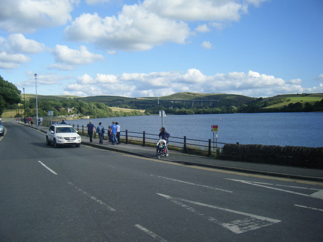
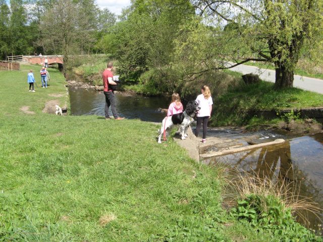
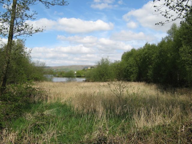
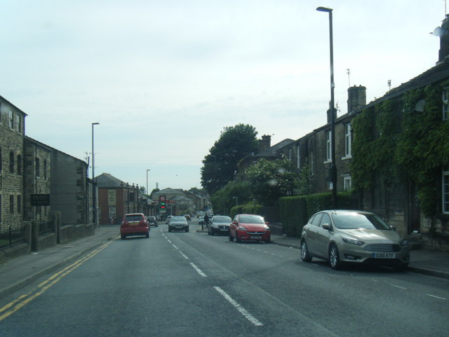
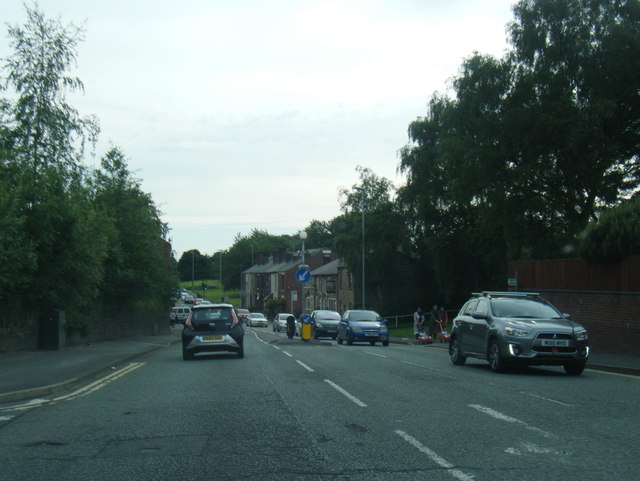
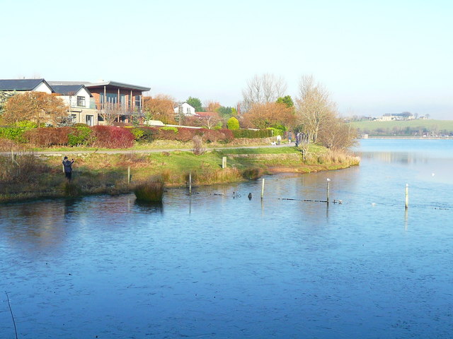
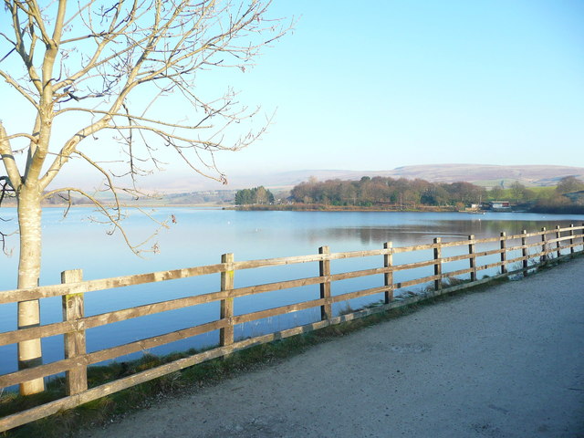
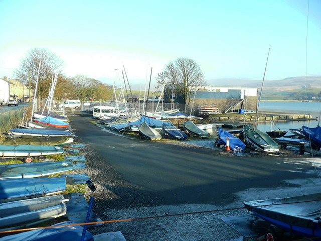
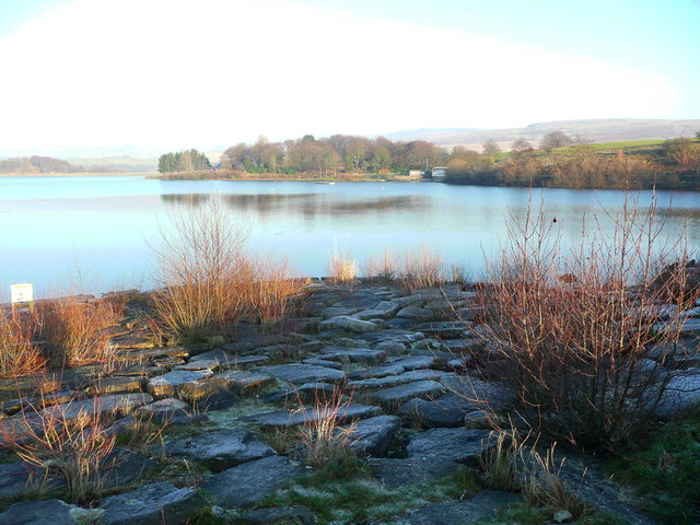
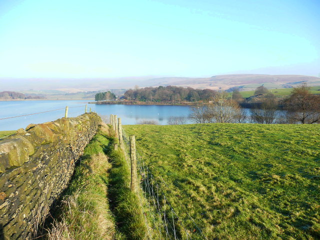
Stubley Images

Images are sourced within 2km of 53.642444/-2.1064181 or Grid Reference SD9316. Thanks to Geograph Open Source API. All images are credited.

Hollingworth Lake with the elevated M62 beyond
Remembrance Sunday 2014 Remembrance Ceremony at the Wardle Memorial Garden, 9 November 2014, with the Wardle Academy Brass Band.

Taken from an upper floor window of the Wardle & Smallbridge Community Centre (former Wardle UDC offices).
Remembrance Sunday 2014
Remembrance Ceremony at the Wardle Memorial Garden, 9 November 2014, with the Wardle Academy Brass Band. Taken from an upper floor window of the Wardle & Smallbridge Community Centre (former Wardle UDC offices).
Silver birch at Hollingworth Lake Looking north over the lake from a point near the lakeside café.
Silver birch at Hollingworth Lake
Looking north over the lake from a point near the lakeside café.
Hollingworth Lake
Hollingworth Lake
Longden End Brook The brook passes over a gauging weir as it approaches Hollingworth Lake, a popular place for swimming dogs, it seems, though my assistant Madog is staying dry for a change.
Longden End Brook
The brook passes over a gauging weir as it approaches Hollingworth Lake, a popular place for swimming dogs, it seems, though my assistant Madog is staying dry for a change.
Wetland view An extensive reed bed is part of the nature reserve at the southern, shallow end of the reservoir, near to the influx of the Longden End Brook.
Wetland view
An extensive reed bed is part of the nature reserve at the southern, shallow end of the reservoir, near to the influx of the Longden End Brook.
Beach view A view of the southern margin of the reservoir, which is mostly shallow.
Beach view
A view of the southern margin of the reservoir, which is mostly shallow.
Equine traffic Horses taking the path around the lake.
Equine traffic
Horses taking the path around the lake.
A58 Church Street, Littleborough
A58 New road, Dearnley
A58 Halifax Road heading west
Ash tree, Hollingworth Lake There are several trees alongside the lakeside that have been cut about a metre above ground, prompting the production of a large number of thin branches.
Ash tree, Hollingworth Lake
There are several trees alongside the lakeside that have been cut about a metre above ground, prompting the production of a large number of thin branches.
Houses alongside Hollingworth Lake These houses have a good view of the lake, and have access from a residential road behind.
Houses alongside Hollingworth Lake
These houses have a good view of the lake, and have access from a residential road behind.
View from the lakeside path, Hollingworth Lake
The lakeside path, Hollingworth Lake
The boat yard, Hollingworth Lake
Rocky shore, Hollingworth Lake Here is a place where you can get down to the edge of the water safely.
Rocky shore, Hollingworth Lake
Here is a place where you can get down to the edge of the water safely.
Footpath to Hollingworth Lake This is part of a network of paths to the south of the lake. It looks to be fairly well used, but strangely there is no stile over the wall where it meets the lakeside path.
Footpath to Hollingworth Lake
This is part of a network of paths to the south of the lake. It looks to be fairly well used, but strangely there is no stile over the wall where it meets the lakeside path.
Show me another place!

Stubley is located at Grid Ref: SD9316 (Lat: 53.642444, Lng: -2.1064181)

Unitary Authority: Rochdale

Police Authority: Greater Manchester

What 3 Words

///monks.vital.feel. Near Littleborough, Manchester

Nearby Locations

Caldermoor Stubley

Related Wikis

Featherstall Brook

Featherstall Brook is a watercourse in Greater Manchester and a tributary of the River Roch. == Tributaries == Middle Wood Brook Hills Brook

Littleborough and Saddleworth (UK Parliament constituency)

Littleborough and Saddleworth was a parliamentary constituency in Greater Manchester, England. It returned one Member of Parliament (MP) to the House...

Littleborough, Greater Manchester

Littleborough ( LIT-əl-bər-ə) is a town in the Metropolitan Borough of Rochdale, Greater Manchester, England, in the upper Roch Valley by the foothills...

Littleborough railway station

Littleborough railway station serves the town of Littleborough in the Metropolitan Borough of Rochdale, Greater Manchester, England. It lies on the Calder...

Nearby Amenities

Located within 500m of 53.642444,-2.1064181
Caldermoor
Is In: Littleborough, Rochdale, Greater Manchester, UK
Place: suburb
Source: npe
Lat/Long: 53.6462054/-2.1051563
Bus Stop
Church Street/Stockton Street
Bus: yes
Naptan AtcoCode: 1800NE49031
Naptan Bearing: W
Naptan CommonName: Church Street/Stockton Street
Naptan Indicator: Opp Ind Estate
Naptan Landmark: HOUSE 121
Naptan NaptanCode: mangdwpj
Naptan PlusbusZoneRef: MNCRPIC
Naptan ShortCommonName: Stockton Street
Naptan Street: CHURCH STREET
Naptan Verified: no
Network: TfGM
Public Transport: platform
Source: naptan_import
Lat/Long: 53.6425561/-2.1009683
Bus Stop
Featherstall Road/Police Station
Bus: yes
Naptan AtcoCode: 1800NE49041
Naptan Bearing: E
Naptan CommonName: Featherstall Road/Police Station
Naptan Indicator: Police Station
Naptan Landmark: HOUSE 6
Naptan NaptanCode: mangdwpm
Naptan PlusbusZoneRef: MNCRPIC
Naptan ShortCommonName: Police Station
Naptan Street: Featherstall Road
Naptan Verified: no
Network: TfGM
Public Transport: platform
Source: naptan_import
Lat/Long: 53.6423933/-2.1021931
Bus Stop
Featherstall Road/Police Station
Bus: yes
Naptan AtcoCode: 1800NE49051
Naptan Bearing: W
Naptan CommonName: Featherstall Road/Police Station
Naptan Indicator: O/s House 41
Naptan Landmark: HOUSE 41
Naptan NaptanCode: mangdwpt
Naptan PlusbusZoneRef: MNCRPIC
Naptan ShortCommonName: Police Station
Naptan Street: Featherstall Road
Naptan Verified: no
Network: TfGM
Public Transport: platform
Source: naptan_import
Lat/Long: 53.6419334/-2.1038861
Bus Stop
Featherstall Road/Whitelees Road
Bus: yes
Naptan AtcoCode: 1800NE49061
Naptan Bearing: E
Naptan CommonName: Featherstall Road/Whitelees Road
Naptan Indicator: Royal Exchange
Naptan Landmark: ROYAL EXCHANGE
Naptan NaptanCode: mangdwpw
Naptan PlusbusZoneRef: MNCRPIC
Naptan ShortCommonName: Whitelees Road
Naptan Street: Featherstall Road
Naptan Verified: no
Network: TfGM
Public Transport: platform
Source: naptan_import
Lat/Long: 53.6420838/-2.1067
Bus Stop
Featherstall Road/Whitelees Road
Bus: yes
Naptan AtcoCode: 1800NE49071
Naptan Bearing: W
Naptan CommonName: Featherstall Road/Whitelees Road
Naptan Indicator: Os Hairdressers
Naptan Landmark: HAIRDRESSERS
Naptan NaptanCode: mangdwta
Naptan PlusbusZoneRef: MNCRPIC
Naptan ShortCommonName: Whitelees Road
Naptan Street: Featherstall Road
Naptan Verified: no
Network: TfGM
Public Transport: platform
Source: naptan_import
Lat/Long: 53.6419482/-2.1075013
Bus Stop
New Road/Stubley Hall
Bus: yes
Naptan AtcoCode: 1800NE49081
Naptan Bearing: NE
Naptan CommonName: New Road/Stubley Hall
Naptan Indicator: Shops
Naptan Landmark: HOUSE 8
Naptan NaptanCode: mangdwtd
Naptan PlusbusZoneRef: MNCRPIC
Naptan ShortCommonName: Stubley Hall
Naptan Street: NEW ROAD
Naptan Verified: no
Network: TfGM
Public Transport: platform
Source: naptan_import
Lat/Long: 53.6411352/-2.1119462
Bus Stop
New Road/Stubley Hall
Bus: yes
Naptan AtcoCode: 1800NE49091
Naptan Bearing: SW
Naptan CommonName: New Road/Stubley Hall
Naptan Indicator: House 20
Naptan Landmark: HOUSE 20
Naptan NaptanCode: mangdwtg
Naptan PlusbusZoneRef: MNCRPIC
Naptan ShortCommonName: Stubley Hall
Naptan Street: NEW ROAD
Naptan Verified: no
Network: TfGM
Public Transport: platform
Source: naptan_import
Lat/Long: 53.6405771/-2.1127616
Childcare
The Ark
Source: OS_OpenData_StreetView
Lat/Long: 53.642488/-2.1029636
Place Of Worship
St Mary Of The Annunciation R C Church
Addr Housenumber: 40
Addr Postcode: OL15 9DW
Addr Street: Featherstall Road
Religion: christian
Website: http://stmarys.rochdale.dofs.org.uk/
Lat/Long: 53.6424155/-2.104496
Fuel
Texaco
Brand: Texaco
Brand Wikidata: Q775060
Lat/Long: 53.6426073/-2.1003682
Stubly Hall
Building: yes
Lat/Long: 53.6411349/-2.1107108
corner shop
Shop: convenience
Lat/Long: 53.6419251/-2.1072213
Fast Food
Tattersals sandwhich shop
Lat/Long: 53.6419235/-2.1070443
Barrier: bollard
Bicycle: yes
Foot: yes
Horse: yes
Motor Vehicle: no
Lat/Long: 53.6411446/-2.1073569
Generator Method: photovoltaic
Generator Output Electricity: yes
Generator Source: solar
Generator Type: solar_photovoltaic_panel
Location: roof
Power: generator
Lat/Long: 53.6389853/-2.1073731
Generator Method: photovoltaic
Generator Output Electricity: yes
Generator Source: solar
Generator Type: solar_photovoltaic_panel
Location: roof
Power: generator
Lat/Long: 53.6427445/-2.1105342
Generator Method: photovoltaic
Generator Output Electricity: yes
Generator Source: solar
Generator Type: solar_photovoltaic_panel
Location: roof
Power: generator
Lat/Long: 53.6425513/-2.1134842
Generator Method: photovoltaic
Generator Output Electricity: yes
Generator Source: solar
Generator Type: solar_photovoltaic_panel
Location: roof
Power: generator
Lat/Long: 53.639967/-2.1059823
Generator Method: photovoltaic
Generator Output Electricity: yes
Generator Source: solar
Generator Type: solar_photovoltaic_panel
Location: roof
Power: generator
Lat/Long: 53.6426408/-2.1128487
Generator Method: photovoltaic
Generator Output Electricity: yes
Generator Source: solar
Generator Type: solar_photovoltaic_panel
Location: roof
Power: generator
Lat/Long: 53.6417412/-2.1120014
Generator Method: photovoltaic
Generator Output Electricity: yes
Generator Source: solar
Generator Type: solar_photovoltaic_panel
Location: roof
Power: generator
Lat/Long: 53.6407946/-2.1022902
Generator Method: photovoltaic
Generator Output Electricity: yes
Generator Source: solar
Generator Type: solar_photovoltaic_panel
Location: roof
Power: generator
Lat/Long: 53.6411307/-2.099257
Generator Method: photovoltaic
Generator Output Electricity: yes
Generator Source: solar
Generator Type: solar_photovoltaic_panel
Location: roof
Power: generator
Lat/Long: 53.6431798/-2.1099692
Generator Method: photovoltaic
Generator Output Electricity: yes
Generator Source: solar
Generator Type: solar_photovoltaic_panel
Location: roof
Power: generator
Lat/Long: 53.6409953/-2.1022153
Generator Method: photovoltaic
Generator Output Electricity: yes
Generator Source: solar
Generator Type: solar_photovoltaic_panel
Location: roof
Power: generator
Lat/Long: 53.6407545/-2.1016672
Generator Method: photovoltaic
Generator Output Electricity: yes
Generator Source: solar
Generator Type: solar_photovoltaic_panel
Location: roof
Power: generator
Lat/Long: 53.6408055/-2.1022225
Barrier: lift_gate
Lat/Long: 53.6443841/-2.1015813
Barrier: yes
Lat/Long: 53.6431218/-2.1014791
Barrier: bollard
Bicycle: yes
Foot: yes
Horse: yes
Motor Vehicle: no
Lat/Long: 53.6390085/-2.1071542
Barrier: bollard
Bicycle: yes
Foot: yes
Horse: yes
Motor Vehicle: no
Lat/Long: 53.6412936/-2.1074175
Barrier: bollard
Lat/Long: 53.6421708/-2.0996528
Barrier: bollard
Lat/Long: 53.6422902/-2.0991405
Bus Stop
Laburnum Way
Bus: yes
Naptan AtcoCode: 1800NEH2851
Naptan Bearing: SE
Naptan CommonName: Laburnum Way
Naptan Indicator: SE-bound
Naptan Street: Laburnum Way
Naptan Verified: no
Network: TfGM
Public Transport: platform
Source: naptan;bing;naptan_compare_tool
Lat/Long: 53.6451377/-2.1116587
Bus Stop
Laburnum Way
Bus: yes
Naptan AtcoCode: 1800NEH4511
Naptan Bearing: NW
Naptan CommonName: Laburnum Way
Naptan Indicator: NW-bound
Naptan Street: Laburnum Way
Naptan Verified: no
Network: TfGM
Public Transport: platform
Source: naptan;bing;naptan_compare_tool
Lat/Long: 53.6451006/-2.1117755
Bus Stop
Starring Way
Bus: yes
Naptan AtcoCode: 1800NEH2841
Naptan Bearing: SE
Naptan CommonName: Starring Way
Naptan Indicator: SE-bound
Naptan Street: Starring Way
Naptan Verified: no
Network: TfGM
Public Transport: platform
Source: naptan;bing;naptan_compare_tool
Lat/Long: 53.6433296/-2.1132422
Bus Stop
Starring Way
Bus: yes
Naptan AtcoCode: 1800NEH4491
Naptan Bearing: NW
Naptan CommonName: Starring Way
Naptan Indicator: NW-bound
Naptan Street: Starring Way
Naptan Verified: no
Network: TfGM
Public Transport: platform
Source: naptan;bing;naptan_compare_tool
Lat/Long: 53.6432845/-2.1134085
Bus Stop
Starring Way
Bus: yes
Naptan AtcoCode: 1800NEH0441
Naptan Bearing: W
Naptan CommonName: Starring Way
Naptan Indicator: W-bound
Naptan Street: Starring Way
Naptan Verified: no
Network: TfGM
Public Transport: platform
Source: naptan;bing;naptan_compare_tool
Lat/Long: 53.6433215/-2.1099168
Bus Stop
Starring Way
Bus: yes
Naptan AtcoCode: 1800NEH4521
Naptan Bearing: E
Naptan CommonName: Starring Way
Naptan Indicator: E-bound
Naptan Street: Starring Way
Naptan Verified: no
Network: TfGM
Public Transport: platform
Source: naptan;bing;naptan_compare_tool
Lat/Long: 53.6434031/-2.1099757
Bus Stop
Lime Grove
Bus: yes
Naptan AtcoCode: 1800NEH2271
Naptan Bearing: SE
Naptan CommonName: Lime Grove
Naptan Indicator: SE-bound
Naptan Street: Lime Grove
Naptan Verified: no
Network: TfGM
Public Transport: platform
Source: naptan;bing;naptan_compare_tool
Lat/Long: 53.6452569/-2.1091177
Bus Stop
Lime Grove
Bus: yes
Naptan AtcoCode: 1800NEH2281
Naptan Bearing: NW
Naptan CommonName: Lime Grove
Naptan Indicator: NW-bound
Naptan Street: Lime Grove
Naptan Verified: no
Network: TfGM
Public Transport: platform
Source: naptan;bing;naptan_compare_tool
Lat/Long: 53.6451856/-2.1091327
Parcel Locker
Nova
Brand: Amazon Locker
Brand Wikidata: Q16974764
Opening Hours: 24/7
Lat/Long: 53.642627/-2.1005797
Addr City: Littleborough
Addr Housenumber: 26
Addr Postcode: OL15 8DN
Addr Street: Featherstall Road
Lat/Long: 53.6421744/-2.1034474
Addr City: Littleborough
Addr Housenumber: 28
Addr Postcode: OL15 8DH
Addr Street: Featherstall Road
Lat/Long: 53.6421591/-2.1035334
Addr City: Littleborough
Addr Housenumber: 30
Addr Postcode: OL15 8DH
Addr Street: Featherstall Road
Lat/Long: 53.6421397/-2.1036281
Addr City: Littleborough
Addr Housenumber: 158
Addr Postcode: OL15 8NZ
Addr Street: Featherstall Road
Lat/Long: 53.6415339/-2.1111143
Addr City: Littleborough
Addr Housenumber: 160
Addr Postcode: OL15 8NZ
Addr Street: Featherstall Road
Lat/Long: 53.6415046/-2.1112144
Addr City: Littleborough
Addr Housenumber: 162
Addr Postcode: OL15 8NZ
Addr Street: Featherstall Road
Lat/Long: 53.6414749/-2.1113018
Addr City: Littleborough
Addr Housenumber: 163
Addr Postcode: OL15 8PH
Addr Street: Featherstall Road
Lat/Long: 53.6415012/-2.1100261
Addr City: Littleborough
Addr Housenumber: 165
Addr Postcode: OL15 8PH
Addr Street: Featherstall Road
Lat/Long: 53.6414859/-2.1101823
Addr City: Littleborough
Addr Housenumber: 21
Addr Postcode: OL15 8JE
Addr Street: Charles Street
Lat/Long: 53.642015/-2.1002352
Addr City: Littleborough
Addr Housenumber: 99
Addr Postcode: OL15 8AA
Addr Street: Church Street
Lat/Long: 53.6430211/-2.0989488
Addr City: Littleborough
Addr Housenumber: 23
Addr Postcode: OL15 8PF
Addr Street: Spenwood Road
Lat/Long: 53.6414105/-2.1077084
Addr City: Littleborough
Addr Housenumber: 21
Addr Postcode: OL15 8PF
Addr Street: Spenwood Road
Lat/Long: 53.6413866/-2.1077766
Addr City: Littleborough
Addr Housenumber: 4
Addr Postcode: OL15 8PF
Addr Street: Spenwood Road
Lat/Long: 53.6410413/-2.1088904
Addr City: Littleborough
Addr Housenumber: 12
Addr Postcode: OL15 8PF
Addr Street: Spenwood Road
Lat/Long: 53.6411093/-2.1083606
Addr City: Littleborough
Addr Housenumber: 11
Addr Postcode: OL15 8PF
Addr Street: Spenwood Road
Lat/Long: 53.6412879/-2.1084459
Addr City: Littleborough
Addr Housenumber: 13
Addr Postcode: OL15 8PF
Addr Street: Spenwood Road
Lat/Long: 53.6413197/-2.1082583
Addr City: Littleborough
Addr Housenumber: 15
Addr Postcode: OL15 8PF
Addr Street: Spenwood Road
Lat/Long: 53.6413343/-2.1081488
Addr City: Littleborough
Addr Housenumber: 2
Addr Postcode: OL15 8LT
Addr Street: James Street
Lat/Long: 53.6414771/-2.112069
Addr City: Littleborough
Addr Housenumber: 12
Addr Postcode: OL15 8LT
Addr Street: James Street
Lat/Long: 53.6413606/-2.112337
Addr City: Littleborough
Addr Housenumber: 16
Addr Postcode: OL15 8LT
Addr Street: James Street
Lat/Long: 53.6413036/-2.1125671
Addr City: Littleborough
Addr Housenumber: 14
Addr Postcode: OL15 8LT
Addr Street: James Street
Lat/Long: 53.6413301/-2.1125135
Addr City: Littleborough
Addr Housenumber: 10
Addr Postcode: OL15 8LT
Addr Street: James Street
Lat/Long: 53.6413818/-2.1122923
ReUse Littleborough
Addr Housenumber: 111
Addr Postcode: OL15 8AA
Addr Street: Church Street
Building: commercial
Mobile: 07729 564556
Opening Hours: Tu-Fr 09:00-16:00; Sa 10:00-15:00
Shop: charity
Website: http://www.reuselittleborough.co.uk
Lat/Long: 53.6427363/-2.0998668
Crossing
Crossing: traffic_signals
Crossing Island: no
Tactile Paving: yes
Lat/Long: 53.6427168/-2.1005077
The data included in this document is from www.openstreetmap.org. The data is made available under ODbL.

Have you been to Stubley?

Leave your review of Stubley below (or comments, questions and feedback).