Coed Hafodwen

Wood, Forest in Denbighshire

Wales

Coed Hafodwen

Tregeiriog, Ceiriog Valley Looking towards Ty'n-y-fedw.
Tregeiriog, Ceiriog Valley Credit: Mike Faherty

Coed Hafodwen is a picturesque woodland located in Denbighshire, Wales. Covering an area of approximately 50 acres, it is a haven for nature lovers and outdoor enthusiasts alike. The woodland is situated near the village of Llanrhaeadr-yng-Nghinmeirch, offering a peaceful retreat away from the hustle and bustle of urban life.

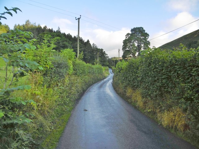
Coed Hafodwen is primarily composed of native broadleaf trees, such as oak, beech, and birch, creating a diverse and rich habitat for a variety of wildlife. Visitors can explore the well-maintained footpaths that wind through the woodland, providing an opportunity to observe the flora and fauna up close. The forest floor is adorned with a carpet of bluebells in the springtime, creating a breathtaking sight.

The woodland is also home to a number of bird species, including woodpeckers, owls, and various songbirds. Birdwatchers will delight in the abundance of avian life found in Coed Hafodwen. Additionally, the woodland provides a natural habitat for small mammals such as squirrels, rabbits, and voles.

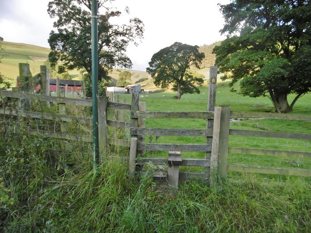
Coed Hafodwen offers more than just natural beauty; it also provides recreational activities for visitors. There are picnic areas and benches throughout the woodland, allowing visitors to relax and enjoy the tranquil surroundings. The woodland is also a popular destination for hiking and cycling, with designated trails that cater to different skill levels.

Overall, Coed Hafodwen is a hidden gem in Denbighshire, offering a serene escape into nature. Its lush greenery, diverse wildlife, and recreational opportunities make it a must-visit destination for both locals and tourists alike.

If you have any feedback on the listing, please let us know in the comments section below.

Coed Hafodwen Images

Images are sourced within 2km of 52.905725/-3.253092 or Grid Reference SJ1534. Thanks to Geograph Open Source API. All images are credited.

Tregeiriog, Ceiriog Valley Looking towards Ty'n-y-fedw.
Tregeiriog, Ceiriog Valley
Looking towards Ty'n-y-fedw.
Llanarmon Dyffryn Ceiriog, minor road From the village to Pentre, where the road becomes an "other route with public access".
Llanarmon Dyffryn Ceiriog, minor road
From the village to Pentre, where the road becomes an "other route with public access".
Llanarmon Dyffryn Ceiriog, stile At the beginning of the footpath up the valley of Pant Sarffle and back to the village.
Llanarmon Dyffryn Ceiriog, stile
At the beginning of the footpath up the valley of Pant Sarffle and back to the village.
Llanarmon Dyffryn Ceiriog, rams Handsome horned rams, grazing next to Nant Sarffle.
Llanarmon Dyffryn Ceiriog, rams
Handsome horned rams, grazing next to Nant Sarffle.
Llanarmon Dyffryn Ceiriog, minor road From the village to Pentre, after which it becomes an "other route" over the hills.
Llanarmon Dyffryn Ceiriog, minor road
From the village to Pentre, after which it becomes an "other route" over the hills.
Llanarmon Dyffryn Ceiriog, stream Nant Sarffle, shortly before it flows into Afon Ceiriog; Sarffle Farm in the distance.
Llanarmon Dyffryn Ceiriog, stream
Nant Sarffle, shortly before it flows into Afon Ceiriog; Sarffle Farm in the distance.
Old Milestone by the B4500, west of Tregeiriog, Ceirog Ucha parish Wrexham plate by the B4500, in parish of Ceiriog Ucha (Wrexham County Borough District), West of Tregeiriog, on grass bank, Northwest side of road.

Inscription reads:-
WREXHAM DISTRICT
1894
DCC
WREXHAM 20m 2f
CHIRK 10m
GLYN 3m 5f
LLANARMON DC 1m 1f

Grade II listed by Cadw.
Reference Number: 81167 <span class="nowrap"><a title="https://cadwpublic-api.azurewebsites.net/reports/listedbuilding/FullReport?lang=&id=81167" rel="nofollow ugc noopener" href="https://cadwpublic-api.azurewebsites.net/reports/listedbuilding/FullReport?lang=&id=81167">Link</a><img style="margin-left:2px;" alt="External link" title="External link - shift click to open in new window" src="https://s1.geograph.org.uk/img/external.png" width="10" height="10"/></span>

Surveyed

Milestone Society National ID: DEN_WRLA20
Old Milestone by the B4500, west of Tregeiriog, Ceirog Ucha parish
Wrexham plate by the B4500, in parish of Ceiriog Ucha (Wrexham County Borough District), West of Tregeiriog, on grass bank, Northwest side of road. Inscription reads:- WREXHAM DISTRICT 1894 DCC WREXHAM 20m 2f CHIRK 10m GLYN 3m 5f LLANARMON DC 1m 1f Grade II listed by Cadw. Reference Number: 81167 LinkExternal link Surveyed Milestone Society National ID: DEN_WRLA20
The track to Dolwen Farm
Dolwen farmhouse from the valley below Dolwen is a fine, Grade II* listed <span class="nowrap"><a title="https://britishlistedbuildings.co.uk/300000602-dolwen-ceiriog-ucha#.XVpHduhKhPY" rel="nofollow ugc noopener" href="https://britishlistedbuildings.co.uk/300000602-dolwen-ceiriog-ucha#.XVpHduhKhPY">Link</a><img style="margin-left:2px;" alt="External link" title="External link - shift click to open in new window" src="https://s1.geograph.org.uk/img/external.png" width="10" height="10"/></span> late 16th or early 17th century valley farm. Its state of preservation is quite remarkable from the outside, and going by the conversation I had with the lady currently living there with her family, the interior isn't in bad nick either.
Dolwen farmhouse from the valley below
Dolwen is a fine, Grade II* listed LinkExternal link late 16th or early 17th century valley farm. Its state of preservation is quite remarkable from the outside, and going by the conversation I had with the lady currently living there with her family, the interior isn't in bad nick either.
Dolwen farmhouse Seen from its garden; Dolwen farmhouse is late 16th century with extensions in the 17th century, and sufficiently well preserved since then to have attracted a Grade II* listing <span class="nowrap"><a title="https://britishlistedbuildings.co.uk/300000602-dolwen-ceiriog-ucha#.XVpHduhKhPY" rel="nofollow ugc noopener" href="https://britishlistedbuildings.co.uk/300000602-dolwen-ceiriog-ucha#.XVpHduhKhPY">Link</a><img style="margin-left:2px;" alt="External link" title="External link - shift click to open in new window" src="https://s1.geograph.org.uk/img/external.png" width="10" height="10"/></span> in 2003. Many fine features remain, including flagstone floors, oak staircase, an external garderobe/toilet, 17th century wooden panelling and a bread oven.
Dolwen farmhouse
Seen from its garden; Dolwen farmhouse is late 16th century with extensions in the 17th century, and sufficiently well preserved since then to have attracted a Grade II* listing LinkExternal link in 2003. Many fine features remain, including flagstone floors, oak staircase, an external garderobe/toilet, 17th century wooden panelling and a bread oven.
The garderobe at Dolwen A most unusual remnant of 17th century plumbing and waste disposal - an external garderobe. Without going into too much detail, many of these were used as an early toilet, typically with a hole in the base, which allowed the waste 'products' to escape down the wall of the building. Presumably some water was often thrown down to assist the process. The hole in this one is now stopped up, otherwise it gets a bit draughty indoors, so I was told.
The garderobe at Dolwen
A most unusual remnant of 17th century plumbing and waste disposal - an external garderobe. Without going into too much detail, many of these were used as an early toilet, typically with a hole in the base, which allowed the waste 'products' to escape down the wall of the building. Presumably some water was often thrown down to assist the process. The hole in this one is now stopped up, otherwise it gets a bit draughty indoors, so I was told.
Coed Cochion: autumnal woodland
Woodland track
Woodland track
Isolated barn Above the Ceiriog valley.
Isolated barn
Above the Ceiriog valley.
Approaching Bryn Du trig point (561m)
Remains of moorland wall
Forestry re-planting
Standing stone
Standing stone
Show me another place!

Coed Hafodwen is located at Grid Ref: SJ1534 (Lat: 52.905725, Lng: -3.253092)

Unitary Authority: Wrexham

Police Authority: North Wales

What 3 Words

///scorched.sonic.area. Near Llangollen, Denbighshire

Related Wikis

Ceiriog Ucha

Ceiriog Ucha, also spelled as Ceiriog Uchaf (meaning "Upper Ceiriog"), is a community in Wrexham County Borough, Wales. The community lies in the Ceiriog...

Llanarmon Dyffryn Ceiriog

Llanarmon Dyffryn Ceiriog (; often referred to as Llanarmon DC or locally simply as Llanarmon) is a village in Wrexham County Borough, Wales. It lies on...

Tregeiriog

Tregeiriog (a Welsh name translating roughly as "settlement [on the] River Ceiriog") is a village in Wrexham County Borough, Wales. It is in the community...

Pandy, Ceiriog Valley

Pandy () is a hamlet in the Ceiriog Valley, Wrexham County Borough, Wales. It is located on the confluence of the River Ceiriog to the east, and the smaller...

Ceiriog Valley

The Ceiriog Valley (Welsh: Dyffryn Ceiriog) is the valley of the River Ceiriog in north-east Wales. Its Welsh name, "Dyffryn Ceiriog", is the name of an...
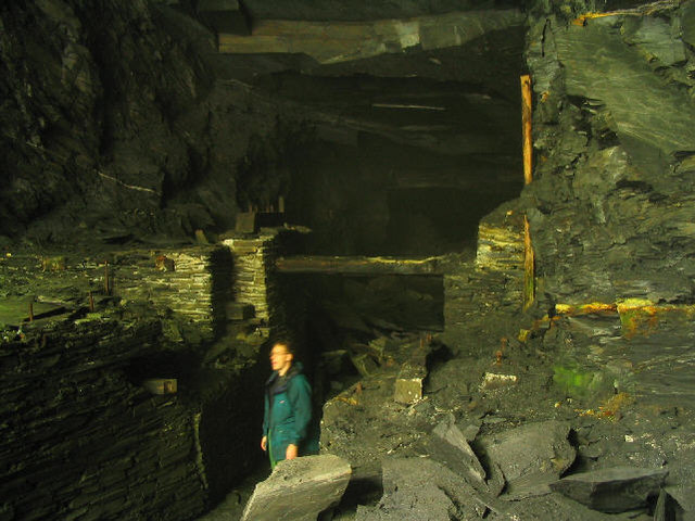
Cambrian quarry

The Cambrian quarry was a slate quarry, located to the west of Glyn Ceiriog in Denbighshire, North Wales. There was some small-scale extraction of slate...
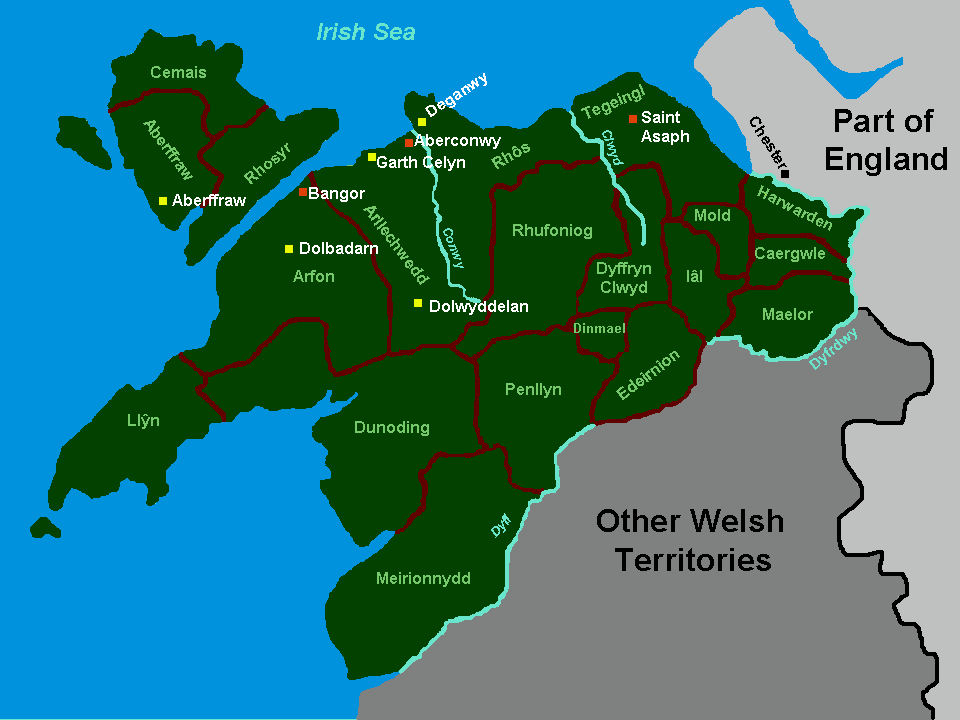
Rhufoniog

Rhufoniog was a small sub-kingdom of the Dark Ages Gwynedd, and later a cantref in medieval Wales. == Geography == The cantref Rhos lay between it and...

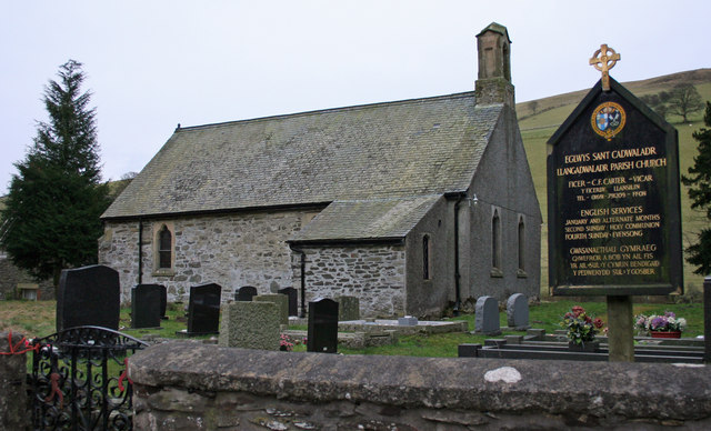
Llangadwaladr, Powys

Llangadwaladr (), formerly spelt Llancadwaladr in some sources, is an isolated mountain parish in Powys, Wales. It was formerly in the historic county...

Nearby Amenities

Located within 500m of 52.905725,-3.253092
The data included in this document is from www.openstreetmap.org. The data is made available under ODbL.

Have you been to Coed Hafodwen?

Leave your review of Coed Hafodwen below (or comments, questions and feedback).