Pen-y-banc Wood

Wood, Forest in Montgomeryshire

Wales

Pen-y-banc Wood

Riding along Middle Dolfor Road near Graig
Riding along Middle Dolfor Road near Graig Credit: Richard Law

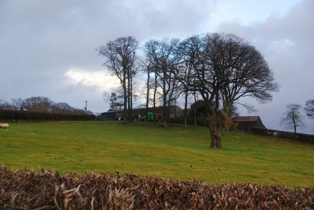
Pen-y-banc Wood is a picturesque woodland located in Montgomeryshire, Wales. Covering an area of approximately 30 acres, it is nestled in the rolling hills of the Welsh countryside. The wood is primarily composed of native deciduous trees, including oak, beech, and ash, which create a diverse and vibrant ecosystem.

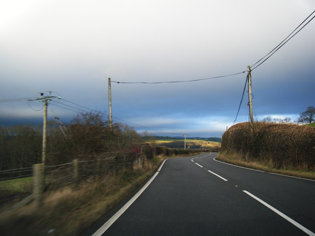
The wood is known for its serene and tranquil atmosphere, making it a popular destination for nature enthusiasts and hikers. A network of well-maintained footpaths wind through the wood, providing visitors with the opportunity to explore its natural beauty and observe the wildlife that calls it home. From colorful wildflowers in the spring to the golden hues of autumn, Pen-y-banc Wood offers a spectacle of seasonal beauty throughout the year.

In addition to its natural wonders, the wood also holds historical significance. It is believed that the area has been wooded for centuries, with evidence of human activity dating back to the Roman era. Today, remnants of old stone walls and the ruins of an ancient farmhouse can still be found within the wood, serving as a reminder of the area's rich past.

Pen-y-banc Wood is managed by a local conservation organization, ensuring its preservation and protection for future generations to enjoy. The wood offers a peaceful retreat from the hustle and bustle of everyday life, inviting visitors to reconnect with nature and immerse themselves in its tranquil ambiance.

If you have any feedback on the listing, please let us know in the comments section below.

Pen-y-banc Wood Images

Images are sourced within 2km of 52.495025/-3.3377155 or Grid Reference SO0989. Thanks to Geograph Open Source API. All images are credited.

Riding along Middle Dolfor Road near Graig
Llettyderyn A hill farm above Stepaside.
Llettyderyn
A hill farm above Stepaside.
Steeply undulating farmland at Gelli Situated between valleys which drain towards the Severn at Newtown.
Steeply undulating farmland at Gelli
Situated between valleys which drain towards the Severn at Newtown.
Dolau Inn, Mochdre Viewed from behind and further up the hill, with Llyfnant Brook running between.
Dolau Inn, Mochdre
Viewed from behind and further up the hill, with Llyfnant Brook running between.
Garden hedges in Stepaside The village appears to be entirely residential.
Garden hedges in Stepaside
The village appears to be entirely residential.
The main street in Stepaside In all honesty, there isn't much in this village to step aside for. There appear to be no community facilities.
The main street in Stepaside
In all honesty, there isn't much in this village to step aside for. There appear to be no community facilities.
High hedges on the road from Stepaside This is the road to Newtown. The road is narrow but there are small passing places.
High hedges on the road from Stepaside
This is the road to Newtown. The road is narrow but there are small passing places.
A483 at Garreg
A483 at Garreg
A483 bend near Bryn-bedwen
A483 heading north
A483 heading north
Dolfor Road near Pen-y-banc Wood
One Of A Pair Two fine old Veteran Common Yews sit looking South from Garreg Hill. Much exposed to the elements they have had to fight for their existence.
One Of A Pair
Two fine old Veteran Common Yews sit looking South from Garreg Hill. Much exposed to the elements they have had to fight for their existence.
Damaged Milestone
Damaged Milestone
Newtown Bypass construction by the Mochdre Industrial Estate
Newtown Bypass construction by the Dolfor Road I think this is a base for the construction team.
Newtown Bypass construction by the Dolfor Road
I think this is a base for the construction team.
Newtown Bypass construction I think this is the entrance to a base for the construction team beside the Dolfor Road. Just across the new road is the Mochdre Industrial Estate and beyond, most of the rest of the town.
Newtown Bypass construction
I think this is the entrance to a base for the construction team beside the Dolfor Road. Just across the new road is the Mochdre Industrial Estate and beyond, most of the rest of the town.
Remains of a tree Removed during Newtown Bypass construction.
Remains of a tree
Removed during Newtown Bypass construction.
Remains of a tree Removed during Newtown Bypass construction.
Remains of a tree
Removed during Newtown Bypass construction.
Show me another place!

Pen-y-banc Wood is located at Grid Ref: SO0989 (Lat: 52.495025, Lng: -3.3377155)

Unitary Authority: Powys

Police Authority: Dyfed Powys

What 3 Words

///lift.aviators.otherwise. Near Mochdre, Powys

Related Wikis

Newtown Central

Newtown Central was the name of a county electoral ward in the town of Newtown, Powys, Wales. It remains as a community ward to Newtown and Llanllwchaiarn...

Scafell Halt railway station

Scafell Halt was a railway station on the Cambrian Line, located to the west of Newtown, Powys, Wales; it was adjacent to Scafell Bridge on the River Severn...

Newtown High School, Powys

Newtown High School is a secondary comprehensive school for boys and girls. The school is based on two campuses in the towns of Newtown and Presteigne...
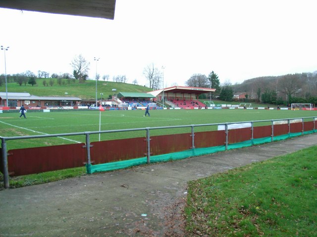
Latham Park

Latham Park is a multi-purpose stadium in Newtown, Wales. It is currently used for football matches and is the home ground of Newtown A.F.C. The stadium...

Nearby Amenities

Located within 500m of 52.495025,-3.3377155
Power: pole
Lat/Long: 52.4943142/-3.3443391
Power: pole
Lat/Long: 52.4949381/-3.343631
Power: pole
Lat/Long: 52.4957807/-3.3429819
Power: pole
Lat/Long: 52.4966266/-3.3424401
Power: pole
Lat/Long: 52.4974234/-3.3418286
Power: pole
Lat/Long: 52.4980537/-3.3413726
Power: pole
Lat/Long: 52.4986644/-3.3409756
Power: pole
Lat/Long: 52.4988898/-3.3397633
Power: pole
Lat/Long: 52.4985175/-3.340348
Power: pole
Lat/Long: 52.4979264/-3.3409596
Power: pole
Lat/Long: 52.4972732/-3.3415389
Power: pole
Lat/Long: 52.4961889/-3.3416355
Power: pole
Lat/Long: 52.4954476/-3.341732
Power: pole
Lat/Long: 52.4946049/-3.3418393
Power: pole
Lat/Long: 52.4936153/-3.3418769
Power: pole
Lat/Long: 52.4928347/-3.3425742
Power: pole
Lat/Long: 52.4921259/-3.3431858
The data included in this document is from www.openstreetmap.org. The data is made available under ODbL.

Have you been to Pen-y-banc Wood?

Leave your review of Pen-y-banc Wood below (or comments, questions and feedback).