Castell-y-dail Wood

Wood, Forest in Montgomeryshire

Wales

Castell-y-dail Wood

Riding along Middle Dolfor Road near Graig
Riding along Middle Dolfor Road near Graig Credit: Richard Law

Castell-y-dail Wood is a picturesque forest located in Montgomeryshire, Wales. Situated on the eastern side of the River Severn, this woodland is a tranquil haven for nature enthusiasts and outdoor enthusiasts alike.

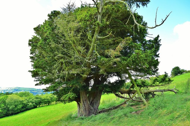
Covering an area of approximately 100 hectares, Castell-y-dail Wood is known for its diverse flora and fauna. The forest is predominantly made up of deciduous trees, including oak, beech, and birch, which create a vibrant and colorful landscape throughout the seasons. In spring, the forest floor is adorned with a carpet of bluebells, adding to the enchanting atmosphere.

The wood is crisscrossed by a network of well-maintained footpaths and trails, making it easily accessible for walkers and hikers. These paths offer visitors the opportunity to explore the woodland, discovering hidden nooks and crannies along the way. Various viewpoints throughout the forest provide breathtaking vistas of the surrounding countryside, including the nearby rolling hills and the meandering river.

Castell-y-dail Wood is also home to a wide range of wildlife. Birdwatchers can spot numerous species, such as woodpeckers, nuthatches, and tawny owls. If lucky, visitors may even catch a glimpse of elusive animals like badgers, foxes, and deer.

The forest has a rich history, with the remains of an ancient castle, Castell-y-dail, located within its grounds. The castle, believed to have been built in the 13th century, adds a touch of intrigue to the woodland, inviting visitors to imagine its former grandeur.

Overall, Castell-y-dail Wood offers a captivating blend of natural beauty, recreational opportunities, and historical significance, making it a must-visit destination for nature lovers and history enthusiasts alike.

If you have any feedback on the listing, please let us know in the comments section below.

Castell-y-dail Wood Images

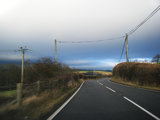
Images are sourced within 2km of 52.49835/-3.3339126 or Grid Reference SO0989. Thanks to Geograph Open Source API. All images are credited.

Riding along Middle Dolfor Road near Graig
Steeply undulating farmland at Gelli Situated between valleys which drain towards the Severn at Newtown.
Steeply undulating farmland at Gelli
Situated between valleys which drain towards the Severn at Newtown.
Dolau Inn, Mochdre Viewed from behind and further up the hill, with Llyfnant Brook running between.
Dolau Inn, Mochdre
Viewed from behind and further up the hill, with Llyfnant Brook running between.
Garden hedges in Stepaside The village appears to be entirely residential.
Garden hedges in Stepaside
The village appears to be entirely residential.
The main street in Stepaside In all honesty, there isn't much in this village to step aside for. There appear to be no community facilities.
The main street in Stepaside
In all honesty, there isn't much in this village to step aside for. There appear to be no community facilities.
High hedges on the road from Stepaside This is the road to Newtown. The road is narrow but there are small passing places.
High hedges on the road from Stepaside
This is the road to Newtown. The road is narrow but there are small passing places.
A483 bend near Bryn-bedwen
A483 heading north
A483 heading north
Dolfor Road near Pen-y-banc Wood
One Of A Pair Two fine old Veteran Common Yews sit looking South from Garreg Hill. Much exposed to the elements they have had to fight for their existence.
One Of A Pair
Two fine old Veteran Common Yews sit looking South from Garreg Hill. Much exposed to the elements they have had to fight for their existence.
Damaged Milestone
Damaged Milestone
Newtown Bypass construction by the Mochdre Industrial Estate
Newtown Bypass construction by the Dolfor Road I think this is a base for the construction team.
Newtown Bypass construction by the Dolfor Road
I think this is a base for the construction team.
Newtown Bypass construction I think this is the entrance to a base for the construction team beside the Dolfor Road. Just across the new road is the Mochdre Industrial Estate and beyond, most of the rest of the town.
Newtown Bypass construction
I think this is the entrance to a base for the construction team beside the Dolfor Road. Just across the new road is the Mochdre Industrial Estate and beyond, most of the rest of the town.
Remains of a tree Removed during Newtown Bypass construction.
Remains of a tree
Removed during Newtown Bypass construction.
Remains of a tree Removed during Newtown Bypass construction.
Remains of a tree
Removed during Newtown Bypass construction.
Mochdre Brook
Mochdre Brook
Brook Terrace, Mochdre Presumably built to house mill workers.
See also <a title="https://www.geograph.org.uk/photo/5988403" href="https://www.geograph.org.uk/photo/5988403">Link</a>
Brook Terrace, Mochdre
Presumably built to house mill workers. See also Link
Show me another place!

Castell-y-dail Wood is located at Grid Ref: SO0989 (Lat: 52.49835, Lng: -3.3339126)

Unitary Authority: Powys

Police Authority: Dyfed Powys

What 3 Words

///haircuts.wheels.gilding. Near Mochdre, Powys

Related Wikis

Newtown Central

Newtown Central was the name of a county electoral ward in the town of Newtown, Powys, Wales. It remains as a community ward to Newtown and Llanllwchaiarn...

Newtown High School, Powys

Newtown High School is a secondary comprehensive school for boys and girls. The school is based on two campuses in the towns of Newtown and Presteigne...

Scafell Halt railway station

Scafell Halt was a railway station on the Cambrian Line, located to the west of Newtown, Powys, Wales; it was adjacent to Scafell Bridge on the River Severn...

Latham Park

Latham Park is a multi-purpose stadium in Newtown, Wales. It is currently used for football matches and is the home ground of Newtown A.F.C. The stadium...

Nearby Amenities

Located within 500m of 52.49835,-3.3339126
Power: pole
Lat/Long: 52.5005349/-3.3289958
Mochdre Industrial Estate
Place: suburb
Lat/Long: 52.5008624/-3.3296782
Power: pole
Lat/Long: 52.5026383/-3.332833
Parking
Surface: concrete
Lat/Long: 52.4993628/-3.3291142
Power: pole
Lat/Long: 52.4986644/-3.3409756
Power: pole
Lat/Long: 52.4995854/-3.3387065
Power: pole
Lat/Long: 52.4988898/-3.3397633
Power: pole
Lat/Long: 52.4985175/-3.340348
Power: pole
Lat/Long: 52.4979264/-3.3409596
Location Transition: yes
Power: pole
Lat/Long: 52.5005275/-3.3296487
Direction: 235
Generator Method: photovoltaic
Generator Output Electricity: yes
Generator Solar Modules: 48
Generator Source: solar
Generator Type: solar_photovoltaic_panel
Location: roof
Power: generator
Lat/Long: 52.5022844/-3.3359599
Access: no
Barrier: lift_gate
Lat/Long: 52.5009012/-3.3334303
The data included in this document is from www.openstreetmap.org. The data is made available under ODbL.

Have you been to Castell-y-dail Wood?

Leave your review of Castell-y-dail Wood below (or comments, questions and feedback).