Buxton

Settlement in Norfolk Broadland

England

Buxton

Approaching Buxton The approach to Buxton Station is seen from a Bure Valley Railway train heading towards Wroxham. On the left the footpath level crossing can just be made out. Adjacent to the station is a car park of railway users and walkers, with a housing estate beyond that.
Approaching Buxton Credit: Glen Denny

Buxton is a small village located in the county of Norfolk, England. Situated in the eastern part of the country, Buxton is nestled in the heart of the picturesque Norfolk Broads, a network of rivers, lakes, and marshes that make up one of the UK's most famous national parks.

With a population of around 1,000 residents, Buxton offers a peaceful and close-knit community atmosphere. The village is known for its charming rural setting, surrounded by rolling fields and scenic waterways. The tranquil River Bure passes through the village, providing opportunities for boating, fishing, and leisurely walks along its banks.

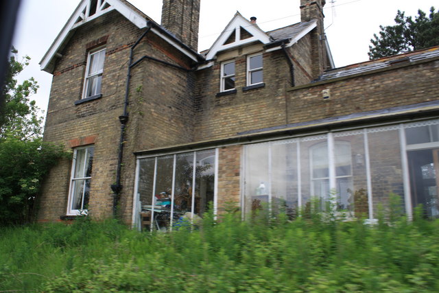
Historically, Buxton was predominantly an agricultural community, and remnants of this heritage can still be seen in the traditional buildings that line its streets. The village church, St. Andrew's, is a prominent feature, boasting a beautiful medieval tower that dates back to the 13th century.

Buxton is well-connected to neighboring towns and cities, with the city of Norwich just a short drive away. This accessibility allows residents to enjoy the benefits of rural living while still having access to urban amenities and employment opportunities.

In recent years, Buxton has become a popular destination for tourists seeking a peaceful retreat. The village offers a range of accommodation options, from cozy bed and breakfasts to charming cottages, providing visitors with a genuine taste of Norfolk village life.

Overall, Buxton, Norfolk, is a quintessential English village, offering a tranquil and picturesque setting, a close-knit community, and easy access to the stunning Norfolk Broads.

If you have any feedback on the listing, please let us know in the comments section below.
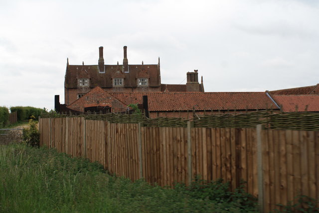
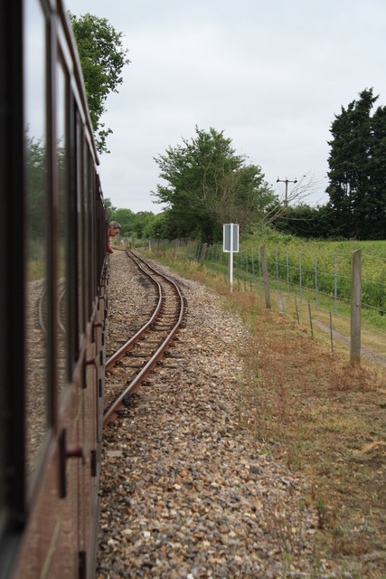
Buxton Images

Images are sourced within 2km of 52.753931/1.306846 or Grid Reference TG2322. Thanks to Geograph Open Source API. All images are credited.

Approaching Buxton The approach to Buxton Station is seen from a Bure Valley Railway train heading towards Wroxham. On the left the footpath level crossing can just be made out. Adjacent to the station is a car park of railway users and walkers, with a housing estate beyond that.
Approaching Buxton
The approach to Buxton Station is seen from a Bure Valley Railway train heading towards Wroxham. On the left the footpath level crossing can just be made out. Adjacent to the station is a car park of railway users and walkers, with a housing estate beyond that.
Buxton Station Buxton Station is seen from a Bure Valley Railway train. A single platform serves trains heading in both directions. Just beyond the station can be glimpsed the buildings of the original Buxton station.
Buxton Station
Buxton Station is seen from a Bure Valley Railway train. A single platform serves trains heading in both directions. Just beyond the station can be glimpsed the buildings of the original Buxton station.
Buxton Station Buxton station has one platform, serving Bure Valley Railway trains heading in either direction. Just beyond the present station can be glimpsed one of the buildings remaining of the original Buxton station.
Buxton Station
Buxton station has one platform, serving Bure Valley Railway trains heading in either direction. Just beyond the present station can be glimpsed one of the buildings remaining of the original Buxton station.
Former station at Buxton This is the view from a Bure Valley Railway train of the former station buildings at Buxton, which are now in use as a private dwelling.
Former station at Buxton
This is the view from a Bure Valley Railway train of the former station buildings at Buxton, which are now in use as a private dwelling.
View across the Bure Valley This is a view across the Bure Valley from the Bure Valley Railway train, between Buxton and Coltishall.
View across the Bure Valley
This is a view across the Bure Valley from the Bure Valley Railway train, between Buxton and Coltishall.
View across the Bure Valley The Bure Valley is seen from a Bure Valley Railway train between Buxton and Coltishall.
View across the Bure Valley
The Bure Valley is seen from a Bure Valley Railway train between Buxton and Coltishall.
Bure Valley Railway warning sign This warning sign is at the beginning of a passing loop and is close to a level crossing connecting Fendyke Nursery with the marshes.
Bure Valley Railway warning sign
This warning sign is at the beginning of a passing loop and is close to a level crossing connecting Fendyke Nursery with the marshes.
Level Crossing near Fendyke Nursery This level crossing allows access across the Bure Valley Railway between Fendyke Nursery and the marshes. This is the view from a BVR train.
Level Crossing near Fendyke Nursery
This level crossing allows access across the Bure Valley Railway between Fendyke Nursery and the marshes. This is the view from a BVR train.
Bure Valley Railway passing loop This passing loop is close to Little Hautbois Hall.
Bure Valley Railway passing loop
This passing loop is close to Little Hautbois Hall.
Bure Valley Railway near Little Hautbois Hall The train from where this image was taken is on one of the tracks of a passing loop.
Bure Valley Railway near Little Hautbois Hall
The train from where this image was taken is on one of the tracks of a passing loop.
Bure Valley Railway near Little Hautbois Hall The train from which this image is taken is leaving the passing loop and entering the single-track section to Coltishall station. Some of the farm buildings at Little Hautbois Hall can be glimpsed beside the tree on the left.
Bure Valley Railway near Little Hautbois Hall
The train from which this image is taken is leaving the passing loop and entering the single-track section to Coltishall station. Some of the farm buildings at Little Hautbois Hall can be glimpsed beside the tree on the left.
Bure Valley Railway near Little Hautbois Hall The train from which this image is taken is leaving the passing loop and entering the single-track section to Coltishall station.
Bure Valley Railway near Little Hautbois Hall
The train from which this image is taken is leaving the passing loop and entering the single-track section to Coltishall station.
Little Hautbois Hall This is the view from a Bure Valley Railway train as it approaches the level crossing near Little Hautbois Hall.
Little Hautbois Hall
This is the view from a Bure Valley Railway train as it approaches the level crossing near Little Hautbois Hall.
Little Hautbois Hall This is a view from a Bure Valley Railway train as it passes over the level crossing adjacent to Little Hautbois Hall. At this point the Bure Valley Path crosses over the railway to parallel it from the south side.
Little Hautbois Hall
This is a view from a Bure Valley Railway train as it passes over the level crossing adjacent to Little Hautbois Hall. At this point the Bure Valley Path crosses over the railway to parallel it from the south side.
Little Hautbois Hall This is a view of Little Hautbois Hall from a passing Bure Valley Railway train.
Little Hautbois Hall
This is a view of Little Hautbois Hall from a passing Bure Valley Railway train.
Approach Little Hautbois Hall level crossing These warning signs indicate to the driver the speed at which the level crossing can be negotiated and also that the whistle/horn is to be used.
Approach Little Hautbois Hall level crossing
These warning signs indicate to the driver the speed at which the level crossing can be negotiated and also that the whistle/horn is to be used.
Bure Valley Path The Bure Valley Path is seen near to Little Hautbois Hall from a Bure Valley Railway train.
Bure Valley Path
The Bure Valley Path is seen near to Little Hautbois Hall from a Bure Valley Railway train.
Bure Valley Railway and Bure Valley Path This is the passing loop close to Little Hautbois Hall, with the Bure Valley Path on the right.
Bure Valley Railway and Bure Valley Path
This is the passing loop close to Little Hautbois Hall, with the Bure Valley Path on the right.
Show me another place!

Buxton is located at Grid Ref: TG2322 (Lat: 52.753931, Lng: 1.306846)

Administrative County: Norfolk

District: Broadland

Police Authority: Norfolk

What 3 Words

///calms.stocks.abstracts. Near Buxton, Norfolk

Related Wikis

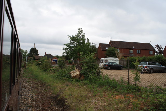
Buxton Lamas railway station

Buxton Lamas was a railway station in Buxton with Lamas, Norfolk. It was located near the Bure Valley Railway's present Buxton station. == References ==

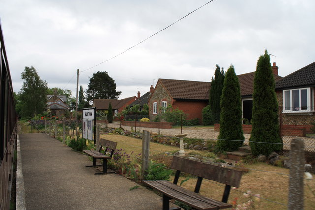
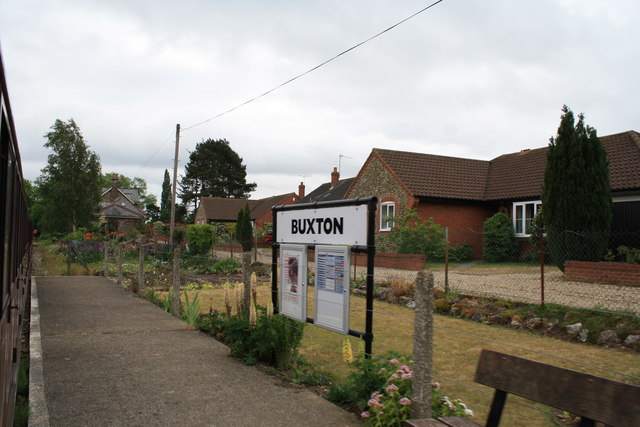
Buxton railway station (Norfolk)

Buxton railway station serves the village of Buxton in Norfolk and is served by the Bure Valley Railway.

Bure Valley Path

The Bure Valley Path is a 9-mile (14 km) long walking trail and cycling trail in Norfolk, England. It runs alongside the Bure Valley Railway, a heritage...

Buxton, Norfolk

Buxton is a village in the parish of Buxton with Lamas, in the Broadland district of the county of Norfolk, England. It is located between Norwich and...

Nearby Amenities

Located within 500m of 52.753931,1.306846
Buxton
Railway: station
Tourism: preserved_railway
Usage: tourism
Wikidata: Q5003285
Lat/Long: 52.7575759/1.3070895
Bus Stop
Crown, opp
Bench: yes
Bin: yes
Bus: yes
Lit: no
Naptan AtcoCode: 2900B671
Naptan Bearing: SW
Naptan BusStopType: CUS
Naptan CommonName: Crown
Naptan Indicator: opp
Naptan Landmark: Aylsham Road
Naptan Locality: Buxton
Naptan NaptanCode: nfoagptg
Naptan Street: Crown Road
Naptan Verified: no
Public Transport: platform
Shelter: yes
Source: naptan_import
Tactile Paving: yes
Lat/Long: 52.7548831/1.3048761
Bus Stop
Black Lion, opp
Bus: yes
Naptan AtcoCode: 2900B6710
Naptan Bearing: SW
Naptan BusStopType: CUS
Naptan CommonName: Black Lion
Naptan Indicator: opp
Naptan Landmark: public house
Naptan Locality: Buxton
Naptan NaptanCode: nfoagptj
Naptan ShortCommonName: Black Lion
Naptan Street: Crown Road
Naptan Verified: no
Public Transport: platform
Source: naptan_import
Lat/Long: 52.7528189/1.3005849
church, adj
Naptan AtcoCode: 2900B6711
Naptan Bearing: NE
Naptan BusStopType: CUS
Naptan CommonName: church
Naptan Indicator: adj
Naptan Landmark: church
Naptan Locality: Buxton
Naptan NaptanCode: nfoagptm
Naptan ShortCommonName: church
Naptan Street: Mill Street
Naptan Verified: no
Source: naptan_import
Lat/Long: 52.7555592/1.3086665
church, opp
Naptan AtcoCode: 2900B6713
Naptan Bearing: SW
Naptan BusStopType: CUS
Naptan CommonName: church
Naptan Indicator: opp
Naptan Landmark: church
Naptan Locality: Buxton
Naptan NaptanCode: nfoagptw
Naptan ShortCommonName: church
Naptan Street: Mill Street
Naptan Verified: no
Source: naptan_import
Lat/Long: 52.755529/1.3087828
Sewell Road, opp
Naptan AtcoCode: 2900B672
Naptan Bearing: NW
Naptan BusStopType: CUS
Naptan CommonName: Sewell Road
Naptan Indicator: opp
Naptan Landmark: St Andrews Close
Naptan Locality: Buxton
Naptan NaptanCode: nfoagpwa
Naptan Street: Aylsham Road
Naptan Verified: no
Source: naptan_import
Lat/Long: 52.7556292/1.3042246
Sewell Road, adj
Naptan AtcoCode: 2900B673
Naptan Bearing: SE
Naptan BusStopType: CUS
Naptan CommonName: Sewell Road
Naptan Indicator: adj
Naptan Landmark: St Andrews Close
Naptan Locality: Buxton
Naptan NaptanCode: nfoagpwd
Naptan Street: Aylsham Road
Naptan Verified: no
Source: naptan_import
Lat/Long: 52.7555565/1.3045749
Bus Stop
Black Lion, adj
Bus: yes
Naptan AtcoCode: 2900B675
Naptan Bearing: NE
Naptan BusStopType: CUS
Naptan CommonName: Black Lion
Naptan Indicator: adj
Naptan Landmark: public house
Naptan Locality: Buxton
Naptan NaptanCode: nfoagpwg
Naptan ShortCommonName: Black Lion
Naptan Street: Crown Road
Naptan Verified: no
Public Transport: platform
Source: naptan_import
Lat/Long: 52.7527899/1.3001674
Bus Stop
Crown, adj
Bus: yes
Naptan AtcoCode: 2900B679
Naptan Bearing: NE
Naptan BusStopType: CUS
Naptan CommonName: Crown
Naptan Indicator: adj
Naptan Landmark: Crown P H
Naptan Locality: Buxton
Naptan NaptanCode: nfoagpwp
Naptan Street: Crown Road
Naptan Verified: no
Public Transport: platform
Source: naptan_import
Lat/Long: 52.7548985/1.3045644
Bicycle: yes
Crossing: uncontrolled
Railway: crossing
Lat/Long: 52.7577903/1.3064761
Booth: K6
Removed Amenity: telephone
Lat/Long: 52.7522844/1.3000463
Note: bing_ref_point;corner_of_car_ park
Lat/Long: 52.7549783/1.3091648
Shop: hairdresser
Lat/Long: 52.755127/1.3080366
Historic: memorial
Lat/Long: 52.7555292/1.3080461
Atm
Lat/Long: 52.7548807/1.3042281
Location Transition: yes
Power: pole
Transformer: distribution
Lat/Long: 52.7561492/1.311241
Recycling
Location: overground
Recycling Paper: yes
Recycling Type: container
Lat/Long: 52.7578688/1.3058782
Buxton
Place: village
Wikidata: Q5003259
Wikipedia: en:Buxton, Norfolk
Lat/Long: 52.7547251/1.3067651
Post Box
Note: collection plate missing 2013-08-26
Post Box Type: wall
Royal Cypher: VR
Royal Cypher Wikidata: Q33102356
Lat/Long: 52.7566947/1.3121462
Barrier: kissing_gate
Bicycle: yes
Foot: yes
Lat/Long: 52.7577527/1.3064371
Barrier: kissing_gate
Bicycle: yes
Foot: yes
Lat/Long: 52.757806/1.3064924
Tourism: picnic_site
Lat/Long: 52.7581727/1.3054527
Bench
Backrest: no
Material: wood
Seats: 4
Lat/Long: 52.7553986/1.3083646
Man Made: flagpole
Lat/Long: 52.7555807/1.3082308
Give Way
Direction: backward
Lat/Long: 52.7552447/1.3083327
Buxton
Inscription: Presented by Buxton & District Womens Institute / Golden Jubilee / 1927–1977 / Presented by Buxton and District WI in their 75th year to Celebrate the Golden Jubilee of Her Majesty Queen Elizabeth II / 1952 – 2002
Man Made: village_sign
Material: stone
Start Date: 1977
Lat/Long: 52.7554267/1.3084097
Give Way
Direction: forward
Lat/Long: 52.7554543/1.3081078
Entrance: main
Lat/Long: 52.7556606/1.3083564
Give Way
Direction: forward
Lat/Long: 52.7554759/1.308571
Entrance: yes
Lat/Long: 52.7558855/1.3083479
Entrance: yes
Lat/Long: 52.7557128/1.3085712
Post Box
Operator: Royal Mail
Post Box Type: wall
Lat/Long: 52.7538415/1.3095953
Give Way
Lat/Long: 52.7540038/1.3094622
Give Way
Lat/Long: 52.7538846/1.3096319
Give Way
Lat/Long: 52.7538133/1.3094869
Bench
Backrest: yes
Material: metal
Seats: 2
Lat/Long: 52.757552/1.3070733
Bench
Backrest: yes
Material: metal
Seats: 2
Lat/Long: 52.7575914/1.3069593
Barrier: kissing_gate
Bicycle: yes
Foot: yes
Lat/Long: 52.7577768/1.3064628
Post Office
Buxton Post Office
Addr City: Norwich
Addr Housename: McColls
Addr Postcode: NR10 5EN
Addr Street: Crown Road
Addr Village: Buxton
Brand: Post Office
Brand Wikidata: Q1783168
Brand Wikipedia: en:Post Office Ltd
Contact Website: https://www.postoffice.co.uk/branch-finder/5491363/buxton
Ref Pol Id: 133285
Source Addr: pol_branch_list_2020‑11‑13
Lat/Long: 52.7549757/1.3042233
Give Way
Lat/Long: 52.75166/1.3010524
Give Way
Lat/Long: 52.7547642/1.3042722
Give Way
Lat/Long: 52.7559439/1.3042449
Crossing
Crossing: unmarked
Lat/Long: 52.7555206/1.3043968
Give Way
Lat/Long: 52.7550111/1.3049524
Buxton Lamas
Disused Railway: station
Wikidata: Q5003271
Lat/Long: 52.7572096/1.308113
Power: pole
Lat/Long: 52.7554876/1.3011731
The data included in this document is from www.openstreetmap.org. The data is made available under ODbL.

Have you been to Buxton?

Leave your review of Buxton below (or comments, questions and feedback).