Allt Goch

Settlement in Montgomeryshire

Wales

Allt Goch

Ordnance Survey Rivet This OS rivet can be found on the cattle grid north side of the road. It marks a point 328.116m above mean sea level.
Ordnance Survey Rivet Credit: Adrian Dust

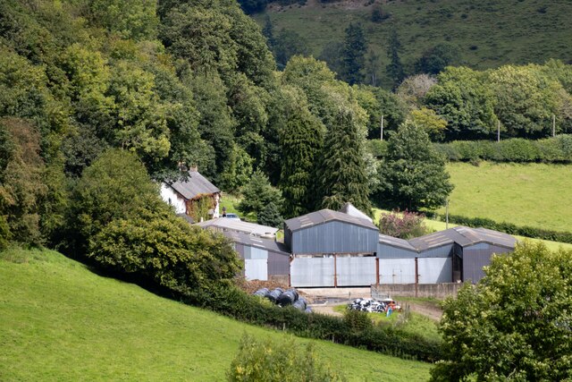
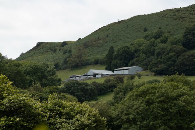
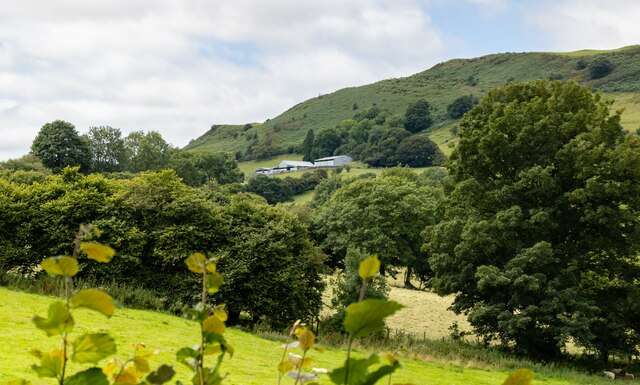
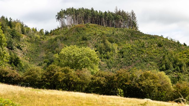
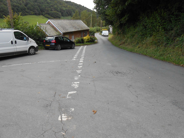
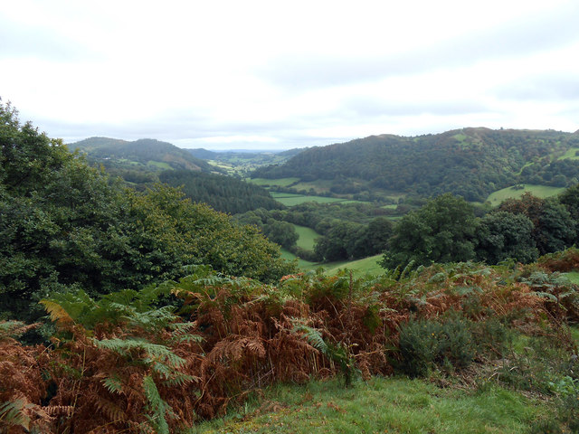
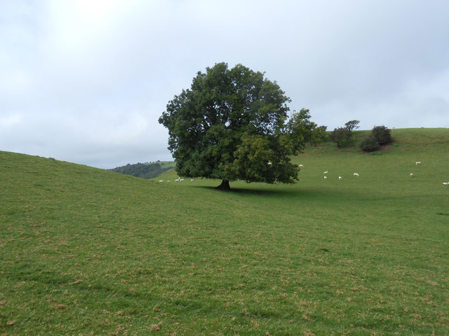
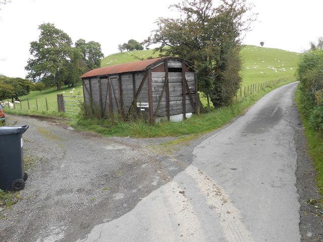
Allt Goch is a small village located in the historic county of Montgomeryshire, Wales. Situated in the picturesque countryside, the village is surrounded by rolling hills and lush green fields. It is situated approximately 5 miles northeast of the town of Montgomery and 12 miles southwest of Welshpool.

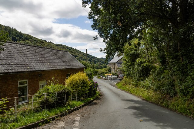
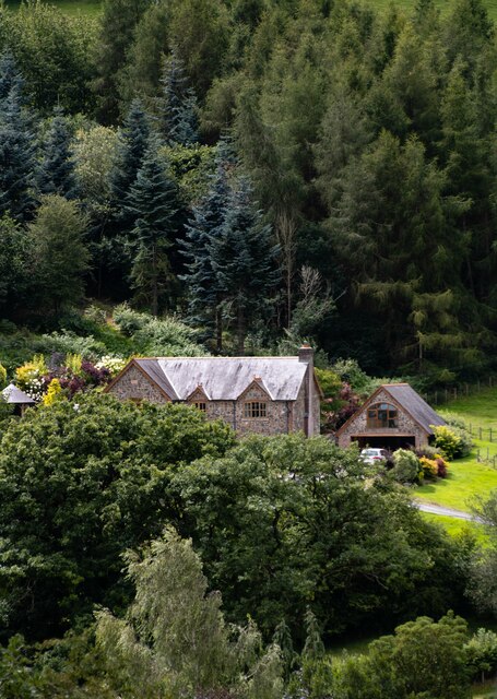
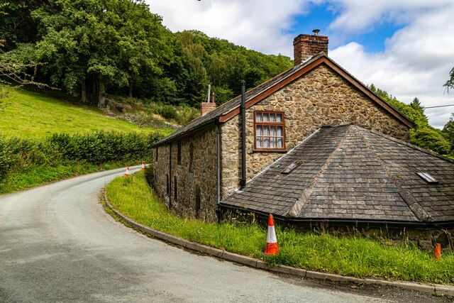
The village itself is home to a small population, with a close-knit community feel. The houses in Allt Goch are a mix of traditional stone cottages and more modern dwellings. The village is known for its tranquility and natural beauty, making it an attractive destination for those seeking a peaceful retreat.

Although Allt Goch is primarily a residential area, there are a few amenities available to residents and visitors. There is a local pub that serves as a social hub for the community, offering a place to gather and enjoy a drink or meal. The village also has a small primary school, providing education for the local children.

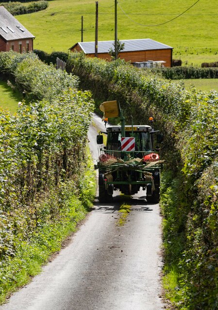
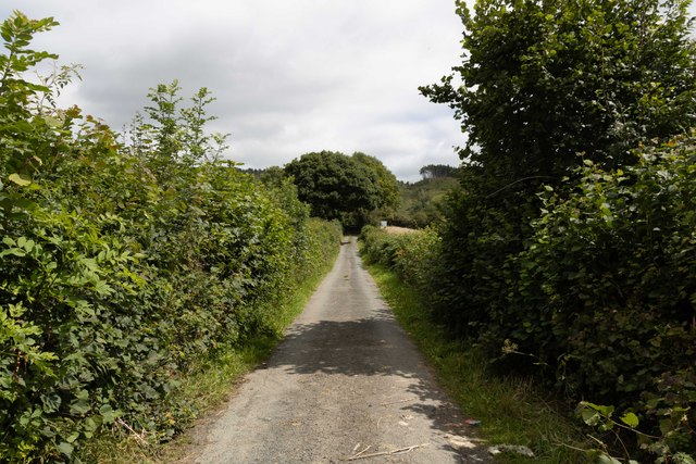
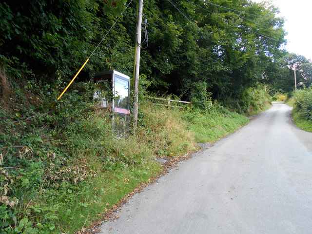
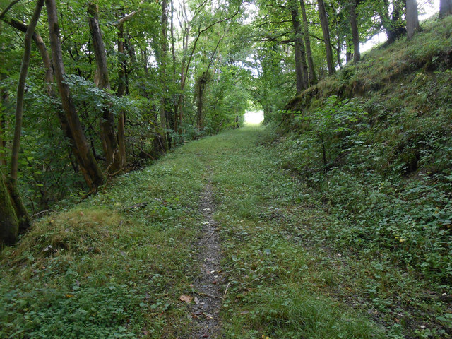
For outdoor enthusiasts, Allt Goch offers plenty of opportunities for exploration and leisure activities. The surrounding countryside is ideal for walking, hiking, and cycling, with numerous trails and paths to discover. The village is also close to the Montgomeryshire Canal, which provides the chance for boating and fishing.

Overall, Allt Goch is a charming village that offers a peaceful and idyllic setting for those who appreciate the beauty of the Welsh countryside.

If you have any feedback on the listing, please let us know in the comments section below.

Allt Goch Images

Images are sourced within 2km of 52.747073/-3.29106 or Grid Reference SJ1217. Thanks to Geograph Open Source API. All images are credited.

Ordnance Survey Rivet This OS rivet can be found on the cattle grid north side of the road. It marks a point 328.116m above mean sea level.
Ordnance Survey Rivet
This OS rivet can be found on the cattle grid north side of the road. It marks a point 328.116m above mean sea level.
New House New house under construction near Bachie Ganol.
New House
New house under construction near Bachie Ganol.
Plas Houses at Plas.
Plas
Houses at Plas.
Fron Haul View looking across the valley to Fron Haul Farm.
Fron Haul
View looking across the valley to Fron Haul Farm.
Fron Haul Tractor near Fron Haul Farm.
Fron Haul
Tractor near Fron Haul Farm.
Stud Farm
Stud Farm
The Larches
The Larches
Allt-Goch
Allt-Goch
Allt-Goch
Allt-Goch
Lluest Lane
Lluest Lane
Allt y Gadar
Allt y Gadar
Cwm Nant y Meichiaid communication centre Other than shear rural loveliness, there is not much to see at Cwm Nant-y-Meichiaid.  I will shortly post photos from the hills round-abouts - and also the 180 degree view from this defunct phonebox.
Cwm Nant y Meichiaid communication centre
Other than shear rural loveliness, there is not much to see at Cwm Nant-y-Meichiaid. I will shortly post photos from the hills round-abouts - and also the 180 degree view from this defunct phonebox.
Cwm Nant-y-Meichiaid city centre Rush hour in Cwm Nant-y-Meichiaid.  This photo 180 degrees from my photo of the phone box (behind me).  The valley is gorgeous, but you have to get up high to appreciate it properly.
Cwm Nant-y-Meichiaid city centre
Rush hour in Cwm Nant-y-Meichiaid. This photo 180 degrees from my photo of the phone box (behind me). The valley is gorgeous, but you have to get up high to appreciate it properly.
Forest track in Big Wood, Cwm Nant-y-Meichiaid We thought this was the public right of way from the bend at Cwm Nant - it isn't - we took the wrong path - this one ended in the field which is the light at the end of the tunnel in this picture.
Forest track in Big Wood, Cwm Nant-y-Meichiaid
We thought this was the public right of way from the bend at Cwm Nant - it isn't - we took the wrong path - this one ended in the field which is the light at the end of the tunnel in this picture.
Looking down into Cwm Nant-y-Meichiaid A look back into this loveliest of quiet and hidden valleys deep in rural Montgomeryshire.  This is effectively nowhere, and that valley is the middle of it.  There are a few places like that around here.  The hilltops, undulate for miles and navigation, even for experienced map-readers can still be a little confusing.  And I live here.  The twin hills are unnamed as far as the map goes, but lie just south of Craignant Mawr.
Looking down into Cwm Nant-y-Meichiaid
A look back into this loveliest of quiet and hidden valleys deep in rural Montgomeryshire. This is effectively nowhere, and that valley is the middle of it. There are a few places like that around here. The hilltops, undulate for miles and navigation, even for experienced map-readers can still be a little confusing. And I live here. The twin hills are unnamed as far as the map goes, but lie just south of Craignant Mawr.
Ash tree in bwlch between two minor tops Ash trees are magical.  Just go and touch this one to find out.  Hidden from the rest of humanity except those braving this rarely walked path below Moel Llaethbwlch.
Ash tree in bwlch between two minor tops
Ash trees are magical. Just go and touch this one to find out. Hidden from the rest of humanity except those braving this rarely walked path below Moel Llaethbwlch.
Trackway to Craignant-mawr An extremely peaceful area - a lot of our walked covered the endless lanes and we only saw one car all day - the postman.  Moel Llaethbwlch behind the photographer.
Trackway to Craignant-mawr
An extremely peaceful area - a lot of our walked covered the endless lanes and we only saw one car all day - the postman. Moel Llaethbwlch behind the photographer.
Show me another place!

Allt Goch is located at Grid Ref: SJ1217 (Lat: 52.747073, Lng: -3.29106)

Unitary Authority: Powys

Police Authority: Dyfed Powys

What 3 Words

///quick.doubt.colonies. Near Llanfyllin, Powys

Related Wikis

Llanfyllin High School

Llanfyllin High School (Welsh: Ysgol Uwchradd Llanfyllin) was a bilingual secondary school situated in the mid-Wales town of Llanfyllin. As of its final...

Bodfach

Bodfach is a hamlet in the community of Llanfyllin, Powys, Wales, which is 89 miles (144 km) from Cardiff and 160 miles (257 km) from London.Nearby Bodfach...

Llanfyllin

Llanfyllin (Welsh pronunciation: [ɬanˈvəɬɪn] – ) is a market town and community in Powys, Wales. The town population in 2021 was 1,586 and the town's...

Llanfyllin railway station

Llanfyllin railway station is the former terminal station of the Llanfyllin Branch of Cambrian Railways, which served the town of Llanfyllin in Powys,...

Lonely Tree

The Lonely Tree was a Scots pine on a hill near Llanfyllin, Powys, Wales. Visible from much of the town it was a local landmark with several traditions...

Tomen yr Allt

Tomen yr Allt (or Domen yr Allt) was a Medieval motte and bailey defensive castle near Llanfyllin in Powys, Wales. "Tomen ar hallt" is modern Welsh for...

Allt-y-Main

Allt-y-Main is a hamlet in the community of Meifod, Powys, Wales, which is 86 miles (139 km) from Cardiff and 156 miles (252 km) from London. == References... ==

Bryngwyn Halt railway station

Bryngwyn Halt railway station is a disused station that was on the Llanfyllin Branch of the Cambrian Railways. It served the villages of Bwlch-y-cibau...

Nearby Amenities

Located within 500m of 52.747073,-3.29106
Building: yes
Lat/Long: 52.7493159/-3.2909591
Place: farm
Lat/Long: 52.7462376/-3.28744
Barrier: cattle_grid
Lat/Long: 52.7448694/-3.2958779
The data included in this document is from www.openstreetmap.org. The data is made available under ODbL.

Have you been to Allt Goch?

Leave your review of Allt Goch below (or comments, questions and feedback).