Butterwick

Settlement in Westmorland Eden

England

Butterwick

Telephone Box from Withnail and I, Bampton A place of pilgrimage for fans of the film.
Telephone Box from Withnail and I, Bampton Credit: Rich Tea

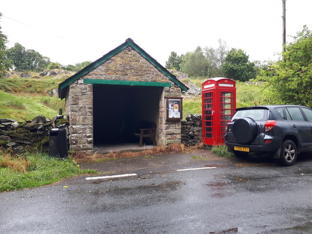
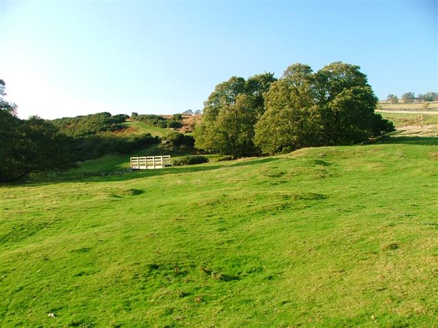
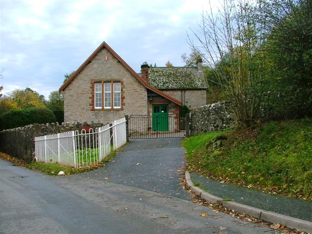
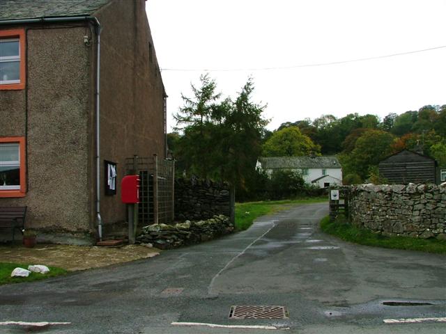
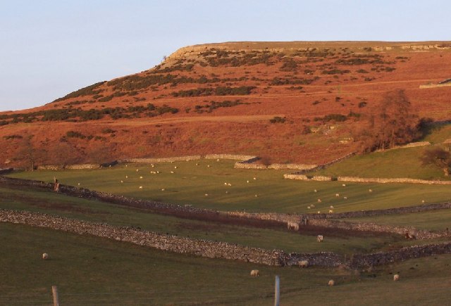
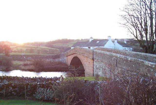
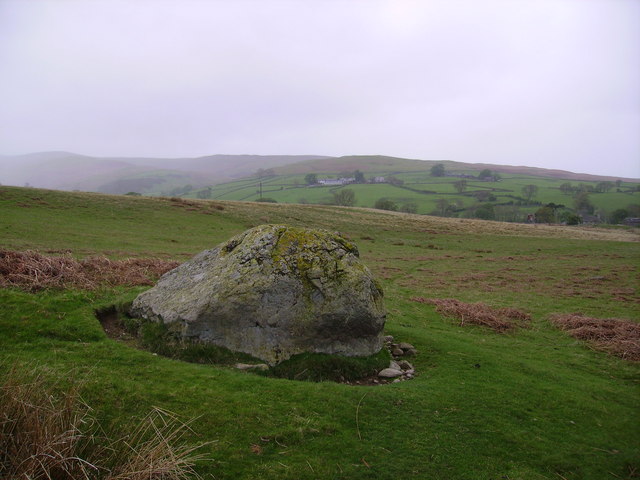
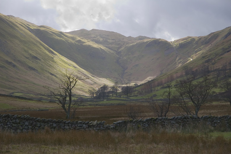
Butterwick is a small village located in the county of Westmorland, England. Situated in the picturesque countryside, the village is nestled between rolling hills and lush green fields. With a population of around 200 residents, Butterwick is a close-knit community that embodies the charm and tranquility of rural England.

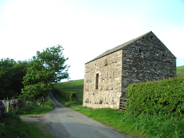
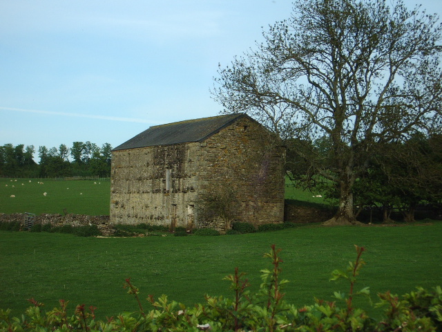
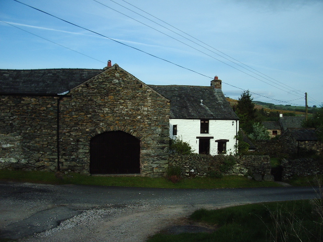
The village dates back to medieval times and still retains its historic character, with several old stone buildings and traditional cottages dotting the landscape. One of the notable landmarks is St. John's Church, a beautiful 12th-century structure that stands as a testament to the village's rich history.

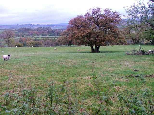
Life in Butterwick revolves around its strong agricultural heritage. The fertile land surrounding the village is predominantly used for farming, with crops such as wheat, barley, and vegetables being cultivated. Livestock farming is also a significant part of the local economy, with dairy farming and sheep rearing being popular among the villagers.

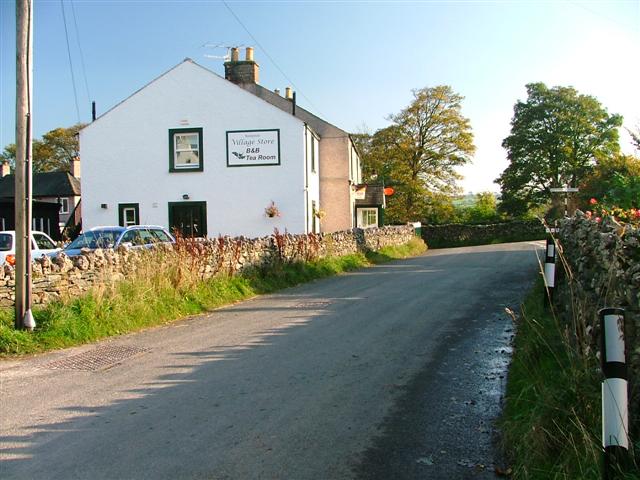
Despite its small size, Butterwick offers a range of amenities to its residents. The village has a primary school, a village hall, and a local pub, providing essential services and a sense of community. Additionally, the surrounding natural environment offers ample opportunities for outdoor activities such as hiking, cycling, and fishing.

Butterwick's peaceful and idyllic setting makes it an attractive destination for visitors seeking a retreat from the hustle and bustle of urban life. Its proximity to the Lake District National Park further adds to its appeal, making it a convenient base for exploring the stunning natural beauty of the region.

In summary, Butterwick is a charming village in Westmorland, renowned for its rural beauty, historic architecture, and strong agricultural heritage. Its tranquil atmosphere and range of amenities make it a delightful place to live or visit.

If you have any feedback on the listing, please let us know in the comments section below.
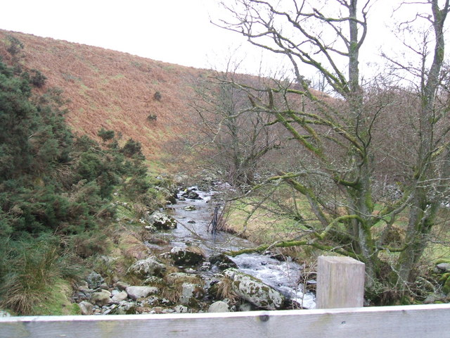
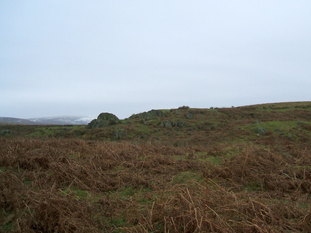
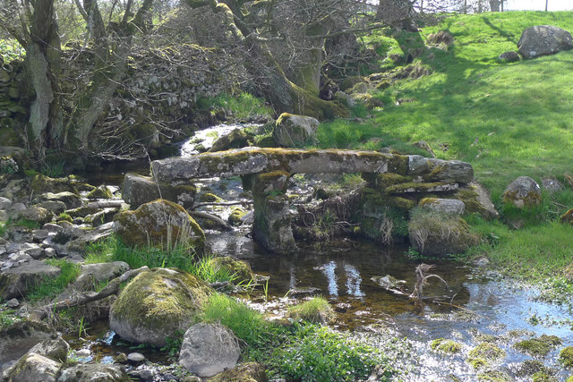
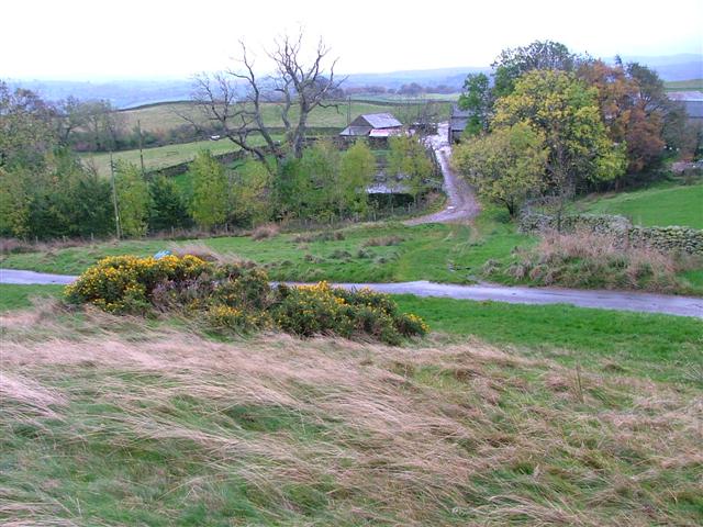
Butterwick Images

Images are sourced within 2km of 54.570243/-2.758662 or Grid Reference NY5119. Thanks to Geograph Open Source API. All images are credited.

Telephone Box from Withnail and I, Bampton A place of pilgrimage for fans of the film.
Telephone Box from Withnail and I, Bampton
A place of pilgrimage for fans of the film.
Footbridge Over Heltondale Beck
Barn The "C" class road runs north to Askham 4kms away, the woodland to the left is the southern point of Nelly's Wood.
Barn
The "C" class road runs north to Askham 4kms away, the woodland to the left is the southern point of Nelly's Wood.
Barn Barn .5km south of the hamlet of Whale
Barn
Barn .5km south of the hamlet of Whale
Walled track near Helton
Heltondale Beck
Heltondale Beck
Lanty Crag Not really worthy of the term 'crag'
Lanty Crag
Not really worthy of the term 'crag'
Clapper bridge, Whale This stone footbridge crosses a small stream south of Whale. The path is on the Westmorland Way.
Clapper bridge, Whale
This stone footbridge crosses a small stream south of Whale. The path is on the Westmorland Way.
Farm Road to Hullockhowe
Bampton Endowed School In 1999 the school had 21 pupils.
Bampton Endowed School
In 1999 the school had 21 pupils.
Bampton Village Store and Post Office
Postbox, Butterwick
Postbox, Butterwick
Fields Below Low Hullockhowe Looking north east from below Low Hullockhowe across the Lowther valley.
Fields Below Low Hullockhowe
Looking north east from below Low Hullockhowe across the Lowther valley.
Knipe Moor A very distinct skyline and autumn colours.
Knipe Moor
A very distinct skyline and autumn colours.
The bridge at Bampton Grange. A beautiful sandstone bridge.
The bridge at Bampton Grange.
A beautiful sandstone bridge.
Boulder near Sceugh From the unenclosed road near Dalefoot
Boulder near Sceugh
From the unenclosed road near Dalefoot
Fell End Farm, Butterwick, Penrith
The telephone kiosk from 'Withnail & I' A close up of the "Withnail and I" phone box. Filmed in 1986 the movie has a cult following around the world.
The telephone kiosk from 'Withnail & I'
A close up of the "Withnail and I" phone box. Filmed in 1986 the movie has a cult following around the world.
Show me another place!

Butterwick is located at Grid Ref: NY5119 (Lat: 54.570243, Lng: -2.758662)

Administrative County: Cumbria

District: Eden

Police Authority: Cumbria

What 3 Words

///sweep.clenching.hatter. Near Shap, Cumbria

Related Wikis

Butterwick, Cumbria

Butterwick is a hamlet in Cumbria, England, near the village of Helton. == Location grid ==

West Ward Rural District

West Ward was a rural district of the administrative county of Westmorland. The area was directly based on the former West Ward rural sanitary district...

Boredale Hause

Boredale Hause is a mountain pass between Place Fell and Angletarn Pikes in the east of the English Lake District. It links the Patterdale and Boredale...

Bampton, Cumbria

Bampton is a village and civil parish in the Westmorland and Furness unitary authority area of Cumbria, England, on the edge of the Lake District National...

Knipescar Common

Knipescar Common, or Knipe Scar, is an upland area in the east of the English Lake District, above the River Lowther, near Bampton, Cumbria. It is the...

Haweswater Beck

Haweswater Beck flows through Cumbria in England. It arises as a stream discharge from Haweswater Reservoir, at Gill Dubs, just east of the dam, and flows...

Whale, Cumbria

Whale is a hamlet in the Westmorland and Furness unitary authority area, Cumbria, England. Historically in Westmorland, it is about a mile south of the...

Helton, Cumbria

Helton is a village in the Eden district, in the English county of Cumbria. It is about a mile south of the village of Askham. Circa 1870, it had a population...

Nearby Amenities

Located within 500m of 54.570243,-2.758662
Butterwick Cottages
Naptan AtcoCode: 090074062202
Naptan Bearing: N
Naptan BusStopType: CUS
Naptan CommonName: Butterwick Cottages
Naptan Indicator: o/s
Naptan Landmark: Butterwick Cottages
Naptan NaptanCode: cumdadap
Naptan Street: No name
Naptan Verified: no
Source: naptan_import
Lat/Long: 54.5683882/-2.7582035
Cafe
Beckfoot Country House
Addr City: Helton
Addr Country: GB
Addr Housename: Beckfoot Country House
Addr Postcode: CA10 2QB
Email: info@beckfoot.co.uk
Fax: +44 1931 713391
Phone: +44 1931 713241
Tourism: guest_house
Website: www.beckfoot.co.uk
Lat/Long: 54.5744845/-2.7594639
Butterwick
Place: hamlet
Wikidata: Q5003029
Lat/Long: 54.5676417/-2.7590165
Post Box
Ref: CA10 31
Source: survey
Lat/Long: 54.5684001/-2.7582552
Grit Bin
Lat/Long: 54.5684131/-2.758046
Ford: yes
Lat/Long: 54.5683132/-2.7588354
Power: pole
Lat/Long: 54.5746485/-2.7582622
Power: pole
Lat/Long: 54.5740004/-2.7580917
Power: pole
Lat/Long: 54.5733212/-2.7579239
Power: pole
Lat/Long: 54.5722244/-2.7576109
Power: pole
Lat/Long: 54.5709527/-2.7572799
Power: pole
Lat/Long: 54.5700439/-2.7570294
Power: pole
Lat/Long: 54.5692193/-2.7568102
Power: pole
Lat/Long: 54.5687202/-2.7566827
Power: pole
Lat/Long: 54.5676155/-2.7560297
Power: pole
Lat/Long: 54.5665044/-2.7553767
Power: pole
Lat/Long: 54.5746629/-2.7588744
Power: pole
Lat/Long: 54.568759/-2.7574722
Power: pole
Lat/Long: 54.5686644/-2.7590444
Power: pole
Lat/Long: 54.5698935/-2.7560241
Power: pole
Lat/Long: 54.5697664/-2.7551072
Power: pole
Lat/Long: 54.569957/-2.7535999
Power: pole
Lat/Long: 54.5701152/-2.7522983
The data included in this document is from www.openstreetmap.org. The data is made available under ODbL.

Have you been to Butterwick?

Leave your review of Butterwick below (or comments, questions and feedback).