Butterton

Settlement in Staffordshire Staffordshire Moorlands

England

Butterton

Brookside Stables
Brookside Stables Credit: Alex McGregor

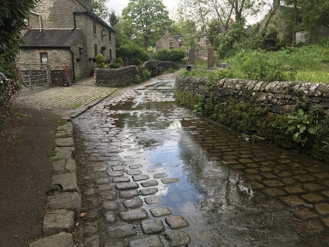
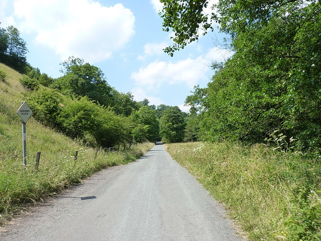
Butterton is a small village located in the Staffordshire Moorlands district of Staffordshire, England. Situated within the Peak District National Park, Butterton is surrounded by picturesque countryside and is known for its tranquil and idyllic setting.

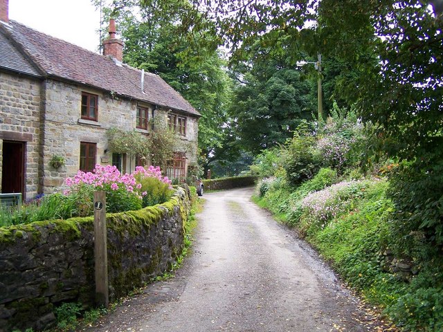
The village has a population of around 350 residents, making it a close-knit and tight community. Its history dates back to medieval times, and evidence of this can still be seen in the form of historic buildings and structures. The Church of St. Bartholomew, a Grade II listed building, is a prominent feature in the village, with its distinctive tower and stained glass windows.

Despite its small size, Butterton offers a range of amenities to its residents and visitors. There is a local pub, The Black Lion Inn, which serves traditional food and drink, providing a welcoming atmosphere for locals and tourists alike. The village also has a village hall, which is used for various community events and gatherings.

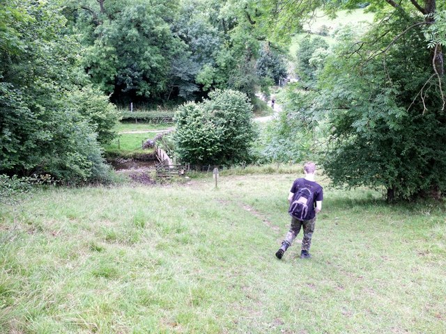
Butterton is a popular destination for outdoor enthusiasts, thanks to its proximity to the Peak District. There are numerous walking and cycling routes in the area, allowing visitors to explore the stunning natural landscapes that surround the village. The Manifold Way, a scenic trail along the River Manifold, is a particularly popular choice.

Overall, Butterton is a charming village that offers a peaceful and picturesque retreat for those looking to escape the hustle and bustle of city life. With its rich history, beautiful countryside, and friendly community, it is a hidden gem in the heart of Staffordshire.

If you have any feedback on the listing, please let us know in the comments section below.
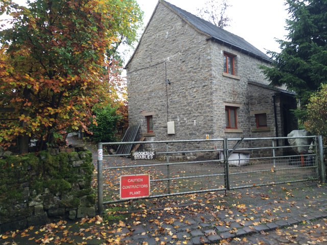
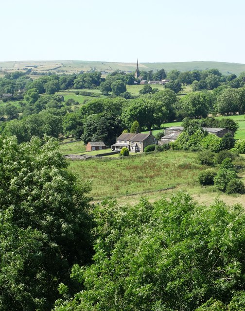
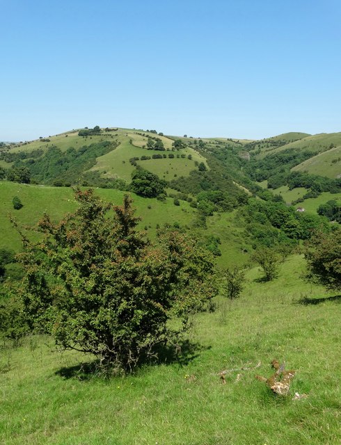
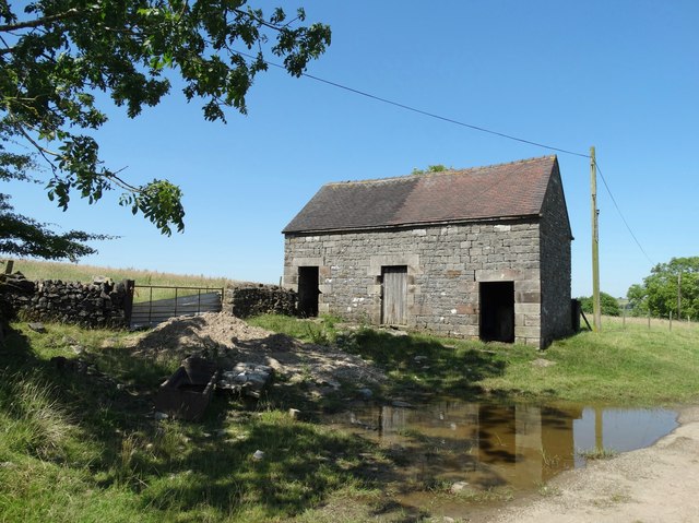
Butterton Images

Images are sourced within 2km of 53.10494/-1.8887861 or Grid Reference SK0756. Thanks to Geograph Open Source API. All images are credited.

Brookside Stables
Brookside Stables
The Manifold Valley at Swainsley Close to the river you can make out a stone tower. This is Swainsley Dovecote which was photographed from a very different viewpoint and described  by Roger Lombard in 2008:- <a title="https://www.geograph.org.uk/photo/2243785" href="https://www.geograph.org.uk/photo/2243785">Link</a>
The Manifold Valley at Swainsley
Close to the river you can make out a stone tower. This is Swainsley Dovecote which was photographed from a very different viewpoint and described by Roger Lombard in 2008:- Link
View to Broadmeadow and Butterton
Hawthorn tree above Foo Brook Looking towards Dale Farm and Sugarloaf.
Hawthorn tree above Foo Brook
Looking towards Dale Farm and Sugarloaf.
Relaxing by The River Manifold at Wetton Mill On the hottest day of the year - July 19th.
Relaxing by The River Manifold at Wetton Mill
On the hottest day of the year - July 19th.
Dale Farm View
Dale Farm View
Old barn north of Grindon
Picnic by the River Manifold near Wetton Mill
Steep path down off Ossoms Hill to Hoo Brook
Road tunnel. Manifold valley.
Road tunnel.
Manifold valley.
Swainsley dovecote. Interesting old building in the meadows beside the river Manifold.
Swainsley dovecote.
Interesting old building in the meadows beside the river Manifold.
Butterton Ford Another visit to the setted fords at Butterton. A video of the fords can be seen at:<span class="nowrap"><a title="https://youtu.be/JBR5LQss6Hc" rel="nofollow ugc noopener" href="https://youtu.be/JBR5LQss6Hc">Link</a><img style="margin-left:2px;" alt="External link" title="External link - shift click to open in new window" src="https://s1.geograph.org.uk/img/external.png" width="10" height="10"/></span>
and on a previous visit:<a title="https://www.geograph.org.uk/photo/2792811" href="https://www.geograph.org.uk/photo/2792811">Link</a>
Butterton Ford
Another visit to the setted fords at Butterton. A video of the fords can be seen at:LinkExternal link and on a previous visit:Link
Ford at Lower Elkstone This interesting cattle bridge ford is found on the Warslow Brook at Lower Elkstone.
Ford at Lower Elkstone
This interesting cattle bridge ford is found on the Warslow Brook at Lower Elkstone.
The River Manifold
The River Manifold
Down to the Manifold A steep track down into the Manifold valley. It is National Trust land.
Down to the Manifold
A steep track down into the Manifold valley. It is National Trust land.
On the narrow lane northwest of Wetton Mill 'Upgraded' from a section of the old railway line to a public road, but still rather narrow.
On the narrow lane northwest of Wetton Mill
'Upgraded' from a section of the old railway line to a public road, but still rather narrow.
Narrow lane in the Manifold valley Not actually part of the Manifold Way trail (that takes a track to the east of the river) but the metalled road here follows the route of the former railway line, including the Swainsley tunnel a little way to the north.
Narrow lane in the Manifold valley
Not actually part of the Manifold Way trail (that takes a track to the east of the river) but the metalled road here follows the route of the former railway line, including the Swainsley tunnel a little way to the north.
Swainsley tunnel southern entrance portal The Swainsley Tunnel took the Leek and Manifold Valley Light Railway under a steep spur of hillside, and is now used as a public path and road.
Swainsley tunnel southern entrance portal
The Swainsley Tunnel took the Leek and Manifold Valley Light Railway under a steep spur of hillside, and is now used as a public path and road.
Show me another place!

Butterton is located at Grid Ref: SK0756 (Lat: 53.10494, Lng: -1.8887861)

Administrative County: Staffordshire

District: Staffordshire Moorlands

Police Authority: Staffordshire

What 3 Words

///cure.haircuts.neater. Near Leek, Staffordshire

Nearby Locations

Butterton Butterton

Related Wikis

St Bartholomew's Church, Butterton

St Bartholomew's Church, Butterton is a Grade II listed parish church in the Church of England in Butterton. == History == St Bartholomew's Church was...

Butterton

Butterton is a small village in the Staffordshire Peak District of England (grid reference SK075565). It overlooks the Manifold Valley and Ecton Hill,...

Elkstones

Elkstones is a small hamlet in the parish of Warslow and Elkstones, consisting of Upper Elkstone and Lower Elkstone. Situated high in the Staffordshire...

Warslow and Elkstones

Warslow and Elkstones is a civil parish in the district of Staffordshire Moorlands in north-east Staffordshire, England. It includes the village of Warslow...

Wetton Mill railway station

Wetton Mill railway station was a minor station on the Leek and Manifold Light Railway serving the nearby Wetton Mill in Wetton, Staffordshire. The site...
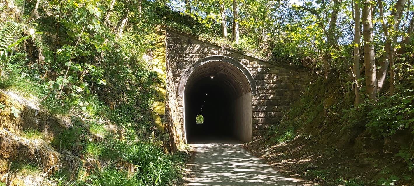
Swainsley Tunnel

Swainsley Tunnel is a tunnel on the route of the former Leek and Manifold Light Railway, which connected the market town of Leek with Hulme End, via Waterhouses...

Butterton railway station

Butterton railway station was a station on the Leek and Manifold Light Railway. It served the village of Butterton in Staffordshire. The site is now part...

Grindon, Staffordshire

Grindon is a small village in the Staffordshire Peak District of England. == Geography == Grindon is situated near the southern end of the Peak District...

Nearby Amenities

Located within 500m of 53.10494,-1.8887861
Butterton
Is In: Staffordshire, United Kingdom
Place: village
Wikidata: Q5003028
Wikipedia: en:Butterton
Lat/Long: 53.1059782/-1.8879451
Pub
The Black Lion Inn
Addr Postcode: ST13 7SP
Addr Street: Church Lane
Fhrs Id: 1259618
Source Addr: FHRS Open Data
Lat/Long: 53.1061129/-1.8889233
Post Box
Lat/Long: 53.1064404/-1.8905789
Source: GPS survey
Lat/Long: 53.103453/-1.8895754
Ford: yes
Lat/Long: 53.1031357/-1.8895362
Bus Stop
Bartholomew's Church
Naptan AtcoCode: 3800C803800
Naptan Bearing: N
Naptan CommonName: Bartholomew's Church
Naptan Indicator: Adj
Naptan Landmark: Post Box
Naptan Street: Church Lane
Naptan Verified: no
Source: naptan_import
Lat/Long: 53.106074/-1.8886712
Bench
Ele: 301.2565918
Lat/Long: 53.1066211/-1.8887239
Barrier: stile
Ele: 255.5943604
Steps: 2
Stile: stepover
Lat/Long: 53.1026383/-1.8869528
Barrier: stile
Ele: 258.9588623
Steps: 2
Stile: stepover
Lat/Long: 53.1030479/-1.8885147
Barrier: stile
Ele: 260.6411133
Stile: squeezer
Lat/Long: 53.1031282/-1.8888609
Barrier: stile
Material: stone
Source: survey;gps
Stile: squeezer
Lat/Long: 53.1085564/-1.8845327
Barrier: stile
Material: stone
Source: survey;gps
Stile: squeezer
Lat/Long: 53.1024288/-1.8890444
Barrier: stile
Material: stone
Source: survey;gps
Stile: squeezer
Lat/Long: 53.1018584/-1.8872189
Post Office
Note: village shop
Shop: convenience
Lat/Long: 53.1069895/-1.8930253
Barrier: stile
Material: stone
Source: survey;gps
Stile: squeezer
Lat/Long: 53.102682/-1.8925785
Barrier: stile
Material: stone
Source: survey;gps
Stile: squeezer
Lat/Long: 53.1067609/-1.8872495
Barrier: stile
Material: wood
Source: survey;gps
Stile: stepover
Lat/Long: 53.1071193/-1.8861672
Barrier: stile
Material: stone
Source: survey;gps
Stile: squeezer
Lat/Long: 53.102684/-1.8935929
Ford: yes
Lat/Long: 53.1032667/-1.8894488
Ford: yes
Lat/Long: 53.1033286/-1.8894677
Barrier: stile
Material: stone
Source: survey;gps
Stile: squeezer
Lat/Long: 53.1034742/-1.890529
Barrier: stile
Source: survey;gps
Stile: squeezer
Lat/Long: 53.1041572/-1.8930865
Barrier: stile
Material: stone
Source: survey;gps
Stile: squeezer
Lat/Long: 53.1043365/-1.8907236
Barrier: stile
Material: wood
Source: survey;gps
Stile: stepover
Lat/Long: 53.1043877/-1.8840744
Barrier: stile
Material: stone
Source: survey;gps
Stile: stepover
Lat/Long: 53.103461/-1.8905371
Barrier: stile
Material: stone
Source: survey;gps
Stile: stepover
Lat/Long: 53.1042135/-1.886569
Barrier: stile
Source: survey;gps
Lat/Long: 53.1025539/-1.8947708
Barrier: stile
Material: stone
Source: survey;gps
Stile: squeezer
Lat/Long: 53.1026278/-1.8942735
Ford: yes
Lat/Long: 53.1035951/-1.8896416
The data included in this document is from www.openstreetmap.org. The data is made available under ODbL.

Have you been to Butterton?

Leave your review of Butterton below (or comments, questions and feedback).