Butterwick

Settlement in Durham

England

Butterwick

Derelict filling station on north side of A689 The old petrol station was clearly a modest affair by modern standards, having just a tiny forecourt. It has been disused for some time - even seven year's earlier, Pauline's image shows the building to be in a poor state <a title="https://www.geograph.org.uk/photo/4015894" href="https://www.geograph.org.uk/photo/4015894">Link</a> .
Derelict filling station on north side of A689 Credit: Trevor Littlewood

Butterwick is a small village located in County Durham, England. Situated in the northeast of the country, it lies approximately 7 miles southwest of the town of Stockton-on-Tees. The village is surrounded by picturesque countryside, offering residents and visitors a tranquil and scenic environment.

Although small in size, Butterwick has a rich history. The area was first mentioned in historical records dating back to the 12th century, and evidence of Roman settlements nearby suggests even earlier habitation. The village's name is believed to derive from the Old English words "butere" (butter) and "wic" (dairy farm), indicating its agricultural roots.

Today, Butterwick maintains its rural charm, with a small population of around 500 residents. The village is known for its quaint cottages, many of which date back several centuries, and its well-preserved historic buildings. The local community is tight-knit, and there is a strong sense of pride and community spirit among the residents.

While Butterwick may be small, it offers a range of amenities for its residents. The village has a primary school, a village hall, and a local pub, providing essential services and acting as a hub for social gatherings. The surrounding countryside also offers numerous opportunities for outdoor activities such as hiking, cycling, and fishing.

Overall, Butterwick is a charming and idyllic village, steeped in history and surrounded by natural beauty. Its peaceful atmosphere and close-knit community make it an appealing place to live or visit for those seeking a tranquil escape from the hustle and bustle of city life.

If you have any feedback on the listing, please let us know in the comments section below.

Butterwick Images

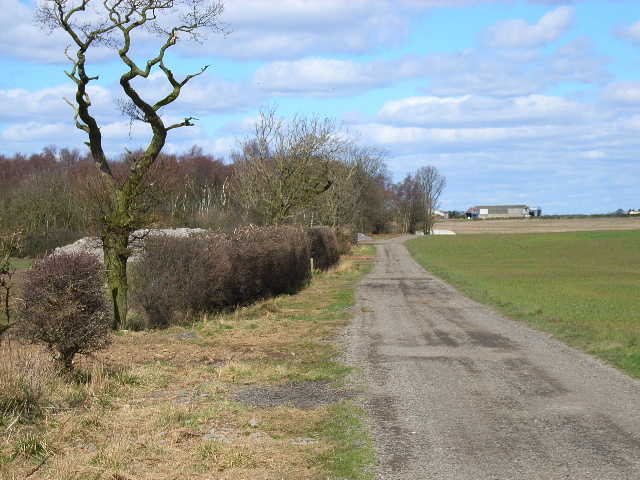
Images are sourced within 2km of 54.661114/-1.403904 or Grid Reference NZ3829. Thanks to Geograph Open Source API. All images are credited.

Derelict filling station on north side of A689 The old petrol station was clearly a modest affair by modern standards, having just a tiny forecourt. It has been disused for some time - even seven year's earlier, Pauline's image shows the building to be in a poor state <a title="https://www.geograph.org.uk/photo/4015894" href="https://www.geograph.org.uk/photo/4015894">Link</a> .
Derelict filling station on north side of A689
The old petrol station was clearly a modest affair by modern standards, having just a tiny forecourt. It has been disused for some time - even seven year's earlier, Pauline's image shows the building to be in a poor state Link .
Poultry houses at Little Butterwick Farm
Entering County Durham on the A689 Leaving Teesside
Entering County Durham on the A689
Leaving Teesside
Farm road to Old Acres Hall Farm
A689 road linking A1(north) with Teesside The dual carriageway has recently been extended over this section and a cycle path incorporated on the south side (right hand side of this picture)
A689 road linking A1(north) with Teesside
The dual carriageway has recently been extended over this section and a cycle path incorporated on the south side (right hand side of this picture)
Ten O'Clock Farm
Ten O'Clock Farm
Farm road from Butterwick Moor Farm
Farm road to Butterwick Moor Farm
Butterwick Moor Farm
Poultry sheds at Pinchbeck Farm, Sedgefield
Butterwick House Farm, near Sedgefield
Green Hill Farm
Green Hill Farm
Bridleway in Square Plantation Old Acres Hall Farm is in the background.
Bridleway in Square Plantation
Old Acres Hall Farm is in the background.
Bridge over ditch, Square Plantation
The edge of square plantation With Old Acres Hall Farm in the background.
The edge of square plantation
With Old Acres Hall Farm in the background.
Looking back towards the remainder of Square Plantation It is evident that the southernmost part of the plantation has been felled and the ground levelled.
Looking back towards the remainder of Square Plantation
It is evident that the southernmost part of the plantation has been felled and the ground levelled.
Sustrans cycle way This runs alongside the A689 dual carriageway. This section is part of the old A689 single road and leads to the quieter road towards Fishburn village.
Sustrans cycle way
This runs alongside the A689 dual carriageway. This section is part of the old A689 single road and leads to the quieter road towards Fishburn village.
Wild flowers beside the cycle way I think these are pink dead nettle.
Wild flowers beside the cycle way
I think these are pink dead nettle.
Show me another place!

Butterwick is located at Grid Ref: NZ3829 (Lat: 54.661114, Lng: -1.403904)

Unitary Authority: County Durham

Police Authority: Durham

What 3 Words

///husky.pots.cheered. Near Sedgefield, Co. Durham

Nearby Locations

Butterwick

Related Wikis

Butterwick, County Durham

Butterwick is a small village in County Durham, England. It is situated a short distance to the south east of Fishburn. Butterwick is first mentioned in...

Wynyard railway station (England)

Wynyard railway station was a railway station on the Castle Eden branch of the North Eastern Railway (NER) from 1880 to 1931. It was located immediately...

Sedgefield Community College

Sedgefield Community College, which is in the laidlaw trust, is an coeducational secondary school located in Sedgefield in County Durham, England. ��2...

Sedgefield (borough)

Sedgefield District was, from 1974 to 2009, a local government district and (from 1996), borough in County Durham, in North East England. It had a population...

Nearby Amenities

Located within 500m of 54.661114,-1.403904
Bus Stop
Lodge Farm
Naptan AtcoCode: 13006518B
Naptan Bearing: NE
Naptan CommonName: Lodge Farm
Naptan Indicator: north east bound
Naptan Landmark: Landmark not known
Naptan NaptanCode: durdpagm
Naptan Notes: Old Acres Lodge Farm- A689 Sedgefield to Wynyard- Sedgefield- (Eastbound)
Naptan Street: A689 Beacon Lane
Naptan Verified: no
Source: naptan_import
Lat/Long: 54.6575701/-1.402052
Bus Stop
Lodge Farm
Naptan AtcoCode: 13006518F
Naptan Bearing: SW
Naptan CommonName: Lodge Farm
Naptan Indicator: south west bound
Naptan Landmark: Landmark not known
Naptan NaptanCode: durdpagp
Naptan Notes: Old Acres Lodge Farm- A689 Sedgefield to Wynyard- Sedgefield (Westbound)
Naptan Street: A689 Beacon Lane
Naptan Verified: no
Source: naptan_import
Lat/Long: 54.657296/-1.4017884
Power: pole
Lat/Long: 54.6607529/-1.4020309
Power: pole
Lat/Long: 54.6603395/-1.4031225
Power: pole
Lat/Long: 54.6597414/-1.4044087
Power: pole
Lat/Long: 54.6591681/-1.4056961
Power: pole
Lat/Long: 54.6581433/-1.4079773
Power: pole
Lat/Long: 54.6586328/-1.406934
Power: pole
Lat/Long: 54.658162/-1.4052281
Power: pole
Lat/Long: 54.6577081/-1.4035369
Power: pole
Lat/Long: 54.6574925/-1.4027591
Power: pole
Transformer: distribution
Lat/Long: 54.6572318/-1.4018096
Old Acres Lodge Farm
Addr City: Stockton-on-Tees
Addr Postcode: TS21 3HP
Place: farm
Source Name: OS_OpenData_StreetView
Source Postcode: CodePoint Open
Lat/Long: 54.6570386/-1.4022884
Power: pole
Lat/Long: 54.6651355/-1.4005208
The data included in this document is from www.openstreetmap.org. The data is made available under ODbL.

Have you been to Butterwick?

Leave your review of Butterwick below (or comments, questions and feedback).