Allt Goch

Wood, Forest in Montgomeryshire

Wales

Allt Goch

Glyndwr's Way near Llanidloes
Glyndwr's Way near Llanidloes Credit: Dave Kelly

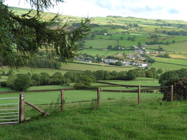
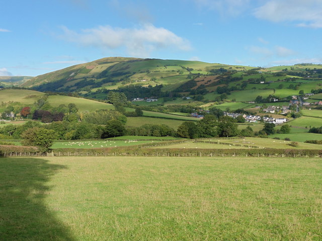
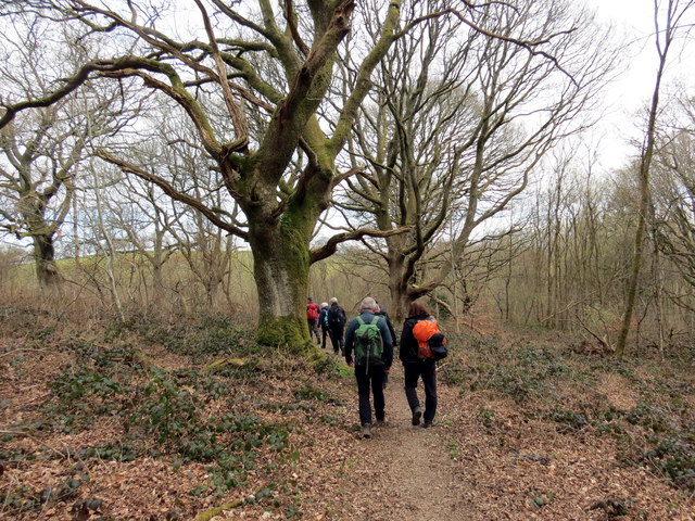
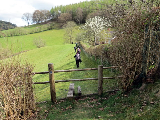
Allt Goch, located in Montgomeryshire, is a stunning woodland area that stretches across a vast expanse of land. It is a natural haven, encompassing a variety of tree species and providing a tranquil retreat for nature enthusiasts. The name "Allt Goch" translates to "Red Wood" in English, possibly referring to the reddish hue that the trees take on during certain seasons.

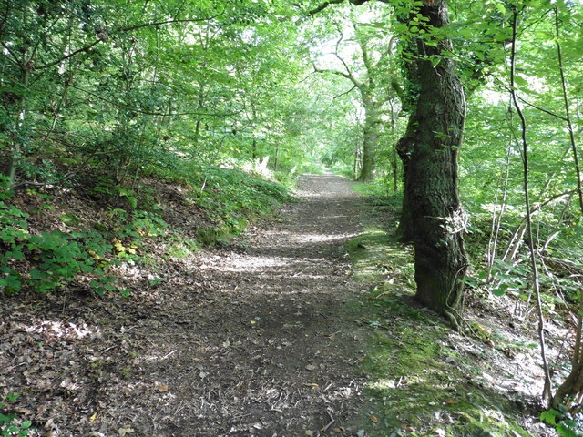
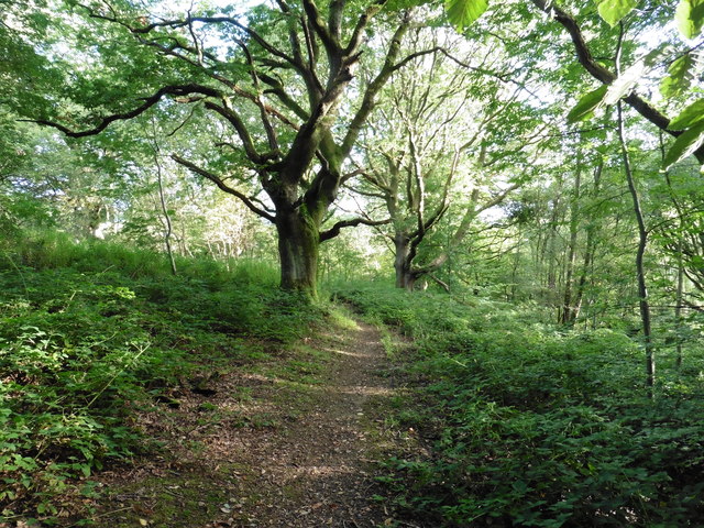
This forest offers a rich diversity of flora and fauna, with a canopy formed by towering oak, beech, and birch trees. The forest floor is adorned with a colorful carpet of wildflowers, including bluebells, primroses, and foxgloves, creating an enchanting atmosphere. Allt Goch is home to a myriad of wildlife species, including deer, foxes, badgers, and various bird species, making it a popular destination for birdwatchers and wildlife photographers.

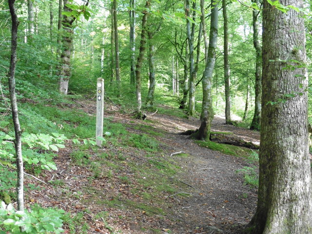
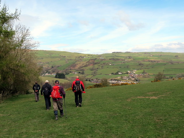
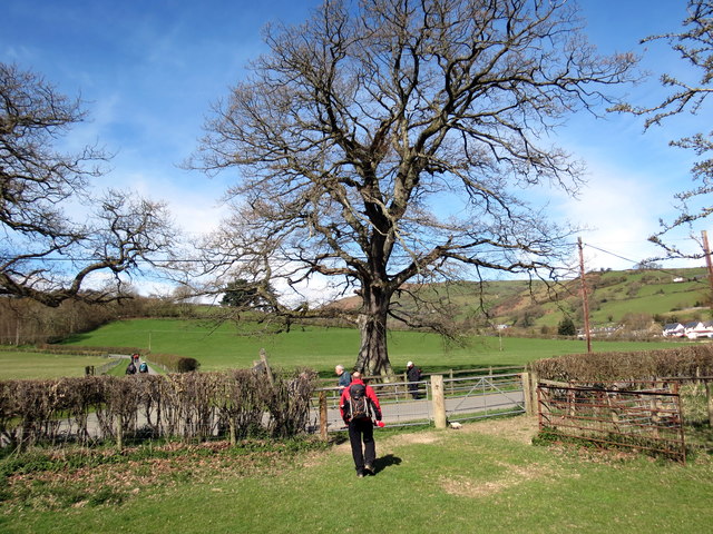
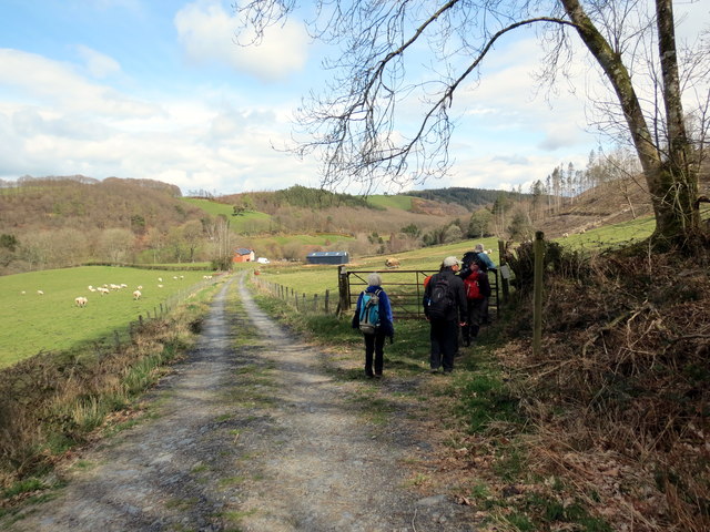
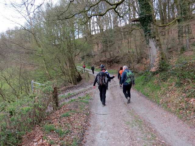
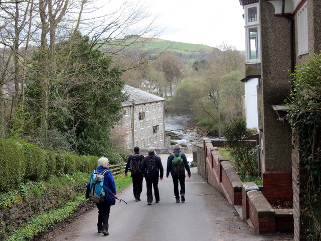
The forest is crisscrossed by a network of walking trails, providing visitors with the opportunity to explore its natural beauty. These trails take visitors through dense woodland, across babbling brooks, and up gentle hills, offering breathtaking panoramic views of the surrounding countryside. There are also picnic areas and benches strategically placed along the trails, allowing visitors to pause and immerse themselves in the tranquility of their surroundings.

Allt Goch, with its idyllic setting and diverse ecosystem, is not only a haven for nature-lovers but also an important ecological site. It serves as a valuable carbon sink, helping to mitigate climate change by absorbing and storing large amounts of carbon dioxide. The forest also plays a crucial role in maintaining local biodiversity and providing a habitat for numerous endangered species.

Overall, Allt Goch is a true gem in Montgomeryshire, offering a slice of natural beauty and serenity to all who visit.

If you have any feedback on the listing, please let us know in the comments section below.
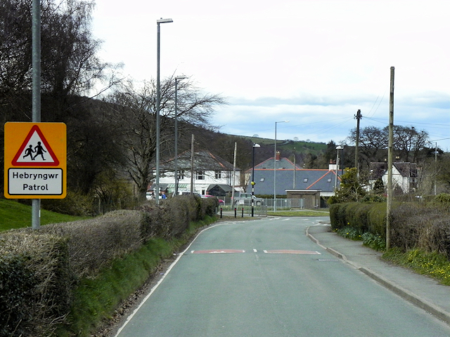
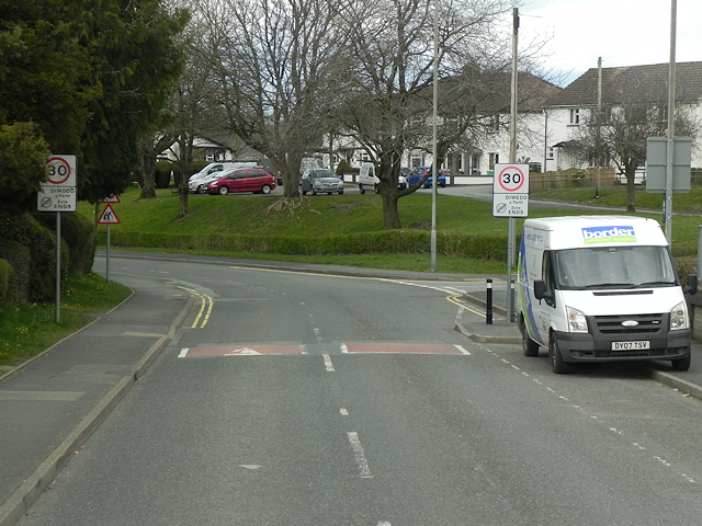
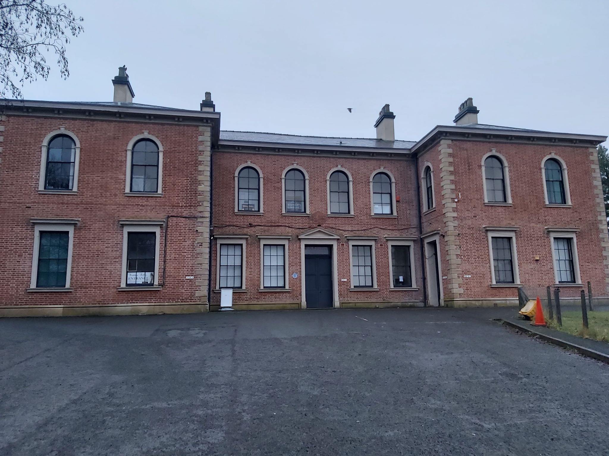
Allt Goch Images

Images are sourced within 2km of 52.457123/-3.5399789 or Grid Reference SN9585. Thanks to Geograph Open Source API. All images are credited.

Glyndwr's Way near Llanidloes
Glyndwr's Way near Llanidloes One of several route alterations North of Llanidloes
Glyndwr's Way near Llanidloes
One of several route alterations North of Llanidloes
Glyndwr's Way near Llanidloes
Glyndwr's Way by St Idloes golf club
Glyndwr's Way near Van Van may be seen in the distance
Glyndwr's Way near Van
Van may be seen in the distance
Glyndwr's Way near Van
Ordnance Survey Flush Bracket S0731 This can be found on the wall of St Idloes Church in Llanidloes.
For more detail see : <span class="nowrap"><a title="http://www.bench-marks.org.uk/bm12516" rel="nofollow ugc noopener" href="http://www.bench-marks.org.uk/bm12516">Link</a><img style="margin-left:2px;" alt="External link" title="External link - shift click to open in new window" src="https://s1.geograph.org.uk/img/external.png" width="10" height="10"/></span>
Ordnance Survey Flush Bracket S0731
This can be found on the wall of St Idloes Church in Llanidloes. For more detail see : LinkExternal link
The Church of St Idloes in Llanidloes Viewed from the south.
The Church of St Idloes in Llanidloes
Viewed from the south.
Allt Goch Cerddwyr yn dilyn Llwybr Glynhir drwy goedwig Allt Goch.

Walkers following the Glyndwr Way through woods known as Allt Goch (trans red hill).
Allt Goch
Cerddwyr yn dilyn Llwybr Glynhir drwy goedwig Allt Goch. Walkers following the Glyndwr Way through woods known as Allt Goch (trans red hill).
Ger Bron y Geifr / Near Bron y Geifr Cerddwyr yn dilyn Llwybr Glyndwr. Yr anheddiad yn y pellter yw y Fan.

Walkers following the Glyndwr Way. The settlement in the distance is the Fan (trans. peak).
Ger Bron y Geifr / Near Bron y Geifr
Cerddwyr yn dilyn Llwybr Glyndwr. Yr anheddiad yn y pellter yw y Fan. Walkers following the Glyndwr Way. The settlement in the distance is the Fan (trans. peak).
Ger y Fan / Near Y Fan Cerddwyr yn dilyn Llwybr Glyndwr ger pentre o'r enw'r Fan.

Walkers following Glyndwr's Way near a village called Y Fan (the peak).
Ger y Fan / Near Y Fan
Cerddwyr yn dilyn Llwybr Glyndwr ger pentre o'r enw'r Fan. Walkers following Glyndwr's Way near a village called Y Fan (the peak).
Ger Rhyd y Gwreiddyn / Near Rhyd y Gwreiddyn Cerddwyr yn dilyn llwybr cyhoeddus ger Ffarm Rhyd y Gwreiddyn.

Walkers following a public footpath near Rhyd y Gwreiddyn Farm (ford of the stream source).
Ger Rhyd y Gwreiddyn / Near Rhyd y Gwreiddyn
Cerddwyr yn dilyn llwybr cyhoeddus ger Ffarm Rhyd y Gwreiddyn. Walkers following a public footpath near Rhyd y Gwreiddyn Farm (ford of the stream source).
Sticil Cwmeryr Bach / Cwmeryr Bach Stile Sticil wrth ymyl anhedd-dy o'r enw Cwmeryr Bach.

A stile at Cwmeryr Bach (trans. eagle valley)
Sticil Cwmeryr Bach / Cwmeryr Bach Stile
Sticil wrth ymyl anhedd-dy o'r enw Cwmeryr Bach. A stile at Cwmeryr Bach (trans. eagle valley)
Tuag at Lanidloes / Towards Llanidloes Cerddwyr yn dilyn heol ddiwyneb tuag at Lanidloes.

Walkers following an unsurfaced road towards Llanidloes (trans. church of Idloes).
Tuag at Lanidloes / Towards Llanidloes
Cerddwyr yn dilyn heol ddiwyneb tuag at Lanidloes. Walkers following an unsurfaced road towards Llanidloes (trans. church of Idloes).
Cyrraedd Llanidloes / Arriving at Llanidloes Cerddwyr yn cyrraedd Llanidloes.

Walkers arriving at Llanidloes (trans. church of Idloes).
Cyrraedd Llanidloes / Arriving at Llanidloes
Cerddwyr yn cyrraedd Llanidloes. Walkers arriving at Llanidloes (trans. church of Idloes).
Llanidloes, Traffic Calming near the High School Traffic calming measures on Llangurig Road (B4518) near to Llanidloes High School.
Llanidloes, Traffic Calming near the High School
Traffic calming measures on Llangurig Road (B4518) near to Llanidloes High School.
Llanidloes, Llangurig Road Llandiloes is situated along the A470 and B4518 roads in Powys, within the historic county boundaries of Montgomeryshire. The town’s official website <span class="nowrap"><a title="http://www.llanidloes.com/" rel="nofollow ugc noopener" href="http://www.llanidloes.com/">Link</a><img style="margin-left:2px;" alt="External link" title="External link - shift click to open in new window" src="https://s1.geograph.org.uk/img/external.png" width="10" height="10"/></span>  describes it as “a small town at the heart of Wales, nestling amidst the eastern slopes of the Cambrian Mountains, Llanidloes is at the heart of the ancient medieval kingdom of Arwystli and is one of the great little market towns of Mid Wales, UK and the first town on the River Severn.” The population recorded at the 2011 census was 2,929, of whom 15% were Welsh-speakers. Llanidloes takes its name from the early seventh century Celtic Saint Idloes (Llan-Idloes = the Church of St Idloes), after whom its parish church is named. It received a market charter from the King in 1270.  The present-day street plan follows much of the 13th century grid layout.
Llanidloes, Llangurig Road
Llandiloes is situated along the A470 and B4518 roads in Powys, within the historic county boundaries of Montgomeryshire. The town’s official website LinkExternal link describes it as “a small town at the heart of Wales, nestling amidst the eastern slopes of the Cambrian Mountains, Llanidloes is at the heart of the ancient medieval kingdom of Arwystli and is one of the great little market towns of Mid Wales, UK and the first town on the River Severn.” The population recorded at the 2011 census was 2,929, of whom 15% were Welsh-speakers. Llanidloes takes its name from the early seventh century Celtic Saint Idloes (Llan-Idloes = the Church of St Idloes), after whom its parish church is named. It received a market charter from the King in 1270. The present-day street plan follows much of the 13th century grid layout.
Llangurig Road (B4518) Llandiloes is situated along the A470 and B4518 roads in Powys, within the historic county boundaries of Montgomeryshire. The town’s official website <span class="nowrap"><a title="http://www.llanidloes.com/" rel="nofollow ugc noopener" href="http://www.llanidloes.com/">Link</a><img style="margin-left:2px;" alt="External link" title="External link - shift click to open in new window" src="https://s1.geograph.org.uk/img/external.png" width="10" height="10"/></span>  describes it as “a small town at the heart of Wales, nestling amidst the eastern slopes of the Cambrian Mountains, Llanidloes is at the heart of the ancient medieval kingdom of Arwystli and is one of the great little market towns of Mid Wales, UK and the first town on the River Severn.” The population recorded at the 2011 census was 2,929, of whom 15% were Welsh-speakers. Llanidloes takes its name from the early seventh century Celtic Saint Idloes (Llan-Idloes = the Church of St Idloes), after whom its parish church is named. It received a market charter from the King in 1270.  The present-day street plan follows much of the 13th century grid layout.
Llangurig Road (B4518)
Llandiloes is situated along the A470 and B4518 roads in Powys, within the historic county boundaries of Montgomeryshire. The town’s official website LinkExternal link describes it as “a small town at the heart of Wales, nestling amidst the eastern slopes of the Cambrian Mountains, Llanidloes is at the heart of the ancient medieval kingdom of Arwystli and is one of the great little market towns of Mid Wales, UK and the first town on the River Severn.” The population recorded at the 2011 census was 2,929, of whom 15% were Welsh-speakers. Llanidloes takes its name from the early seventh century Celtic Saint Idloes (Llan-Idloes = the Church of St Idloes), after whom its parish church is named. It received a market charter from the King in 1270. The present-day street plan follows much of the 13th century grid layout.
Show me another place!

Allt Goch is located at Grid Ref: SN9585 (Lat: 52.457123, Lng: -3.5399789)

Unitary Authority: Powys

Police Authority: Dyfed Powys

What 3 Words

///pollution.locating.safely. Near Llanidloes, Powys

Nearby Locations

Allt Goch Pen-yr-allt Wood

Related Wikis

Llanidloes War Memorial Hospital

Llanidloes War Memorial Hospital (Welsh: Ysbyty Coffa Rhyfel Llanidloes) is a health facility in Eastgate Street, Llanidloes, Powys, Wales. It is managed...

Afon Clywedog

The Afon Clywedog is an upland headwater tributary of the River Severn in Powys, Wales. It is approximately 29 km long and has its source on the flanks...

Llanidloes Town F.C.

Llanidloes Town Football Club (Welsh: Clwb Pêl-droed Tref Llanidloes) are an association football club based in the town of Llanidloes, Wales. They currently...

Llanidloes

Llanidloes (Welsh pronunciation: [ɬanˈɪdlɔɨs]) is a town and community on the A470 and B4518 roads in Powys, within the historic county boundaries of Montgomeryshire...

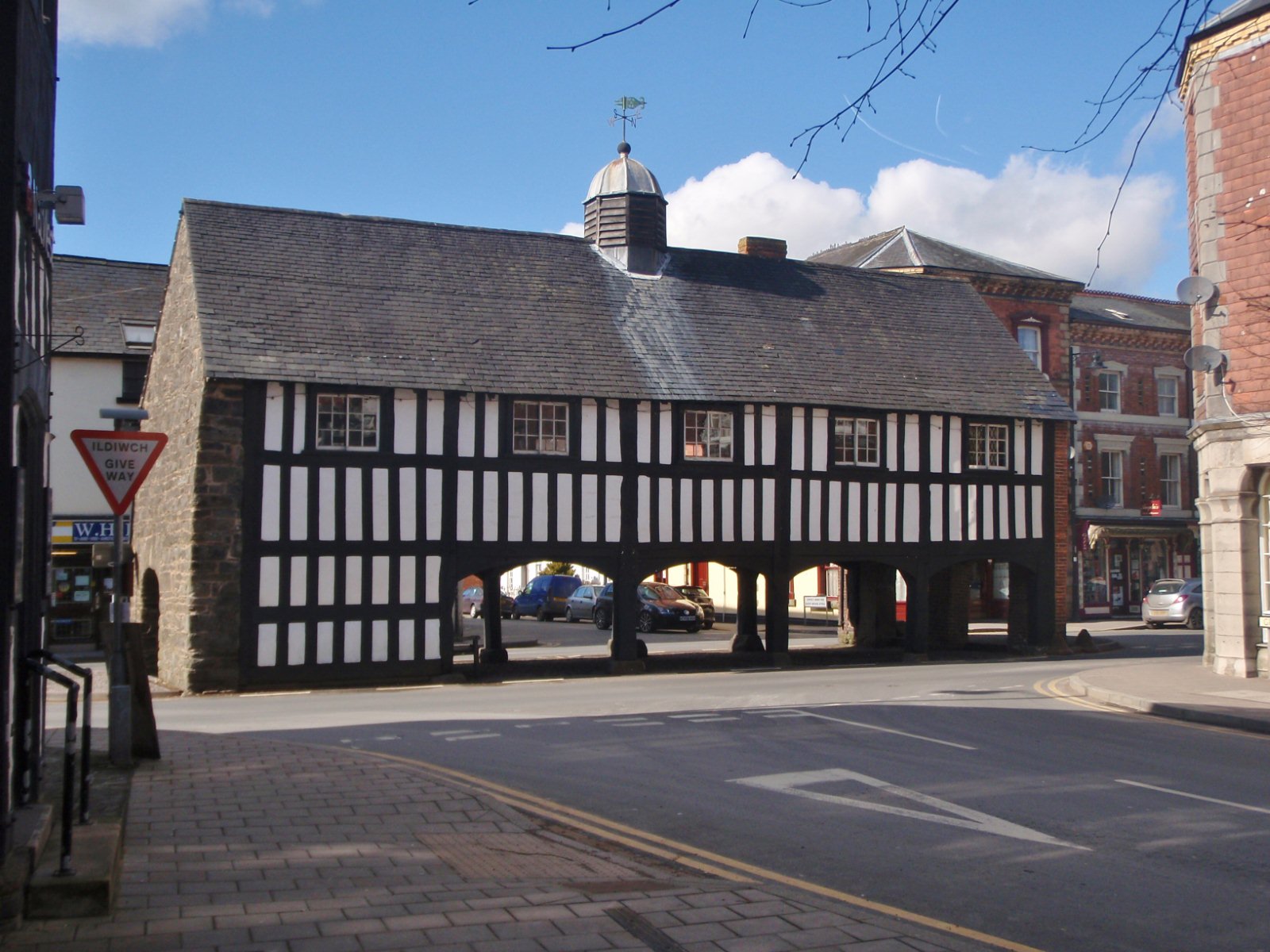
Old Market Hall, Llanidloes

The Old Market Hall is the oldest timber-framed market hall in Llanidloes, Wales, dating to the early 17th century. Until well into the 20th century a...

Llanidloes Town Hall

Llanidloes Town Hall (Welsh: Neuadd y Dref Llanidloes) is a municipal building in Great Oak Street, Llanidloes in Powys, Wales. The structure, which is...

Llanidloes railway station

Llanidloes railway station is a former junction railway station in Llanidloes, Powys, Wales. The Cambrian Railways, which completed the building in 1864...

Llanidloes transmitting station

The Llanidloes transmitting station is a broadcasting and telecommunications facility consisting of a self-supporting 23 m lattice mast erected on land...

Related Videos

Our PATIO paradise | A small space made beautiful

This is the story of how we transformed an ugly strip of old concrete slabs in front of our house into a beautiful outdoor space - our ...

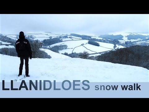
Walking in the Snow | to Llanidloes, Mid Wales

A wonderfully atmospheric short winter walk in the snow. It starts high in the misty hills of the Upper Severn Valley not far from the ...

Passive solar GREENHOUSE update | YEAR 2

Here is our Year 2 update on our wonderful passive solar greenhouse in Mid Wales in the UK. The video captures what happened ...

BARREN FIELD to PRODUCTIVE PLOT | Organic fruit & vegetable growing in Mid Wales

Watch us transform a barren hillside field into a productive fruit and vegetable garden over a period of several seasons. Our patch ...

Nearby Amenities

Located within 500m of 52.457123,-3.5399789
Turning Circle
Lat/Long: 52.4536982/-3.5384989
Bryn Dol-Llys
Place: locality
Lat/Long: 52.4593546/-3.5407906
Power: pole
Lat/Long: 52.4548727/-3.5343616
Power: pole
Lat/Long: 52.4552535/-3.5356772
Power: pole
Lat/Long: 52.4557344/-3.5330278
Power: pole
Lat/Long: 52.4556347/-3.5330251
Power: pole
Lat/Long: 52.4551312/-3.5343394
Power: pole
Lat/Long: 52.4554467/-3.5355598
Power: pole
Lat/Long: 52.4553217/-3.5356953
Power: pole
Lat/Long: 52.4549833/-3.5343649
Toilets
Access: yes
Fee: no
Toilets Disposal: chemical
Toilets Position: seated
Unisex: yes
Lat/Long: 52.4584316/-3.5374072
Leisure: picnic_table
Lat/Long: 52.4582714/-3.537713
Bench
Source: survey;gps
Lat/Long: 52.4547108/-3.5404421
Bench
Source: survey;gps
Lat/Long: 52.4564834/-3.5390943
Allt Goch
Board Type: nature
Information: board
Tourism: information
Lat/Long: 52.453435/-3.5416786
Post Box
Lat/Long: 52.45316/-3.5379916
Direction: 125
Generator Method: photovoltaic
Generator Output Electricity: yes
Generator Solar Modules: 12
Generator Source: solar
Generator Type: solar_photovoltaic_panel
Location: roof
Power: generator
Lat/Long: 52.4557439/-3.5371465
Direction: 125
Generator Method: photovoltaic
Generator Output Electricity: yes
Generator Solar Modules: 16
Generator Source: solar
Generator Type: solar_photovoltaic_panel
Location: roof
Power: generator
Lat/Long: 52.453185/-3.5408996
Direction: 145
Generator Method: photovoltaic
Generator Output Electricity: yes
Generator Solar Modules: 46
Generator Source: solar
Generator Type: solar_photovoltaic_panel
Location: roof
Power: generator
Lat/Long: 52.4611315/-3.5405756
The data included in this document is from www.openstreetmap.org. The data is made available under ODbL.

Have you been to Allt Goch?

Leave your review of Allt Goch below (or comments, questions and feedback).