Coed y Cefn

Wood, Forest in Radnorshire

Wales

Coed y Cefn

Clock Tower, Rhayader
Clock Tower, Rhayader Credit: Richard Sutcliffe

Coed y Cefn, located in Radnorshire, Wales, is a picturesque and enchanting wood or forest. Spread across a vast area, it is considered one of the most beautiful natural sites in the region. The woodland is characterized by its dense canopy of trees, diverse flora, and fauna, making it a haven for nature enthusiasts and wildlife lovers.

The forest features a wide range of tree species, including oak, ash, beech, and birch, which create a rich and vibrant tapestry of colors throughout the year. The forest floor is covered with a thick carpet of moss, ferns, and wildflowers, adding to the overall charm of the woodland.

Coed y Cefn is also home to a variety of wildlife species, making it an important habitat for biodiversity. Birdwatchers can catch glimpses of rare and migratory species, such as woodpeckers, owls, and cuckoos. Additionally, the forest provides a sanctuary for small mammals like foxes, badgers, and squirrels.

The wood is open to the public and offers a network of well-maintained paths and trails, allowing visitors to explore its natural beauty on foot. There are also picnic areas and benches scattered throughout the forest, providing a perfect spot to relax and enjoy the serene surroundings.

Coed y Cefn truly offers a tranquil escape from the hustle and bustle of everyday life. Its majestic trees, vibrant flora, and diverse wildlife create an idyllic setting where visitors can immerse themselves in the wonders of nature.

If you have any feedback on the listing, please let us know in the comments section below.

Coed y Cefn Images

Images are sourced within 2km of 52.298976/-3.5348811 or Grid Reference SN9567. Thanks to Geograph Open Source API. All images are credited.

Clock Tower, Rhayader
Rhayader, Tan House Bridge Rhayader (Welsh: Rhaeadr Gwy) is a small market town in Powys; its population was recorded as  2088 at the 2011 census. The town is one of the principal centres of population in the predominantly rural historic county of Radnorshire. It is situated on the A470, roughly midway between north and south Wales, 13 miles north of Builth Wells and 30 miles east of Aberystwyth, some 700ft above sea level in the Upper Wye Valley.

The name "Rhayader" is corrupted from the Welsh "Rhaeadr Gwy", meaning Waterfall on the Wye. Little remains of the waterfall itself, it having been destroyed in 1780 to make way for the bridge linking the town to Cwmdauddwr and the Elan Valley.
Rhayader, Tan House Bridge
Rhayader (Welsh: Rhaeadr Gwy) is a small market town in Powys; its population was recorded as 2088 at the 2011 census. The town is one of the principal centres of population in the predominantly rural historic county of Radnorshire. It is situated on the A470, roughly midway between north and south Wales, 13 miles north of Builth Wells and 30 miles east of Aberystwyth, some 700ft above sea level in the Upper Wye Valley. The name "Rhayader" is corrupted from the Welsh "Rhaeadr Gwy", meaning Waterfall on the Wye. Little remains of the waterfall itself, it having been destroyed in 1780 to make way for the bridge linking the town to Cwmdauddwr and the Elan Valley.
Rhayader, South Street Rhayader (Welsh: Rhaeadr Gwy) is a small market town in Powys; its population was recorded as  2088 at the 2011 census. The town is one of the principal centres of population in the predominantly rural historic county of Radnorshire. It is situated on the A470, roughly midway between north and south Wales, 13 miles north of Builth Wells and 30 miles east of Aberystwyth, some 700ft above sea level in the Upper Wye Valley.

The name "Rhayader" is corrupted from the Welsh "Rhaeadr Gwy", meaning Waterfall on the Wye. Little remains of the waterfall itself, it having been destroyed in 1780 to make way for the bridge linking the town to Cwmdauddwr and the Elan Valley.
Rhayader, South Street
Rhayader (Welsh: Rhaeadr Gwy) is a small market town in Powys; its population was recorded as 2088 at the 2011 census. The town is one of the principal centres of population in the predominantly rural historic county of Radnorshire. It is situated on the A470, roughly midway between north and south Wales, 13 miles north of Builth Wells and 30 miles east of Aberystwyth, some 700ft above sea level in the Upper Wye Valley. The name "Rhayader" is corrupted from the Welsh "Rhaeadr Gwy", meaning Waterfall on the Wye. Little remains of the waterfall itself, it having been destroyed in 1780 to make way for the bridge linking the town to Cwmdauddwr and the Elan Valley.
South Street, Rhayader Rhayader (Welsh: Rhaeadr Gwy) is a small market town in Powys; its population was recorded as  2088 at the 2011 census. The town is one of the principal centres of population in the predominantly rural historic county of Radnorshire. It is situated on the A470, roughly midway between north and south Wales, 13 miles north of Builth Wells and 30 miles east of Aberystwyth, some 700ft above sea level in the Upper Wye Valley.

The name "Rhayader" is corrupted from the Welsh "Rhaeadr Gwy", meaning Waterfall on the Wye. Little remains of the waterfall itself, it having been destroyed in 1780 to make way for the bridge linking the town to Cwmdauddwr and the Elan Valley.
South Street, Rhayader
Rhayader (Welsh: Rhaeadr Gwy) is a small market town in Powys; its population was recorded as 2088 at the 2011 census. The town is one of the principal centres of population in the predominantly rural historic county of Radnorshire. It is situated on the A470, roughly midway between north and south Wales, 13 miles north of Builth Wells and 30 miles east of Aberystwyth, some 700ft above sea level in the Upper Wye Valley. The name "Rhayader" is corrupted from the Welsh "Rhaeadr Gwy", meaning Waterfall on the Wye. Little remains of the waterfall itself, it having been destroyed in 1780 to make way for the bridge linking the town to Cwmdauddwr and the Elan Valley.
Rhayader, West Street Rhayader (Welsh: Rhaeadr Gwy) is a small market town in Powys; its population was recorded as  2088 at the 2011 census. The town is one of the principal centres of population in the predominantly rural historic county of Radnorshire. It is situated on the A470, roughly midway between north and south Wales, 13 miles north of Builth Wells and 30 miles east of Aberystwyth, some 700ft above sea level in the Upper Wye Valley.

The name "Rhayader" is corrupted from the Welsh "Rhaeadr Gwy", meaning Waterfall on the Wye. Little remains of the waterfall itself, it having been destroyed in 1780 to make way for the bridge linking the town to Cwmdauddwr and the Elan Valley.
Rhayader, West Street
Rhayader (Welsh: Rhaeadr Gwy) is a small market town in Powys; its population was recorded as 2088 at the 2011 census. The town is one of the principal centres of population in the predominantly rural historic county of Radnorshire. It is situated on the A470, roughly midway between north and south Wales, 13 miles north of Builth Wells and 30 miles east of Aberystwyth, some 700ft above sea level in the Upper Wye Valley. The name "Rhayader" is corrupted from the Welsh "Rhaeadr Gwy", meaning Waterfall on the Wye. Little remains of the waterfall itself, it having been destroyed in 1780 to make way for the bridge linking the town to Cwmdauddwr and the Elan Valley.
Rhayader, Bridge Street Rhayader (Welsh: Rhaeadr Gwy) is a small market town in Powys; its population was recorded as  2088 at the 2011 census. The town is one of the principal centres of population in the predominantly rural historic county of Radnorshire. It is situated on the A470, roughly midway between north and south Wales, 13 miles north of Builth Wells and 30 miles east of Aberystwyth, some 700ft above sea level in the Upper Wye Valley.

The name "Rhayader" is corrupted from the Welsh "Rhaeadr Gwy", meaning Waterfall on the Wye. Little remains of the waterfall itself, it having been destroyed in 1780 to make way for the bridge linking the town to Cwmdauddwr and the Elan Valley.
Rhayader, Bridge Street
Rhayader (Welsh: Rhaeadr Gwy) is a small market town in Powys; its population was recorded as 2088 at the 2011 census. The town is one of the principal centres of population in the predominantly rural historic county of Radnorshire. It is situated on the A470, roughly midway between north and south Wales, 13 miles north of Builth Wells and 30 miles east of Aberystwyth, some 700ft above sea level in the Upper Wye Valley. The name "Rhayader" is corrupted from the Welsh "Rhaeadr Gwy", meaning Waterfall on the Wye. Little remains of the waterfall itself, it having been destroyed in 1780 to make way for the bridge linking the town to Cwmdauddwr and the Elan Valley.
Bridge Street, Rhayader Rhayader (Welsh: Rhaeadr Gwy) is a small market town in Powys; its population was recorded as  2088 at the 2011 census. The town is one of the principal centres of population in the predominantly rural historic county of Radnorshire. It is situated on the A470, roughly midway between north and south Wales, 13 miles north of Builth Wells and 30 miles east of Aberystwyth, some 700ft above sea level in the Upper Wye Valley.

The name "Rhayader" is corrupted from the Welsh "Rhaeadr Gwy", meaning Waterfall on the Wye. Little remains of the waterfall itself, it having been destroyed in 1780 to make way for the bridge linking the town to Cwmdauddwr and the Elan Valley.
Bridge Street, Rhayader
Rhayader (Welsh: Rhaeadr Gwy) is a small market town in Powys; its population was recorded as 2088 at the 2011 census. The town is one of the principal centres of population in the predominantly rural historic county of Radnorshire. It is situated on the A470, roughly midway between north and south Wales, 13 miles north of Builth Wells and 30 miles east of Aberystwyth, some 700ft above sea level in the Upper Wye Valley. The name "Rhayader" is corrupted from the Welsh "Rhaeadr Gwy", meaning Waterfall on the Wye. Little remains of the waterfall itself, it having been destroyed in 1780 to make way for the bridge linking the town to Cwmdauddwr and the Elan Valley.
Rhayader, Wye View Terrace The A470 entering Rhayader from the north.
Rhayader, Wye View Terrace
The A470 entering Rhayader from the north.
Wye View Terrace Rhayader (Welsh: Rhaeadr Gwy) is a small market town in Powys; its population was recorded as  2088 at the 2011 census. The town is one of the principal centres of population in the predominantly rural historic county of Radnorshire. It is situated on the A470, roughly midway between north and south Wales, 13 miles north of Builth Wells and 30 miles east of Aberystwyth, some 700ft above sea level in the Upper Wye Valley.

The name "Rhayader" is corrupted from the Welsh "Rhaeadr Gwy", meaning Waterfall on the Wye. Little remains of the waterfall itself, it having been destroyed in 1780 to make way for the bridge linking the town to Cwmdauddwr and the Elan Valley.
Wye View Terrace
Rhayader (Welsh: Rhaeadr Gwy) is a small market town in Powys; its population was recorded as 2088 at the 2011 census. The town is one of the principal centres of population in the predominantly rural historic county of Radnorshire. It is situated on the A470, roughly midway between north and south Wales, 13 miles north of Builth Wells and 30 miles east of Aberystwyth, some 700ft above sea level in the Upper Wye Valley. The name "Rhayader" is corrupted from the Welsh "Rhaeadr Gwy", meaning Waterfall on the Wye. Little remains of the waterfall itself, it having been destroyed in 1780 to make way for the bridge linking the town to Cwmdauddwr and the Elan Valley.
Rhayader/Rhaeadr Gwy and Gwestedyn Hill Gwestedyn is the hill rising to the south east of the town and identified by a cairn on its highest point. It is well-known locally for the annual hill race which takes place during Carnival Week in July – from the town clock to the top of Gwestedyn and back.
Rhayader/Rhaeadr Gwy and Gwestedyn Hill
Gwestedyn is the hill rising to the south east of the town and identified by a cairn on its highest point. It is well-known locally for the annual hill race which takes place during Carnival Week in July – from the town clock to the top of Gwestedyn and back.
Rhayader, North Street and Gwestedyn Gwestedyn is the hill rising to the south east of the town and identified by a cairn on its highest point. It is well-known locally for the annual hill race which takes place during Carnival Week in July – from the town clock to the top of Gwestedyn and back.
Rhayader, North Street and Gwestedyn
Gwestedyn is the hill rising to the south east of the town and identified by a cairn on its highest point. It is well-known locally for the annual hill race which takes place during Carnival Week in July – from the town clock to the top of Gwestedyn and back.
Rhayader, North Street Rhayader (Welsh: Rhaeadr Gwy) is a small market town in Powys; its population was recorded as  2088 at the 2011 census. The town is one of the principal centres of population in the predominantly rural historic county of Radnorshire. It is situated on the A470, roughly midway between north and south Wales, 13 miles north of Builth Wells and 30 miles east of Aberystwyth, some 700ft above sea level in the Upper Wye Valley.

The name "Rhayader" is corrupted from the Welsh "Rhaeadr Gwy", meaning Waterfall on the Wye. Little remains of the waterfall itself, it having been destroyed in 1780 to make way for the bridge linking the town to Cwmdauddwr and the Elan Valley.
Rhayader, North Street
Rhayader (Welsh: Rhaeadr Gwy) is a small market town in Powys; its population was recorded as 2088 at the 2011 census. The town is one of the principal centres of population in the predominantly rural historic county of Radnorshire. It is situated on the A470, roughly midway between north and south Wales, 13 miles north of Builth Wells and 30 miles east of Aberystwyth, some 700ft above sea level in the Upper Wye Valley. The name "Rhayader" is corrupted from the Welsh "Rhaeadr Gwy", meaning Waterfall on the Wye. Little remains of the waterfall itself, it having been destroyed in 1780 to make way for the bridge linking the town to Cwmdauddwr and the Elan Valley.
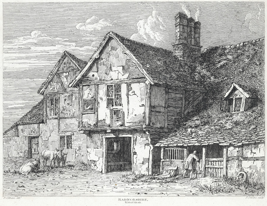
The Old Swan Tea Room and Cake Shop, Rhayader The Old Swan, a historic former public house which stands on the corner of West and South Street, is one of the oldest buildings in Rhayader; the original building was mentioned in 1676 as being one of the two inns in Rhayader at that date. Some changes were made in 1683, including the rebuilding of the three chimney stacks, and this date is carved into the old timbers inside the building. During the 1860s the Old Swan stopped trading as an inn, and it was used in later years as a hardware shop, a saddlers, a butcher's shop, and other businesses. For a time, part of it was used as the Tourist Information Centre. The section of the building on the corner is used as a teashop. It is a Grade II listed building (Cadw Building ID: 16191 <span class="nowrap"><a title="http://www.britishlistedbuildings.co.uk/wa-16191-former-tourist-information-centre-west-st#.V2Gyzo-cGHt" rel="nofollow ugc noopener" href="http://www.britishlistedbuildings.co.uk/wa-16191-former-tourist-information-centre-west-st#.V2Gyzo-cGHt">Link</a><img style="margin-left:2px;" alt="External link" title="External link - shift click to open in new window" src="https://s1.geograph.org.uk/img/external.png" width="10" height="10"/></span>  British Listed Buildings).
The Old Swan Tea Room and Cake Shop, Rhayader
The Old Swan, a historic former public house which stands on the corner of West and South Street, is one of the oldest buildings in Rhayader; the original building was mentioned in 1676 as being one of the two inns in Rhayader at that date. Some changes were made in 1683, including the rebuilding of the three chimney stacks, and this date is carved into the old timbers inside the building. During the 1860s the Old Swan stopped trading as an inn, and it was used in later years as a hardware shop, a saddlers, a butcher's shop, and other businesses. For a time, part of it was used as the Tourist Information Centre. The section of the building on the corner is used as a teashop. It is a Grade II listed building (Cadw Building ID: 16191 LinkExternal link British Listed Buildings).
Rhayader, South Street and Gwestedyn Gwestedyn is the hill rising to the south east of the town and identified by a cairn on its highest point. It is well-known locally for the annual hill race which takes place during Carnival Week in July – from the town clock to the top of Gwestedyn and back.
Rhayader, South Street and Gwestedyn
Gwestedyn is the hill rising to the south east of the town and identified by a cairn on its highest point. It is well-known locally for the annual hill race which takes place during Carnival Week in July – from the town clock to the top of Gwestedyn and back.
A470 (South Street) Rhayader Rhayader (Welsh: Rhaeadr Gwy) is a small market town in Powys; its population was recorded as  2088 at the 2011 census. The town is one of the principal centres of population in the predominantly rural historic county of Radnorshire. It is situated on the A470, roughly midway between north and south Wales, 13 miles north of Builth Wells and 30 miles east of Aberystwyth, some 700ft above sea level in the Upper Wye Valley.

The name "Rhayader" is corrupted from the Welsh "Rhaeadr Gwy", meaning Waterfall on the Wye. Little remains of the waterfall itself, it having been destroyed in 1780 to make way for the bridge linking the town to Cwmdauddwr and the Elan Valley.
A470 (South Street) Rhayader
Rhayader (Welsh: Rhaeadr Gwy) is a small market town in Powys; its population was recorded as 2088 at the 2011 census. The town is one of the principal centres of population in the predominantly rural historic county of Radnorshire. It is situated on the A470, roughly midway between north and south Wales, 13 miles north of Builth Wells and 30 miles east of Aberystwyth, some 700ft above sea level in the Upper Wye Valley. The name "Rhayader" is corrupted from the Welsh "Rhaeadr Gwy", meaning Waterfall on the Wye. Little remains of the waterfall itself, it having been destroyed in 1780 to make way for the bridge linking the town to Cwmdauddwr and the Elan Valley.
B4518, South West of Rhayader
B4518, Llansantffraed-Cwmdeuddwr
Lone Tree by the B4518
Show me another place!

Coed y Cefn is located at Grid Ref: SN9567 (Lat: 52.298976, Lng: -3.5348811)

Unitary Authority: Powys

Police Authority: Dyfed Powys

What 3 Words

///easels.remotest.heartless. Near Rhayader, Powys

Related Wikis

Rhayader railway station

Rhayader railway station was a station serving the town of Rhayader, Powys, on the Mid Wales Railway line. It was opened in 1864 in Cwmdauddwr, a village...

Cwmdauddwr

Cwmdauddwr (rarely referred to by its correct full name of Llansanffraid Cwmteuddwr) is a village in Powys, Wales. It is contiguous with the town of Rhayader...

Rhayader Rural District

Rhayader was, from 1894 to 1974, a rural district in the administrative county of Radnorshire, Wales. The district was formed by the Local Government Act...

Rhayader

Rhayader (; Welsh: Rhaeadr Gwy; pronounced [ˈr̥əɪadar ˈɡʊi̯]) is a market town and community in Powys, Wales, within the historic county of Radnorshire...

Rhayader Town F.C.

Rhayader Town Football Club (Welsh: Clwb Pêl-droed Tref Rhaeadr Gwy) are a Welsh football team. The club dates from around 1884 and their ground is called...

Old Swan, Rhayader

The Old Swan is a former historic public house at the centre of Rhayader, Powys, Wales. The buildings are timber framed and while there is a datestone...

Afon Elan

The Afon Elan (English: River Elan) is a tributary of the River Wye which runs through the wide expanse of upland moors, traditionally known as Elenydd...

Carn Gafallt

Carn Gafallt is a Site of Special Scientific Interest in Breconshire, Powys, Wales, and a hill of 466 metres (1529 feet) which is a Marilyn. == See... ==

Nearby Amenities

Located within 500m of 52.298976,-3.5348811
The data included in this document is from www.openstreetmap.org. The data is made available under ODbL.

Have you been to Coed y Cefn?

Leave your review of Coed y Cefn below (or comments, questions and feedback).