Coed Gwilym

Wood, Forest in Glamorgan

Wales

Coed Gwilym

Ordnance Survey Cut Mark This OS cut mark can be found on the NW buttress of the now removed railway bridge. It marks a point 46.918m above mean sea level.
Ordnance Survey Cut Mark Credit: Adrian Dust

Coed Gwilym, located in Glamorgan, Wales, is a picturesque wood or forest known for its natural beauty and rich biodiversity. Spanning over a vast area, Coed Gwilym offers a tranquil and serene environment that attracts nature lovers, hikers, and birdwatchers alike.

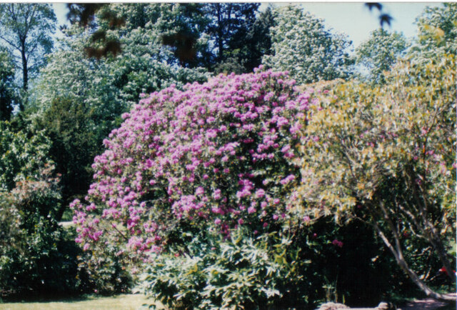
The wood is home to a diverse range of tree species, including oak, beech, ash, and birch. These towering trees create a dense canopy, providing shade and shelter for a variety of flora and fauna. The forest floor is adorned with a vibrant carpet of wildflowers, ferns, and mosses, adding to its enchanting appeal.

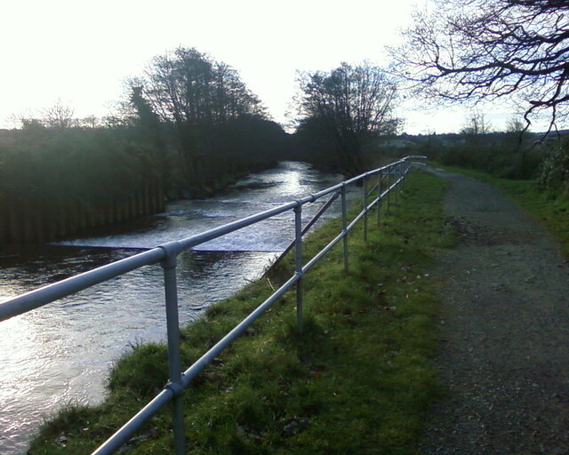
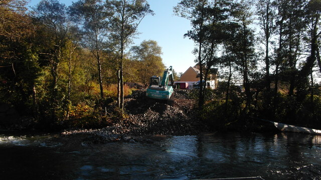
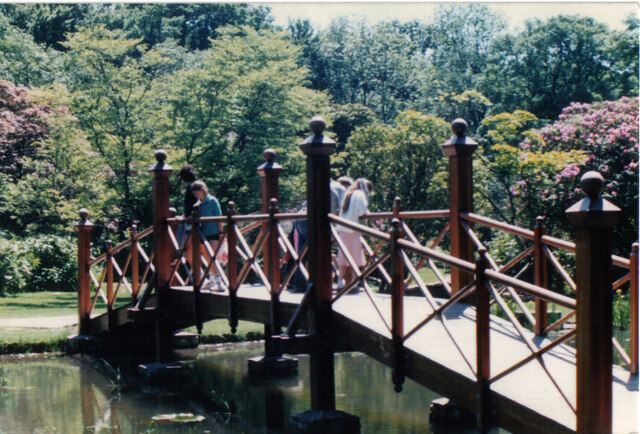
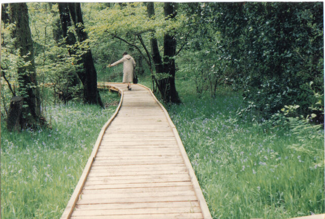
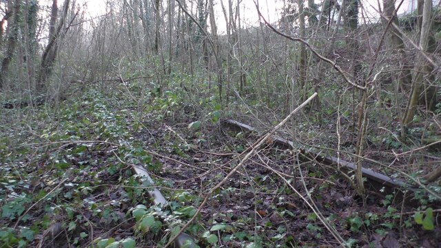
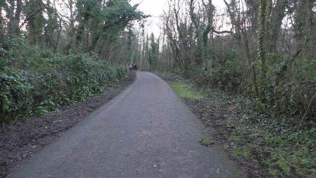
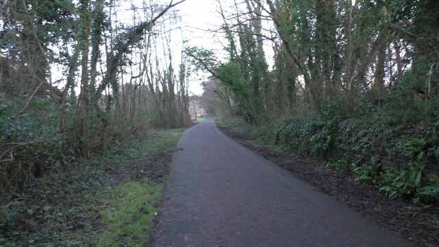
Coed Gwilym is crisscrossed by a network of well-maintained trails, allowing visitors to explore the different sections of the wood. The paths wind through the forest, revealing hidden glades, babbling brooks, and small ponds. These water features attract a host of wildlife, including ducks, herons, and dragonflies.

Bird enthusiasts will be delighted by the abundance of avian species found in Coed Gwilym. The wood is a haven for various woodland birds, such as woodpeckers, song thrushes, and tawny owls. Birdwatchers can spot these feathered inhabitants perched on branches or hear their melodious calls echoing through the trees.

With its natural beauty and diverse ecosystems, Coed Gwilym offers a peaceful retreat for those seeking solace in nature. Whether it's a leisurely stroll, a birdwatching expedition, or simply enjoying the serenity of the forest, this woodland gem in Glamorgan is a must-visit destination for nature enthusiasts.

If you have any feedback on the listing, please let us know in the comments section below.
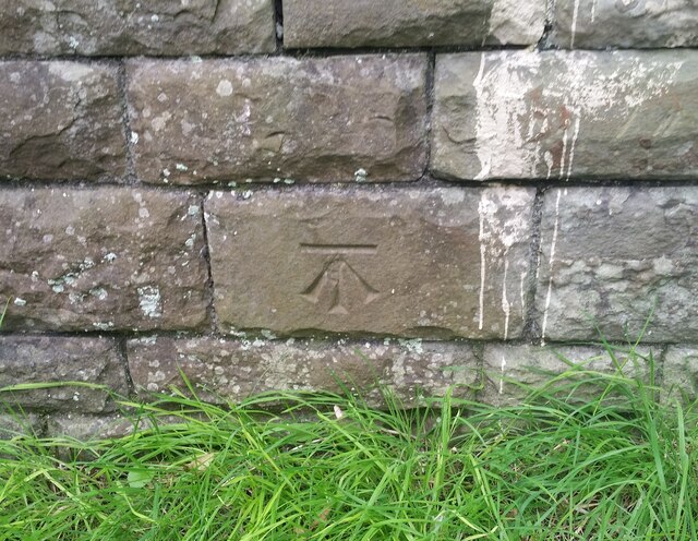
Coed Gwilym Images

Images are sourced within 2km of 51.565282/-3.5816045 or Grid Reference SS9086. Thanks to Geograph Open Source API. All images are credited.

Ordnance Survey Cut Mark This OS cut mark can be found on the NW buttress of the now removed railway bridge. It marks a point 46.918m above mean sea level.
Ordnance Survey Cut Mark
This OS cut mark can be found on the NW buttress of the now removed railway bridge. It marks a point 46.918m above mean sea level.
Ordnance Survey Cut Mark This OS cut mark can be found on the rock outcrop NW side of the cycle track. It marks a point 59.116m above mean sea level.
Ordnance Survey Cut Mark
This OS cut mark can be found on the rock outcrop NW side of the cycle track. It marks a point 59.116m above mean sea level.
Ordnance Survey Cut Mark This OS cut mark can be found on the NE parapet of Abergarw Bridge. It marks a point 56.912m above mean sea level.
Ordnance Survey Cut Mark
This OS cut mark can be found on the NE parapet of Abergarw Bridge. It marks a point 56.912m above mean sea level.
Ordnance Survey Cut Mark This OS cut mark can be found on the wall NW side of the Abergarw Road. It marks a point 59.381m above mean sea level.
Ordnance Survey Cut Mark
This OS cut mark can be found on the wall NW side of the Abergarw Road. It marks a point 59.381m above mean sea level.
Ordnance Survey Cut Mark This OS cut mark can be found on the wall east side of the road. It marks a point 61.500m above mean sea level.
Ordnance Survey Cut Mark
This OS cut mark can be found on the wall east side of the road. It marks a point 61.500m above mean sea level.
Ordnance Survey Cut Mark This OS cut mark can be found on the Council Offices on Abergarw Road. It marks a point 52.130m above mean sea level.
Ordnance Survey Cut Mark
This OS cut mark can be found on the Council Offices on Abergarw Road. It marks a point 52.130m above mean sea level.
Ordnance Survey Rivet This OS rivet can be found on the east face of the Fox & Hounds. It marks a point 51.999m above mean sea level.
Ordnance Survey Rivet
This OS rivet can be found on the east face of the Fox & Hounds. It marks a point 51.999m above mean sea level.
Ordnance Survey Cut Mark This OS cut mark can be found on the wall of No168 Bryn Road. It marks a point 58.878m above mean sea level.
Ordnance Survey Cut Mark
This OS cut mark can be found on the wall of No168 Bryn Road. It marks a point 58.878m above mean sea level.
River Ogmore River Ogmore and cycle track, viewed down river from under the old railway bridge at rear of Ynysawdre school
River Ogmore
River Ogmore and cycle track, viewed down river from under the old railway bridge at rear of Ynysawdre school
Ynysawdre Tondu Ynysawdre Tondu, works on River Ogmore and housing site
Ynysawdre Tondu
Ynysawdre Tondu, works on River Ogmore and housing site
Bryngarw House Bryngarw Park; the house was opened to the public just a few weeks before I took these pics.
Bryngarw House
Bryngarw Park; the house was opened to the public just a few weeks before I took these pics.
Bryngarw View across the car park, the cafe and gift shop, Bryngarw park
Bryngarw
View across the car park, the cafe and gift shop, Bryngarw park
Bryngarw Bryngarw, the Japanese garden, with bridge across the pond
Bryngarw
Bryngarw, the Japanese garden, with bridge across the pond
Bryngarw Bryngarw, the Japanese garden, pink blossom trees
Bryngarw
Bryngarw, the Japanese garden, pink blossom trees
Bryngarw Bryngarw, the boarded footpath across the wetland area, at rear of the estate
Bryngarw
Bryngarw, the boarded footpath across the wetland area, at rear of the estate
Brynmenyn Brynmenyn, near the old railway station, the now disused railway which ran from Tondu to the Garw Valley Ogmore Valley also Gilfach Heol y Cyw Brynna
Brynmenyn
Brynmenyn, near the old railway station, the now disused railway which ran from Tondu to the Garw Valley Ogmore Valley also Gilfach Heol y Cyw Brynna
Brynmenyn Brynmenyn, cycletrack, this was formerly Brynmenyn railway station, with view direction towards Tondu, the stone walls are still visible where the platforms were, just behind the bushes to the right, was the platform which led trains up down the Garw Valley
Brynmenyn
Brynmenyn, cycletrack, this was formerly Brynmenyn railway station, with view direction towards Tondu, the stone walls are still visible where the platforms were, just behind the bushes to the right, was the platform which led trains up down the Garw Valley
Brynmenyn Brynmenyn, now a cycletrack, this was formerly Brynmenyn railway station, the stone walls are still visible where the platform was, which would have taken trains the direction view towards the Ogmore Valley, Gilfach Valley, Heol y Cyw and Brynna
Brynmenyn
Brynmenyn, now a cycletrack, this was formerly Brynmenyn railway station, the stone walls are still visible where the platform was, which would have taken trains the direction view towards the Ogmore Valley, Gilfach Valley, Heol y Cyw and Brynna
Show me another place!

Coed Gwilym is located at Grid Ref: SS9086 (Lat: 51.565282, Lng: -3.5816045)

Unitary Authority: Bridgend

Police Authority: South Wales

What 3 Words

///releasing.digests.umpires. Near Betws, Bridgend

Related Wikis

Bettws, Bridgend

Bettws , (Welsh: Betws) is a small ex-mining and farming village in the South Wales Valleys in the county borough of Bridgend, Wales. Bettws is also an...

St David's Church, Bettws

St David's Church is a Grade I listed church in Bettws, Bridgend County Borough, southern Wales. The church is believed to date to the 12th century, though...

Ogmore (Senedd constituency)

Ogmore (Welsh: Ogwr) is a constituency of the Senedd. It elects one Member of the Senedd by the first past the post method of election. It is one of seven...

Llangeinor

Llangeinor (Welsh: Llangeinwyr) is a small village (and community council electoral ward) located in the Garw Valley around 5 miles (8 km) north of Bridgend...

Nearby Amenities

Located within 500m of 51.565282,-3.5816045
Turning Loop
Lat/Long: 51.5667852/-3.5846219
Turning Loop
Lat/Long: 51.5654036/-3.5852602
Turning Loop
Lat/Long: 51.565549/-3.5841337
Turning Loop
Lat/Long: 51.5660901/-3.5841555
Power: tower
Lat/Long: 51.5629113/-3.5875989
Power: tower
Lat/Long: 51.5622606/-3.5763574
Power: tower
Lat/Long: 51.5626944/-3.5837729
Disused Amenity: post_office
Lat/Long: 51.5671673/-3.5877551
Bus Stop
Naptan AtcoCode: 5510AWA12969
Naptan NaptanCode: breadpd
Shelter: yes
Lat/Long: 51.566852/-3.5870267
Bus Stop
Naptan AtcoCode: 5510AWA12970
Naptan NaptanCode: breadmp
Shelter: yes
Lat/Long: 51.5668929/-3.5872668
Post Box
Collection Times: Mo-Fr 16:45; Sa 11:30
Operator: Royal Mail
Post Box Type: pillar
Ref: CF32 85
Royal Cypher: EIIR
Royal Cypher Wikidata: Q33102113
Lat/Long: 51.5673739/-3.5874123
Direction: SSW
Generator Method: photovoltaic
Generator Output Electricity: yes
Generator Solar Modules: 15
Generator Source: solar
Generator Type: solar_photovoltaic_panel
Location: roof
Power: generator
Lat/Long: 51.5655624/-3.5851106
Direction: 165
Generator Method: photovoltaic
Generator Output Electricity: yes
Generator Solar Modules: 15
Generator Source: solar
Generator Type: solar_photovoltaic_panel
Location: roof
Power: generator
Lat/Long: 51.5657166/-3.5854543
The data included in this document is from www.openstreetmap.org. The data is made available under ODbL.

Have you been to Coed Gwilym?

Leave your review of Coed Gwilym below (or comments, questions and feedback).