Coed y Cwrt

Wood, Forest in Denbighshire

Wales

Coed y Cwrt

Farmland south of Glasfryn The brown section is the bog associated with the River Nug. It is an SSSI.
Farmland south of Glasfryn Credit: Eirian Evans

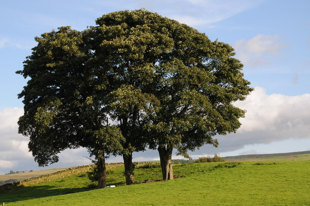
Coed y Cwrt is a woodland area located in Denbighshire, Wales. Covering an area of approximately 200 hectares, the forest is a mix of native broadleaf trees such as oak, beech, and birch, as well as coniferous species like pine and spruce. The forest is managed by Natural Resources Wales, with a focus on sustainable forestry practices and conservation efforts.

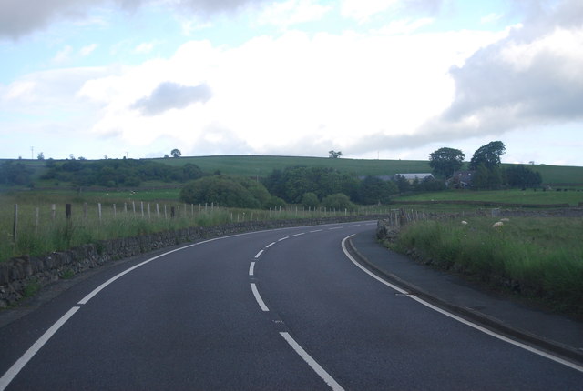
Coed y Cwrt offers visitors a peaceful and scenic environment to explore, with various walking trails and paths winding through the trees. The forest is home to a diverse range of wildlife, including birds, mammals, and insects, making it a popular spot for birdwatching and nature enthusiasts.

In addition to its natural beauty, Coed y Cwrt also has historical significance, with remnants of ancient settlements and structures scattered throughout the woodland. Visitors can learn about the area's rich history and cultural heritage as they wander through the forest.

Overall, Coed y Cwrt is a tranquil and picturesque destination for those looking to connect with nature and experience the beauty of the Welsh countryside.

If you have any feedback on the listing, please let us know in the comments section below.

Coed y Cwrt Images

Images are sourced within 2km of 53.04591/-3.6352253 or Grid Reference SH9051. Thanks to Geograph Open Source API. All images are credited.

Farmland south of Glasfryn The brown section is the bog associated with the River Nug. It is an SSSI.
Farmland south of Glasfryn
The brown section is the bog associated with the River Nug. It is an SSSI.
Farm building at Cernioge Mawr near Cerrigydrudion I must have passed this distinctive building many times and it has always made me think 'why is it so ornate?' so today I stopped off briefly to take a photo with a view to researching it for geograph. Turns out it was built beside the new Holyhead road, now the A5 of course, to enable horses to be changed and to offer refreshment to passengers who would have to stretch their legs in the interval between teams. Apparently Queen Victoria, no less, was one such passenger who stopped here for a cup of tea.

The building is part of an old farm now farmed by a local farmer who breeds prize rams and sheep here. The glories are fading fast but the fittings declare its past status. I suppose it was an early equivalent of our motorway services.
Farm building at Cernioge Mawr near Cerrigydrudion
I must have passed this distinctive building many times and it has always made me think 'why is it so ornate?' so today I stopped off briefly to take a photo with a view to researching it for geograph. Turns out it was built beside the new Holyhead road, now the A5 of course, to enable horses to be changed and to offer refreshment to passengers who would have to stretch their legs in the interval between teams. Apparently Queen Victoria, no less, was one such passenger who stopped here for a cup of tea. The building is part of an old farm now farmed by a local farmer who breeds prize rams and sheep here. The glories are fading fast but the fittings declare its past status. I suppose it was an early equivalent of our motorway services.
Old barn at Cernioge Mawr on the A5 near Cerrigydrudion Now just a barn - but once Queen Victoria stopped here (well, in the yard anyway) for a brew. Was she amused? I trust that she was.
Old barn at Cernioge Mawr on the A5 near Cerrigydrudion
Now just a barn - but once Queen Victoria stopped here (well, in the yard anyway) for a brew. Was she amused? I trust that she was.
Trees beside the A5 Trees beside the A5 near Rhydlydan.
Trees beside the A5
Trees beside the A5 near Rhydlydan.
Upland grazing near Rhydlydan Upland grazing viewed from the A5 to the east of near Rhydlydan.
Upland grazing near Rhydlydan
Upland grazing viewed from the A5 to the east of near Rhydlydan.
Sweeping curve, A5 The A5 is a major trunk road that runs 260 miles from London to Holyhead. It follows the course of an old Roman Road (Watling Street).
Wikipedia: <span class="nowrap"><a title="http://en.wikipedia.org/wiki/A5_road_(Great_Britain)" rel="nofollow ugc noopener" href="http://en.wikipedia.org/wiki/A5_road_(Great_Britain)">Link</a><img style="margin-left:2px;" alt="External link" title="External link - shift click to open in new window" src="https://s1.geograph.org.uk/img/external.png" width="10" height="10"/></span>
Sweeping curve, A5
The A5 is a major trunk road that runs 260 miles from London to Holyhead. It follows the course of an old Roman Road (Watling Street). Wikipedia: LinkExternal link
A small woodland , Cae Gwyn
Cae Gwyn Farm
Cae Gwyn Farm
A5 near Rhydlydan The A5 is a major trunk road that runs 260 miles from London to Holyhead. It follows the course of an old Roman Road (Watling Street).
Wikipedia: <span class="nowrap"><a title="http://en.wikipedia.org/wiki/A5_road_(Great_Britain)" rel="nofollow ugc noopener" href="http://en.wikipedia.org/wiki/A5_road_(Great_Britain)">Link</a><img style="margin-left:2px;" alt="External link" title="External link - shift click to open in new window" src="https://s1.geograph.org.uk/img/external.png" width="10" height="10"/></span>
A5 near Rhydlydan
The A5 is a major trunk road that runs 260 miles from London to Holyhead. It follows the course of an old Roman Road (Watling Street). Wikipedia: LinkExternal link
A5, Cefn Rhyd The A5 is a major trunk road that runs 260 miles from London to Holyhead. It follows the course of an old Roman Road (Watling Street).
Wikipedia: <span class="nowrap"><a title="http://en.wikipedia.org/wiki/A5_road_(Great_Britain)" rel="nofollow ugc noopener" href="http://en.wikipedia.org/wiki/A5_road_(Great_Britain)">Link</a><img style="margin-left:2px;" alt="External link" title="External link - shift click to open in new window" src="https://s1.geograph.org.uk/img/external.png" width="10" height="10"/></span>
A5, Cefn Rhyd
The A5 is a major trunk road that runs 260 miles from London to Holyhead. It follows the course of an old Roman Road (Watling Street). Wikipedia: LinkExternal link
Sheep grazing rough pasture
A5, eastbound The A5 is a major trunk road that runs 260 miles from London to Holyhead. It follows the course of an old Roman Road (Watling Street).
Wikipedia: <span class="nowrap"><a title="http://en.wikipedia.org/wiki/A5_road_(Great_Britain)" rel="nofollow ugc noopener" href="http://en.wikipedia.org/wiki/A5_road_(Great_Britain)">Link</a><img style="margin-left:2px;" alt="External link" title="External link - shift click to open in new window" src="https://s1.geograph.org.uk/img/external.png" width="10" height="10"/></span>
A5, eastbound
The A5 is a major trunk road that runs 260 miles from London to Holyhead. It follows the course of an old Roman Road (Watling Street). Wikipedia: LinkExternal link
Sheep grazing rough pasture
Cernioge Mawr The A5 is a major trunk road that runs 260 miles from London to Holyhead. It follows the course of an old Roman Road (Watling Street).
Wikipedia: <span class="nowrap"><a title="http://en.wikipedia.org/wiki/A5_road_(Great_Britain)" rel="nofollow ugc noopener" href="http://en.wikipedia.org/wiki/A5_road_(Great_Britain)">Link</a><img style="margin-left:2px;" alt="External link" title="External link - shift click to open in new window" src="https://s1.geograph.org.uk/img/external.png" width="10" height="10"/></span>
Cernioge Mawr
The A5 is a major trunk road that runs 260 miles from London to Holyhead. It follows the course of an old Roman Road (Watling Street). Wikipedia: LinkExternal link
Sweeping curve, A5 The A5 is a major trunk road that runs 260 miles from London to Holyhead. It follows the course of an old Roman Road (Watling Street).
Wikipedia: <span class="nowrap"><a title="http://en.wikipedia.org/wiki/A5_road_(Great_Britain)" rel="nofollow ugc noopener" href="http://en.wikipedia.org/wiki/A5_road_(Great_Britain)">Link</a><img style="margin-left:2px;" alt="External link" title="External link - shift click to open in new window" src="https://s1.geograph.org.uk/img/external.png" width="10" height="10"/></span>
Sweeping curve, A5
The A5 is a major trunk road that runs 260 miles from London to Holyhead. It follows the course of an old Roman Road (Watling Street). Wikipedia: LinkExternal link
A small disused quarry by the A5
A5 heading to Glasfryn The A5 is a major trunk road that runs 260 miles from London to Holyhead. It follows the course of an old Roman Road (Watling Street).
Wikipedia: <span class="nowrap"><a title="http://en.wikipedia.org/wiki/A5_road_(Great_Britain)" rel="nofollow ugc noopener" href="http://en.wikipedia.org/wiki/A5_road_(Great_Britain)">Link</a><img style="margin-left:2px;" alt="External link" title="External link - shift click to open in new window" src="https://s1.geograph.org.uk/img/external.png" width="10" height="10"/></span>
A5 heading to Glasfryn
The A5 is a major trunk road that runs 260 miles from London to Holyhead. It follows the course of an old Roman Road (Watling Street). Wikipedia: LinkExternal link
Glasfryn The A5 is a major trunk road that runs 260 miles from London to Holyhead. It follows the course of an old Roman Road (Watling Street).
Wikipedia: <span class="nowrap"><a title="http://en.wikipedia.org/wiki/A5_road_(Great_Britain)" rel="nofollow ugc noopener" href="http://en.wikipedia.org/wiki/A5_road_(Great_Britain)">Link</a><img style="margin-left:2px;" alt="External link" title="External link - shift click to open in new window" src="https://s1.geograph.org.uk/img/external.png" width="10" height="10"/></span>
Glasfryn
The A5 is a major trunk road that runs 260 miles from London to Holyhead. It follows the course of an old Roman Road (Watling Street). Wikipedia: LinkExternal link
Show me another place!

Coed y Cwrt is located at Grid Ref: SH9051 (Lat: 53.04591, Lng: -3.6352253)

Unitary Authority: Conwy

Police Authority: North Wales

What 3 Words

///array.shorthand.feared. Near Llangwm, Conwy

Nearby Locations

Coed y Cwrt Llyn y Cwrt

Related Wikis

Pentrefoelas

Pentrefoelas is a village and community in Conwy County Borough, Wales. The village lies on the A5 road between Betws-y-Coed to the west and Cerrigydrudion...

Mwdwl-eithin

Mwdwl-eithin (532 metres (1,745 ft)) is the highest point on the Denbigh Moors (Welsh: Mynydd Hiraethog) of North Wales. This gently rising mountain lies...

Afon Merddwr

Afon Merddwr is a river in the south of the county of Conwy, Wales. It is a tributary of the River Conwy and joins it near Pentrefoelas. It is about 10...

Alwen Reservoir

The Alwen Reservoir (Welsh: Cronfa Alwen) is a 5 kilometres (3 mi) long reservoir near Pentre-Llyn-Cymmer in Conwy County Borough, Wales. == History... ==

Have you been to Coed y Cwrt?

Leave your review of Coed y Cwrt below (or comments, questions and feedback).