Burton Joyce

Settlement in Nottinghamshire Gedling

England

Burton Joyce

Road Junction in Burton Joyce
Road Junction in Burton Joyce Credit: Jonathan Clitheroe

Burton Joyce is a peaceful village located in the borough of Gedling, Nottinghamshire, England. Situated on the banks of the River Trent, it is approximately 7 miles east of Nottingham city center. With a population of around 4,500 residents, it offers a tight-knit community feel.

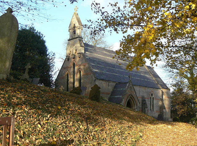
The history of Burton Joyce can be traced back to the Domesday Book of 1086, where it was referred to as "Burtone." The village boasts several historical buildings, including St. Helen's Church, which dates back to the 12th century and features a striking tower with a spire. The Trent Navigation Inn, a former coaching inn, is another notable landmark in the area.

The village offers a range of amenities to its residents, including a primary school, a post office, a library, and a medical center. There are also several sports facilities, such as a cricket club, football pitches, and a tennis club, providing opportunities for recreational activities.

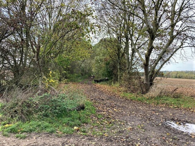
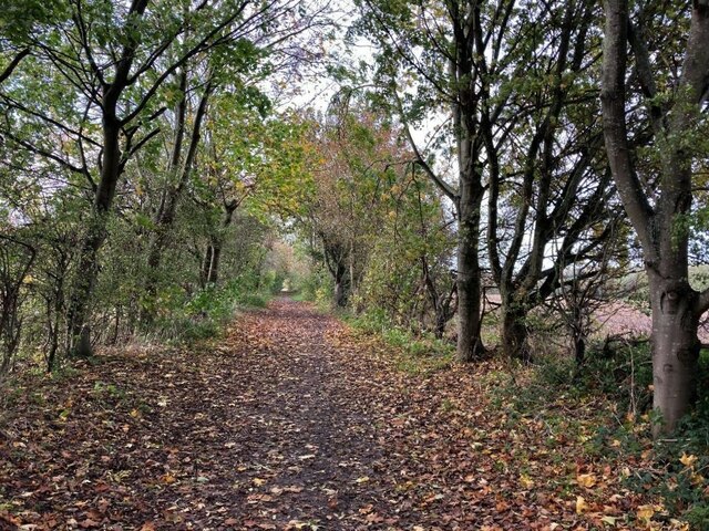
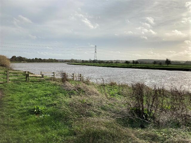
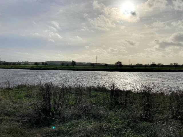
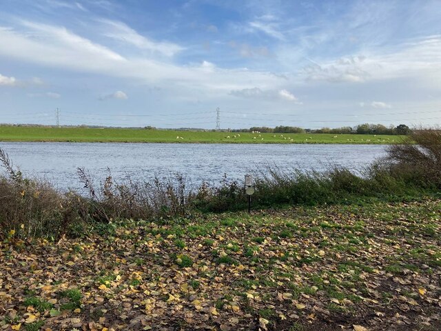
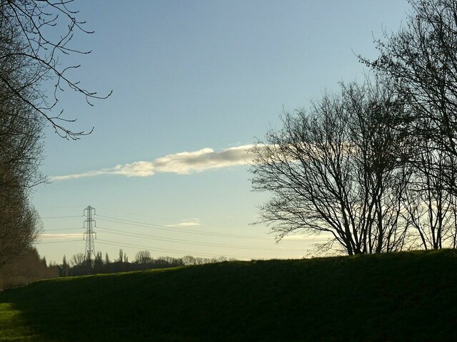
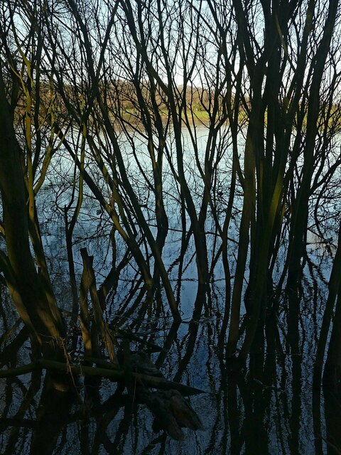
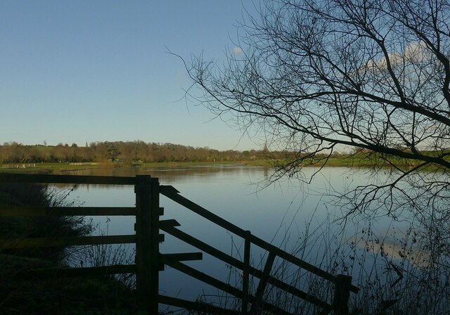
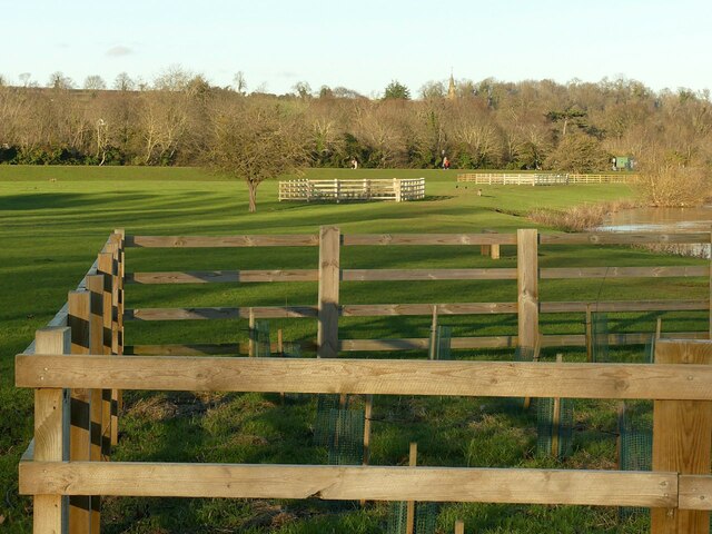
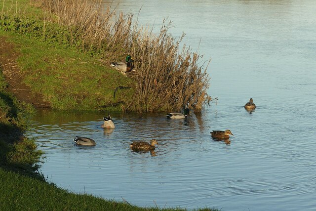
Burton Joyce benefits from its proximity to the River Trent, offering picturesque views and opportunities for boating and fishing. The village is also surrounded by beautiful countryside, with walking and cycling trails, providing residents with a serene environment to explore.

Transport links in Burton Joyce are convenient, with regular bus services to Nottingham and surrounding towns. The nearby A612 road provides easy access to the city center, as well as the nearby towns of Southwell and Newark-on-Trent.

Overall, Burton Joyce is a charming village that combines a rich history with modern amenities, making it an attractive place to reside for those seeking a tranquil community atmosphere.

If you have any feedback on the listing, please let us know in the comments section below.
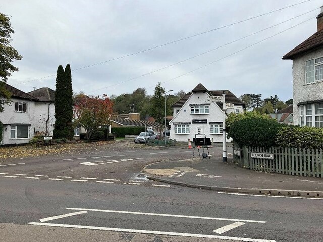
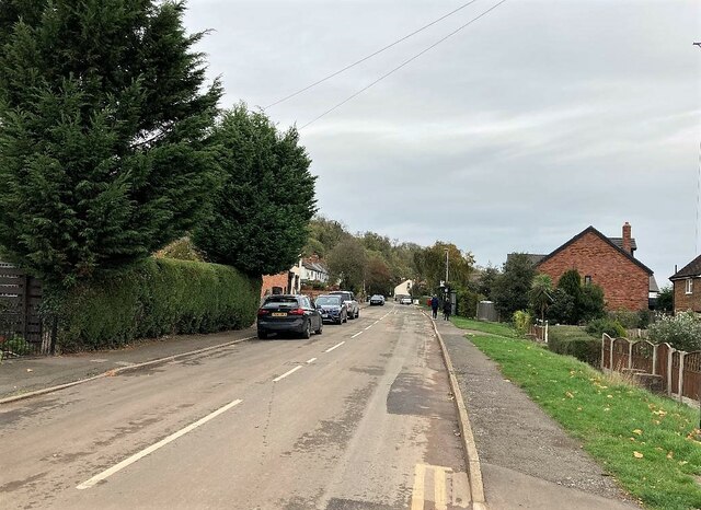
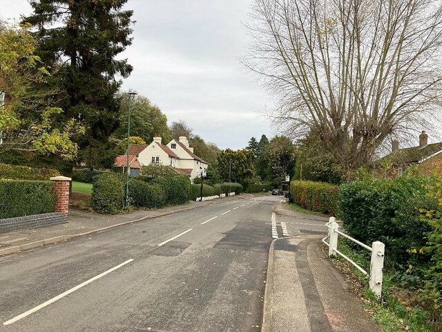
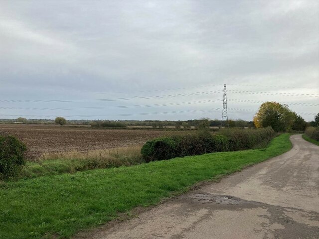
Burton Joyce Images

Images are sourced within 2km of 52.988412/-1.035751 or Grid Reference SK6443. Thanks to Geograph Open Source API. All images are credited.

Road Junction in Burton Joyce
Main Street in Burton Joyce
Old Main Road in Burton Joyce
Track and Fields near Bulcote Farm
Trent Lane Bridleway Pictured from a path junction at Burton Meadows.
Trent Lane Bridleway
Pictured from a path junction at Burton Meadows.
Wooded Bridleway at Trent Meadows The meandering River Trent is less than a hundred metres or so out of sight to the left of picture.
Wooded Bridleway at Trent Meadows
The meandering River Trent is less than a hundred metres or so out of sight to the left of picture.
The River Trent near Burton Joyce A broad sweep of the river which almost like spilt milk on a table here.
The River Trent near Burton Joyce
A broad sweep of the river which almost like spilt milk on a table here.
The River Trent near Burton Joyce
Grazing by the River Trent Pictured from the riverbank by Stokes Lane.
Grazing by the River Trent
Pictured from the riverbank by Stokes Lane.
Winter trees and sky Between Stoke Bardolph and Burton Joyce. The bank in the foreground is part of the River Trent flood defences.
Winter trees and sky
Between Stoke Bardolph and Burton Joyce. The bank in the foreground is part of the River Trent flood defences.
Swimming against the current Tufted duck drakes and a female Mallard on the River Trent near Burton Joyce.
Swimming against the current
Tufted duck drakes and a female Mallard on the River Trent near Burton Joyce.
Swamped trees Water's edge, River Trent, near Burton Joyce.
Swamped trees
Water's edge, River Trent, near Burton Joyce.
Winter sunshine on the River Trent Near Burton Joyce.
Winter sunshine on the River Trent
Near Burton Joyce.
New tree planting by the River Trent The fences are to protect against cattle which are periodically grazed here.
New tree planting by the River Trent
The fences are to protect against cattle which are periodically grazed here.
A group of feeding Mallard In a little backwater on the River Trent near Burton Joyce.
A group of feeding Mallard
In a little backwater on the River Trent near Burton Joyce.
Going nowhere fast This Mallard drake and duck were swimming hard against the current on the River Trent just to more or less stay in the same place.
Going nowhere fast
This Mallard drake and duck were swimming hard against the current on the River Trent just to more or less stay in the same place.
Towpath bridge at Burton Joyce One of the original bridges from the improvement of navigation on the River Trent in the late 18th century, still in original condition, Listed Grade II.
Towpath bridge at Burton Joyce
One of the original bridges from the improvement of navigation on the River Trent in the late 18th century, still in original condition, Listed Grade II.
Chisel marks Stonework on the towpath bridge <a title="https://www.geograph.org.uk/photo/7374791" href="https://www.geograph.org.uk/photo/7374791">Link</a> . The chisel marks are clearly deliberate to create a texture as the blocks are trimmed square. The style of chiselling does vary from one block to another.
Chisel marks
Stonework on the towpath bridge Link . The chisel marks are clearly deliberate to create a texture as the blocks are trimmed square. The style of chiselling does vary from one block to another.
Show me another place!

Burton Joyce is located at Grid Ref: SK6443 (Lat: 52.988412, Lng: -1.035751)

Administrative County: Nottinghamshire

District: Gedling

Police Authority: Nottinghamshire

What 3 Words

///safe.reseller.impaled. Near Burton Joyce, Nottinghamshire

Nearby Locations

Burton Joyce Burton Joyce

Related Wikis

Burton Joyce

Burton Joyce () is a large village and civil parish in the Gedling district of Nottinghamshire, England, 7 miles (11 km) east of Nottingham, between Stoke...

United Reformed Church, Burton Joyce

The United Reformed Church (formerly known as the village's Congregationalist Church) is a now redundant Christian church that operated under the United...

St Helen's Church, Burton Joyce

St Helen's Church is a Grade I listed parish church in the Church of England in Burton Joyce, Nottinghamshire, England. == History == It was built in the...

Burton Joyce railway station

Burton Joyce railway station serves the large village of Burton Joyce in Nottinghamshire, England. It lies between Carlton and Lowdham stations on the...

Holy Trinity Church, Bulcote

Holy Trinity Church, Bulcote is a Grade II listed parish church in the Church of England in Bulcote. == History == It was built in as a chapel of ease...

Bulcote

Bulcote is a village and civil parish in the Newark and Sherwood district of Nottinghamshire, England. According to the 2001 census it had a population...

Gedling Town F.C.

Gedling Town Football Club was a semi-professional football club based in Stoke Bardolph, Nottinghamshire, England. Founded in 1985 as R & R Scaffolding...

St Peter and St Paul's Church, Shelford

St Peter and St Paul's Church, Shelford is a parish church in the Church of England in Shelford, Nottinghamshire. The church is Grade II* listed by the...

Nearby Amenities

Located within 500m of 52.988412,-1.035751
Burton Joyce
Place: village
Wikidata: Q1869023
Wikipedia: en:Burton Joyce
Lat/Long: 52.9889106/-1.035969
Barrier: cattle_grid
Lat/Long: 52.9876714/-1.0307728
Entrance: main
Lat/Long: 52.9882552/-1.0346599
Turning Circle
Lat/Long: 52.9913972/-1.0308204
Turning Circle
Lat/Long: 52.9917015/-1.0392242
Turning Circle
Lat/Long: 52.9853179/-1.0374208
Turning Circle
Lat/Long: 52.9874885/-1.0340589
Bus Stop
Wheatsheaf Court
Bus: yes
Naptan AtcoCode: 3300GE0220
Naptan Bearing: SW
Naptan CommonName: Wheatsheaf Court
Naptan Crossing: Wheatsheaf Court
Naptan Indicator: opp
Naptan Landmark: Post Office
Naptan NaptanCode: ntsatwat
Naptan Notes: none
Naptan Street: Main Street
Naptan Verified: yes
Public Transport: platform
Shelter: yes
Source: naptan_import
Lat/Long: 52.9881998/-1.0363988
Bus Stop
Lambley Lane
Bus: yes
Naptan AtcoCode: 3300GE0221
Naptan Bearing: N
Naptan CommonName: Lambley Lane
Naptan Crossing: Lambley Lane
Naptan Indicator: adj
Naptan NaptanCode: ntsatwaw
Naptan Notes: none
Naptan Street: Main Street
Naptan Verified: no
Public Transport: platform
Source: naptan_import
Lat/Long: 52.9862598/-1.0398609
Bus Stop
Lambley Lane
Bus: yes
Local Ref: GE0222
Naptan AtcoCode: 3300GE0222
Naptan Bearing: S
Naptan CommonName: Lambley Lane
Naptan Crossing: Lambley Lane
Naptan Indicator: opp
Naptan NaptanCode: ntsatwda
Naptan Notes: none
Naptan Street: Main Street
Naptan Verified: yes
Public Transport: platform
Services: 26, L75, 100
Shelter: yes
Source: naptan_import
Lat/Long: 52.9865275/-1.0396166
Bus Stop
Chesterfield Drive
Bus: yes
Local Ref: GE0307
Naptan AtcoCode: 3300GE0307
Naptan Bearing: NE
Naptan CommonName: Chesterfield Drive
Naptan Crossing: Chesterfield Drive
Naptan Indicator: opp
Naptan NaptanCode: ntsatdjg
Naptan Notes: none
Naptan Street: Main Street
Naptan Verified: yes
Public Transport: platform
Shelter: no
Source: naptan_import
Lat/Long: 52.9909769/-1.0328882
Bus Stop
Wheatsheaf Court
Bus: yes
Local Ref: GE0317
Naptan AtcoCode: 3300GE0317
Naptan Bearing: NE
Naptan CommonName: Wheatsheaf Court
Naptan Crossing: Wheatsheaf Court
Naptan Indicator: adj
Naptan Landmark: Post Office
Naptan NaptanCode: ntsatdtp
Naptan Notes: none
Naptan Street: Main Street
Naptan Verified: yes
Public Transport: platform
Shelter: no
Source: naptan_import
Lat/Long: 52.9883539/-1.0362064
Bus Stop
Chesterfield Drive
Bus: yes
Naptan AtcoCode: 3300GE0318
Naptan Bearing: SW
Naptan CommonName: Chesterfield Drive
Naptan Crossing: Chesterfield Drive
Naptan Indicator: adj
Naptan NaptanCode: ntsatdtw
Naptan Notes: none
Naptan Street: Main Street
Naptan Verified: no
Public Transport: platform
Source: naptan_import
Lat/Long: 52.99019/-1.0334123
Railway: crossing
Lat/Long: 52.9878359/-1.0316523
Post Box
Collection Times: Mo-Fr 17:00; Sa 12:00
Post Box Type: pillar
Ref: NG14 280
Royal Cypher: EIIR
Royal Cypher Wikidata: Q33102113
Source: survey
Lat/Long: 52.9883764/-1.0361445
Entrance: main
Lat/Long: 52.9880246/-1.0366334
Telephone
Defibrillator
Booth: KX100
Covered: booth
Defibrillator Location: inside phone box, Main Street, Burton Joyce
Emergency: defibrillator
Man Made: telephone_box
Lat/Long: 52.9881702/-1.0361966
Barrier: kissing_gate
Lat/Long: 52.9865287/-1.0348135
Railway: crossing
Lat/Long: 52.9864055/-1.0346965
Entrance: main
Lat/Long: 52.9885269/-1.0353924
Power: substation
Substation: minor_distribution
Lat/Long: 52.9909133/-1.0416479
Addr Housenumber: 49A
Addr Postcode: NG14 5DX
Addr Street: Main Street
Entrance: main
Source: survey
Source Addr Postcode: interpolation
Lat/Long: 52.9884534/-1.0360542
Addr Housenumber: 1
Lat/Long: 52.9896013/-1.0424325
Addr Housenumber: 14
Lat/Long: 52.9898403/-1.0416735
Recycling
Lat/Long: 52.9889805/-1.0338436
Entrance: main
Lat/Long: 52.9884313/-1.0361177
Entrance: main
Lat/Long: 52.9884109/-1.0361778
Entrance: main
Lat/Long: 52.9883851/-1.0362507
Entrance: main
Lat/Long: 52.9884907/-1.0359468
Entrance: main
Lat/Long: 52.9884645/-1.0360221
Railway: crossing
Lat/Long: 52.9864384/-1.0347355
Railway: crossing
Lat/Long: 52.9878454/-1.0317666
Post Box
Collection Times: Mo-Fr 09:00; Sa 07:00
Post Box Type: lamp
Ref: NG14 143D
Royal Cypher: EIIR
Royal Cypher Wikidata: Q33102113
Source: survey
Lat/Long: 52.9853031/-1.0398087
Burton Joyce Physiotherapy Clinic
Addr Street: Main Street
Entrance: main
Healthcare: physiotherapist
Source: survey
Lat/Long: 52.988526/-1.0352602
Addr Housenumber: 47A
Addr Postcode: NG14 5DX
Addr Street: Main Street
Entrance: main
Source: survey
Source Addr Postcode: interpolation
Lat/Long: 52.9883988/-1.0362114
Nottingham Psychotherapy Training Institute
Addr Housenumber: 48A
Addr Postcode: NG14 5DZ
Addr Street: Main Street
Entrance: main
Source: survey
Source Addr Postcode: extrapolation
Lat/Long: 52.9884941/-1.0353309
Post News Shop
Addr Housenumber: 24
Addr Postcode: NG14 5AH
Addr Street: Nottingham Road
Shop: newsagent
Source Addr: FHRS Open Data
Lat/Long: 52.985494/-1.040083
Sharp Young & Pearce
Addr Housenumber: 111
Addr Postcode: NG14 5DJ
Addr Street: Church Road
Lawyer: solicitor
Office: lawyer
Source Addr: interpolation
Lat/Long: 52.9880918/-1.033836
Crossing
Crossing: traffic_signals
Crossing Island: no
Source: survey
Tactile Paving: yes
Lat/Long: 52.9853286/-1.0401839
Bench
Backrest: yes
Source: survey
Lat/Long: 52.9880695/-1.0347189
Bicycle Parking
Bicycle Parking: stands
Capacity: 6
Covered: no
Source: survey
Lat/Long: 52.9881932/-1.0362914
Bench
Backrest: yes
Source: survey
Lat/Long: 52.9883344/-1.0341029
Entrance: main
Lat/Long: 52.9886576/-1.0353785
Post Box
Collection Times: Mo-Fr 09:00; Sa 07:00
Post Box Type: pillar
Ref: NG14 139D
Royal Cypher: EIIR
Royal Cypher Wikidata: Q33102113
Source: survey
Lat/Long: 52.9905396/-1.0330297
Bench
Lat/Long: 52.9865877/-1.03954
HE Ref: 1227464
Historic: memorial
Listed Status: Grade II
Memorial: war_memorial
Source Listed Status: Historic England
Lat/Long: 52.986593/-1.0394299
Bench
Lat/Long: 52.9866243/-1.0395208
The Millennium Sundial
Man Made: sundial
Lat/Long: 52.9862906/-1.0384631
Bench
Lat/Long: 52.9860165/-1.0367392
Bench
Lat/Long: 52.9860485/-1.0366531
Bench
Lat/Long: 52.9862701/-1.0359086
Barrier: kissing_gate
Lat/Long: 52.9863643/-1.034651
Bench
Lat/Long: 52.9865087/-1.03685
Bench
Lat/Long: 52.9865375/-1.0367905
Entrance: main
Lat/Long: 52.9865512/-1.0365085
HE Ref: 1235804
Historic: spire_top
Listed Status: Grade II
Source: survey
Source Listed Status: Historic England
Lat/Long: 52.9866181/-1.0366272
Capacity: 4
Leisure: picnic_table
Lat/Long: 52.9872877/-1.0357361
Bench
Seats: 2
Lat/Long: 52.9873099/-1.0356351
Capacity: 4
Leisure: picnic_table
Lat/Long: 52.9873184/-1.0357743
Bench
Seats: 2
Lat/Long: 52.9873285/-1.0356585
Bench
Seats: 2
Lat/Long: 52.9873464/-1.0356787
Capacity: 4
Leisure: picnic_table
Lat/Long: 52.9873478/-1.035751
Crossing
Crossing: traffic_signals
Crossing Island: no
Source: survey
Tactile Paving: yes
Lat/Long: 52.9876367/-1.0354209
Barrier: kissing_gate
Lat/Long: 52.9852679/-1.0368738
Fixme: continues
Lat/Long: 52.9856514/-1.0379528
Dentist
Pear Tree Dental Centre
Addr Housenumber: 22
Addr Postcode: NG14 5AE
Addr Street: Nottingham Road
Healthcare: dentist
Lat/Long: 52.9858099/-1.0399951
Generator Method: photovoltaic
Generator Output Electricity: yes
Generator Source: solar
Generator Type: solar_photovoltaic_panel
Location: roof
Power: generator
Lat/Long: 52.9912216/-1.040585
Generator Method: photovoltaic
Generator Output Electricity: yes
Generator Source: solar
Generator Type: solar_photovoltaic_panel
Location: roof
Power: generator
Lat/Long: 52.9914679/-1.0393404
Generator Method: photovoltaic
Generator Output Electricity: yes
Generator Source: solar
Generator Type: solar_photovoltaic_panel
Location: roof
Power: generator
Lat/Long: 52.991949/-1.0393136
Generator Method: photovoltaic
Generator Output Electricity: yes
Generator Source: solar
Generator Type: solar_photovoltaic_panel
Location: roof
Power: generator
Lat/Long: 52.9905153/-1.0388898
Generator Method: photovoltaic
Generator Output Electricity: yes
Generator Source: solar
Generator Type: solar_photovoltaic_panel
Location: roof
Power: generator
Lat/Long: 52.9909811/-1.0382716
Generator Method: photovoltaic
Generator Output Electricity: yes
Generator Source: solar
Generator Type: solar_photovoltaic_panel
Location: roof
Power: generator
Lat/Long: 52.9906009/-1.0347847
Generator Method: photovoltaic
Generator Output Electricity: yes
Generator Source: solar
Generator Type: solar_photovoltaic_panel
Location: roof
Power: generator
Lat/Long: 52.9901431/-1.0289428
Generator Method: photovoltaic
Generator Output Electricity: yes
Generator Source: solar
Generator Type: solar_photovoltaic_panel
Location: roof
Power: generator
Lat/Long: 52.9905282/-1.0295437
Generator Method: photovoltaic
Generator Output Electricity: yes
Generator Source: solar
Generator Type: solar_photovoltaic_panel
Location: roof
Power: generator
Lat/Long: 52.9880119/-1.0317766
Generator Method: photovoltaic
Generator Output Electricity: yes
Generator Source: solar
Generator Type: solar_photovoltaic_panel
Location: roof
Power: generator
Lat/Long: 52.9882944/-1.0351642
Generator Method: photovoltaic
Generator Output Electricity: yes
Generator Source: solar
Generator Type: solar_photovoltaic_panel
Location: roof
Power: generator
Lat/Long: 52.9895643/-1.0334986
Generator Method: photovoltaic
Generator Output Electricity: yes
Generator Source: solar
Generator Type: solar_photovoltaic_panel
Location: roof
Power: generator
Lat/Long: 52.9882234/-1.0370324
Generator Method: photovoltaic
Generator Output Electricity: yes
Generator Source: solar
Generator Type: solar_photovoltaic_panel
Location: roof
Power: generator
Lat/Long: 52.9885899/-1.0399882
Generator Method: photovoltaic
Generator Output Electricity: yes
Generator Source: solar
Generator Type: solar_photovoltaic_panel
Location: roof
Power: generator
Lat/Long: 52.9860177/-1.0410369
Community Centre
Scout Hut
Addr Street: Lambley Lane
Lat/Long: 52.987463/-1.0394521
Generator Method: photovoltaic
Generator Output Electricity: yes
Generator Source: solar
Generator Type: solar_photovoltaic_panel
Location: roof
Power: generator
Lat/Long: 52.9900351/-1.0314882
Generator Method: photovoltaic
Generator Output Electricity: yes
Generator Source: solar
Generator Type: solar_photovoltaic_panel
Location: roof
Power: generator
Lat/Long: 52.9905776/-1.0295409
Generator Method: photovoltaic
Generator Output Electricity: yes
Generator Source: solar
Generator Type: solar_photovoltaic_panel
Location: roof
Power: generator
Lat/Long: 52.9861309/-1.0417388
Generator Method: photovoltaic
Generator Output Electricity: yes
Generator Source: solar
Generator Type: solar_photovoltaic_panel
Location: roof
Power: generator
Lat/Long: 52.9860541/-1.0416049
Generator Method: photovoltaic
Generator Output Electricity: yes
Generator Source: solar
Generator Type: solar_photovoltaic_panel
Location: roof
Power: generator
Lat/Long: 52.9860894/-1.0416363
Generator Method: photovoltaic
Generator Output Electricity: yes
Generator Source: solar
Generator Type: solar_photovoltaic_panel
Location: roof
Power: generator
Lat/Long: 52.9862027/-1.0403915
Generator Method: photovoltaic
Generator Output Electricity: yes
Generator Source: solar
Generator Type: solar_photovoltaic_panel
Location: roof
Power: generator
Lat/Long: 52.986403/-1.0393832
Generator Method: photovoltaic
Generator Output Electricity: yes
Generator Source: solar
Generator Type: solar_photovoltaic_panel
Location: roof
Power: generator
Lat/Long: 52.9874457/-1.0378665
Generator Method: photovoltaic
Generator Output Electricity: yes
Generator Source: solar
Generator Type: solar_photovoltaic_panel
Location: roof
Power: generator
Lat/Long: 52.9874293/-1.0378017
Generator Method: photovoltaic
Generator Output Electricity: yes
Generator Source: solar
Generator Type: solar_photovoltaic_panel
Location: roof
Power: generator
Lat/Long: 52.9894183/-1.0353874
Generator Method: photovoltaic
Generator Output Electricity: yes
Generator Source: solar
Generator Type: solar_photovoltaic_panel
Location: roof
Power: generator
Lat/Long: 52.9883294/-1.0397246
Cafe
Hugo's
Lat/Long: 52.988546/-1.0359787
The data included in this document is from www.openstreetmap.org. The data is made available under ODbL.

Have you been to Burton Joyce?

Leave your review of Burton Joyce below (or comments, questions and feedback).