Burton in Lonsdale

Settlement in Yorkshire Craven

England

Burton in Lonsdale

Junction of Low Street and Burton Hill The end of terrace house is Pye Cottage; there is an Ordnance Survey cut benchmark on the bottom of the wall adjacent to the large slate kerbstone (photograph <a href="https://www.geograph.org.uk/photo/7160532">SD6572 : Benchmark, Mount View, Burton in Lonsdale</a>).
The green bin is labelled ‘Grit/Salt’ and this is provided to assist vehicles on the steep Burton Hill in winter weather.
Junction of Low Street and Burton Hill Credit: Adrian Taylor

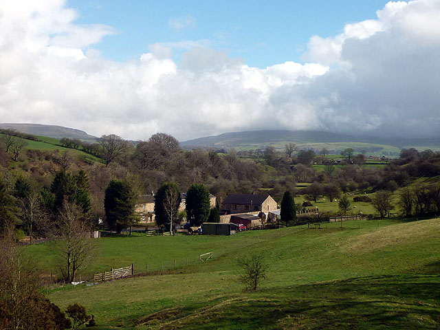
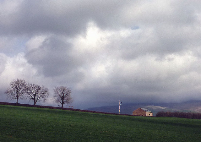
Burton in Lonsdale is a small village located in the county of Yorkshire, England. Situated in the scenic Lune Valley, it lies on the western edge of the Yorkshire Dales National Park. The village is nestled between the rivers Greta and Hindburn, offering picturesque views of rolling hills and lush countryside.

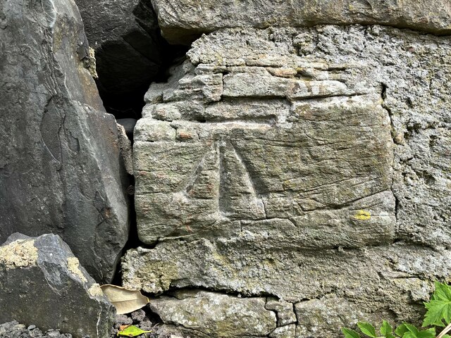
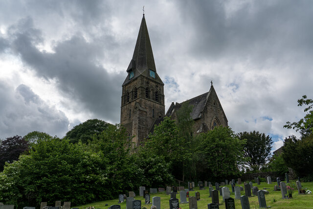
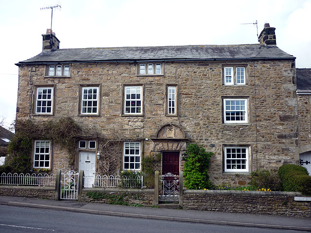
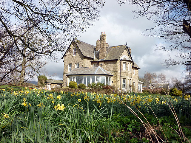
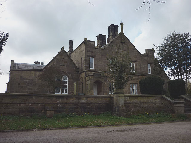
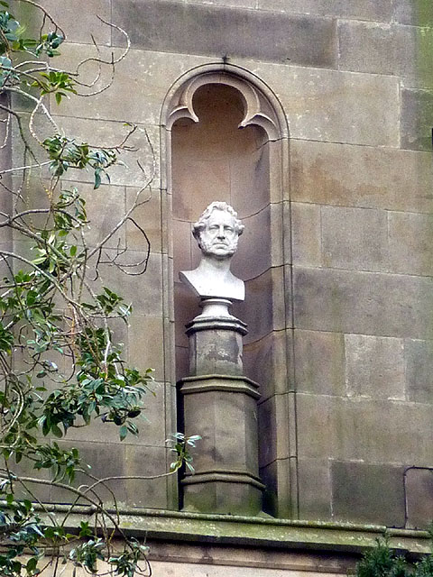
Dating back to the medieval period, Burton in Lonsdale is known for its rich history and charming architecture. The village features several well-preserved buildings from different eras, including the Grade I listed St. John the Evangelist Church, which dates back to the 12th century. The church boasts intricate stonework and a beautiful stained glass window.

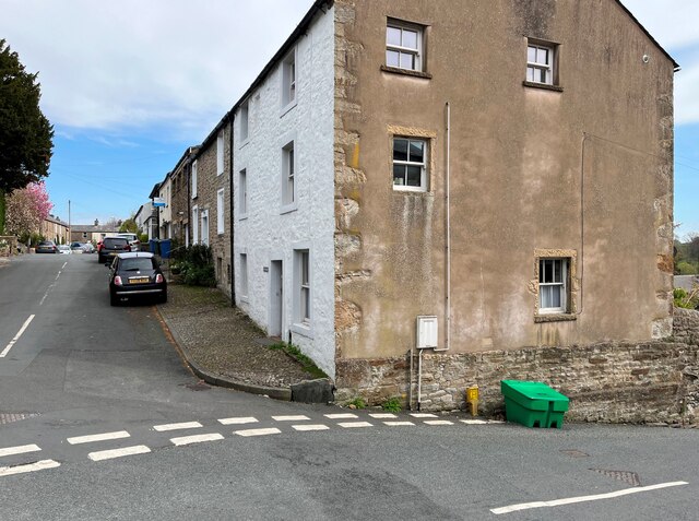
Despite its small size, Burton in Lonsdale has a close-knit community that takes pride in its heritage. The village maintains a traditional feel, with its stone houses, narrow lanes, and well-tended gardens. The local pub, The Punch Bowl, serves as a hub for social gatherings and offers a warm welcome to visitors.

Surrounded by stunning natural landscapes, Burton in Lonsdale attracts outdoor enthusiasts and nature lovers. The nearby Yorkshire Dales provide ample opportunities for hiking, cycling, and exploring the countryside. The village is also a popular starting point for walks along the River Lune and offers easy access to the Ingleborough and Whernside peaks.

In summary, Burton in Lonsdale is a picturesque village with a rich history and a strong sense of community. Its idyllic location in the Yorkshire Dales makes it a haven for those seeking tranquility and natural beauty.

If you have any feedback on the listing, please let us know in the comments section below.

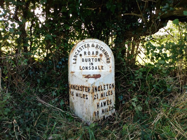
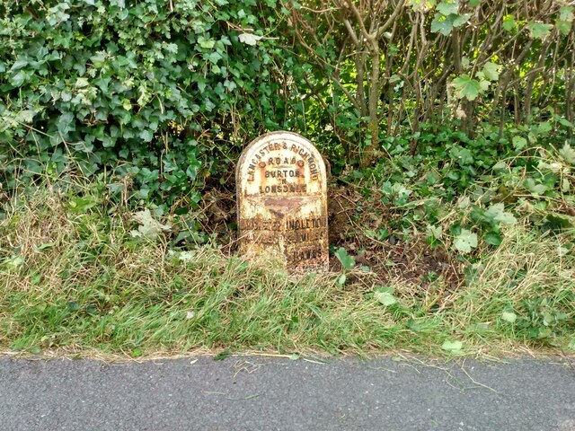
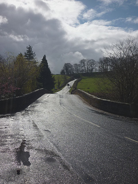
Burton in Lonsdale Images

Images are sourced within 2km of 54.14888/-2.530222 or Grid Reference SD6572. Thanks to Geograph Open Source API. All images are credited.

Junction of Low Street and Burton Hill The end of terrace house is Pye Cottage; there is an Ordnance Survey cut benchmark on the bottom of the wall adjacent to the large slate kerbstone (photograph <a href="https://www.geograph.org.uk/photo/7160532">SD6572 : Benchmark, Mount View, Burton in Lonsdale</a>).
The green bin is labelled ‘Grit/Salt’ and this is provided to assist vehicles on the steep Burton Hill in winter weather.
Junction of Low Street and Burton Hill
The end of terrace house is Pye Cottage; there is an Ordnance Survey cut benchmark on the bottom of the wall adjacent to the large slate kerbstone (photograph SD6572 : Benchmark, Mount View, Burton in Lonsdale). The green bin is labelled ‘Grit/Salt’ and this is provided to assist vehicles on the steep Burton Hill in winter weather.
Benchmark, Mount View, Burton in Lonsdale Detail of an Ordnance Survey cut benchmark on the plinth of Pye Cottage at the corner of Low Street and Burton Hill.  The benchmark marks a height of 79.6351m above mean sea level (Ordnance Datum Newlyn) last verified in 1970 (location photograph <a href="https://www.geograph.org.uk/photo/7160518">SD6572 : Junction of Low Street and Burton Hill</a>).
Benchmark, Mount View, Burton in Lonsdale
Detail of an Ordnance Survey cut benchmark on the plinth of Pye Cottage at the corner of Low Street and Burton Hill. The benchmark marks a height of 79.6351m above mean sea level (Ordnance Datum Newlyn) last verified in 1970 (location photograph SD6572 : Junction of Low Street and Burton Hill).
All Saints Church, Burton in Lonsdale The church was built between 1868 and 1876, and designed by the Lancaster partnership of Paley and Austin. People note that it was seems a large church for what is a small town, but this is because it was thought the railway would come to the village and its population would expand.

<span class="nowrap"><a title="https://en.wikipedia.org/wiki/All_Saints_Church,_Burton_in_Lonsdale" rel="nofollow ugc noopener" href="https://en.wikipedia.org/wiki/All_Saints_Church,_Burton_in_Lonsdale">Link</a><img style="margin-left:2px;" alt="External link" title="External link - shift click to open in new window" src="https://s1.geograph.org.uk/img/external.png" width="10" height="10"/></span>
All Saints Church, Burton in Lonsdale
The church was built between 1868 and 1876, and designed by the Lancaster partnership of Paley and Austin. People note that it was seems a large church for what is a small town, but this is because it was thought the railway would come to the village and its population would expand. LinkExternal link
Old milestone The second West Riding CC milestone north of the Lancashire/Yorkshire boundary  found almost hidden in the undergrowth.  Compare with <a href="https://www.geograph.org.uk/photo/6043998">SD6572 : Old Milestone by the A687, east of Bogg Bridge, Burton in Lonsdale Parish</a> after it had been lifted and repainted in 2013.
Old milestone
The second West Riding CC milestone north of the Lancashire/Yorkshire boundary found almost hidden in the undergrowth. Compare with SD6572 : Old Milestone by the A687, east of Bogg Bridge, Burton in Lonsdale Parish after it had been lifted and repainted in 2013.
Old milestone The second West Riding milestone north of the Lancashire border after some vegetation had been cleared.   At the base of the right face, RICHMOND almost hidden/43 MILES under soil level.   The rusty bit on the bevel - WILLIAM TOWLER/GLOBE FOUNDRY/LEEDS.
Old milestone
The second West Riding milestone north of the Lancashire border after some vegetation had been cleared. At the base of the right face, RICHMOND almost hidden/43 MILES under soil level. The rusty bit on the bevel - WILLIAM TOWLER/GLOBE FOUNDRY/LEEDS.
Old milestone Where is the milestone?   <a href="https://www.geograph.org.uk/photo/6044486">SD6472 : Old Milestone by the A687, Lowfields, Burton in Lonsdale Parish</a> Picture taken in 2013 after this first West Riding CC milestone north of the Lancashire border had been dug out and repainted.   2022, hidden but fortunately its position was known.
Old milestone
Where is the milestone? SD6472 : Old Milestone by the A687, Lowfields, Burton in Lonsdale Parish Picture taken in 2013 after this first West Riding CC milestone north of the Lancashire border had been dug out and repainted. 2022, hidden but fortunately its position was known.
Old milestone There it is, looking very uncared for. 615 of these stones were erected in 1893/94 all over the newly formed West Riding by the family firm of Gill and Frank Stead of Mirfield at a cost of £1.18s.0d each. RICHMOND/44 MILES is under soil level on the right-hand side. The Turnpike road was begun in 1751 but some of the route was over high hill tracks. Later, bridges were widened and by 1795 the route was more or less what it is now avoiding the very highest points.
Old milestone
There it is, looking very uncared for. 615 of these stones were erected in 1893/94 all over the newly formed West Riding by the family firm of Gill and Frank Stead of Mirfield at a cost of £1.18s.0d each. RICHMOND/44 MILES is under soil level on the right-hand side. The Turnpike road was begun in 1751 but some of the route was over high hill tracks. Later, bridges were widened and by 1795 the route was more or less what it is now avoiding the very highest points.
Sun on the road to Bentham A car heads uphill out of Burton after crossing the bridge over the River Greta.
Sun on the road to Bentham
A car heads uphill out of Burton after crossing the bridge over the River Greta.
The valley of the River Greta near Burton-in-Lonsdale Waterside Pottery in the foreground. The clouded height of Ingleborough beyond. The Greta is formed when the Rivers Twiss and Doe combine at Ingleton but does not seem to have a valley named after it (eg Gretadale or Greta Valley). Oddly, Burton-in-Lonsdale is not actually in the valley of the Lune.
The valley of the River Greta near Burton-in-Lonsdale
Waterside Pottery in the foreground. The clouded height of Ingleborough beyond. The Greta is formed when the Rivers Twiss and Doe combine at Ingleton but does not seem to have a valley named after it (eg Gretadale or Greta Valley). Oddly, Burton-in-Lonsdale is not actually in the valley of the Lune.
The valley of the Greta from Bentham Moor Road Faccon Farm on the right and cloud-obscured Ingleborough beyond. The shallow u-shaped valley on the skyline is Chapel-le-Dale, source of the River Doe which combines with the Twiss at Ingleton to form the Greta.
The valley of the Greta from Bentham Moor Road
Faccon Farm on the right and cloud-obscured Ingleborough beyond. The shallow u-shaped valley on the skyline is Chapel-le-Dale, source of the River Doe which combines with the Twiss at Ingleton to form the Greta.
Path by the Greta Fourlands Hill just visible above.
Path by the Greta
Fourlands Hill just visible above.
Kepp House near Burton-in-Lonsdale The left-most cottage has a date stone above the door:
 E
T T
1723
Kepp House near Burton-in-Lonsdale
The left-most cottage has a date stone above the door: E T T 1723
Lowfields farms Lowfields (left) and Lowfields Farm East seen across pastures from the footpath to Barnoldswick Lane.
Lowfields farms
Lowfields (left) and Lowfields Farm East seen across pastures from the footpath to Barnoldswick Lane.
Pasture east of Burton-in-Lonsdale The barn (in the next square) is on Barnoldswick Lane and has been converted to a dwelling - hence the electrical supply pole to its left. In the distance is a cloud-capped Ingleborough.
Pasture east of Burton-in-Lonsdale
The barn (in the next square) is on Barnoldswick Lane and has been converted to a dwelling - hence the electrical supply pole to its left. In the distance is a cloud-capped Ingleborough.
Three storey houses on Main Street, Burton-in-Lonsdale Close to the church on the north side of the road.
Three storey houses on Main Street, Burton-in-Lonsdale
Close to the church on the north side of the road.
Vicarage, Burton-in-Lonsdale Situated on a small hill to the west of the village but still handy for the church.
Vicarage, Burton-in-Lonsdale
Situated on a small hill to the west of the village but still handy for the church.
Richard Thornton's School, Burton-in-Lonsdale The school, founded in 1853, is a Church of England (Bradford Diocese) voluntary aided primary school <span class="nowrap"><a title="http://www.richardthorntons.n-yorks.sch.uk/About.html#The_Premises" rel="nofollow ugc noopener" href="http://www.richardthorntons.n-yorks.sch.uk/About.html#The_Premises">Link</a><img style="margin-left:2px;" alt="External link" title="External link - shift click to open in new window" src="https://s1.geograph.org.uk/img/external.png" width="10" height="10"/></span>  This is the original structure fronting onto the main road. There is a much newer section behind.
Richard Thornton's School, Burton-in-Lonsdale
The school, founded in 1853, is a Church of England (Bradford Diocese) voluntary aided primary school LinkExternal link This is the original structure fronting onto the main road. There is a much newer section behind.
Richard Thornton, I presume? This bust is in a niche on the front of Richard Thornton's School <a title="https://www.geograph.org.uk/photo/2343835" href="https://www.geograph.org.uk/photo/2343835">Link</a> on the west edge of the village. Thornton <span class="nowrap"><a title="http://en.wikipedia.org/wiki/Richard_Thornton" rel="nofollow ugc noopener" href="http://en.wikipedia.org/wiki/Richard_Thornton">Link</a><img style="margin-left:2px;" alt="External link" title="External link - shift click to open in new window" src="https://s1.geograph.org.uk/img/external.png" width="10" height="10"/></span> was born in Burton and became an extremely wealthy man (1776 - 1875) and the school still benefits from his legacy. Looks like there's enough left over to keep the pigeon droppings off.
Richard Thornton, I presume?
This bust is in a niche on the front of Richard Thornton's School Link on the west edge of the village. Thornton LinkExternal link was born in Burton and became an extremely wealthy man (1776 - 1875) and the school still benefits from his legacy. Looks like there's enough left over to keep the pigeon droppings off.
Show me another place!

Burton in Lonsdale is located at Grid Ref: SD6572 (Lat: 54.14888, Lng: -2.530222)

Division: West Riding

Administrative County: North Yorkshire

District: Craven

Police Authority: North Yorkshire

What 3 Words

///boots.innovator.erase. Near High Bentham, North Yorkshire

Related Wikis

Burton in Lonsdale

Burton in Lonsdale is a village and civil parish in the Craven District of North Yorkshire, England, close to the border with Lancashire and Cumbria....

All Saints Church, Burton in Lonsdale

All Saints Church is in the village of Burton in Lonsdale, North Yorkshire, England. It is an active Anglican parish church in the deanery of Ewecross...

Burton in Lonsdale Castle

Burton in Lonsdale Castle was in the village of Burton in Lonsdale in North Yorkshire, England (grid reference SD649721). The Pipe Rolls for the reign...

Ireby, Lancashire

Ireby is a small hamlet and civil parish on the edge of Lancashire, England, bordering North Yorkshire. It lies in the City of Lancaster, just inside the...

Nearby Amenities

Located within 500m of 54.14888,-2.530222
Barrier: cattle_grid
Lat/Long: 54.1511104/-2.5366823
Barrier: stile
Lat/Long: 54.1449171/-2.5297684
Bus Stop
The Croft
Bus: yes
Naptan AtcoCode: 3200YNA91110
Naptan Bearing: S
Naptan BusStopType: MKD
Naptan CommonName: The Croft
Naptan Indicator: opp
Naptan Landmark: The Barn
Naptan LocalityCode: E0048878
Naptan NaptanCode: 32091110
Naptan Street: A687
Naptan Verified: no
Operator: Stagecoach
Public Transport: platform
Ref: 32091110
Source: survey
Lat/Long: 54.1454821/-2.5317866
Bus Stop
The Croft
Bus: yes
Naptan AtcoCode: 3200YNA91109
Naptan Bearing: N
Naptan BusStopType: MKD
Naptan CommonName: The Croft
Naptan Indicator: adj
Naptan Landmark: The Croft
Naptan LocalityCode: E0048878
Naptan NaptanCode: 32091109
Naptan Street: A687
Naptan Verified: no
Operator: Stagecoach
Public Transport: platform
Ref: 32091109
Source: survey
Lat/Long: 54.1455272/-2.5319968
Barrier: stile
Lat/Long: 54.146339/-2.5363433
Barrier: stile
Lat/Long: 54.1457114/-2.5354548
The Croft
Bus: yes
Public Transport: stop_position
Lat/Long: 54.1455069/-2.5318378
The Croft
Bus: yes
Public Transport: stop_position
Lat/Long: 54.1454799/-2.531856
Generator Method: photovoltaic
Generator Output Electricity: yes
Generator Source: solar
Generator Type: solar_photovoltaic_panel
Location: roof
Power: generator
Lat/Long: 54.1448118/-2.5315241
Generator Method: photovoltaic
Generator Output Electricity: yes
Generator Source: solar
Generator Type: solar_photovoltaic_panel
Location: roof
Power: generator
Lat/Long: 54.1458903/-2.5346963
Power: pole
Lat/Long: 54.1457025/-2.5287616
Power: pole
Lat/Long: 54.1465869/-2.5276941
Power: pole
Lat/Long: 54.1470104/-2.5271556
Power: pole
Lat/Long: 54.1476456/-2.5263685
Power: pole
Lat/Long: 54.1482896/-2.5255947
Power: pole
Lat/Long: 54.149281/-2.5255627
Power: pole
Lat/Long: 54.1501819/-2.5255326
Power: pole
Lat/Long: 54.1512361/-2.525493
Power: pole
Lat/Long: 54.1522318/-2.5254742
Power: pole
Lat/Long: 54.1521579/-2.5250054
Power: pole
Lat/Long: 54.1485256/-2.5244895
Power: pole
Lat/Long: 54.148669/-2.5238832
Power: pole
Lat/Long: 54.1471626/-2.5280499
Power: pole
Lat/Long: 54.1473258/-2.52898
Power: pole
Lat/Long: 54.1460829/-2.5300401
Power: pole
Lat/Long: 54.1478306/-2.5310221
Power: pole
Lat/Long: 54.1482566/-2.5309988
Power: pole
Lat/Long: 54.1487435/-2.5309936
Power: pole
Lat/Long: 54.1490615/-2.5306481
Power: pole
Lat/Long: 54.1495195/-2.5304298
Power: pole
Lat/Long: 54.1499698/-2.530196
Power: pole
Lat/Long: 54.1504019/-2.5299778
Power: pole
Lat/Long: 54.1503913/-2.5290322
Power: pole
Lat/Long: 54.1503837/-2.5281229
Power: pole
Lat/Long: 54.1503152/-2.5272916
Power: pole
Lat/Long: 54.1502544/-2.5264161
The data included in this document is from www.openstreetmap.org. The data is made available under ODbL.

Have you been to Burton in Lonsdale?

Leave your review of Burton in Lonsdale below (or comments, questions and feedback).