Burton End

Settlement in Cambridgeshire South Cambridgeshire

England

Burton End

West Wickham: a stinkpipe half hidden in a tree The coronet cap of a green-painted cast-iron sewer vent pokes out of the top of the small tree on the left and its ribbed base can just about be made out in the shadows below. The photo was taken on the bend in High Street next to the church gate. A bright day in winter would be a better time to take a picture than this cloudy one in full-leafed June was.
West Wickham: a stinkpipe half hidden in a tree Credit: John Sutton

Burton End is a small village located in the county of Cambridgeshire, England. Situated approximately five miles southeast of the town of Haverhill, it forms part of the East of England region.

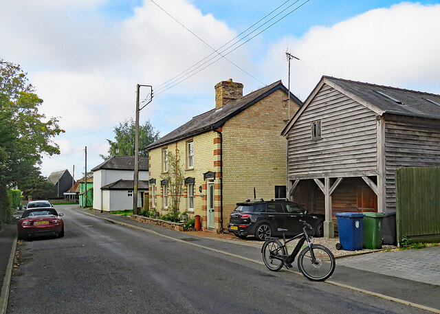
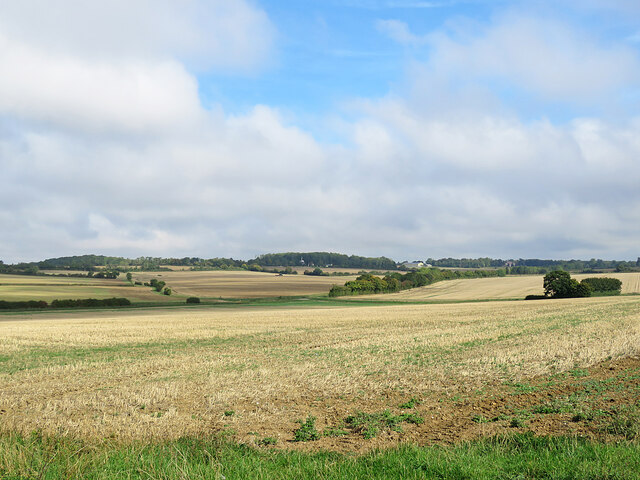
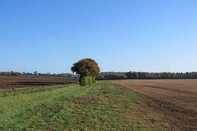
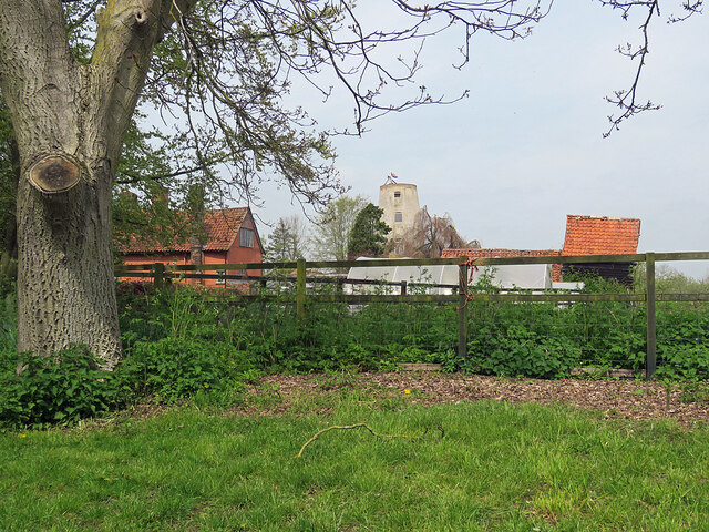
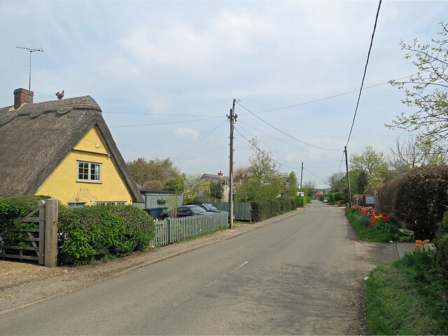
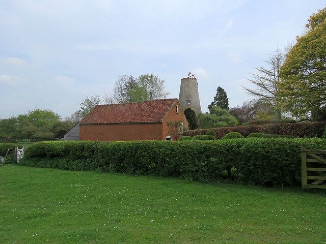
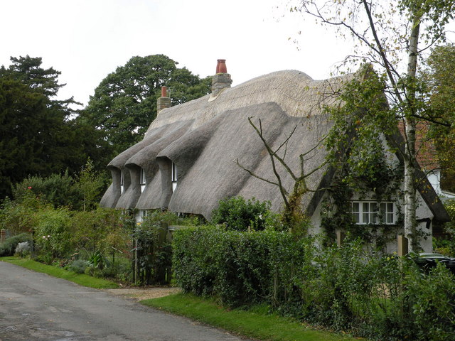
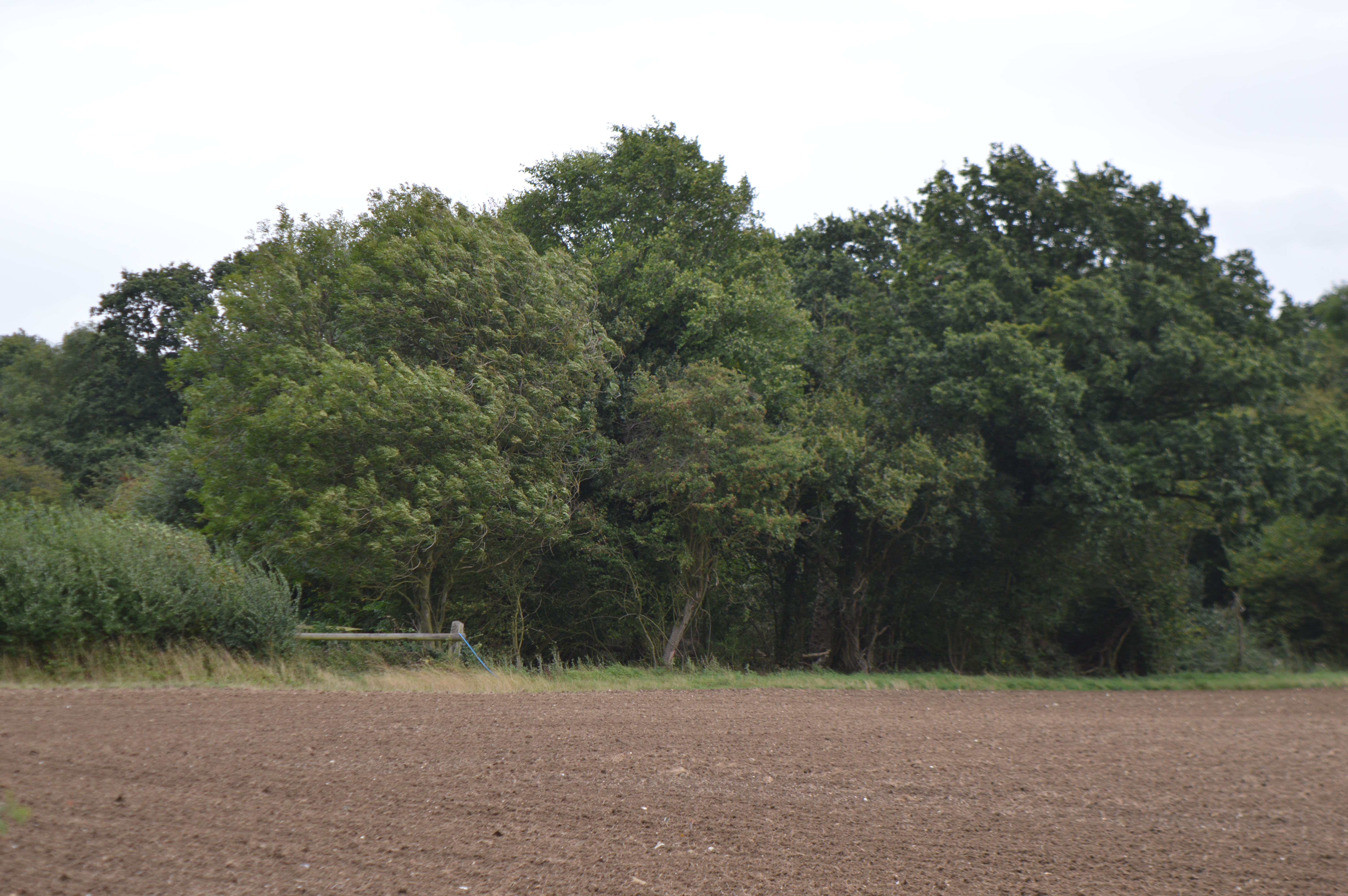
With its picturesque surroundings and rural charm, Burton End offers a peaceful and idyllic setting for its residents. The village is characterized by its traditional thatched cottages, rolling green fields, and a sense of community that is highly valued by its inhabitants.

Despite its small size, Burton End benefits from a range of amenities for its residents. These include a local pub, a village hall that hosts various community events, a primary school, and a small post office. Additionally, the village is well-connected to nearby towns and cities, with good transport links that provide easy access to Haverhill and other neighboring areas.

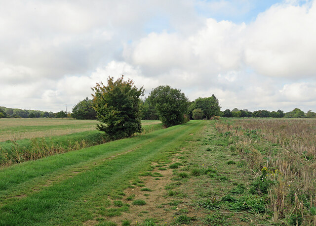
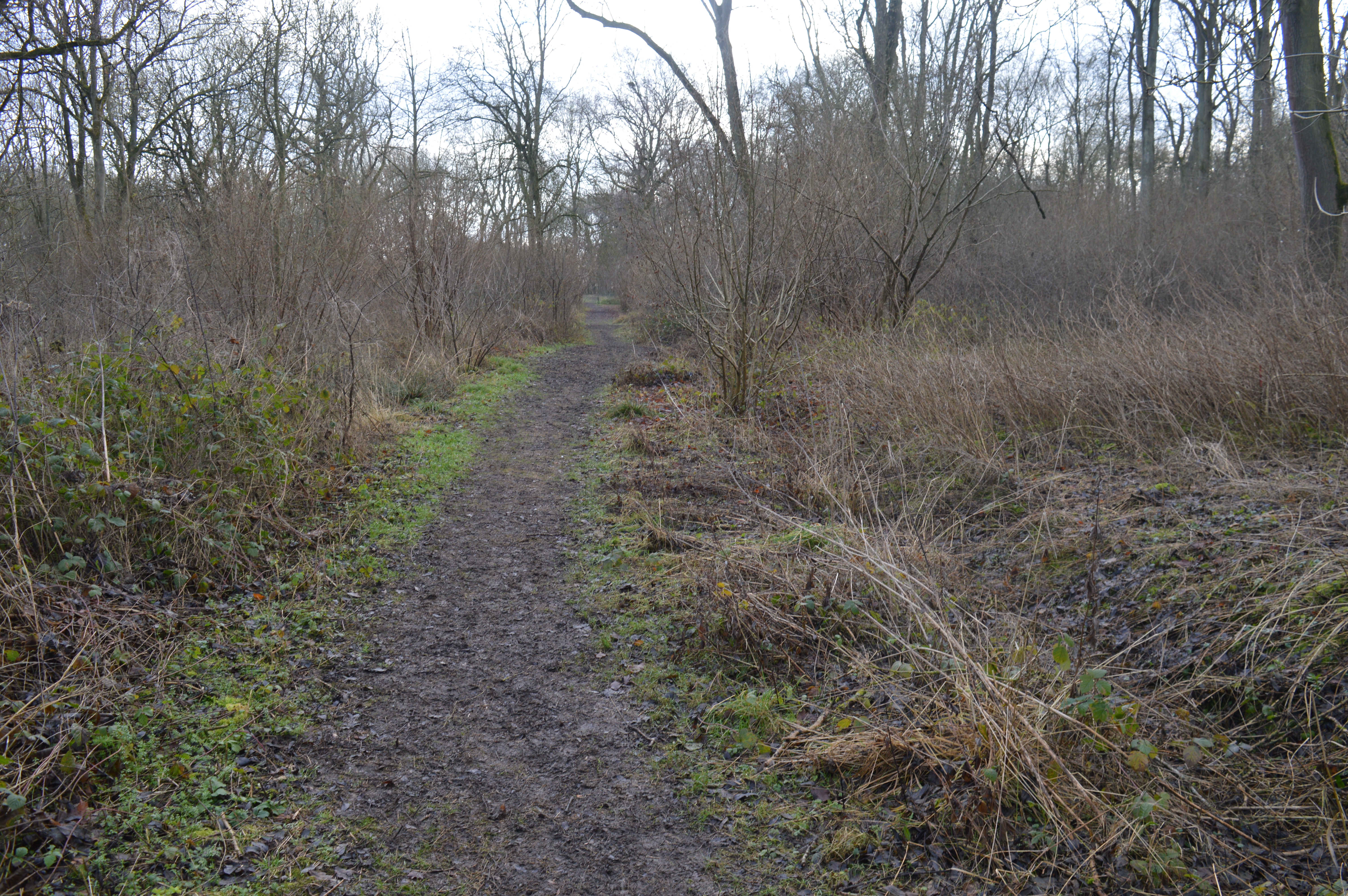
The village is surrounded by beautiful countryside, making it an ideal location for outdoor enthusiasts. There are several footpaths and bridleways in the area, offering opportunities for walking, cycling, and exploring the natural beauty of the region.

Burton End is also within close proximity to notable attractions, such as the historic city of Cambridge, which is approximately 15 miles north. This provides residents with the convenience of accessing a wider range of amenities and cultural experiences.

Overall, Burton End offers a tranquil and close-knit community, surrounded by stunning landscapes and benefiting from its proximity to nearby towns and cities.

If you have any feedback on the listing, please let us know in the comments section below.

Burton End Images

Images are sourced within 2km of 52.121809/0.366235 or Grid Reference TL6249. Thanks to Geograph Open Source API. All images are credited.

West Wickham: a stinkpipe half hidden in a tree The coronet cap of a green-painted cast-iron sewer vent pokes out of the top of the small tree on the left and its ribbed base can just about be made out in the shadows below. The photo was taken on the bend in High Street next to the church gate. A bright day in winter would be a better time to take a picture than this cloudy one in full-leafed June was.
West Wickham: a stinkpipe half hidden in a tree
The coronet cap of a green-painted cast-iron sewer vent pokes out of the top of the small tree on the left and its ribbed base can just about be made out in the shadows below. The photo was taken on the bend in High Street next to the church gate. A bright day in winter would be a better time to take a picture than this cloudy one in full-leafed June was.
West Wickham: St Mary The parish church is screened from the road by fine lime trees. Much of the fabric dates from the 14th century. Restoration work was going on inside on this cloudy summer morning and some renewal of the chancel was already complete. "Chancel: c 1320. Three restored windows of clunch, of two cinquefoil lights with reticulated tracery in two-centred arches. East window of similar period, restored" (from the grade Grade II* listing). The chancel walls lean outwards, restrained by substantial diagonal buttresses.
West Wickham: St Mary
The parish church is screened from the road by fine lime trees. Much of the fabric dates from the 14th century. Restoration work was going on inside on this cloudy summer morning and some renewal of the chancel was already complete. "Chancel: c 1320. Three restored windows of clunch, of two cinquefoil lights with reticulated tracery in two-centred arches. East window of similar period, restored" (from the grade Grade II* listing). The chancel walls lean outwards, restrained by substantial diagonal buttresses.
West Wickham: St Mary - from the west The flint fabric of the church dates mostly from the 14th century. "West tower of four stages, with blocked parapet and three-stage diagonally-set buttressing. Restored reticulated tracery to west window" (from the Grade II* listing text).
West Wickham: St Mary - from the west
The flint fabric of the church dates mostly from the 14th century. "West tower of four stages, with blocked parapet and three-stage diagonally-set buttressing. Restored reticulated tracery to west window" (from the Grade II* listing text).
Trig point, bike and furniture store This picture taken from a field corner shows a bike parked on the path from Burton End to Weston Woods Farm and, in the background, Home Brands, which is based in one of the hangars of RAF Wratting Common, a Bomber Command Station during the Second World War. For more about RAF Wratting, see <span class="nowrap"><a title="http://www.wcnhistory.org.uk/overview.html" rel="nofollow ugc noopener" href="http://www.wcnhistory.org.uk/overview.html">Link</a><img style="margin-left:2px;" alt="External link" title="External link - shift click to open in new window" src="https://s1.geograph.org.uk/img/external.png" width="10" height="10"/></span> .
Trig point, bike and furniture store
This picture taken from a field corner shows a bike parked on the path from Burton End to Weston Woods Farm and, in the background, Home Brands, which is based in one of the hangars of RAF Wratting Common, a Bomber Command Station during the Second World War. For more about RAF Wratting, see LinkExternal link .
Path to Brickyard Cottages This grassy path, gravelled at the other end, leads from Skippers Lane to Burton End. The cottages are hidden by the trees in the centre of the picture.
Path to Brickyard Cottages
This grassy path, gravelled at the other end, leads from Skippers Lane to Burton End. The cottages are hidden by the trees in the centre of the picture.
Stinkpipe and gable end at Burton End Burton End is the eastern part of West Wickham, and this house is at the eastern edge of the village. A slender cast-iron sewer vent pipe pokes above the hedgerow trees on the left. It is the same rather delicate type found in some other Cambridgeshire villages - and at the other end of West Wickham (see <a href="https://www.geograph.org.uk/photo/7214313">TL6149 : West Wickham: a stinkpipe half hidden in a tree</a>).
Stinkpipe and gable end at Burton End
Burton End is the eastern part of West Wickham, and this house is at the eastern edge of the village. A slender cast-iron sewer vent pipe pokes above the hedgerow trees on the left. It is the same rather delicate type found in some other Cambridgeshire villages - and at the other end of West Wickham (see TL6149 : West Wickham: a stinkpipe half hidden in a tree).
West Wickham: scaffolding at Burton End The Grade II listing begins "Row of cottages, now one. C17 origin much altered and remodelled in mid C19. Timber-framed, rendered and long straw thatch roof at two ridge and eaves levels. End and ridge stacks."
West Wickham: scaffolding at Burton End
The Grade II listing begins "Row of cottages, now one. C17 origin much altered and remodelled in mid C19. Timber-framed, rendered and long straw thatch roof at two ridge and eaves levels. End and ridge stacks."
West Wickham: Vicarage Cottage, Burton End The pink timber-framed cottage is Grade II listed and dates from the 18th century.
West Wickham: Vicarage Cottage, Burton End
The pink timber-framed cottage is Grade II listed and dates from the 18th century.
West Wickham High Street Council-built houses on the long main street.
West Wickham High Street
Council-built houses on the long main street.
West Wickham: the south end of High Street Near the junction with the Horseheath to Balsham road.
West Wickham: the south end of High Street
Near the junction with the Horseheath to Balsham road.
North from Bottle Hall Looking towards West Wratting on a cloudy September morning. The cap and a sail of <a href="https://www.geograph.org.uk/photo/4772875">TL6050 : West Wratting Windmill</a> show as a white speck against the skyline wood in the centre of the picture.
North from Bottle Hall
Looking towards West Wratting on a cloudy September morning. The cap and a sail of TL6050 : West Wratting Windmill show as a white speck against the skyline wood in the centre of the picture.
Towards Lawn Wood The view from Skipper's Lane on a bright October morning.
Towards Lawn Wood
The view from Skipper's Lane on a bright October morning.
Autumn cultivation The farm track is shared by a public footpath, part of a dense network in this part of Cambridgeshire.
Autumn cultivation
The farm track is shared by a public footpath, part of a dense network in this part of Cambridgeshire.
At Skipper's Hall Farm The farm road is also the start of a public footpath to Burton End at West Wickham.
At Skipper's Hall Farm
The farm road is also the start of a public footpath to Burton End at West Wickham.
Field-edge path to Yen Hall Farm The path begins at Mill Road, out of the picture to the left. The picture was taken at 9.45 on a cloudless October morning.
Field-edge path to Yen Hall Farm
The path begins at Mill Road, out of the picture to the left. The picture was taken at 9.45 on a cloudless October morning.
Streetly End: towards the windmill The mill was built in 1802 but ceased milling after the sails blew off in 1895. The timber-framed house on the left dates from c 1600 and is Grade II listed.
Streetly End: towards the windmill
The mill was built in 1802 but ceased milling after the sails blew off in 1895. The timber-framed house on the left dates from c 1600 and is Grade II listed.
Streetly End: thatch and tulips Bright tulips in the verge of the road to West Wickham. The Grade II listed timber-framed cottage on the left dates from the 18th century.
Streetly End: thatch and tulips
Bright tulips in the verge of the road to West Wickham. The Grade II listed timber-framed cottage on the left dates from the 18th century.
Streetly End windmill The mill, built in 1802, lost its sails in 1895.
Streetly End windmill
The mill, built in 1802, lost its sails in 1895.
Show me another place!

Burton End is located at Grid Ref: TL6249 (Lat: 52.121809, Lng: 0.366235)

Administrative County: Cambridgeshire

District: South Cambridgeshire

Police Authority: Cambridgeshire

What 3 Words

///sidelined.voted.less. Near Balsham, Cambridgeshire

Nearby Locations

Leys Wood Burton End

Related Wikis

West Wickham, Cambridgeshire

West Wickham is a village and civil parish in South Cambridgeshire, England, 10 miles south-east of Cambridge on the border with Suffolk. == History... ==

Over and Lawn Woods

Over and Lawn Woods is a 43.3-hectare (107-acre) biological Site of Special Scientific Interest north-west of Haverhill in Suffolk. It is listed by Natural...

RAF Wratting Common

Royal Air Force Wratting Common, or more simply RAF Wratting Common, is a former Royal Air Force substation located near Newmarket, Suffolk, UK. ��2�...

Horseheath

Horseheath is a village in Cambridgeshire, England, situated a few miles south-east of Cambridge, between Linton and Haverhill, on the A1307 road. It was...

West Wratting

West Wratting is a village and civil parish 10 miles southeast of Cambridge in Cambridgeshire. At 390 feet (120 m) above sea level, it can claim to be...

Balsham

Balsham is a rural village and civil parish in the county of Cambridgeshire, England, which has much expanded since the 1960s and is now one of several...

Lower Wood

Lower Wood is a 9 hectare nature reserve east of Weston Colville in Cambridgeshire. It is managed by the Wildlife Trust for Bedfordshire, Cambridgeshire...

Balsham Wood

Balsham Wood is a 35 hectare biological Site of Special Scientific Interest south of Balsham in Cambridgeshire.This site has one of the last surviving...

Nearby Amenities

Located within 500m of 52.121809,0.366235
Turning Circle
Lat/Long: 52.1202677/0.3597627
Post Box
Collection Times: Mo-Fr 16:00; Sa 10:15
Operator: Royal Mail
Post Box Type: lamp
Ref: CB21 523
Royal Cypher: EIIR
Royal Cypher Wikidata: Q33102113
Source: survey
Lat/Long: 52.1208529/0.3646378
Bus Stop
Burton End
Naptan AtcoCode: 0500SWESI003
Naptan Bearing: E
Naptan BusStopType: CUS
Naptan CommonName: Burton End
Naptan Indicator: o/s No 29
Naptan Landmark: Burton End
Naptan NaptanCode: cmbgdapa
Naptan ShortCommonName: Burton End
Naptan Street: Burton End
Naptan Verified: no
Source: naptan_import
Lat/Long: 52.1221837/0.3704693
Bus Stop
Burton End
Naptan AtcoCode: 0500SWESI005
Naptan Bearing: W
Naptan BusStopType: CUS
Naptan CommonName: Burton End
Naptan Indicator: opp No 29
Naptan Landmark: Burton End
Naptan NaptanCode: cmbgdapd
Naptan ShortCommonName: Burton End
Naptan Street: Burton End
Naptan Verified: no
Source: naptan_import
Lat/Long: 52.122077/0.370428
Power: pole
Lat/Long: 52.1224825/0.3609283
Power: pole
Lat/Long: 52.1241217/0.3610464
Power: pole
Lat/Long: 52.120824/0.36074
Power: pole
Lat/Long: 52.1208579/0.3593644
Power: pole
Lat/Long: 52.1208299/0.3605251
Power: pole
Lat/Long: 52.121639/0.3608425
Power: pole
Lat/Long: 52.1202945/0.3609385
Power: pole
Lat/Long: 52.1196762/0.3605421
Power: pole
Lat/Long: 52.1249582/0.3610785
Power: pole
Lat/Long: 52.1232924/0.3609927
Post Office
West Wickham stop
Addr City: West Wickham
Addr Housename: West Wickham Village Hall
Addr Postcode: CB21 4SB
Addr Street: High Street
Brand: Post Office
Brand Wikidata: Q1783168
Fixme: Does this still operate. Website no longer operational www.royalmail.com/services-near-you/post-office/west-wickham-mobile-service-cb21-4sb
Opening Hours: Fr 13:30-14:30
Ref Pol Id: 110231
Lat/Long: 52.1204372/0.3601976
Generator Method: photovoltaic
Generator Source: solar
Generator Type: solar_photovoltaic_panel
Power: generator
Lat/Long: 52.1213458/0.3683746
Generator Method: photovoltaic
Generator Source: solar
Generator Type: solar_photovoltaic_panel
Power: generator
Lat/Long: 52.1202968/0.3628519
Generator Method: photovoltaic
Generator Source: solar
Generator Type: solar_photovoltaic_panel
Power: generator
Lat/Long: 52.1205512/0.3641193
Generator Method: photovoltaic
Generator Source: solar
Generator Type: solar_photovoltaic_panel
Power: generator
Lat/Long: 52.1202243/0.3625971
Generator Method: photovoltaic
Generator Source: solar
Generator Type: solar_photovoltaic_panel
Power: generator
Lat/Long: 52.1201626/0.3617737
Defibrillator
Access: yes
Defibrillator Location: outside West Wickham Village Hall
Emergency: defibrillator
Indoor: no
Ref GB The Circuit: 1F0FA7AA-6649-4DCE-98FE-AEAD00F5A3D2
Lat/Long: 52.1205697/0.3601615
Entrance: yes
Lat/Long: 52.1205506/0.3601269
The data included in this document is from www.openstreetmap.org. The data is made available under ODbL.

Have you been to Burton End?

Leave your review of Burton End below (or comments, questions and feedback).