Wet Wood

Wood, Forest in Carmarthenshire

Wales

Wet Wood

Llwybr Caefylchi / Caefylchi path Llwybr cyhoeddus yn mynd i gyfeiriad anedd-dy o'r enw Caefylchi. Yn anffodus ar adeg ysgrifennu hwn mae'r llwybr wedi ei rwystro mewn sawl man. 

A footpath heading in the direction of a property known as Caefylchi. Unfortunately, as the time of writing, the path is obstructed in several places.
Llwybr Caefylchi / Caefylchi path Credit: Alan Richards

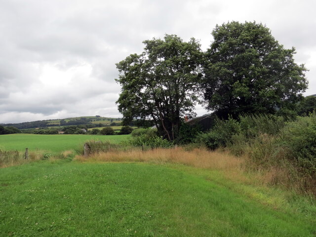
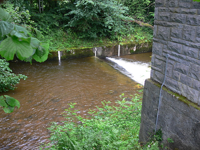
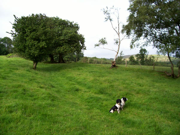
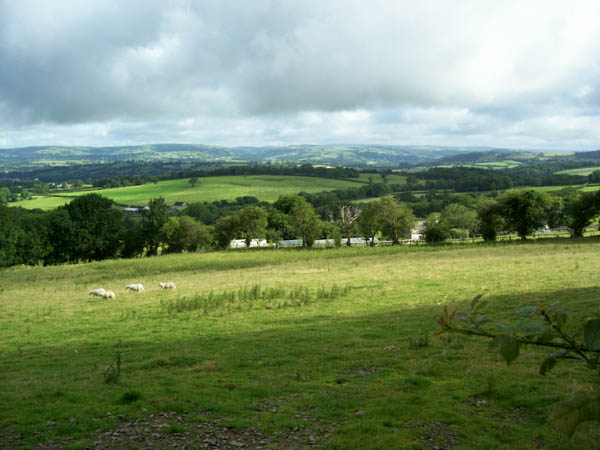
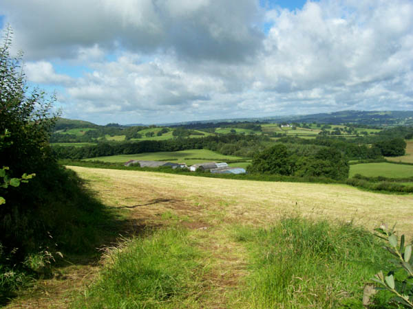
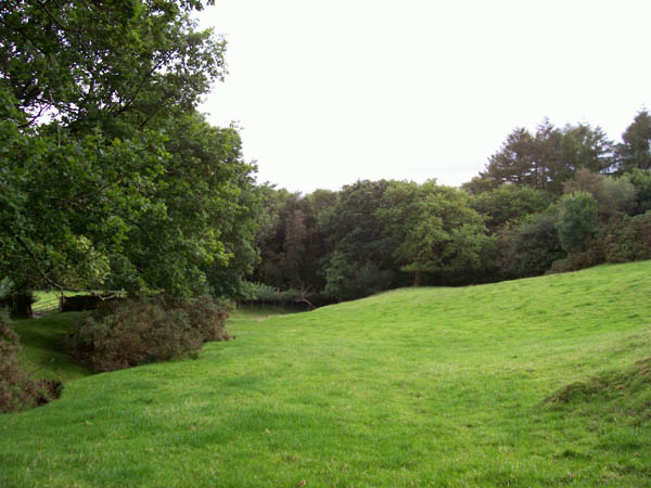
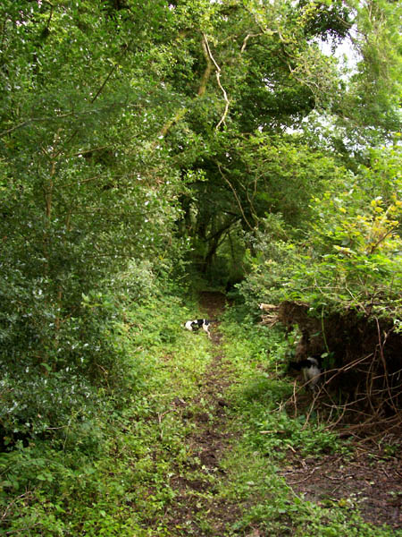
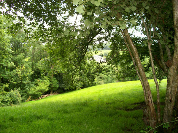
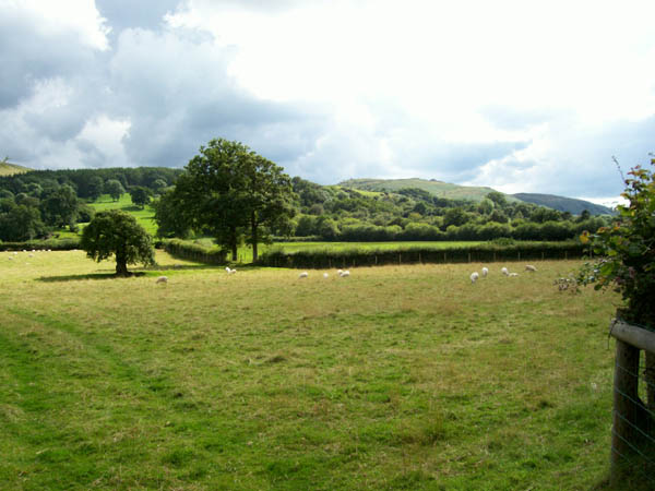
Wet Wood is a captivating forest located in Carmarthenshire, Wales. Spanning over a vast area, this woodland is renowned for its lush greenery, diverse wildlife, and tranquil atmosphere. With its picturesque landscape and serene ambiance, Wet Wood attracts nature enthusiasts, hikers, and photographers from far and wide.

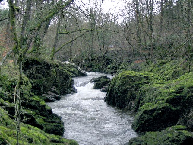
The forest is characterized by its wet and marshy terrain, which gives it its unique name. Its damp climate contributes to the growth of a variety of tree species, including oak, ash, and birch. These towering trees create a dense canopy, providing shade and shelter to a plethora of flora and fauna.

Wet Wood is home to a rich assortment of wildlife, making it a haven for nature lovers. Numerous bird species, such as woodpeckers, owls, and warblers, can be spotted flitting between the branches. The forest floor teems with life, hosting a diverse range of insects, amphibians, and small mammals.

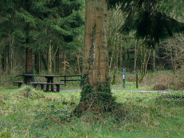
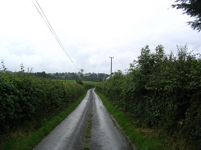
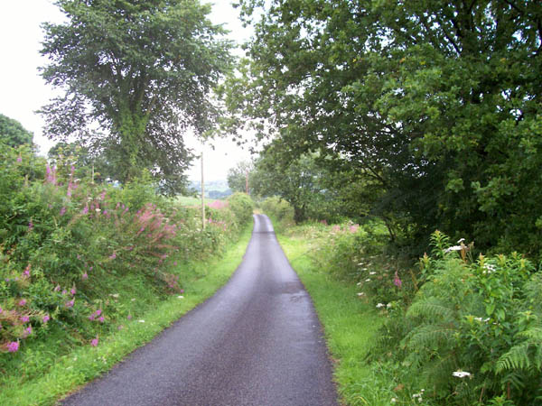
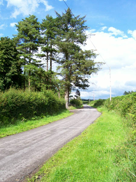
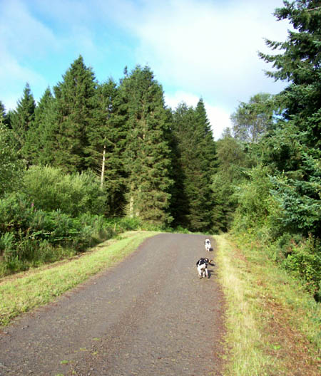
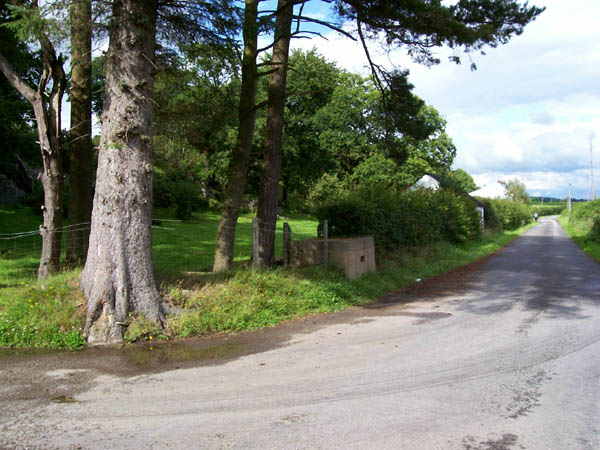
The forest offers an extensive network of walking trails, allowing visitors to explore its beauty at their own pace. These paths wind through the woodland, leading to breathtaking viewpoints, babbling streams, and hidden waterfalls. Adventurers can also partake in activities like bird watching, picnicking, and photography, immersing themselves in the serene surroundings.

Wet Wood, Carmarthenshire, is a haven of natural beauty and tranquility. Its wet and marshy landscape, diverse wildlife, and picturesque scenery make it an ideal destination for those seeking solace in nature.

If you have any feedback on the listing, please let us know in the comments section below.
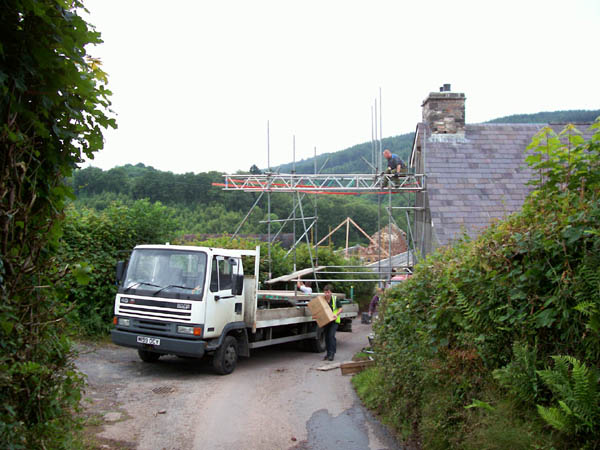
Wet Wood Images

Images are sourced within 2km of 51.914167/-3.8697318 or Grid Reference SN7125. Thanks to Geograph Open Source API. All images are credited.

Llwybr Caefylchi / Caefylchi path Llwybr cyhoeddus yn mynd i gyfeiriad anedd-dy o'r enw Caefylchi. Yn anffodus ar adeg ysgrifennu hwn mae'r llwybr wedi ei rwystro mewn sawl man. 

A footpath heading in the direction of a property known as Caefylchi. Unfortunately, as the time of writing, the path is obstructed in several places.
Llwybr Caefylchi / Caefylchi path
Llwybr cyhoeddus yn mynd i gyfeiriad anedd-dy o'r enw Caefylchi. Yn anffodus ar adeg ysgrifennu hwn mae'r llwybr wedi ei rwystro mewn sawl man. A footpath heading in the direction of a property known as Caefylchi. Unfortunately, as the time of writing, the path is obstructed in several places.
Waterfall on Afon Sawdde This is the river Sawdde flowing north towards Llangadog.
At this point there are roads either side of it: a minor one on the left bank; and the A4069 to Brynaman on the right.
The whole length of the riverbank here is composed of upended strata of rock. You can drive past thousands of years of geology without even realising it.
Waterfall on Afon Sawdde
This is the river Sawdde flowing north towards Llangadog. At this point there are roads either side of it: a minor one on the left bank; and the A4069 to Brynaman on the right. The whole length of the riverbank here is composed of upended strata of rock. You can drive past thousands of years of geology without even realising it.
Sediment ripples in roadside quarry At the side of the minor road by the river Sawdde there is a small quarry (or large alcove). As with the riverbank, it is composed of upended strata. Here though the thick clumsy layers are replaced with thinner, more delicate strata.
On the vertical face you can see ripples in the sediment that once lay flat, presumably caused by wind or water.
Sediment ripples in roadside quarry
At the side of the minor road by the river Sawdde there is a small quarry (or large alcove). As with the riverbank, it is composed of upended strata. Here though the thick clumsy layers are replaced with thinner, more delicate strata. On the vertical face you can see ripples in the sediment that once lay flat, presumably caused by wind or water.
Entrance to Coed Pen Arthur The Forestry Commission sign for this entrance gives the name Coed Pen Arthur, but their web site also list this point as Coed Shon.
There is a picnic table and a circular drive with no well defined car parking spaces.
Deeper in the Pen Arthur forest there is apparently a woodland sauna !
See this link: <span class="nowrap"><a title="http://www.forestry.gov.uk/website/recreation.nsf/LUWebDocsByKey/WalesCarmarthenshireTowyValleyForestsPenArthur" rel="nofollow ugc noopener" href="http://www.forestry.gov.uk/website/recreation.nsf/LUWebDocsByKey/WalesCarmarthenshireTowyValleyForestsPenArthur">Link</a><img style="margin-left:2px;" alt="External link" title="External link - shift click to open in new window" src="https://s1.geograph.org.uk/img/external.png" width="10" height="10"/></span>
Entrance to Coed Pen Arthur
The Forestry Commission sign for this entrance gives the name Coed Pen Arthur, but their web site also list this point as Coed Shon. There is a picnic table and a circular drive with no well defined car parking spaces. Deeper in the Pen Arthur forest there is apparently a woodland sauna ! See this link: LinkExternal link
Weir On Afon Sawdde Water authority building on right. A4069 directly behind camera.
Weir On Afon Sawdde
Water authority building on right. A4069 directly behind camera.
Country Lane Near Llangadog
Cefn y Coed Common A wonderful area of "Access Land" which is an impenetrable mass of Bracken and Willow Herb.
Cefn y Coed Common
A wonderful area of "Access Land" which is an impenetrable mass of Bracken and Willow Herb.
Road near Tal-y-Garn Prominent clump of pine trees at the junction of the farm road.
Road near Tal-y-Garn
Prominent clump of pine trees at the junction of the farm road.
Green lane Green lane marked as "Other Public Access" near to Careg-foel-gam.
Green lane
Green lane marked as "Other Public Access" near to Careg-foel-gam.
Coed Pen-Arthur Forest track near to the northern margin of this large Forestry Commission woodland.
Coed Pen-Arthur
Forest track near to the northern margin of this large Forestry Commission woodland.
Caeaubychain Bach One of several small farms spread out on the flank of the Towy Valley
Caeaubychain Bach
One of several small farms spread out on the flank of the Towy Valley
Caeaubychain Mawr A farm with extensive outbuildings (and kennels from the sound) on the southern flank of the broad Towy valley. The field has yielded a silage crop in the days before the picture was taken, hence the bleached grass.
Caeaubychain Mawr
A farm with extensive outbuildings (and kennels from the sound) on the southern flank of the broad Towy valley. The field has yielded a silage crop in the days before the picture was taken, hence the bleached grass.
Traffic jam, Pant y grafog When you erect scaffolding across the road, the courier has to walk to his destination, as there is no viable alternative route. The Royal Mail was also stuck, the red van is just visible on the other side of the blockage.
Traffic jam, Pant y grafog
When you erect scaffolding across the road, the courier has to walk to his destination, as there is no viable alternative route. The Royal Mail was also stuck, the red van is just visible on the other side of the blockage.
Forest margin Coed Pen Arthur reaches its north-westerly extremity here, where the green lane descends from Careg foel-gam and turns to follow the stream steeply down the valley side.
Forest margin
Coed Pen Arthur reaches its north-westerly extremity here, where the green lane descends from Careg foel-gam and turns to follow the stream steeply down the valley side.
Green lane A narrow and very muddy track which has a stream flowing down it for at least part of its length.
Green lane
A narrow and very muddy track which has a stream flowing down it for at least part of its length.
Woodland glade The farm called Carregfoelgam can just be glimpsed across this woodland glade at the side of the steep lane.
Woodland glade
The farm called Carregfoelgam can just be glimpsed across this woodland glade at the side of the steep lane.
Sheep grazing Pasture alongside the boundary of the National Park, with views of Carn
Goch in the distance.
Sheep grazing
Pasture alongside the boundary of the National Park, with views of Carn Goch in the distance.
Milk-churn dock The importance of dairy farming is indicated by the regular presence at
the roadside of a dock for milk churns. Situated at a height suitable
for moving the churns on the level onto a wagon or lorry, this avoided
lifting heavy weights from the ground. There is even a ramp to the
rear of this one, suggesting that the building in the hedge was once the
dairy.
Milk-churn dock
The importance of dairy farming is indicated by the regular presence at the roadside of a dock for milk churns. Situated at a height suitable for moving the churns on the level onto a wagon or lorry, this avoided lifting heavy weights from the ground. There is even a ramp to the rear of this one, suggesting that the building in the hedge was once the dairy.
Show me another place!

Wet Wood is located at Grid Ref: SN7125 (Lat: 51.914167, Lng: -3.8697318)

Unitary Authority: Carmarthenshire

Police Authority: Dyfed Powys

What 3 Words

///bunny.cupcake.regaining. Near Llansadwrn, Carmarthenshire

Related Wikis

Bont Fawr

Bont Fawr is a tiny hamlet in Carmarthenshire, Wales.

Y Garn Goch

Y Garn Goch is a hill in the Brecon Beacons National Park in the east of Carmarthenshire, Wales. The name means the 'red cairn'. It lies near the village...

Llangadog

Llangadog () is a village and community in Carmarthenshire, Wales, which also includes the villages of Bethlehem and Capel Gwynfe. A notable local landscape...

River Sawdde

The Afon Sawdde is a river in the county of Carmarthenshire, Wales. For most of its course it flows through the Brecon Beacons National Park and Fforest...

Bethlehem, Carmarthenshire

Bethlehem is a tiny farming village in the county of Carmarthenshire, Wales, lying in the Tywi Valley northeast of Llandeilo and southwest of Llangadog...

Glanrhyd Bridge collapse

On 19 October 1987, a train on the Heart of Wales line derailed and fell into the River Towy due to the partial collapse of the Glanrhyd Bridge near Llandeilo...

A4069 road

The A4069 is an A road which connects Llandovery with Gwaun-Cae-Gurwen in Wales, UK. == Route == The route begins at the junction with the A474 at the...

Llangadog railway station

Llangadog railway station serves the village of Llangadog near Llandeilo, Carmarthenshire. The station is on the Heart of Wales Line 36+1⁄2 miles (59 km...

Nearby Amenities

Located within 500m of 51.914167,-3.8697318
Place: farm
Lat/Long: 51.9113076/-3.8687677
Place: farm
Lat/Long: 51.9177225/-3.8684179
Cym-Sawdde
Place: farm
Lat/Long: 51.9178948/-3.873217
Post Box
Collection Times: Mo-Fr 14:45; Sa 07:30
Post Box Type: lamp
Ref: SA19 258
Royal Cypher: EIIR
Royal Cypher Wikidata: Q33102113
Lat/Long: 51.9164502/-3.8701415
Direction: SSW
Generator Method: photovoltaic
Generator Output Electricity: yes
Generator Solar Modules: 20
Generator Source: solar
Generator Type: solar_photovoltaic_panel
Location: roof
Power: generator
Lat/Long: 51.9166405/-3.8681511
The data included in this document is from www.openstreetmap.org. The data is made available under ODbL.

Have you been to Wet Wood?

Leave your review of Wet Wood below (or comments, questions and feedback).