Allt Ddu
Wood, Forest in Cardiganshire
Wales
Allt Ddu
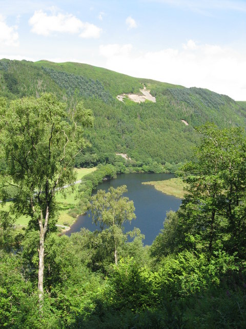
Allt Ddu is a picturesque woodland located in the county of Cardiganshire in Wales. Covering approximately 500 acres, this forested area is known for its natural beauty and diverse range of flora and fauna.
Situated on the slopes of the Cambrian Mountains, Allt Ddu is characterized by its lush greenery and majestic trees. The forest is home to a variety of tree species, including oak, beech, birch, and pine, creating a rich and varied landscape. The dense canopy of the trees provides a haven for numerous bird species, making it a popular spot for birdwatching enthusiasts.
Visitors to Allt Ddu can enjoy a network of walking trails that wind through the forest, offering stunning views of the surrounding countryside. The trails cater to all levels of fitness, with options for leisurely strolls or more challenging hikes. Along the way, hikers may come across babbling brooks and cascading waterfalls, adding to the tranquility and beauty of the area.
The woodland is also home to a diverse range of wildlife, including deer, badgers, and foxes. Nature enthusiasts can explore the forest and try to spot these elusive creatures in their natural habitat. Additionally, Allt Ddu is known for its abundance of wildflowers, which bloom in vibrant colors during the spring and summer months.
Allt Ddu is a haven for nature lovers, offering a peaceful retreat from the hustle and bustle of everyday life. Whether it's exploring the trails, birdwatching, or simply enjoying the serene beauty of the forest, this woodland is a must-visit destination for anyone seeking to connect with nature in Cardiganshire.
If you have any feedback on the listing, please let us know in the comments section below.
Allt Ddu Images
Images are sourced within 2km of 52.385526/-3.8895762 or Grid Reference SN7178. Thanks to Geograph Open Source API. All images are credited.


Allt Ddu is located at Grid Ref: SN7178 (Lat: 52.385526, Lng: -3.8895762)
Unitary Authority: Ceredigion
Police Authority: Dyfed Powys
What 3 Words
///reinstate.strange.save. Near Cwmystwyth, Ceredigion
Nearby Locations
Related Wikis

Rheidol Falls railway station
Rheidol Falls railway station is a railway station serving Rheidol Falls in Ceredigion in Mid-Wales. It is an intermediate station and request stop on...
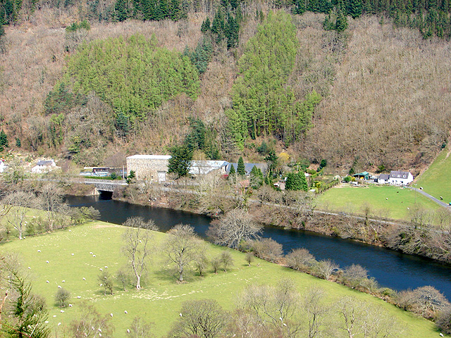
Rheidol Power Station
Rheidol power station is a 56 MW hydroelectric scheme near Aberystwyth, Wales. It was built between 1957 and 1962 and was officially opened on 3 July 1964...
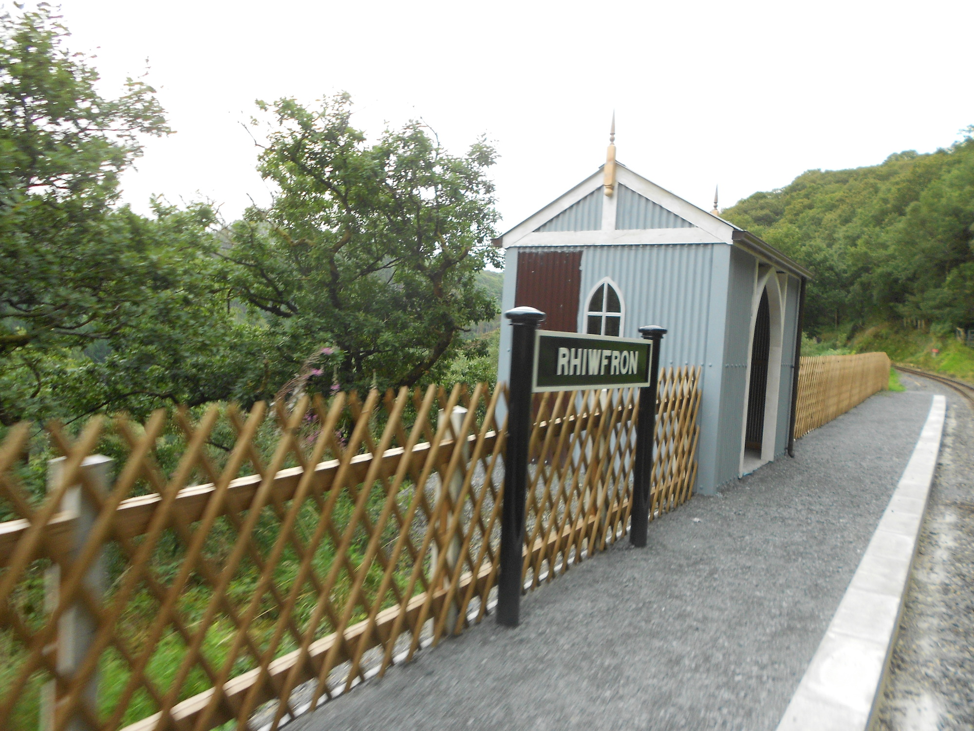
Rhiwfron railway station
Rhiwfron railway station is a railway station serving Rhiwfron in Ceredigion in Mid-Wales. It is an intermediate station on the preserved Vale of Rheidol...

Mynydd Bach, Ceredigion
Mynydd Bach, Ceredigion is a hamlet in the community of Pontarfynach, Ceredigion, Wales, which is 68.5 miles (110.3 km) from Cardiff and 170.7 miles (274...
Coed Rheidol National Nature Reserve
Coed Rheidol National Nature Reserve forms part of the long ribbon of woodland adjoining the Afon Mynach and Afon Rheidol around the lower slopes of hills...
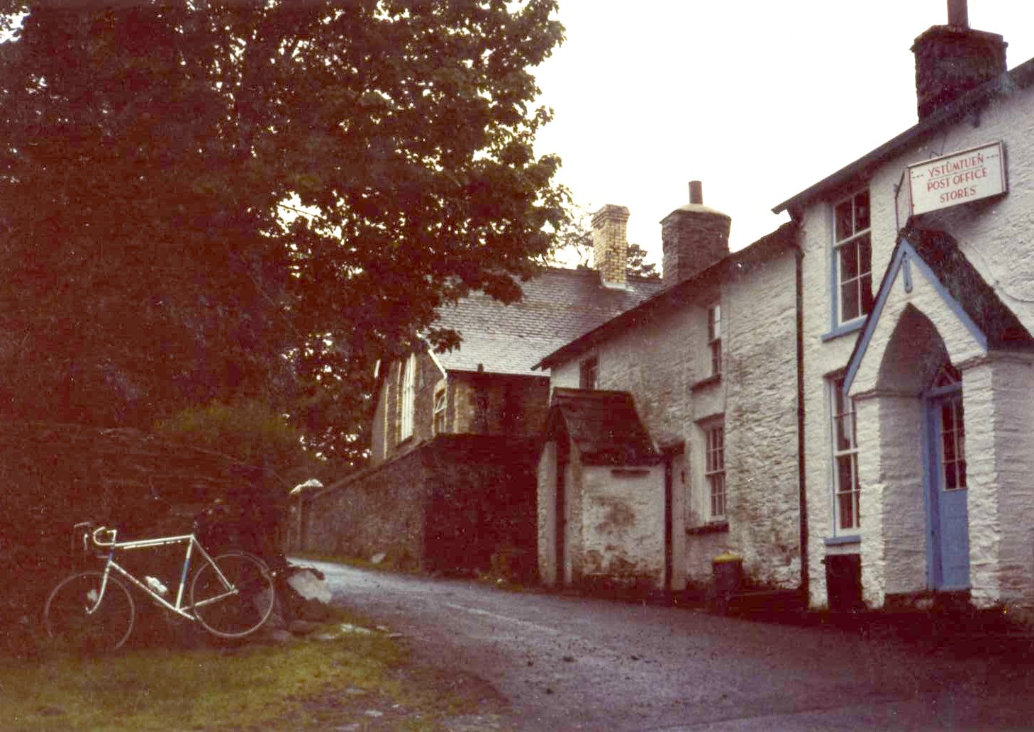
Ystumtuen
Ystumtuen is a small village in northern Ceredigion, Wales. It is situated above the valley of the River Rheidol.It is situated on rocks rich in lead...

Ceredigion (Senedd constituency)
Ceredigion is a constituency of the Senedd. It elects one Member of the Senedd by the first past the post method of election. It is also one of eight constituencies...

Devil's Bridge railway station
Devil's Bridge railway station is a railway station serving Devil's Bridge in Ceredigion in Mid-Wales. It is the eastern terminus of the preserved Vale...
Nearby Amenities
Located within 500m of 52.385526,-3.8895762Have you been to Allt Ddu?
Leave your review of Allt Ddu below (or comments, questions and feedback).