Coed-y-Brenin

Wood, Forest in Merionethshire

Wales

Coed-y-Brenin

A470 near Coed y Brenin
A470 near Coed y Brenin Credit: Steven Brown

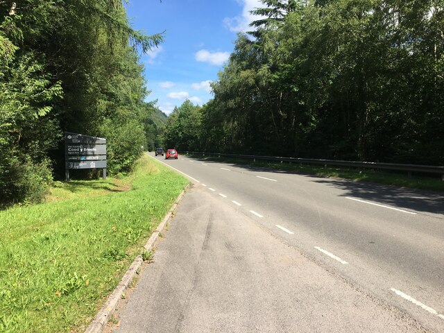
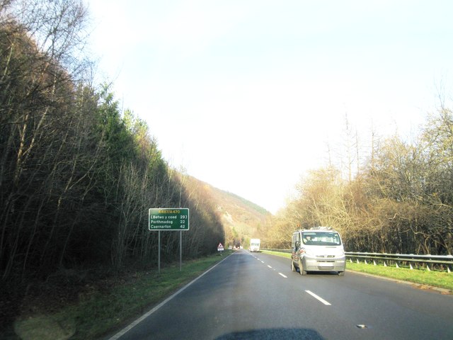
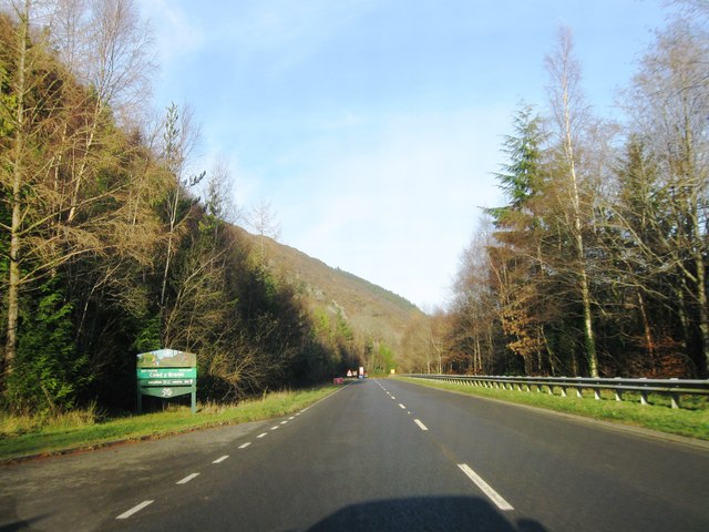
Coed-y-Brenin is a stunning forest located in the county of Merionethshire, Wales. The name "Coed-y-Brenin" translates to "Wood, Forest" in English, which aptly describes the natural beauty and lushness of this area.

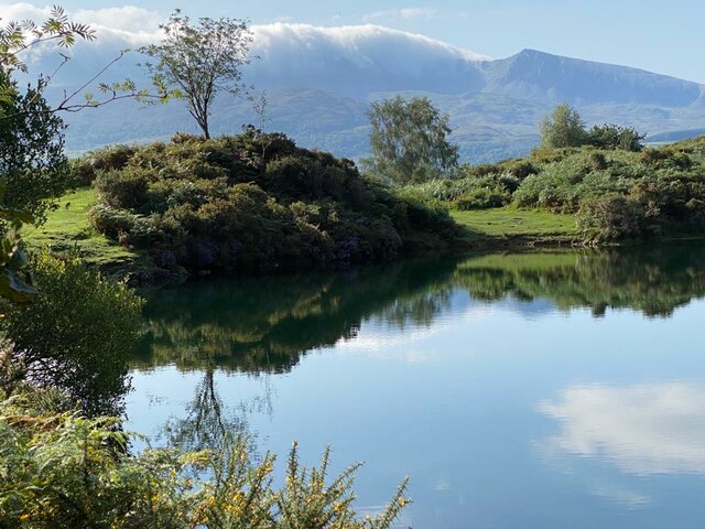
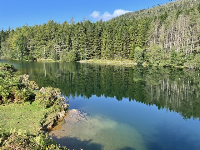
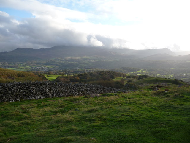
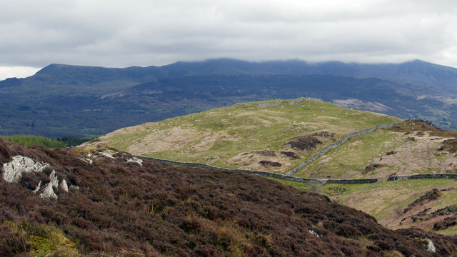
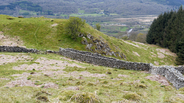
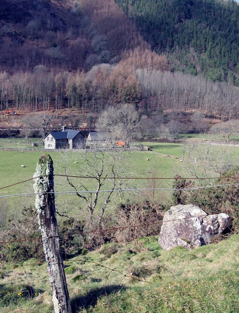
Covering an area of approximately 9,000 acres, Coed-y-Brenin is known for its diverse range of tree species, including oak, beech, and pine. The forest is also home to an abundance of wildlife, such as red squirrels, badgers, and various species of birds, making it a haven for nature enthusiasts and photographers.

The forest offers a wide range of outdoor activities for visitors of all ages and abilities. It is particularly renowned for its extensive network of mountain biking trails, attracting cyclists from all over the country. With trails suitable for beginners through to advanced riders, Coed-y-Brenin provides an exhilarating experience in a picturesque setting.

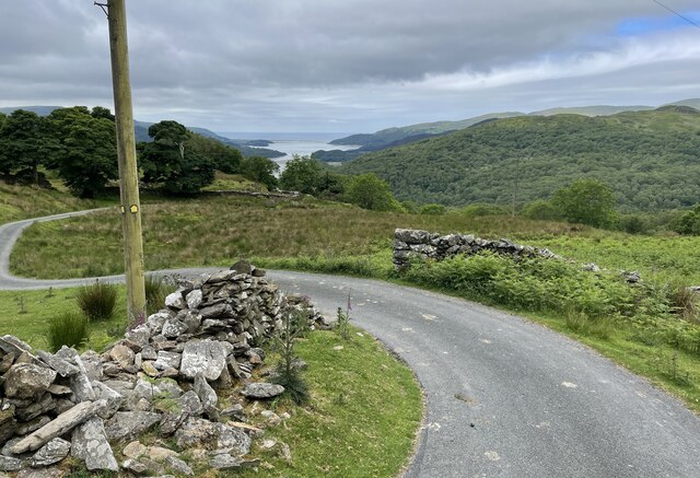
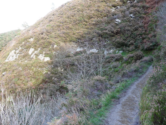
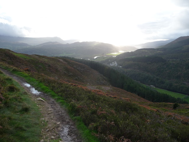
For those who prefer walking or running, the forest features a network of well-maintained trails that showcase the natural beauty of the area. Visitors can explore the enchanting woodland, discover hidden waterfalls, and enjoy breathtaking views of the surrounding mountains.

Coed-y-Brenin also boasts excellent visitor facilities, including a visitor center with a café, bike shop, and information point. The center provides visitors with valuable information about the forest, its trails, and safety guidelines.

In summary, Coed-y-Brenin is a captivating forest in Merionethshire, Wales, offering a wide range of outdoor activities and opportunities for nature appreciation. Its diverse ecosystem, stunning landscapes, and well-developed trails make it a must-visit destination for outdoor enthusiasts and those seeking a peaceful retreat in nature.

If you have any feedback on the listing, please let us know in the comments section below.

Coed-y-Brenin Images

Images are sourced within 2km of 52.768429/-3.9059405 or Grid Reference SH7120. Thanks to Geograph Open Source API. All images are credited.

A470 near Coed y Brenin
Llyn Tan-y-Graig A spectacular September morning shows the lake off at its very best.
Llyn Tan-y-Graig
A spectacular September morning shows the lake off at its very best.
Cadair Idris a Llyn Tan-y-Graig The morning mist and cloud is fast burning off the summits of Cadair Idris, as the sun takes hold on a beautifully warm early September morning.
Cadair Idris a Llyn Tan-y-Graig
The morning mist and cloud is fast burning off the summits of Cadair Idris, as the sun takes hold on a beautifully warm early September morning.
Dying larches, Llyn Tan-y-Graig Unfortunately, many of the larch trees in these forests are dying or already dead, thanks to the rapid spread of the Phytophthora ramorum fungus. There will be major felling over the winter, and this view will soon be gone.
Dying larches, Llyn Tan-y-Graig
Unfortunately, many of the larch trees in these forests are dying or already dead, thanks to the rapid spread of the Phytophthora ramorum fungus. There will be major felling over the winter, and this view will soon be gone.
Track at Foel-Ispri-uchaf The track leads away from the New Precipice Walk and at this point affords views down towards Barmouth Bay.
Track at Foel-Ispri-uchaf
The track leads away from the New Precipice Walk and at this point affords views down towards Barmouth Bay.
The south-west slopes of Foel Faner Looking to the Afon Mawddach estuary.
The south-west slopes of Foel Faner
Looking to the Afon Mawddach estuary.
Little re-entrant on the Precipice Walk An amusing little feature on the walk.
Little re-entrant on the Precipice Walk
An amusing little feature on the walk.
Part of the Precipice Walk above Dolgellau The walk offers great views westards in late afternoon or evening, depending on the season, and the weather.
Part of the Precipice Walk above Dolgellau
The walk offers great views westards in late afternoon or evening, depending on the season, and the weather.
Cadair Idris from the Precipice Walk Majestic, beautiful, inspiring - this view has it all. Though it's not quite as good as the view from that ridgeline...
Cadair Idris from the Precipice Walk
Majestic, beautiful, inspiring - this view has it all. Though it's not quite as good as the view from that ridgeline...
Foel Faner Foel Faner is a lesser top of the hill, Foel Cynwch and is seen from the ridge south of the summit of that hill. The cloud-shadowed and misted mountain range in the distance is Cadair Idris.
Foel Faner
Foel Faner is a lesser top of the hill, Foel Cynwch and is seen from the ridge south of the summit of that hill. The cloud-shadowed and misted mountain range in the distance is Cadair Idris.
Walls beside Coed Dol-fawr The declining south-west ridge of Foel Cynwch has a tapering finger of moorland that eventually gives way to farmland and woods. The walls seen here are adjacent to one of those woods.
Walls beside Coed Dol-fawr
The declining south-west ridge of Foel Cynwch has a tapering finger of moorland that eventually gives way to farmland and woods. The walls seen here are adjacent to one of those woods.
Dol-y-clochydd
Dol-y-clochydd
A470 north from Llanelltyd
A470 near Maes Mawr
A470 near Maes Mawr
A470 northbound
A470 northbound
A470 northbound
A470 northbound
A470 northbound, roadworks
Afon Mawddach In between Coed Y Brenin and Dolgellau
Afon Mawddach
In between Coed Y Brenin and Dolgellau
Show me another place!

Coed-y-Brenin is located at Grid Ref: SH7120 (Lat: 52.768429, Lng: -3.9059405)

Unitary Authority: Gwynedd

Police Authority: North Wales

What 3 Words

///cement.verdict.wash. Near Dolgellau, Gwynedd

Related Wikis

Llanelltyd

Llanelltyd (Welsh: Llanelltyd) is a small village and community in Gwynedd, to the northwest of Dolgellau. The community population taken at the 2011 Census...

Cymer Abbey

Cymer Abbey (Welsh: Abaty Cymer) is a ruined Cistercian abbey near the village of Llanelltyd, just north of Dolgellau, Gwynedd, in north-west Wales, United...

River Wnion

The River Wnion is a river in the southeast of Gwynedd, Wales. It begins high on the slopes of Aran Benllyn about five miles south of Lanuwchllyn and...

Hengwrt

Hengwrt (English: Old Court) was a mansion near Dolgellau in Meirionnydd, Gwynedd. It lay in the parish of Llanelltyd near the confluence of the River...

Dolgellau transmitting station

The Dolgellau transmitting station is a broadcasting and telecommunications facility located on a hill about 1 km north of the town of Dolgellau, in Gwynedd...

Y Garn (Rhinogydd)

For other hills of the same name, see Y Garn (disambiguation). Y Garn is a mountain in the southern Snowdonia, Wales, north of Dolgellau. It is an outlier...

Coleg Meirion-Dwyfor

Coleg Meirion-Dwyfor (meaning in English "Meirion-Dwyfor College"), also known as CMD, is a college in Gwynedd, Wales with its main campus in Dolgellau...

Dr Williams' School

Dr Williams' School was a school founded in Dolgellau in 1875. It opened its doors in 1878 and continued until it was closed in 1975.Samuel Holland was...

Nearby Amenities

Located within 500m of 52.768429,-3.9059405
Barrier: cattle_grid
Source: OS_OpenData_StreetView
Lat/Long: 52.7728855/-3.9060266
Power: pole
Lat/Long: 52.766034/-3.9023683
Power: pole
Lat/Long: 52.7654584/-3.9019394
Power: pole
Lat/Long: 52.7651447/-3.9021732
Power: pole
Lat/Long: 52.7646195/-3.9025594
Power: pole
Lat/Long: 52.7664161/-3.9028706
Power: pole
Lat/Long: 52.7668188/-3.9038653
Power: pole
Lat/Long: 52.7672129/-3.90433
Power: pole
Lat/Long: 52.7721464/-3.9086526
Power: pole
Lat/Long: 52.7714331/-3.9082567
Power: pole
Lat/Long: 52.770575/-3.9079233
Power: pole
Lat/Long: 52.7700065/-3.9076996
Power: pole
Lat/Long: 52.7693676/-3.9074669
Power: pole
Lat/Long: 52.7689899/-3.9067308
Power: pole
Lat/Long: 52.7686353/-3.9060776
Power: pole
Lat/Long: 52.768282/-3.9054757
Power: pole
Lat/Long: 52.7677753/-3.9049495
Direction: 255
Generator Method: photovoltaic
Generator Output Electricity: yes
Generator Solar Modules: 8
Generator Source: solar
Generator Type: solar_photovoltaic_panel
Location: roof
Power: generator
Lat/Long: 52.765349/-3.9026664
Direction: 75
Generator Method: photovoltaic
Generator Output Electricity: yes
Generator Solar Modules: 8
Generator Source: solar
Generator Type: solar_photovoltaic_panel
Location: roof
Power: generator
Lat/Long: 52.7653709/-3.9026248
Crossing
Lat/Long: 52.76832/-3.9052325
The data included in this document is from www.openstreetmap.org. The data is made available under ODbL.

Have you been to Coed-y-Brenin?

Leave your review of Coed-y-Brenin below (or comments, questions and feedback).